
Abstract
Urban noise pollution significantly impacts public health and quality of life, necessitating innovative approaches for its analysis and visualization. This study employs Computational methods to examine and represent urban soundscapes by integrating spatial analysis, sound propagation modelling, and digital visualization techniques. The methodology involves categorizing urban tourist activities, and amenities in Barcelona, based on their proximity to different street types, thereby establishing Correlations between urban functions and noise levels. By overlaying these spatial classifications with computationally generated sound fields, the study visualizes Otherwise imperceptible noise patterns. Through this approach, we develop dynamic representations of urban soundscapes that enhance the understanding of noise Distribution and its implications on urban design. The findings contribute to data-driven urban planning strategies aimed at mitigating noise pollution and improving the Sensory experience of city dwellers.
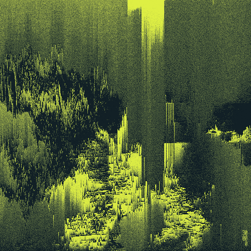
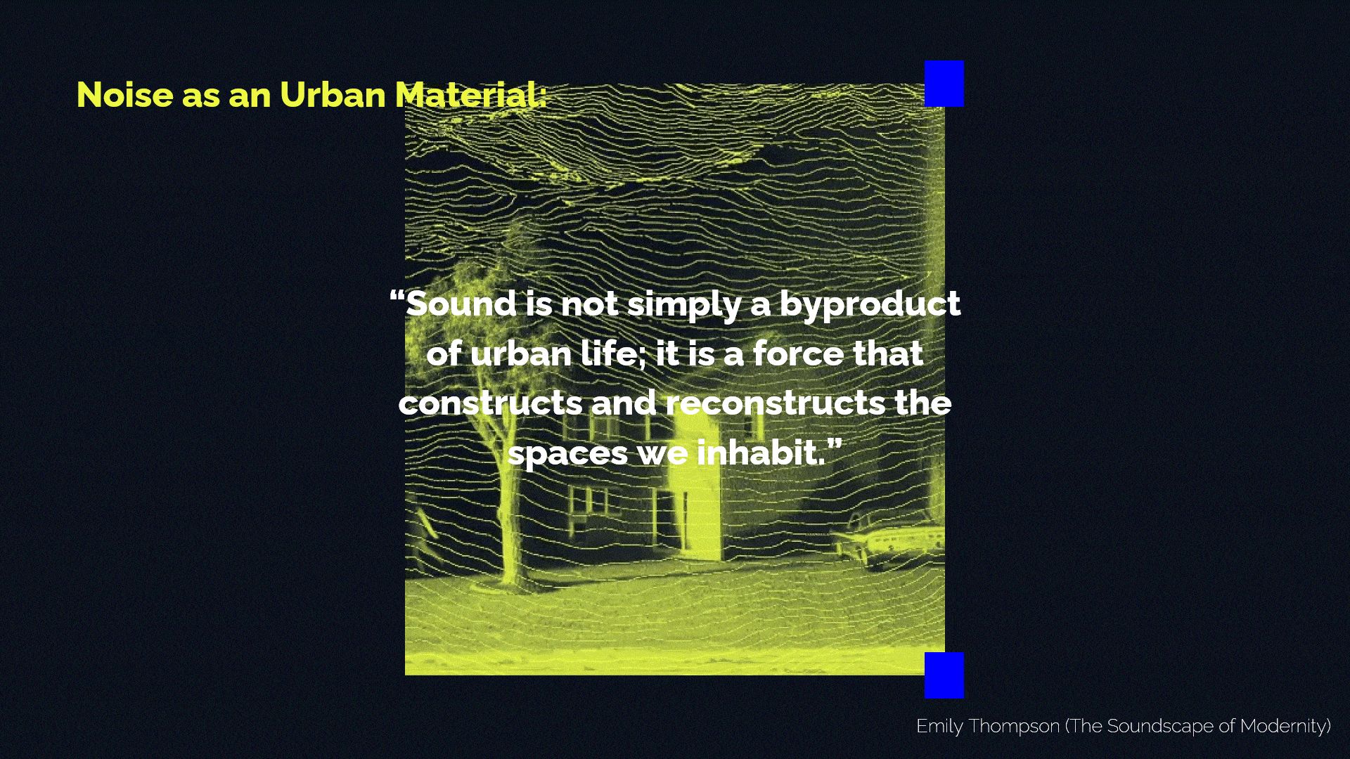
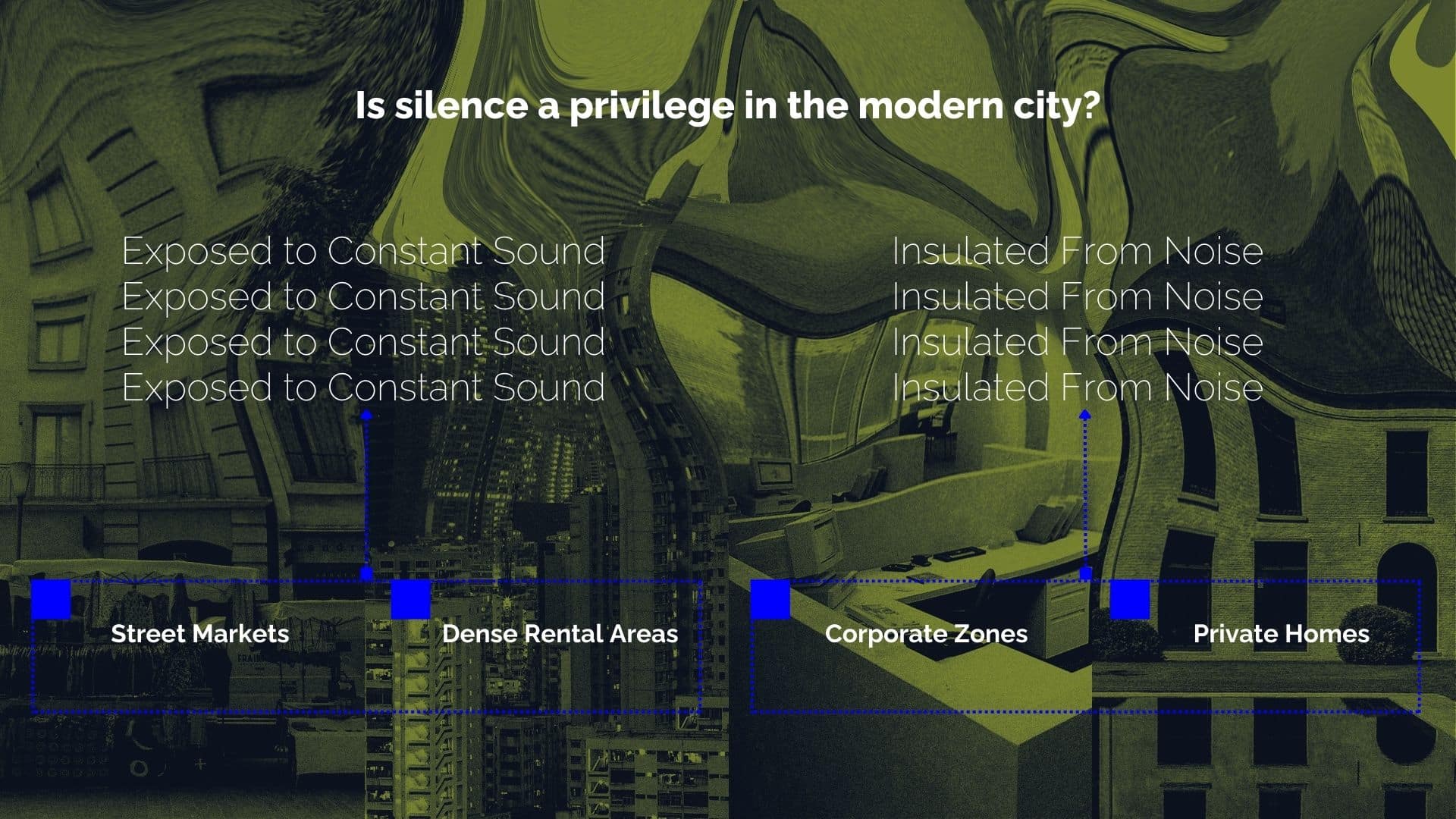
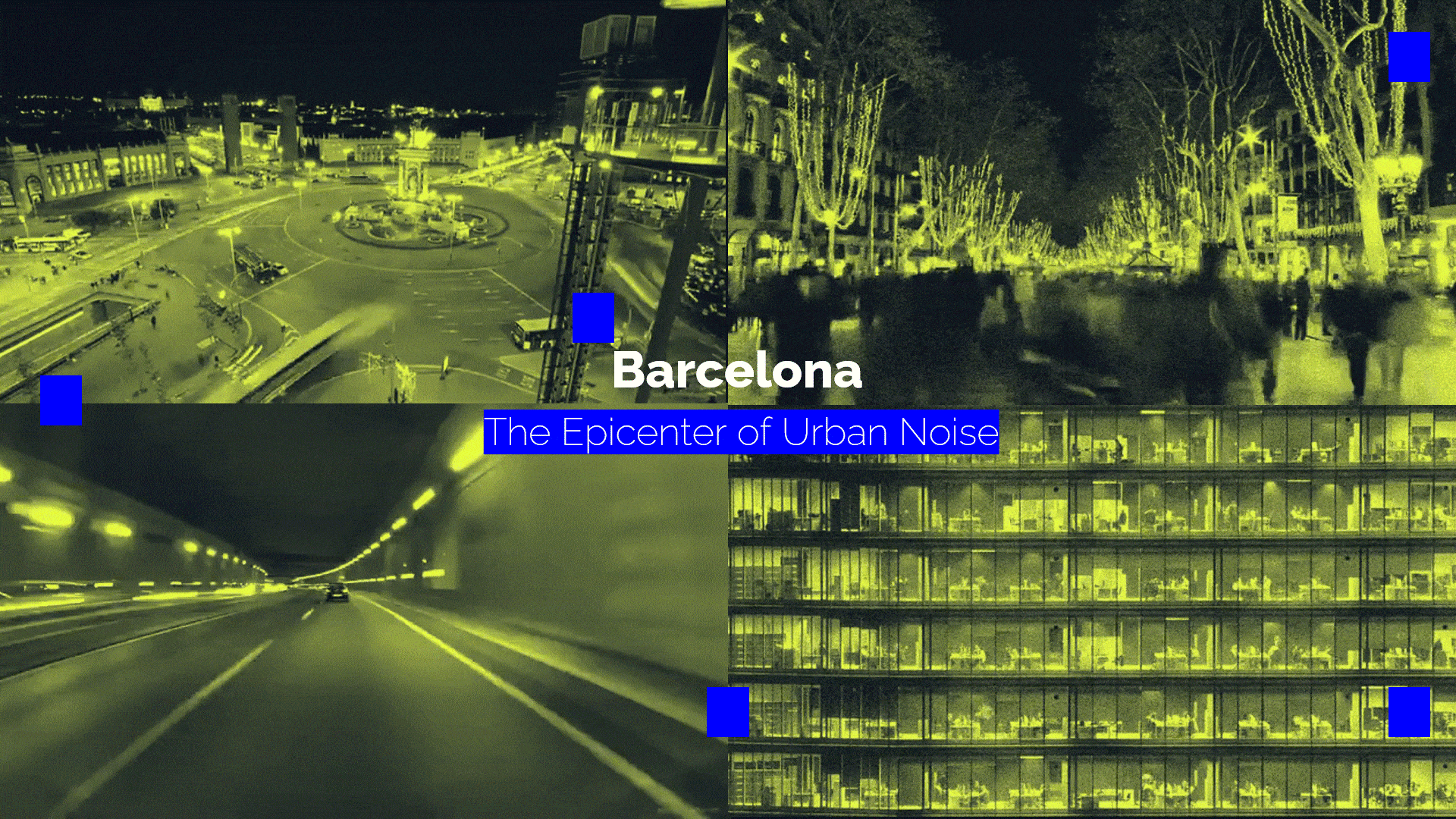
Acoustic Ecology & Urban Noise: Noise pollution, an invisible degradation, subtly shapes urban life and often goes unnoticed, impacting daily well-being. Who controls the soundscape? Neoliberal policies tend to prioritize commerce and transit noise over residential well-being, influencing the unique soundscapes that define a city’s character, as visually hinted by the urban scene on the right.
Hypothesis
The distribution and intensity of urban noise pollution are directly influenced by the spatial organization of land use, tourist activities, and amenities in relation to street typologies.
By computationally analysing and visualizing these relationships, we can identify patterns that inform urban planning strategies to mitigate noise pollution and enhance the acoustic quality of urban environments.
Project Methodology

Noise Relevance in Europe
Noise pollution remains a pressing public health and environmental challenge across Europe, with millions exposed to levels exceeding both EU regulations and WHO recommendations. This research applies computational soundscape analysis to systematically map and visualize urban noise, integrating real-time monitoring, spatial analysis, and predictive modelling. Using GIS, sensor networks, and machine learning, it identifies noise sources and their impact, providing a dynamic understanding of sound distribution.

A key advancement of this methodology lies in its scalability. By expanding noise mapping across multiple European cities, this approach can contribute to an EU-wide noise monitoring framework. Such an upscaled study would enable comparative analyses across regions, highlighting disparities in noise exposure and supporting cross-border urban planning strategies. The insights gained from large-scale noise visualization can drive evidence-based policymaking, enhance environmental noise regulations, and foster healthier, more sustainable urban environments across Europe.
Barcelona: Increasing activities, Increasing Noise
Barcelona faces a critical noise pollution problem, holding the highest number of residents exposed to high noise levels in Europe. This reflects a deep urban issue linked to the dense urban fabric, heavy traffic, and continuous urban activity. Barcelona’s soundscape is highly compromised, raising questions about urban planning, transportation, and public health.

Understanding better how there are different contributors to the noise pollution of Barcelona, it is well established that with high population densities and dynamic urban life there are significant challenges related to elevated noise levels. Several interrelated factors contribute to Barcelona’s persistent noise pollution.
- Traffic volume is a major contributor. As one of the most visited and populated cities in Europe, Barcelona experiences intense vehicular movement, including private cars, buses, taxis, and delivery vans. The city’s narrow streets and dense urban layout often lead to traffic congestion, especially during peak hours, amplifying engine sounds, honking, and public transport noise. Motorcycles and scooters, widely used for mobility in Barcelona, also add to the urban soundscape.
- Barcelona’s vibrant nightlife and social scene add to the city’s noise challenges. Neighbourhoods such as El Raval, Barceloneta, and Gràcia are famous for their bars, clubs, and open plazas, which remain lively well into the night. Street performances, festivals (like La Mercè), and outdoor events contribute to the ambient noise, particularly during evenings and weekends.
- Commercial and construction activities play a significant role. Barcelona’s thriving tourism industry, busy marketplaces, and constant real estate developments ensure that construction noise, such as drilling, machinery, and renovation work, is a regular feature in many districts. Areas like Eixample, Ciutat Vella, and Sant Martí, known for mixed residential-commercial use, are especially affected.
Combined, these factors make noise pollution in Barcelona a complex urban issue tied closely to its population, tourism, transportation, and cultural vibrancy.
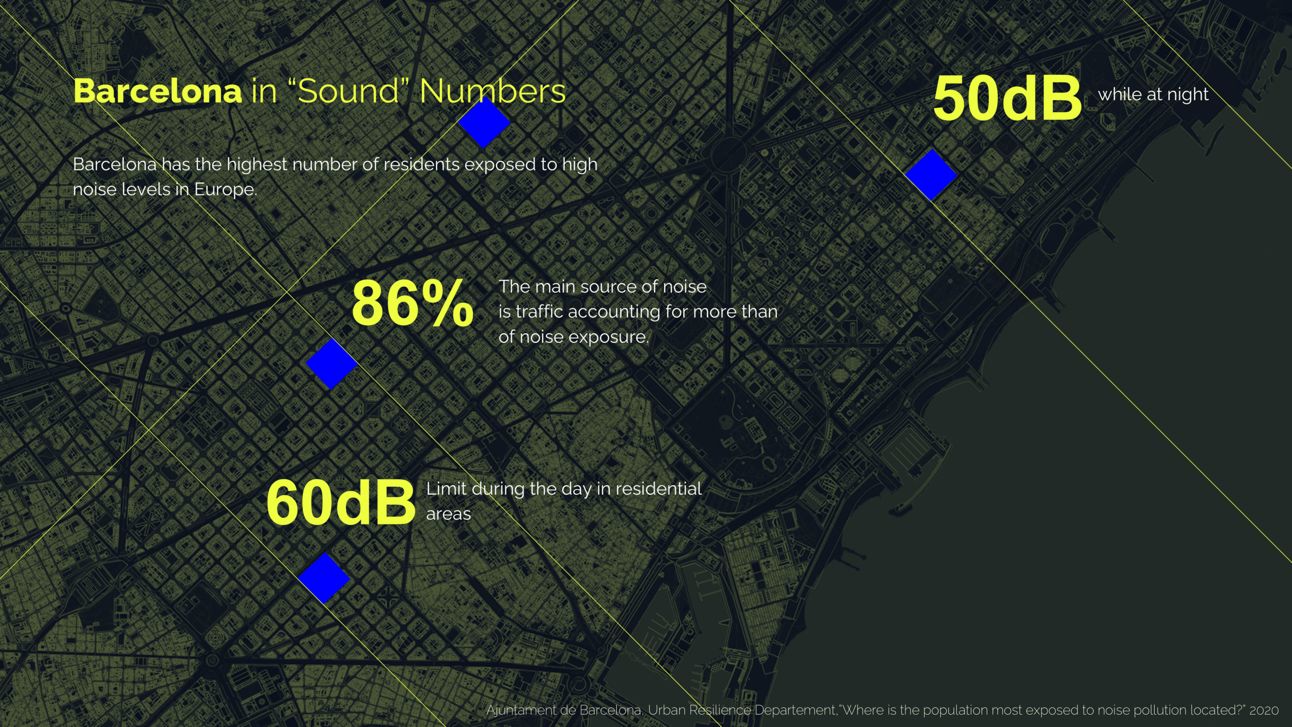
As per all the researches done by the city municipalities and other world organisations, one of the most pressing contributors to Barcelona’s noise pollution crisis is traffic. This accounts for 86% of total noise exposure in the city. The dense urban grid, combined with a high volume of cars, motorcycles, buses, and delivery vehicles, creates a constant background of sound that pervades public and private spaces alike.
In addition to the overwhelming presence of traffic noise, Barcelona’s official noise regulations set specific thresholds to protect residents’ well-being. The legal noise limit in residential areas during the day is 60 decibels (dB), while at night, when citizens are most vulnerable to sound disturbances, the limit is lowered to 50 dB. However, considering the data showing widespread noise exposure, these limits are likely breached in many areas of the city, especially along major roads and nightlife districts. Chronic exposure to noise levels above these thresholds has been linked to serious health issues, including sleep disruption, increased stress, and cardiovascular diseases. Addressing both the sources of noise and enforcing these limits are essential for improving the urban soundscape and ensuring a healthier living environment for Barcelona’s residents.
Objective

Alternate Noise Mapping Methodology
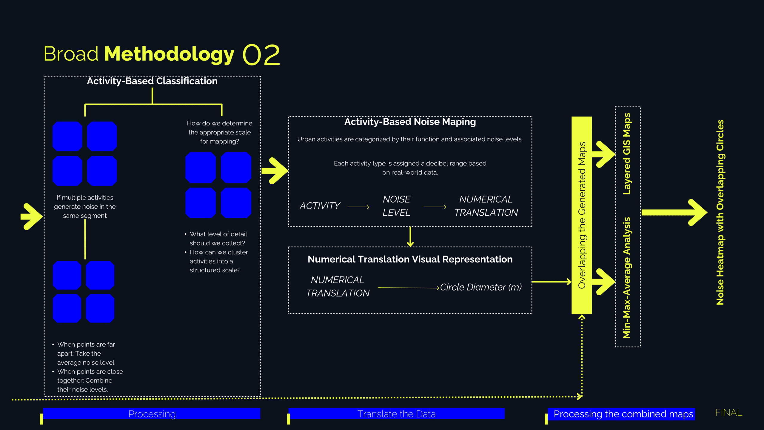
Unlike conventional approaches to decibel mapping that prioritize traffic flow and vehicle counts, this project adopts a methodology that focuses on the amenities and activities present along a given street as primary contributors to urban noise. To implement this alternative approach, an extensive dataset of amenities, tourist attractions, and land use was extracted from the open-source OpenStreetMap database. The selected features are then filtered based on their proximity to the street network, while also considering the classification of each road (e.g., main road, highway, local street).

Case Findings
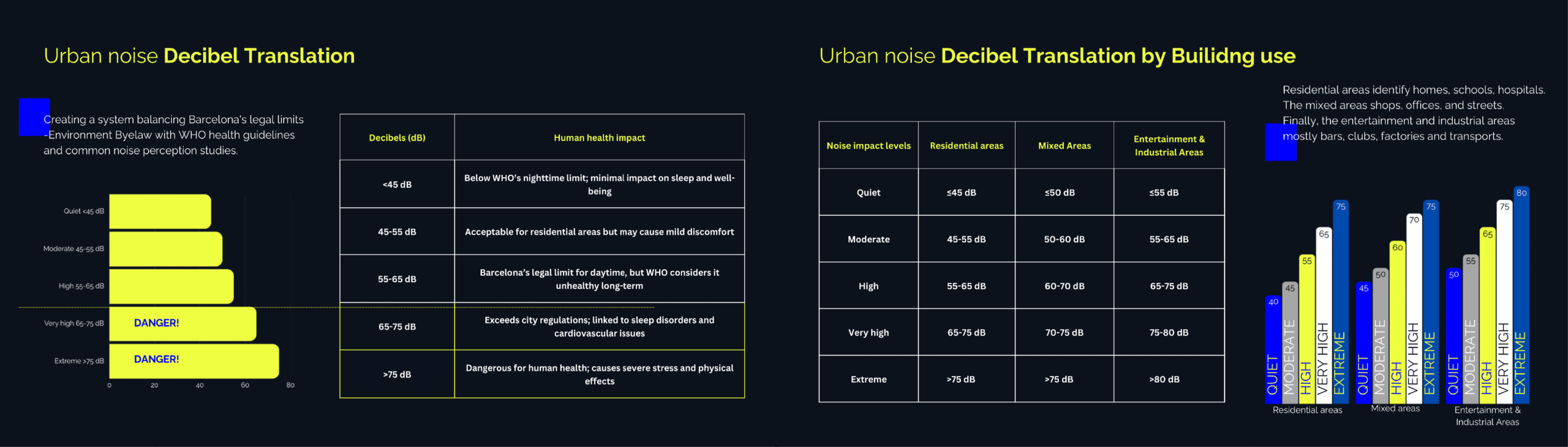
The noise translation process in this study involved categorizing urban noise based on building use, human activity, touristic patterns and time of the day. The starting point was finding the limit values and averages. It was important during this process to highlight the human health impact and the danger zones. Using Barcelona’s Environmental Byelaw and WHO guidelines, noise levels were classified into five categories: quiet, moderate, high, very high, and extreme. Each category had a specific range of decibels to identify them.

The methodology mapped different urban residential zones, mixed-use, entertainment, and industrial zones assigning decibel ranges to each creating activity based clustering. For the mapping process, a filtering system was made, picking specific building usages, assigning a decibel range and mapping the resulting effects. Finally, numerical data was visualized on the road system that was analyzed beforehand, revealing patterns of noise pollution, identifying high-impact areas, and assessing the influence of sound in the urban environment.
Visualising Noise Impacts in Barcelona
Barcelona’s noise pollution is closely tied to the spatial distribution of urban activity and land use, as illustrated in this map. By analyzing the relationship between amenities and road categories, the visualization highlights how different streets contribute to varying noise levels. Primary roads, shown with concentrated noise clusters, indicate high-intensity activity zones, while a more dispersed noise pattern emerges in areas with mixed land use. This analysis underscores how urban design influences soundscapes, revealing the impact of human activity beyond just traffic flow.

Barcelona’s tourism industry is a major driver of urban noise pollution, as depicted in this visualization. The map highlights the spatial distribution of noise generated by tourism-related establishments, including hotels, restaurants, landmarks, and entertainment hubs. The highest noise concentrations are observed in the city’s central districts and along primary roads, where visitor activity is most intense. These clusters align with popular tourist destinations such as La Rambla, the Gothic Quarter, and the beachfront, where high foot traffic and nightlife contribute to elevated noise levels. Additionally, secondary noise hotspots appear in less central but still prominent areas, indicating the widespread impact of tourism on the city’s acoustic environment. The correlation between noise intensity and tourism density underscores the challenges of managing urban soundscapes in a city that relies heavily on tourism.


Future Possibilities
Computational soundscape analysis offers valuable insights for urban planning by leveraging real-time noise monitoring, AI-driven models, and spatial analysis. This approach enables noise-aware zoning, optimized traffic planning, and the design of quieter, more liveable urban spaces. Additionally, immersive technologies like VR and AR facilitate the visualization of soundscapes, improving decision-making in architecture and infrastructure. Beyond urban design, these methods contribute to environmental research, assessing noise pollution’s impact on biodiversity and sustainability. As cities expand, integrating sound analysis will be essential for creating healthier and more balanced environments.
Expanding the Soundscape Analysis
– Refining Data Accuracy
- Incorporate real-time noise monitoring for dynamic mapping.
- Validate modelled noise levels with field recordings.
– Exploring Temporal Variations
- Analyze daily and seasonal noise fluctuations.
- Study the impact of events, tourism surges, and policy changes.
– Assessing Public Health & Policy Implications
- Link noise exposure to well-being and urban stress factors.
- Propose regulatory strategies for noise mitigation in high-impact areas.
– Interactive & Predictive Models
- Develop web-based tools for public engagement with urban sound data.
- Implement AI-driven forecasting to predict noise trends in urban planning.
