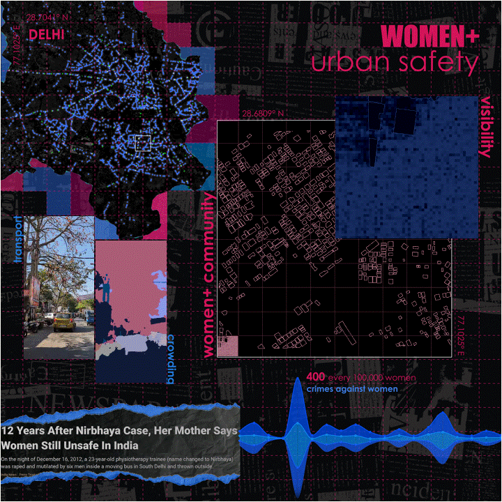
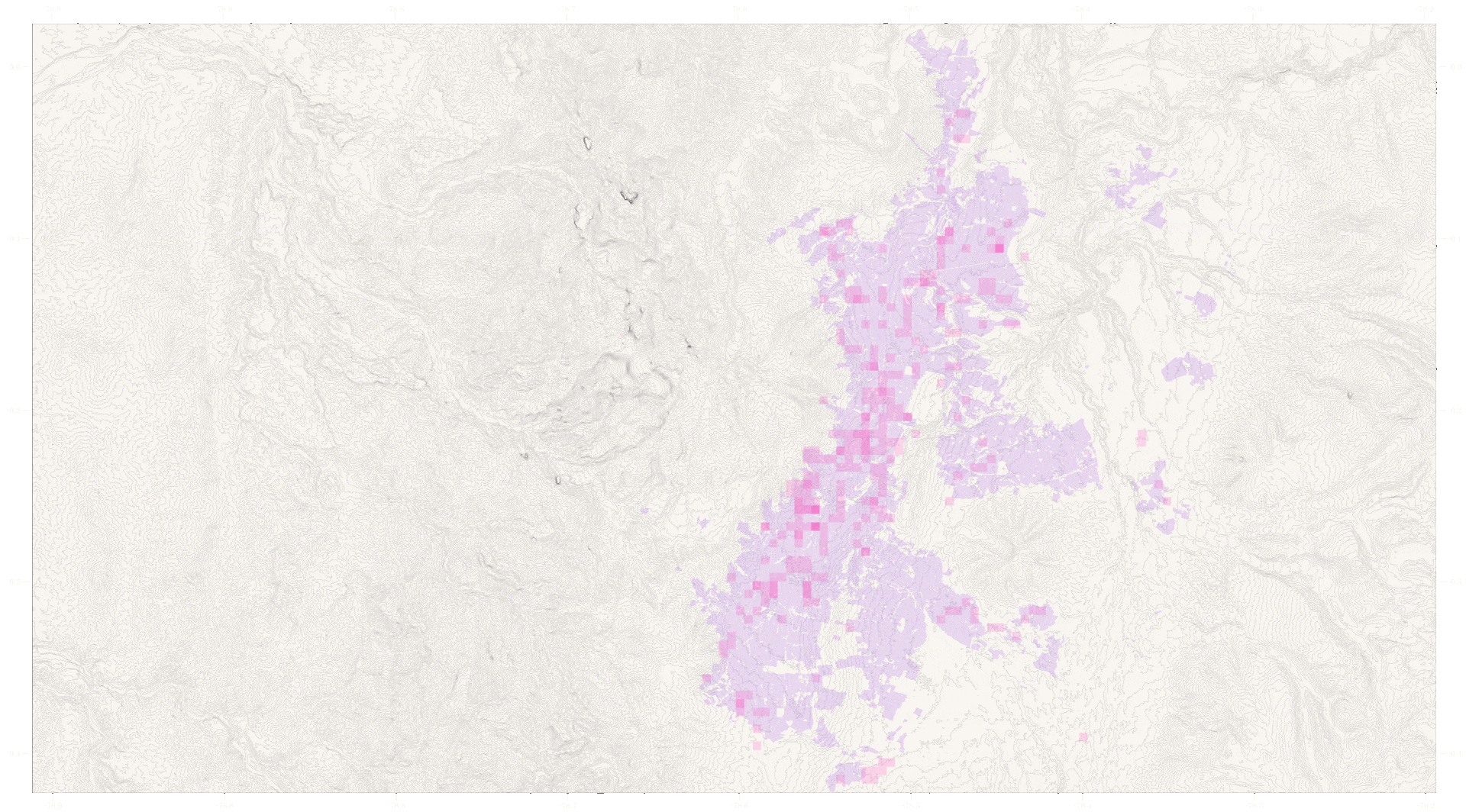
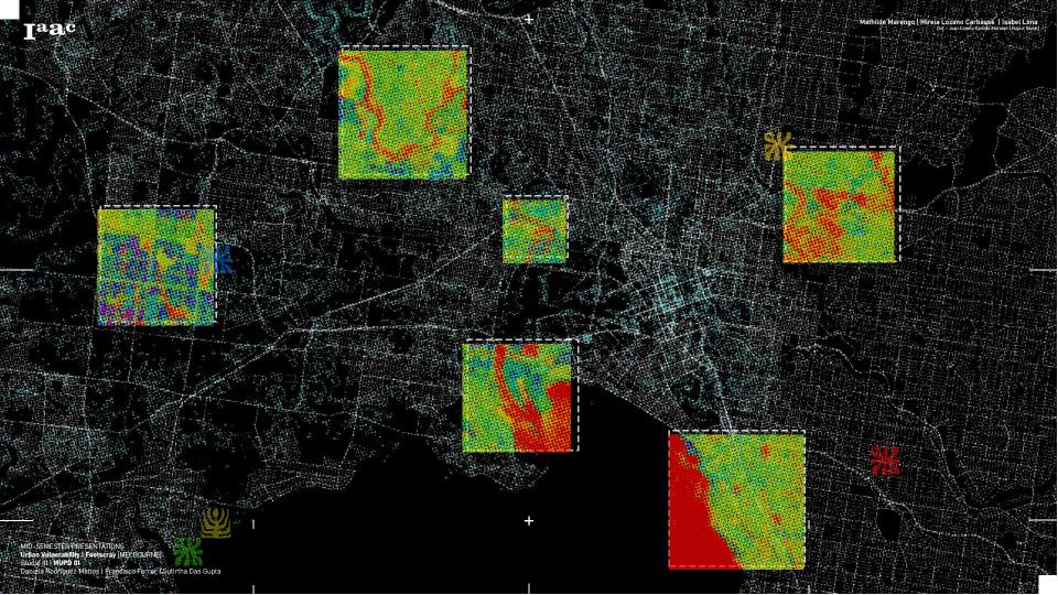
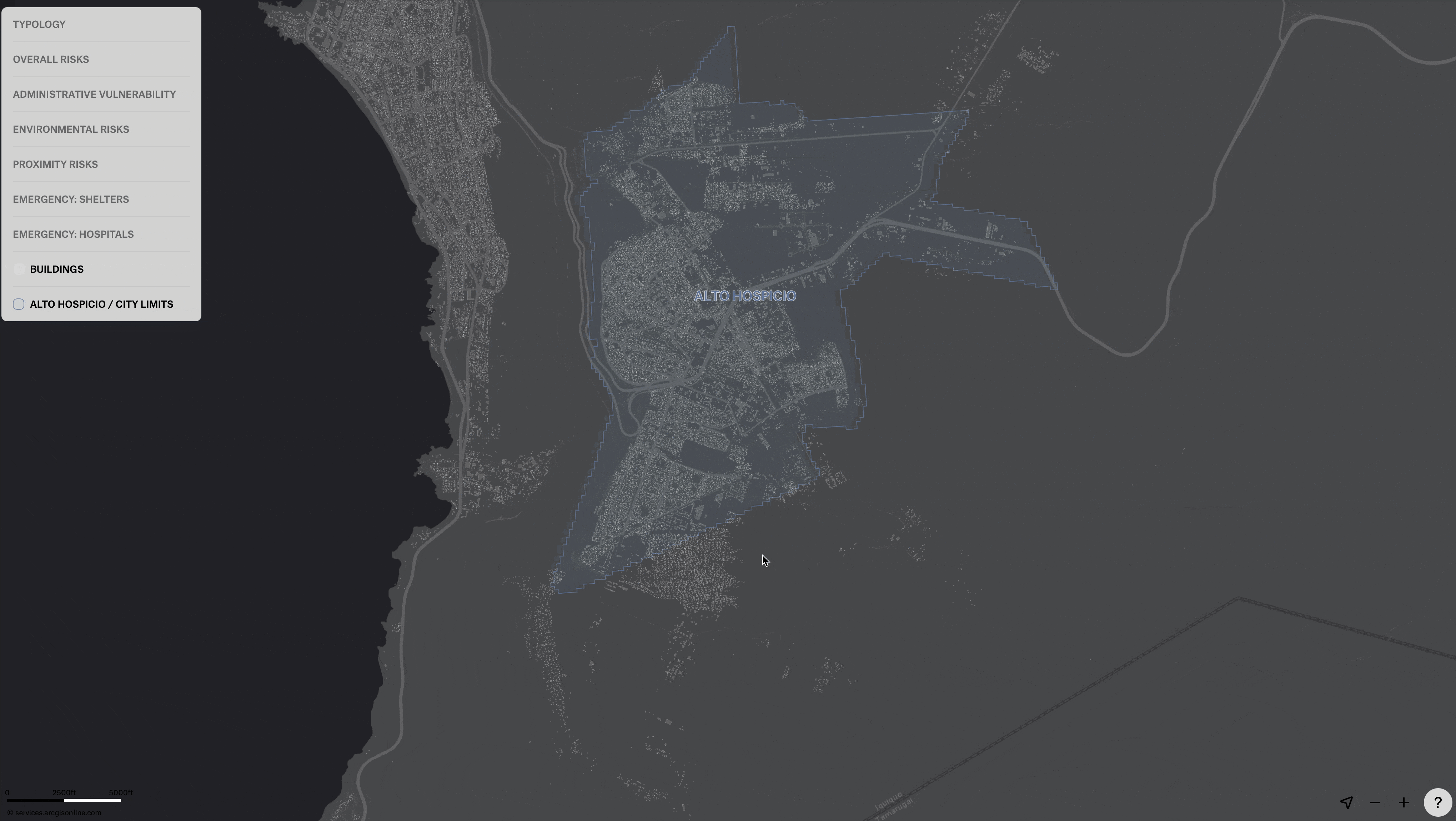
Computing Risk and Planning Resilience from Afar
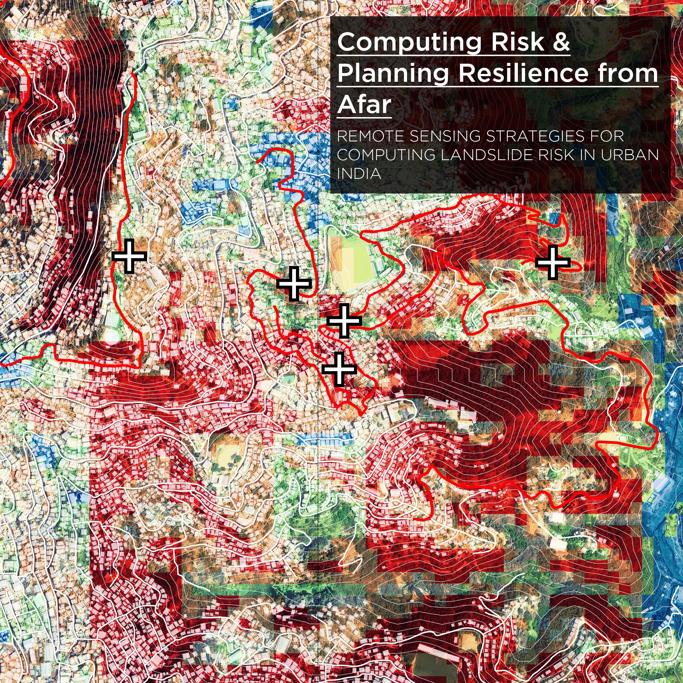
Computing Risk & Planning Resilience from Afar is a remote-sensing–driven investigative study to read, identify and address underlying vulnerabilities associated with landslide risk in urban India. The project aims to develop replicable analysis workflows for compounded risk calculation—making visible what often remains hidden enabling actionable insights in places where institutional data is frequently outdated or … Read more