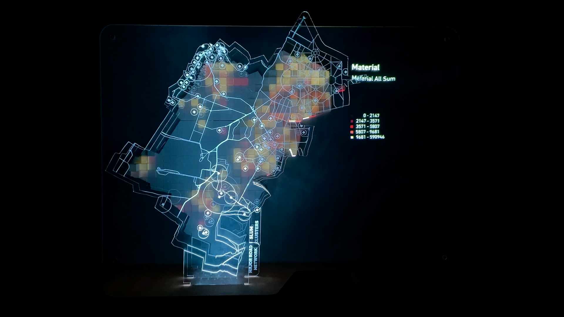
IAAC’s Master in City & Technology (1 or 2-year program) is a unique program oriented towards redefining the analysis, planning, and design of twenty-first-century cities and beyond. The program offers expertise in the design of digitally enhanced, ecological and human-centered urban environments by intersecting the disciplines of urbanism and data science. Taking place in Barcelona, the capital of urbanism, the Master in City & Technology is training the professionals that city administrations, governments, industries, and communities need, to transform the urban environment in the era of big data.


Filters
Years
Course

Risk Vision MR

About The Risk Vision MR project evaluates the feasibility of incorporating augmented reality into urban planning and design practices. The aim of the app developed in this seminar is to offer a tool for interactive and rapid result visualization to various stakeholders involved in urban design. The project focuses on a computational design of a … Read more

[DATA-CITY] MUMBAI

THE DESIGN AND FABRICATION OF CLIMATE ACTION INTERVENTIONS AND MODELS Our explorations surround the creation of climate action data models for the city of Mumbai. For a context that is only now becoming aware of the potential of data, The creation of interactive models can help educate citizens. The curation of multimedia models prototyped and … Read more

Urban Data Visualisation – Barcelona and Brazil

The aim of this studio was to explore the design opportunities arising from three common digital fabrication processes: Laser Cutting, CNC milling and 3D Printing. These exercises were supported by an interactive exploration of each technology and material, while also understanding conceptual and prototyping process of design. 1. Laser Cutting The first digital fabrication exercise … Read more

HANDS OVER BEIRUT and GREEN’IN CORRIDORS

HANDS OVER BEIRUT Beirut Blast impact assessment visualization Neighborhood: Mar Mikhael (Beirut port)/ Gemmayze – Bashoura – Ashrafieh The Area chosen has received the most impact and visualization of the plot of land where buildings got damaged but on a different scale is relevant to understand the shock wave repartition. To physically be able to … Read more