About
The Risk Vision MR project evaluates the feasibility of incorporating augmented reality into urban planning and design practices. The aim of the app developed in this seminar is to offer a tool for interactive and rapid result visualization to various stakeholders involved in urban design. The project focuses on a computational design of a flood containment structure for Parque Barigui, Curitiba, Brazil, with the intention of achieving two objectives: to provide a comprehensive explanation of a complex computational design and to enhance the visualization of the final design outcome in consideration of the contextual effects.
Project context
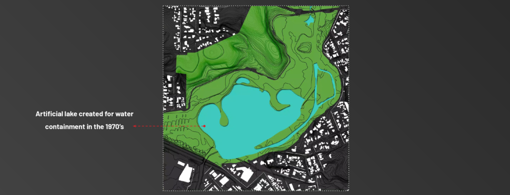
Parque Barigui, a 1970s urban park in Curitiba, Brazil, was established to address flood management in the city. The park’s central feature is an artificial lake that is designed to overflow during the rainy season, thereby preventing floodwaters from reaching the surrounding residential areas.
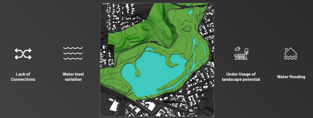
However, drastic water level fluctuations over the past several decades have caused the containment system to malfunction and placed the surrounding areas at risk. The analysis and understanding of the park’s context revealed several issues, such as extensive flooding of unfloodable spaces, disconnections between points of interest in the park, and unrealized landscape potential.
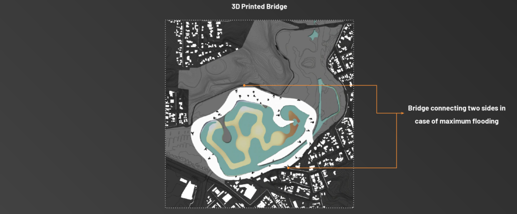
As a result, a bridge was proposed as a design intervention to mitigate the park’s inutilization during floods. This bridge was developed through computational design methods, taking into account the water variations and connections between points of interest as the design parameters. The outcome is an elevated bridge featuring perforated walls, offering spaces that can be utilized according to the lake’s water level.
Physical Realm
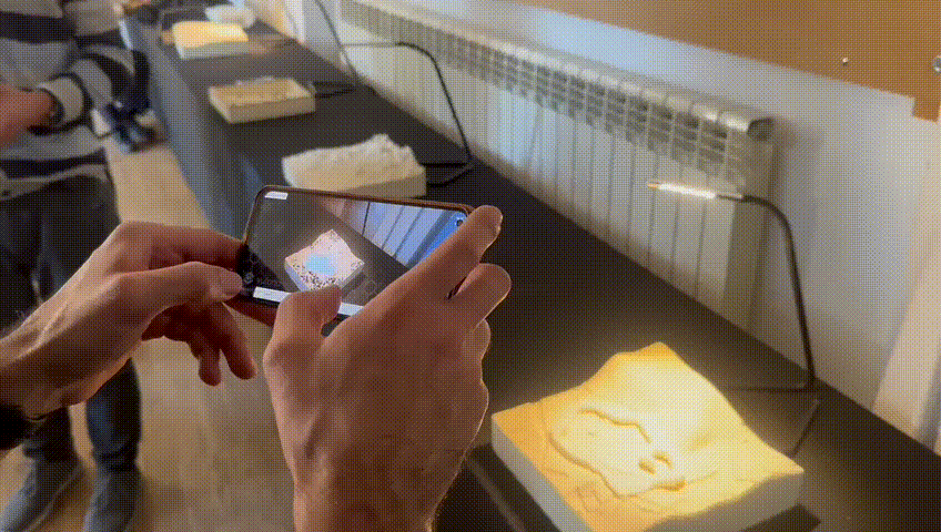
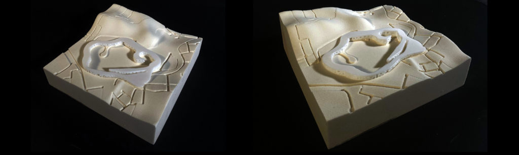
The physical realm of the project involves the utilization of augmented reality to visualize the design process. For this purpose, a physical model of the terrain and the design intervention was produced. The terrain model was fabricated using CNC milling, while the design intervention – the bridge – was created using 3D printing techniques.
Digital Realm
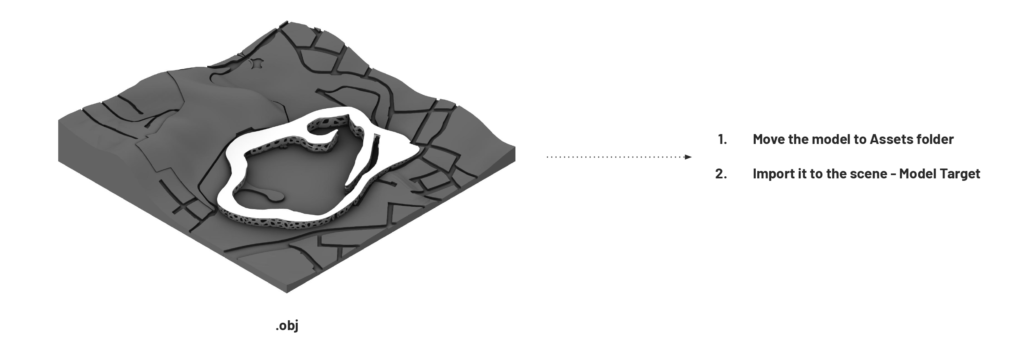
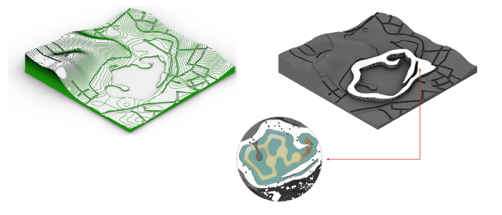
The digital realm of the project was developed using the Unity software. The key technique used to link the physical and digital realms was the training of a model target. The digital model used for CNC milling and 3D printing was used to train the software to identify the physical model and project the proposed interactions through an Android device.
The app consists of four main screens, including an introduction scene, a design process screen, an interaction screen, and a conclusion scene. The introduction scene provides information about the project and enables the user to choose between visualizing the design process or the seasonal effects on the site. The design process screen includes animations that explain the design process step by step and allow the user to navigate through the design steps for better comprehension. The interaction screen provides a playful environment where the user can interact with the model by selecting a season and observing the projected water level rise based on rainfall data, showcasing the design outcomes during various times of the year. The conclusion scene summarizes the project and its key features.
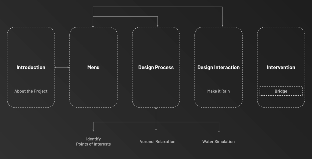
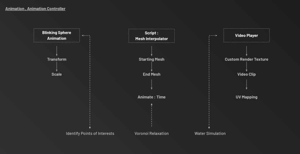
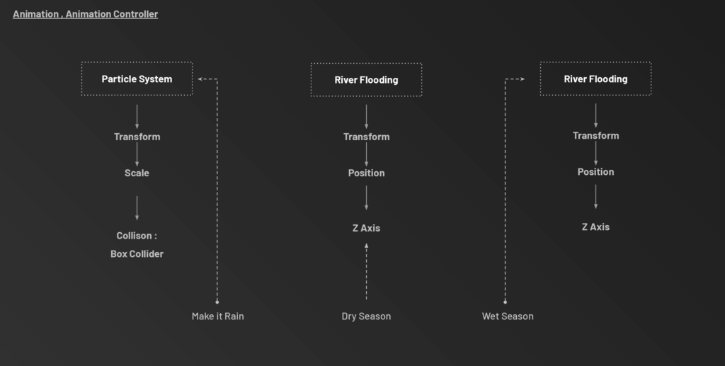
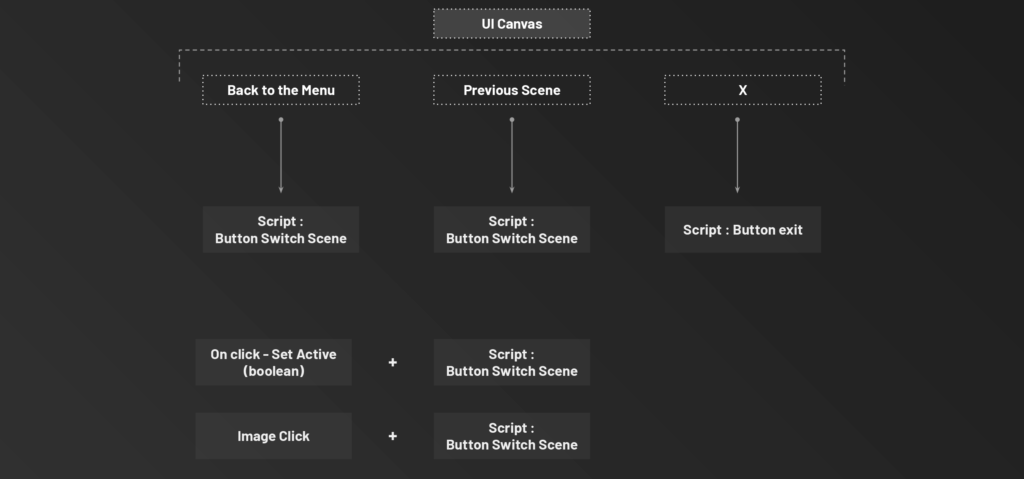
The Unity software utilizes buttons and methods to create interactive portals and is described in detail in the accompanying images.
What’s Next?
Using the model for stakeholder Engagement :
To facilitate collaboration between designers and other stakeholders by working together in a shared virtual environment, they can make informed decisions about which cells can be occupied during which season.
Plan and design of the cells : Help generate interest and feedback, and to build support for the design
Interactive experience:
The flood simulation could be made into an interactive experience, allowing users to navigate the 3D environment and see the impacts of flooding – This would provide a powerful tool for educating people about the potential impacts of flooding and for making informed decisions about when to visit or interact with flood-prone areas.
Benefits to tourism industry:
By providing a better understanding of flood risks and impacts, the Unity-based flood visualization could help the tourism industry make more informed decisions about how to manage and promote tourism activities in flood-prone areas. It could also help to educate tourists about potential risks, and to promote safety and preparedness.