
THE DESIGN AND FABRICATION OF CLIMATE ACTION INTERVENTIONS AND MODELS
Our explorations surround the creation of climate action data models for the city of Mumbai. For a context that is only now becoming aware of the potential of data, The creation of interactive models can help educate citizens. The curation of multimedia models prototyped and developed through this course are an experiment in generating creative interactions through fabrication tools to explore new frontiers of data interactions.
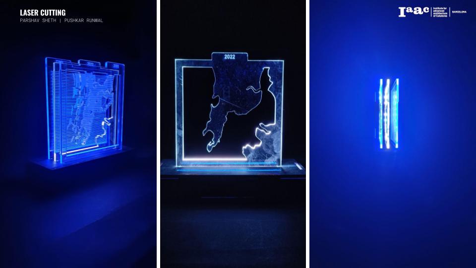
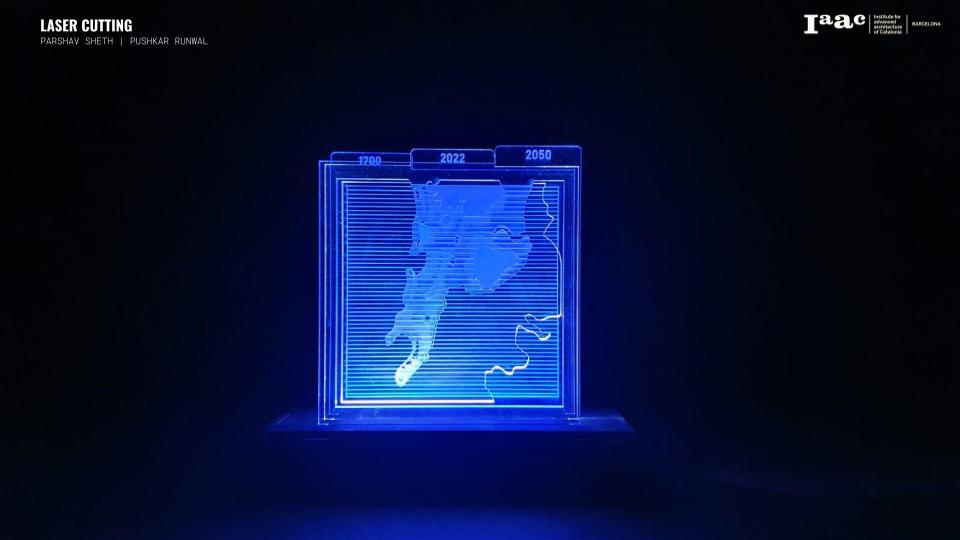
TOOL A : LASER CUTTING | CONCEPT: COASTAL FLOODING
Coastal flooding takes place when sea water enters and inundated large swathes of land. Data shows the areas of Mumbai that could be at risk (shaded in red) to coastal flooding by 2050. The areas at risk cover nearly the whole of Mumbai, including the densely populated south and suburban Mumbai.

PRODUCTION CALCULATIONS: RHINOCEROS
- Laser Cutting Material: 5 mm Transparent Acrylic
- Base Material:5 mm MDF
- Laser Cutting Machine: Rayjet 500
- Workpiece volume: 150x150x50 mm
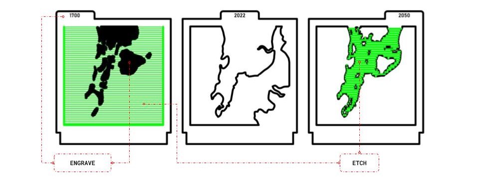
The center of our exploration was coastal flooding. All ‘treatments’ surrounded highlighting the sea. The engraved opaque portion moderate the quality of light penetration and the cuts are made to visualize the current land mass. We included a title tag above each panel to help viewers understand and interact with the models.
FINAL OUTCOME
TOOL B : CNC MINNING | CONCEPT: TOPOLOGY
For this exploration we selected a small site in the northern national park reserve called Sanjay Gandhi National Park. Located in North Mumbai the national park is a 103 square kilometer forest hemmed in by Mumbai’s suburbs, which is home not only to hundreds of species of plants, birds and reptiles but also to deer, crocodiles, and a large well-adapted population of leopards.

We obtained rasters from the Google Earth Engine and used the data to generate a topology map. This map was taken into rhinoceros and converted into a 3D mesh. We created a bounding box around the mesh to enhance the profile of the contours within.
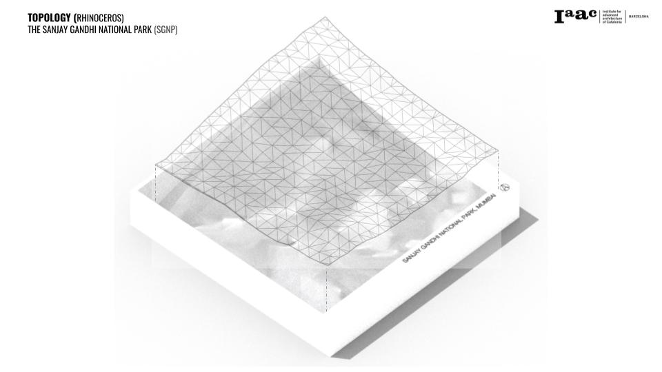
Moreover, we also created a laser cut frame for our CNC mined mesh that could serve not only as a title card but also help the model retain some structural framing. Conversely the two pieces come together to create a stable interactive model.
PRODUCTION CALCULATIONS: RHINOCAM
- CNC Material: 50 mm Foam
- CNC Machine: SHOPBOT_MTC
- Workpiece volume: 290x290x50mm
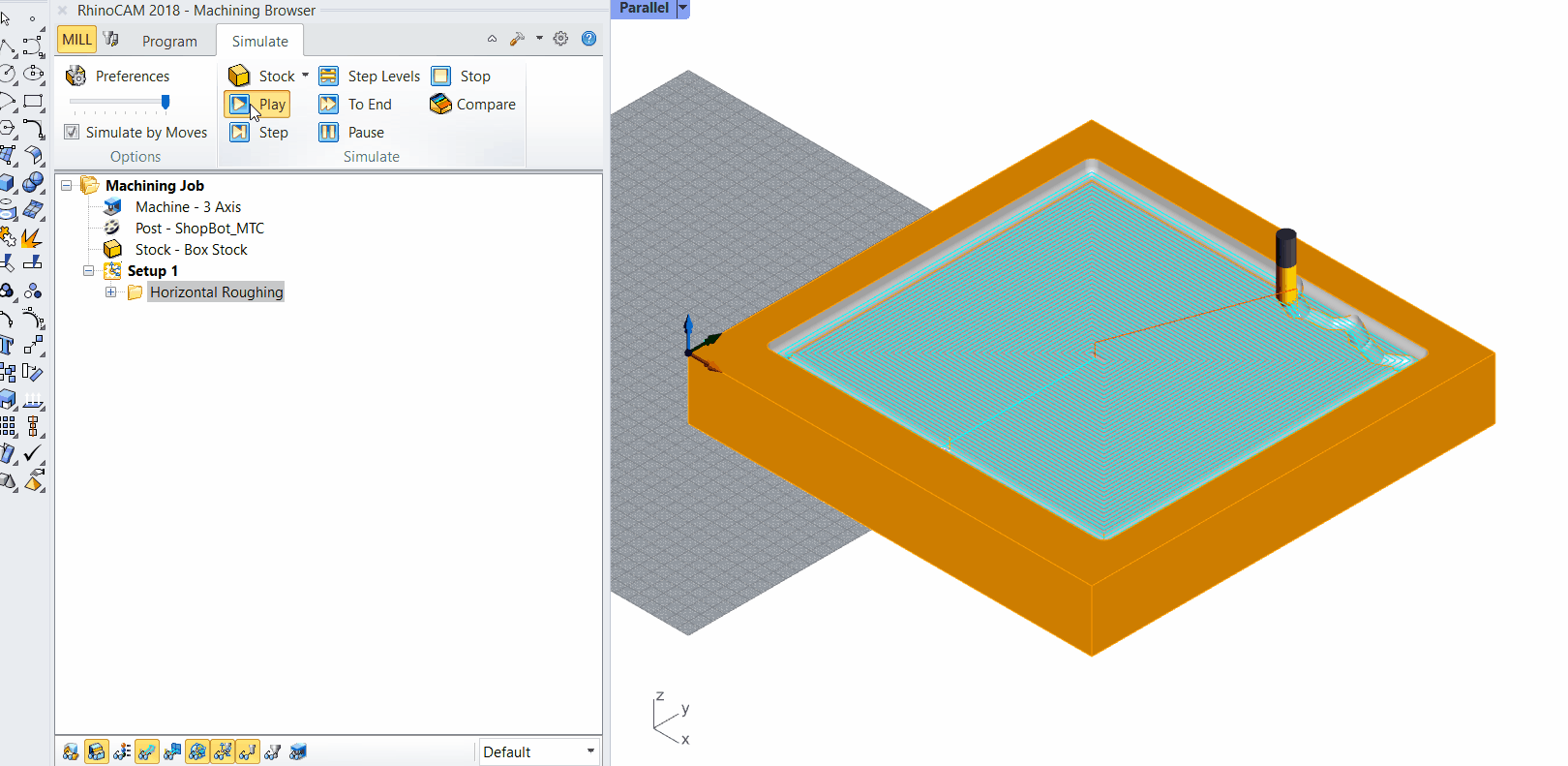
Horizontal Roughing
- Flat Mill
- Diameter: 12
- Spindle Speed: 10000
- Clearance Path: Stock max z + 6
- Stepover Distance: 75%
- Total mill time: 23 minutes
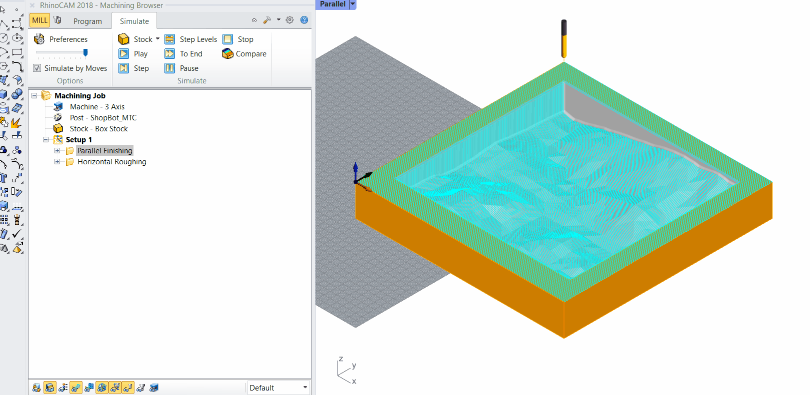
Parallel Finishing
- Ball Mill
- Diameter: 04
- Spindle Speed: 10000
- Clearance Path: Stock max z + 6
- Stepover Control: 25%
- Total mill time: 27 minutes
FINAL OUTCOME

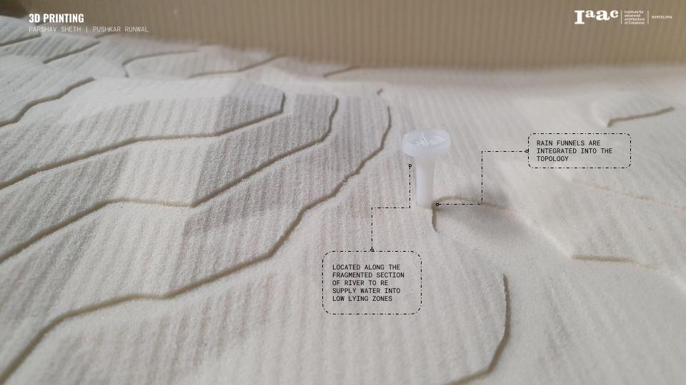
TOOL C : 3D PRINTING | CONCEPT: RAIN RESERVOIRS + GROWTH BIO-DOMES
Our concept for the 3d printing modules was to create rain funnels and growth bio domes that can interact with lights. The design was kept at minimal since the scale we were printing these modules for represents a large site.
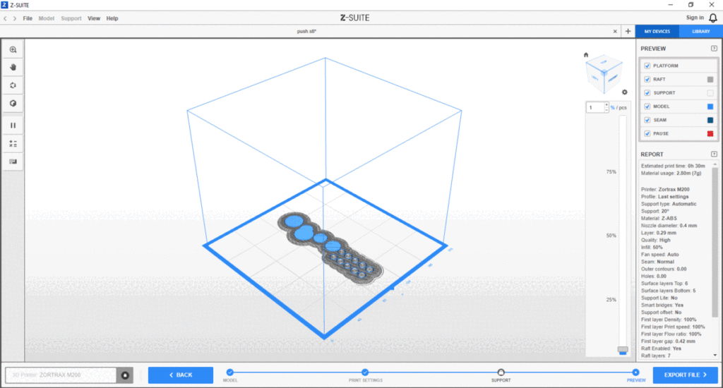
PRODUCTION CALCULATIONS [Z-SUITE]
Setting Up Of All Technical Details Was Done Using Z-Suite. Our Procedure Was Extremely Simple In Design And Execution. The One Area We Struggled A Little Was The Interphase Between The Base Layer And The Printed Material Since The Funnels Were Intended To Be Hollow.
FINAL OUTPUT

TOOL D : VIDEO MAPPING | CONCEPT: THE RAIN RESERVOIR PROJECT
The Rain Reservoir Project is a radical conceptualization of vertical reservoirs that help support ecosystemic activities amidst extreme climate vulnerabilities. Given the high precipitation rates in the tropics, the rain reservoirs are conceptualized to store the storm water over and dispense it systematically over the dry summer months to promote ecological services. The project also explores the creation of biodomes for study and promotion of native species in order to facilitate long term rewilding of the reserve. Data integration serves to be at the heart of the project, through curating the availability of water amidst the ecosystem, the project can promote and capture a plethora of ecosystemic services.

