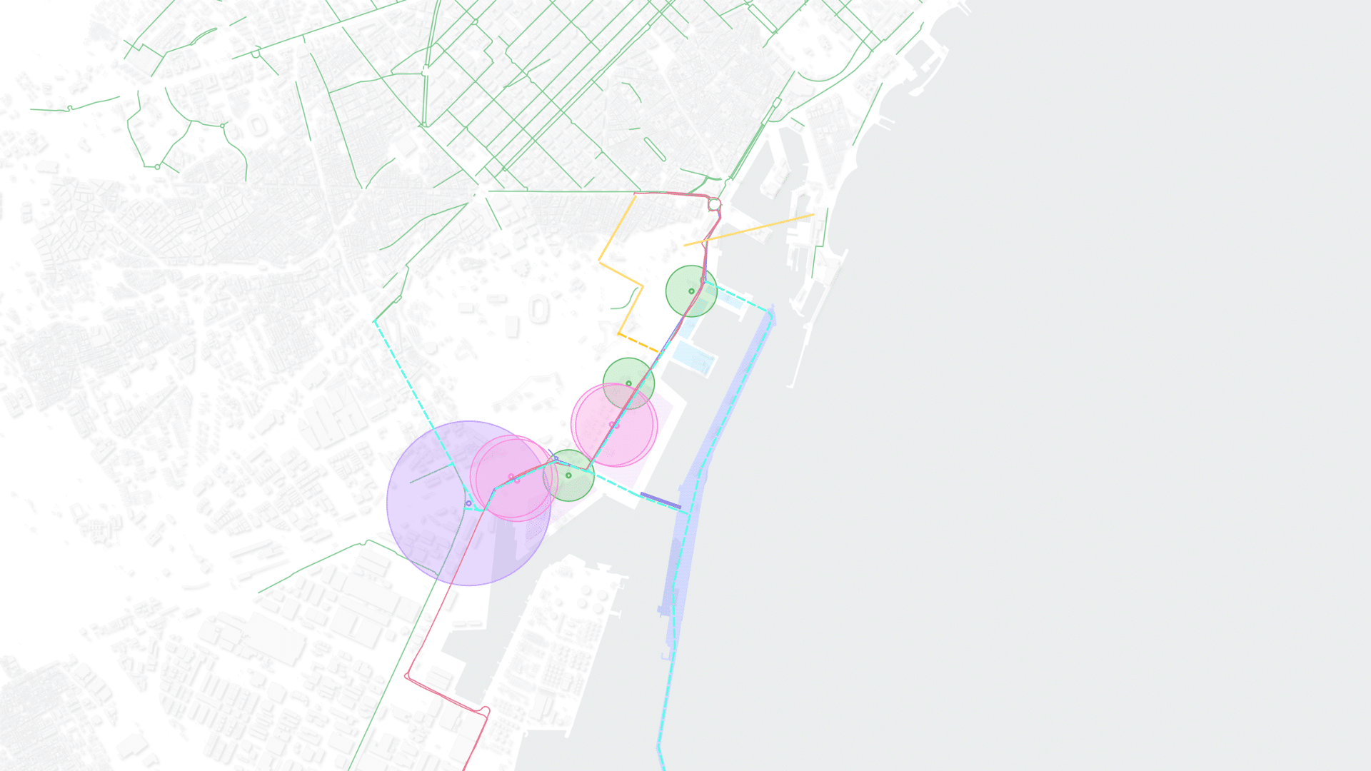
Climate Responsive Urbanism
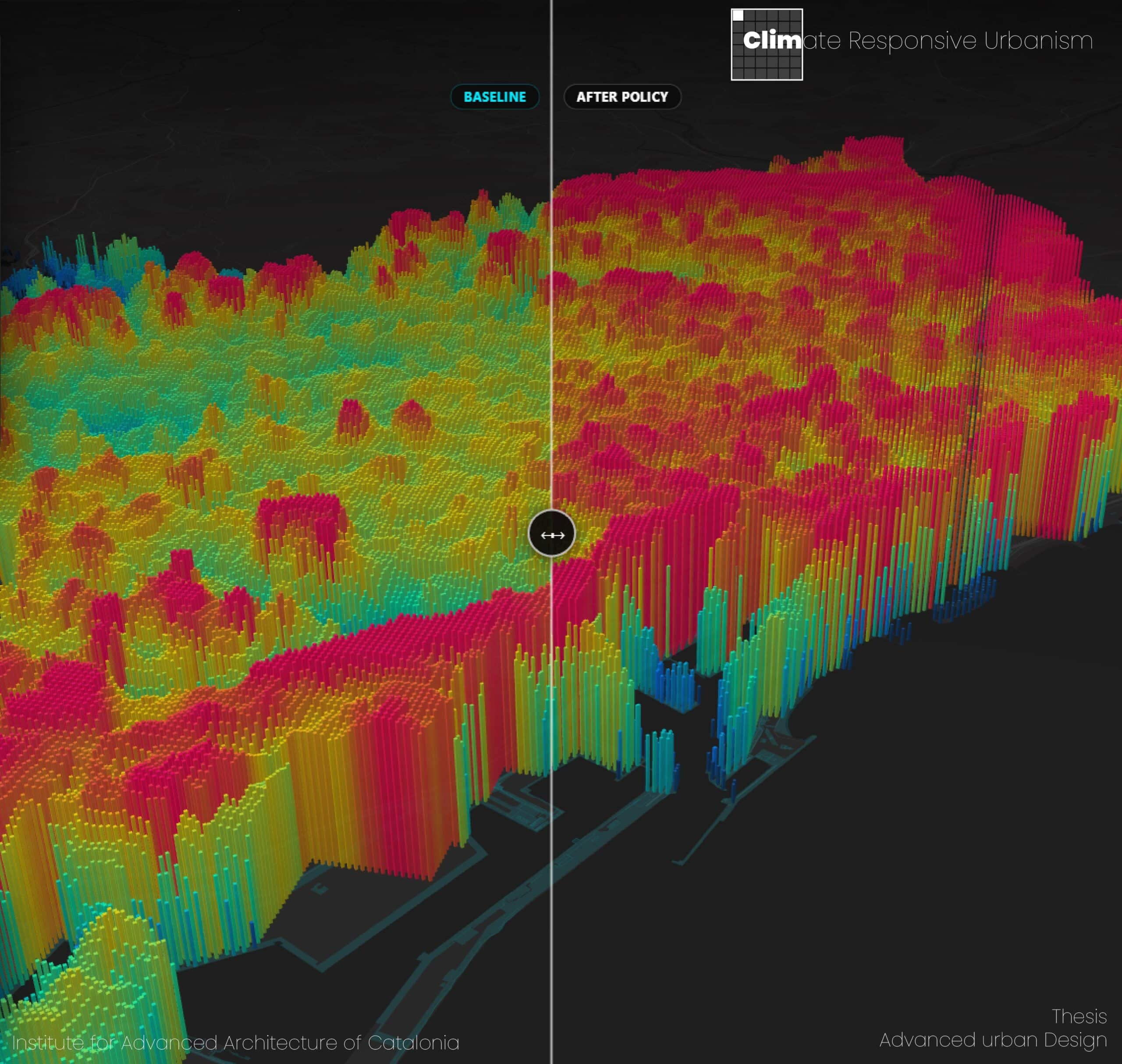
This thesis investigates how the semantic content of urban climate policy can be computationally coupled with high-resolution geospatial data to anticipate the climate consequences those policies set in motion. The work is situated in the metropolitan area of Barcelona, and the central proposition is that policy text far from being inert prescriptive language is itself … Read more