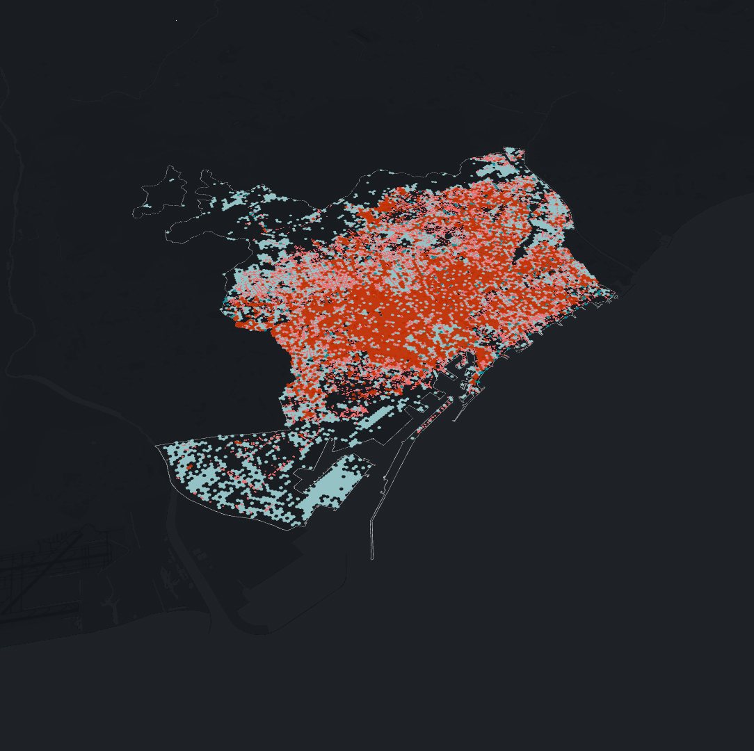
IAAC’s Master in City & Technology (1 or 2-year program) is a unique program oriented towards redefining the analysis, planning, and design of twenty-first-century cities and beyond. The program offers expertise in the design of digitally enhanced, ecological and human-centered urban environments by intersecting the disciplines of urbanism and data science. Taking place in Barcelona, the capital of urbanism, the Master in City & Technology is training the professionals that city administrations, governments, industries, and communities need, to transform the urban environment in the era of big data.


Filters
Course

The Green Ally

In Spain, there is an urban myth, according to which – The country was once so thickly forested that a squirrel could cross the peninsula hopping from tree to tree. -However, this condition has changed throughout the years, both in terms of the natural environment and the existence of squirrels in Spain. The case study … Read more

City of Proximities: Public Markets in Madrid

Madrid Public Markets SystemThe toolkit for municipalities, food delivery platforms and local residents 1/ Overall PerspectiveA first overview of the city of Madrid, throughout its administrative districts, their socio-demographics variables, the location of 46 municipal markets and the proximity patterns between them. 2/ Markets Around the Clock To allow citizens to engage with the markets … Read more

The Wild Deal

ABSTRACT Urban Rights is a term which has been coined by the philosopher Henri Lefebvre (Lefebvre, 1967)  and further explored by David Harvey (Harvey, 2003). It is a concept of a collective right to change the city and shape the process of urbanization. Thus, the right to the city does not merely address what the … Read more

Healthcare BCN

Understanding and analysing the existing Healthcare system of Barcelona with the help of open datasets available. This further helps us to understand the robustness, need and requirement to fill the gaps in the system if any with respect to their typologies and location as per districts Step 1: Documenting the distribution of different types of … Read more

Puerto Rico – population and landscape relation

The idea of combining population density and terrain relief allows to represent connectivity of most relevant settlement areas for future urban and rural building development. The choice of Puerto Rico land was made because of relatively compact territory for this software as well as its pronounced mountain ranges. Today’s migration sprawl challenge is well-known and … Read more

A Parallel City for Pollinators

Introduction to Pollination The project attempts to study and research the possibilities of creating a green, three-dimensional corridor for pollinators in a specific area, the historical city center of Madrid, connecting Madrid’s most prominent green park “el Retiro” in the east to the “Casa de Campo” natural reserve in the west. In particular the proposal … Read more

[DATA-CITY] MUMBAI

THE DESIGN AND FABRICATION OF CLIMATE ACTION INTERVENTIONS AND MODELS Our explorations surround the creation of climate action data models for the city of Mumbai. For a context that is only now becoming aware of the potential of data, The creation of interactive models can help educate citizens. The curation of multimedia models prototyped and … Read more

“Water Bodies towards crisis management”

Potential Conflicts related to flooding phenomena in highly urbanized and agricultural areas.

Almost every day, we are confronted with dramatic images of communities and environments incrisis . Flash floods have recently become one of Greece’s most common natural occurrencesafter wildfires. Flooding occurs due to rapid rainfall and heavy storms, from rising river levelsor melting snow.Deforestation, poor soil quality and rapid urbanization significantly contribute to the genesis of … Read more

HANDS OVER BEIRUT and GREEN’IN CORRIDORS

HANDS OVER BEIRUT Beirut Blast impact assessment visualization Neighborhood: Mar Mikhael (Beirut port)/ Gemmayze – Bashoura – Ashrafieh The Area chosen has received the most impact and visualization of the plot of land where buildings got damaged but on a different scale is relevant to understand the shock wave repartition. To physically be able to … Read more

Streets for People: La Barceloneta

La Barceloneta is one of the most popular neighborhoods in Barcelona. This old fishermen’s neighborhood forms an inseparable entity with the beach of the same name and is synonymous with a lot of charm, food gastronomy, old traditional pubs and a very lively atmosphere. The aim of the proposal is to identify the streets that … Read more

Pedestrianize La Sagrada Familia neighborhood

What is La Sagrada Familia neigborhood? First of all, La Sagrada Familia cathedral is one of the most visited by tourists attractions in Spain. History of La Sagrada Familia Quartier. Urban design issue Initially, Antonio Gaudi, while in charge of designing La Sagrada, envisioned removing two inhabited blocks in front of the main facade of … Read more