
La Mina, Sant Adria de Besos
Our project examines perceived safety in La Mina, Barcelona, by analyzing urban factors such as street lighting, tree density, street width for visibility, and large empty spaces. We develop a scoring system to assess these elements and use map-based analysis to visualize safe and unsafe areas within the neighborhood. By identifying patterns in urban design that influence safety perceptions, our research aims to provide insights for improving public spaces. This study contributes to urban planning discussions, highlighting how environmental features impact community well-being and safety in La Mina.


“Unsafe” La Mina
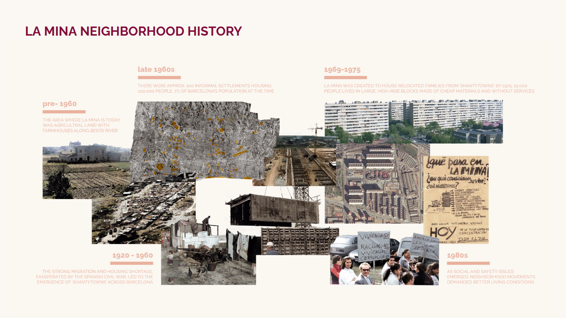
La Mina, a neighborhood in Sant Adrià de Besòs on the outskirts of Barcelona, has a long-standing reputation for safety concerns due to crime, drug trafficking, and social issues. Originally developed in the 1970s to rehouse people from slums, it has struggled with marginalization and high unemployment rates.
While there have been urban renewal efforts to improve conditions, the area still faces challenges related to organized crime and drug-related activities. Visitors are generally advised to exercise caution, especially at night. However, during the day, it is not necessarily dangerous if you remain aware of your surroundings. Locals and authorities continue working on community initiatives to improve safety and quality of life.
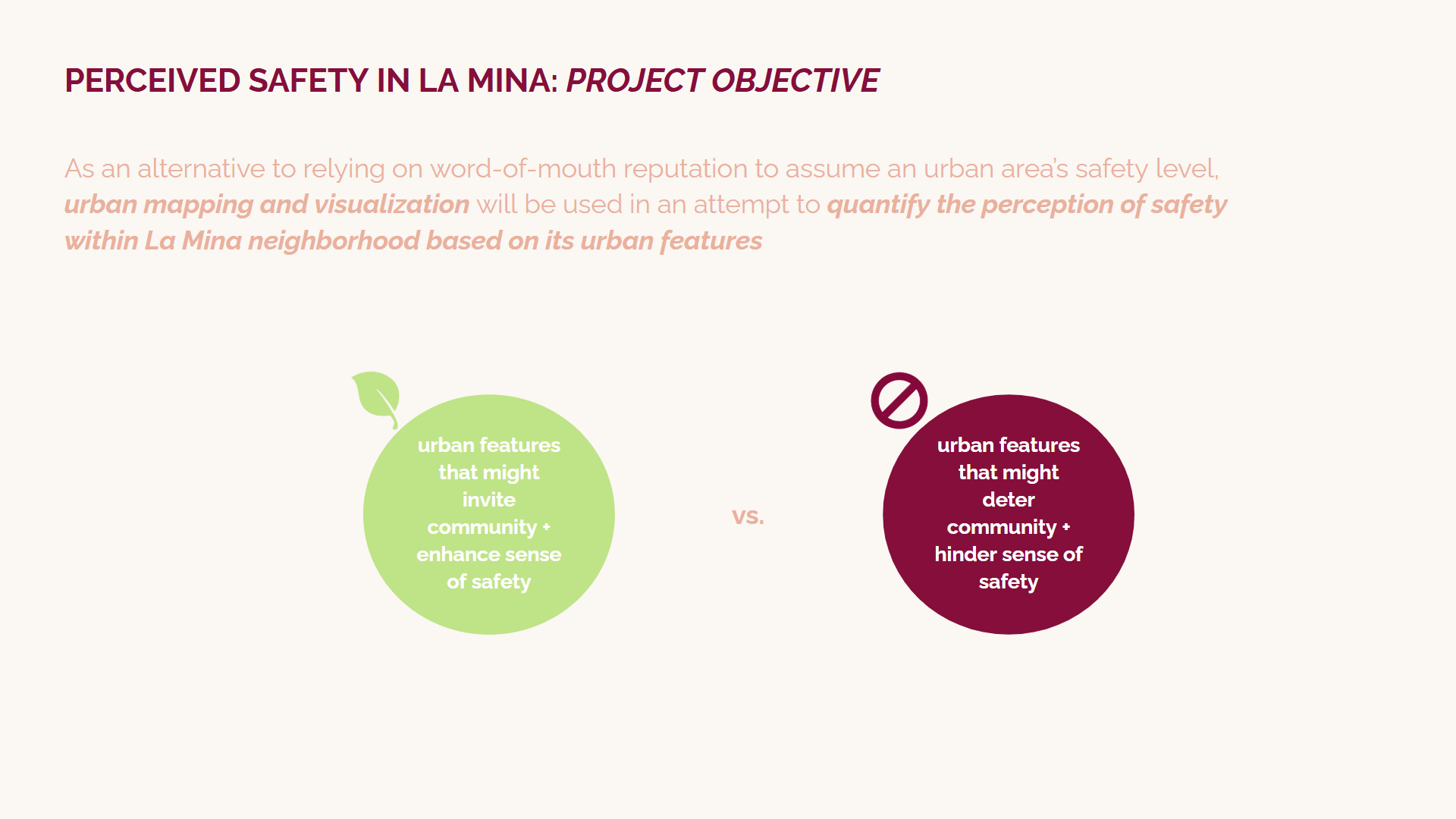
This project examines perceived safety in La Mina by analyzing key urban parameters: the number of trees per block, street lighting, large parking areas, street hierarchy, and street width. Trees can enhance walkability and comfort but may also create concealment risks. Adequate street lighting improves visibility and deters crime. Large parking areas can feel unsafe if poorly maintained or isolated. Street hierarchy influences traffic flow and pedestrian presence, while wider streets may impact surveillance and accessibility. By assessing these factors, we aim to understand their role in shaping residents’ and visitors’ perceptions of safety in the neighborhood.
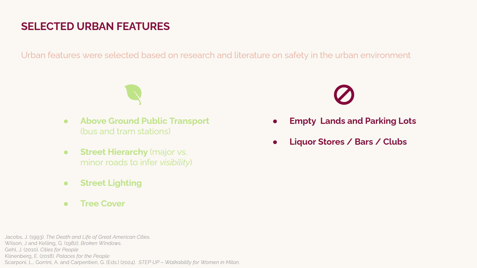
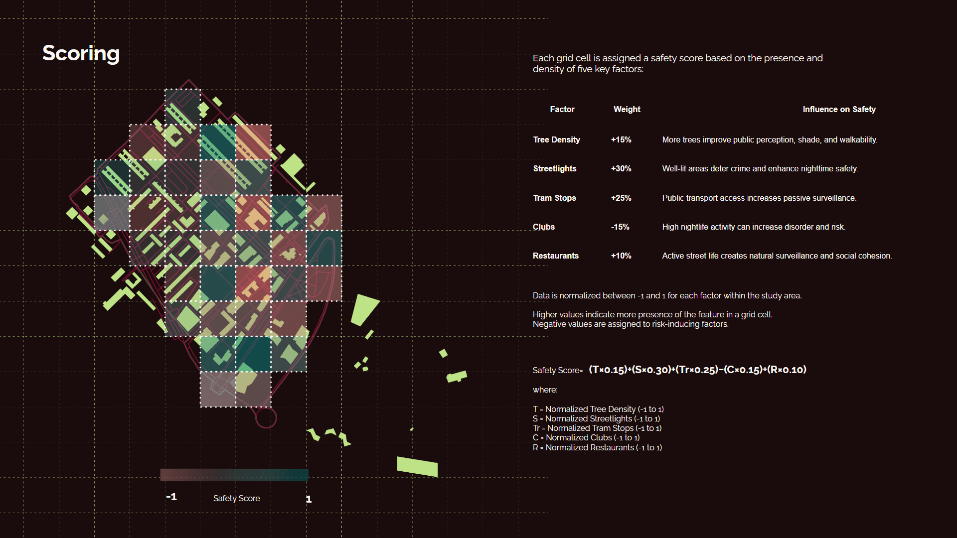
The safety scoring system for La Mina is based on dividing the neighborhood into a quadtree grid and analyzing the density of key urban features within each section. Features that contribute to a sense of security, such as street lighting, well-connected roads, public transportation, and greenery, positively influence the score, while elements that may decrease perceived safety, such as bars, nightclubs, and large, isolated parking lots, have a negative impact. Each feature is assigned a weight according to its influence, and the total score for each grid cell is calculated by summing these weighted values. The scores are then normalized into three categories, ranging from safe to unsafe, allowing for a clear spatial representation of safety conditions across the neighborhood. This approach provides a structured, data-driven analysis that highlights areas requiring attention and potential urban improvements.
In the below video, we aim to show the analysis of the urban features in the neighborhoud such as street hierarchy, amount of trees, amount of street light, transportation and large parking areas. All these data will help us when the scoring takes place, in analyzing the data of each block.
