
How does a world-class shopping destination integrate into one of Europe’s densest urban grids
without destroying it?
This project interrogates Barcelona’s proposed destination mall near La Sagrada Familia originally conceived at 150,000m² with 6,000 car parking spaces and redefines it as a 100,000m² precinct with radically reduced vehicle dependency.
Through a three-pillar spatial methodology examining urban opportunity zones, social infrastructure conflict, and multimodal transport connectivity, we identify sites where commercial scale and neighbourhood liveability coexist. The result is a mall embedded within a redesigned mobility network — not a car destination, but a people-centred precinct.
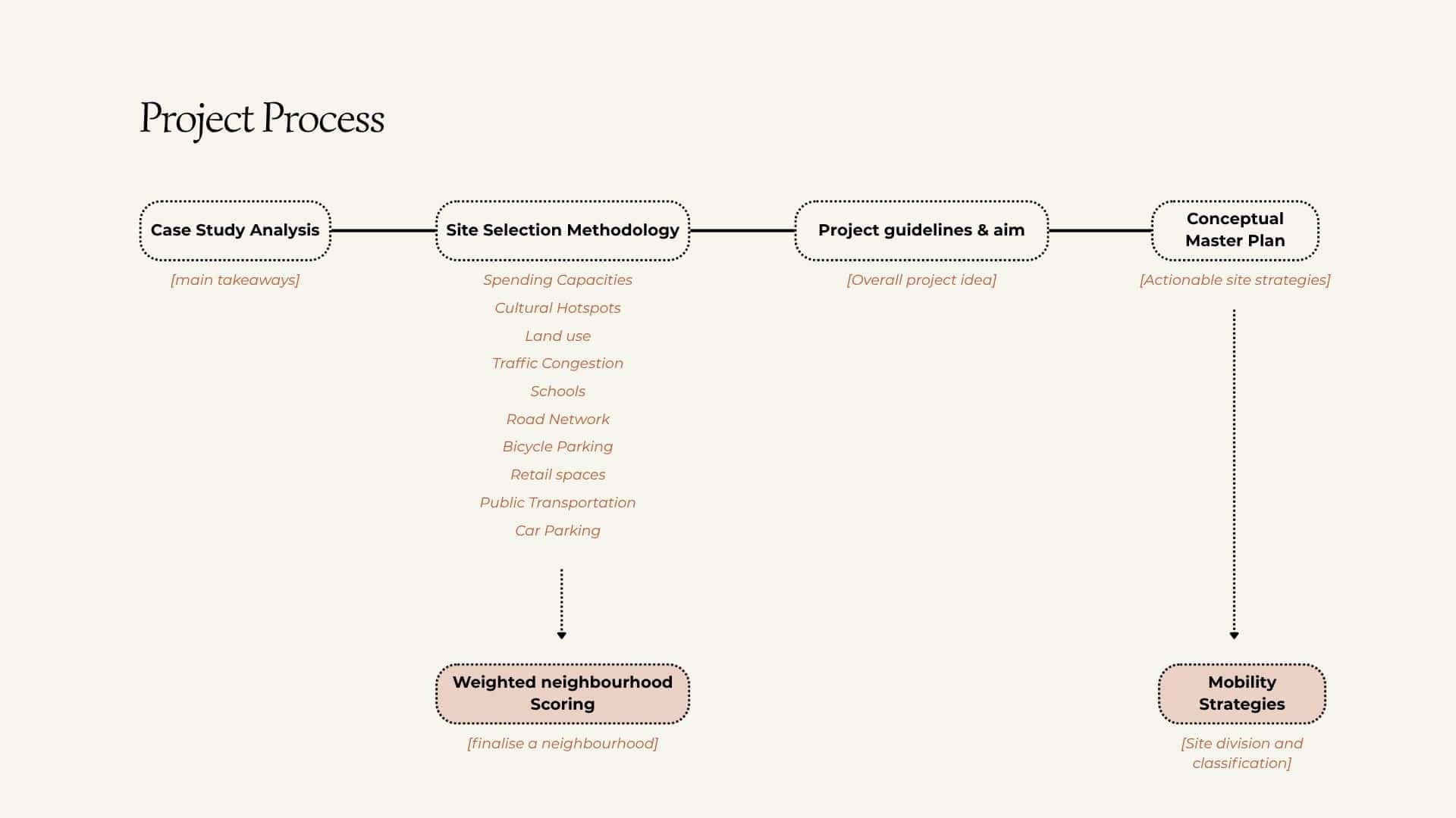
The project moves through four sequential stages: urban analysis, site selection, master planning, and mobility strategy. Data was sourced from Open Data BCN, OpenStreetMap, and the TMB transport network, processed in QGIS across ten spatial layers. Candidate sites were identified through a composite reading of transport, economic, and social criteria. The selected site then informed a master plan and zoning proposal, concluding with a multimodal mobility strategy tailored to the precinct’s urban context.
Case Studies
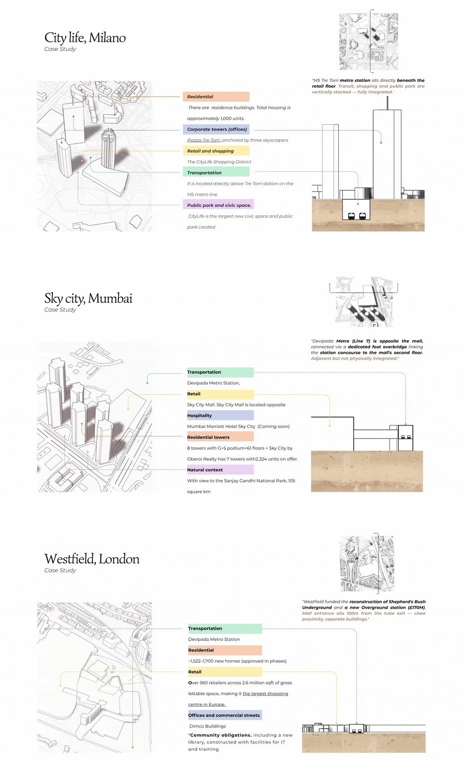
Three international precedents informed our approach to integrating large-scale retail within dense urban fabric.
CityLife Milan demonstrated full vertical integration of metro and retail.
Sky City Mumbai showed how elevated pedestrian infrastructure can bridge transit and commercial space.
Westfield London proved that developer-funded transport upgrades can deliver genuine public mobility benefits.
Together they define a spectrum, from physical integration to strategic proximity — that shaped our own proposal.
Methodology for site selection
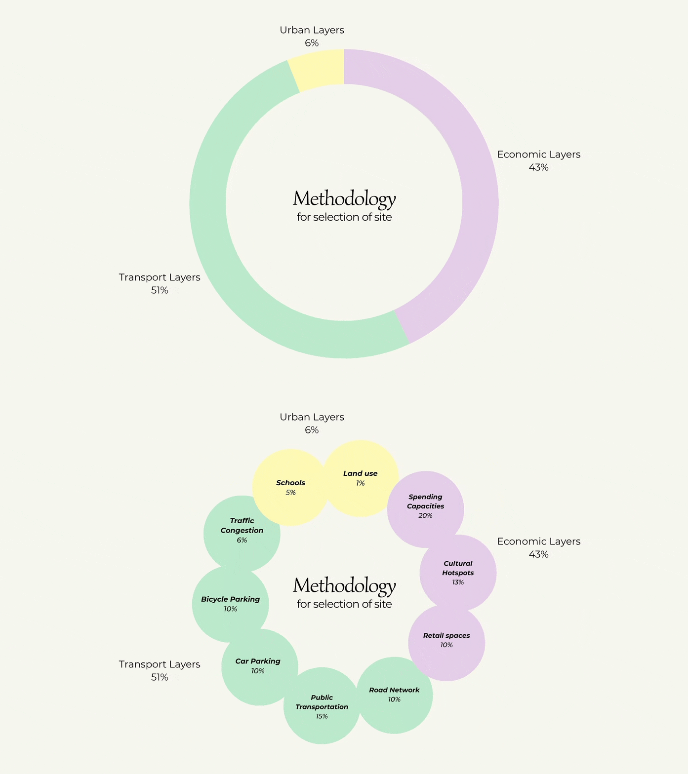
Site selection was structured around three analytical pillars: transport, economic, and social and weighted across ten spatial layers. Rather than flattening data into a single score, each layer was mapped independently to reveal tensions and opportunities across the study area. Transport layers carried the highest weight at 51%, reflecting the centrality of mobility to the brief. Economic layers contributed 43%, capturing spending capacity, cultural gravity, and existing retail density. Social layers, at 6%, defined the key conflict zones to avoid.
Transport Layers
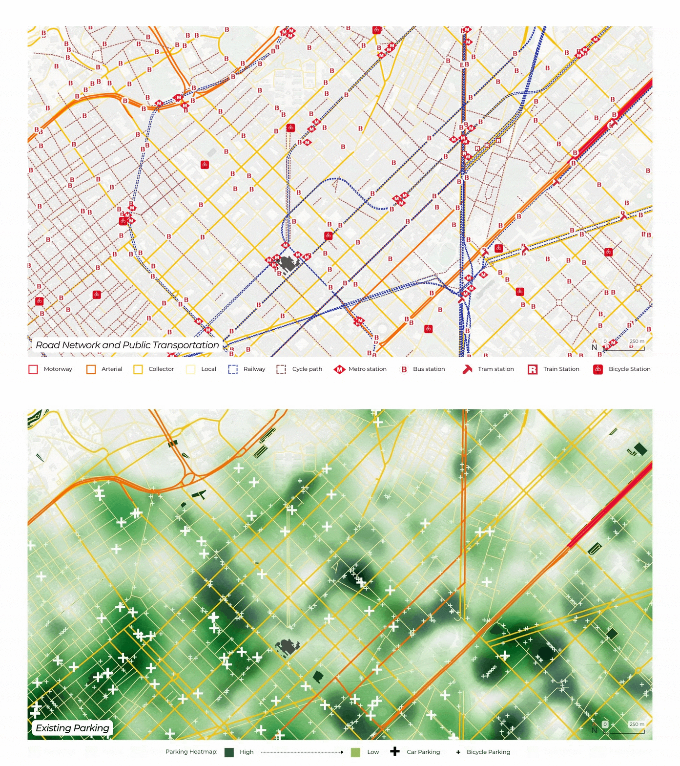
Transport layers formed the backbone of the analysis, accounting for 51% of the total methodology weight. Existing car parking distribution, road network hierarchy, public transportation nodes, and bicycle infrastructure were mapped across the study area. Together these layers revealed which zones have the multimodal connectivity needed to absorb a 100,000m² retail destination without defaulting to car dependency.
Economic Layers
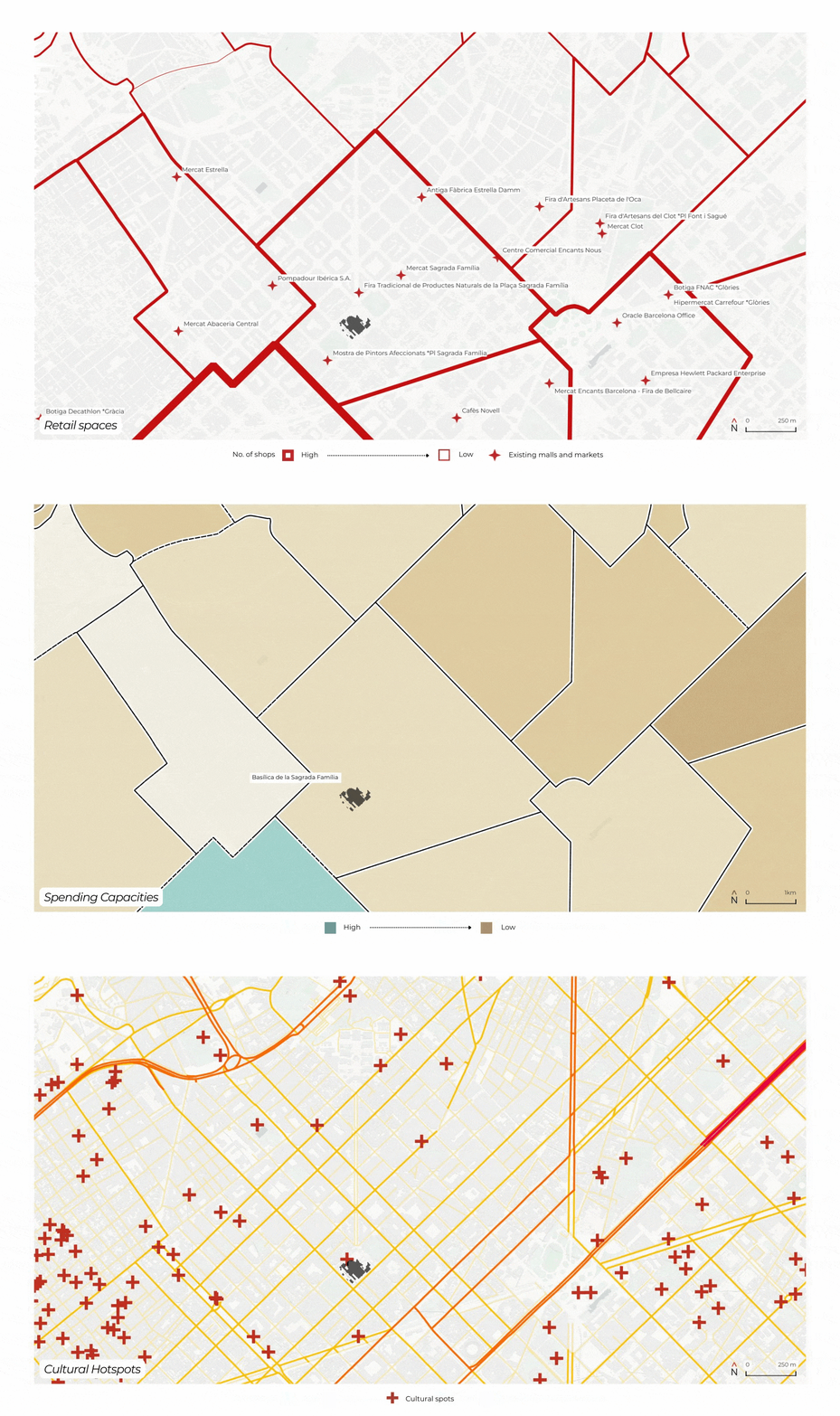
The economic pillar examined where commercial activity, cultural gravity, and household spending capacity already converge. Spending capacity by census section identified neighbourhoods with the purchasing power to sustain a destination mall. Cultural hotspots mapped proven visitor destinations, while existing retail spaces revealed both saturation risks and synergy opportunities. Combined, these layers pointed toward zones where a new precinct would amplify, not displace, existing economic life.
Social Layers
Social layers defined the constraints — where the mall must not go. School locations were buffered at 200m, reflecting the conflict between high vehicle-generating retail and active school zones in Eixample’s dense grid. Traffic congestion data overlaid these buffers to identify corridors already operating at or near capacity. The result is a clear map of residential and civic pressure that any viable site must navigate.
Composite layers
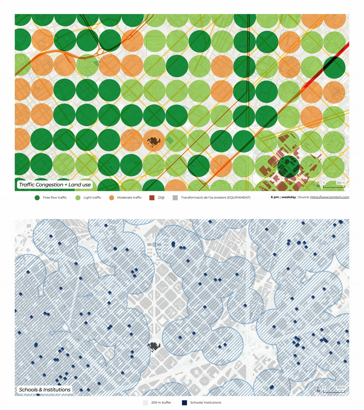
With all three pillars mapped independently, the composite view brings them into dialogue. Opportunity zones — industrial land, 22@ district, urban renewal areas — are read against school buffers and transit access simultaneously. No scoring flattens the data; instead the spatial logic speaks directly.
Sites where opportunity land overlaps with strong transit catchment and minimal school conflict emerge as the viable candidates.
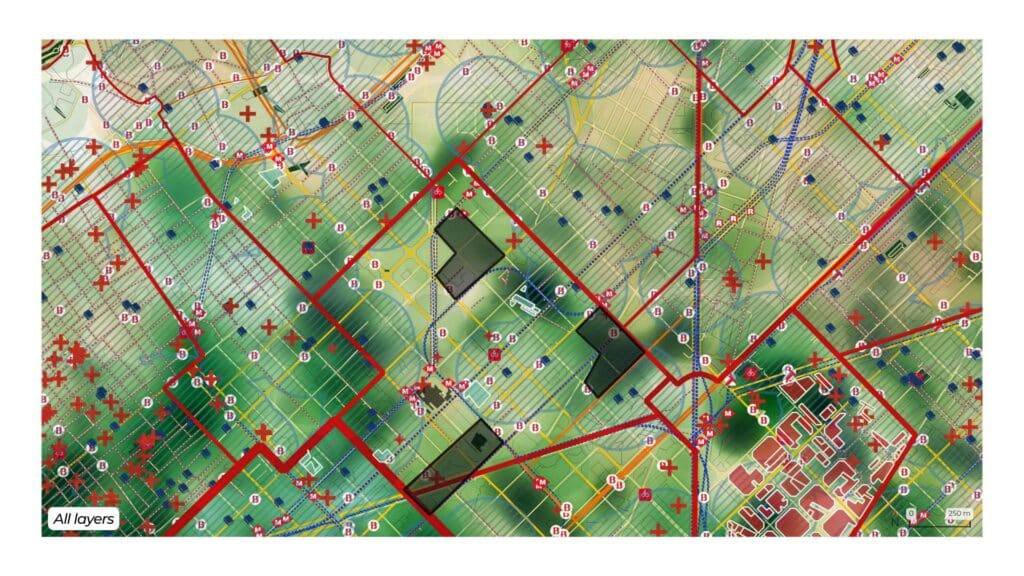
5 main guiding visions
Five principles guide the transformation of the selected site: car-free access prioritisation, multimodal connectivity, integration with the existing neighbourhood fabric, reduced parking footprint, and design that serves both visitors and residents. These visions are not aspirational add-ons, they are the structural logic behind every decision in the master plan, from road access routing to the distribution of public space.
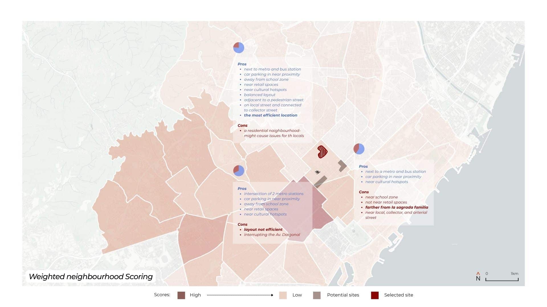
Weighted neighbourhood Scoring
Three candidate sites were evaluated by scoring each of ten spatial layers on a 0–100 scale in QGIS, weighted against their assigned methodology percentages across transport (51%), economic (43%), and social (6%) pillars, then summed into a final composite score. The selected site achieved 76%, driven by strong performance across public transportation proximity (15%), road network connectivity (10%), and cultural hotspot adjacency (13%), with minimal penalty from school conflict zones. The middle site scored 68% — competitive on transit with two intersecting metro lines, but significantly penalised on the road network layer for interrupting Avinguda Diagonal. The coastal site scored 60%, pulled down by school zone overlap and weak retail density in its economic catchment.
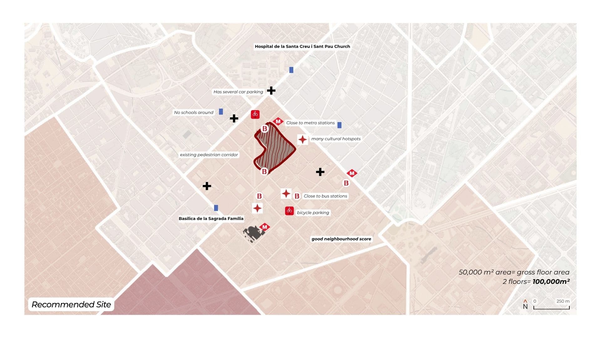
Recommended Site
The selected site sits within reach of metro and bus connections, adjacent to existing retail activity and cultural hotspots, on a local street connected to the collector network, avoiding the arterial stress that would make vehicle access unmanageable.
It falls outside the 200m school buffer zone. At 100,000m², the reduced footprint fits the urban grain without the land assembly conflicts that the original 150,000m² proposal would have required.
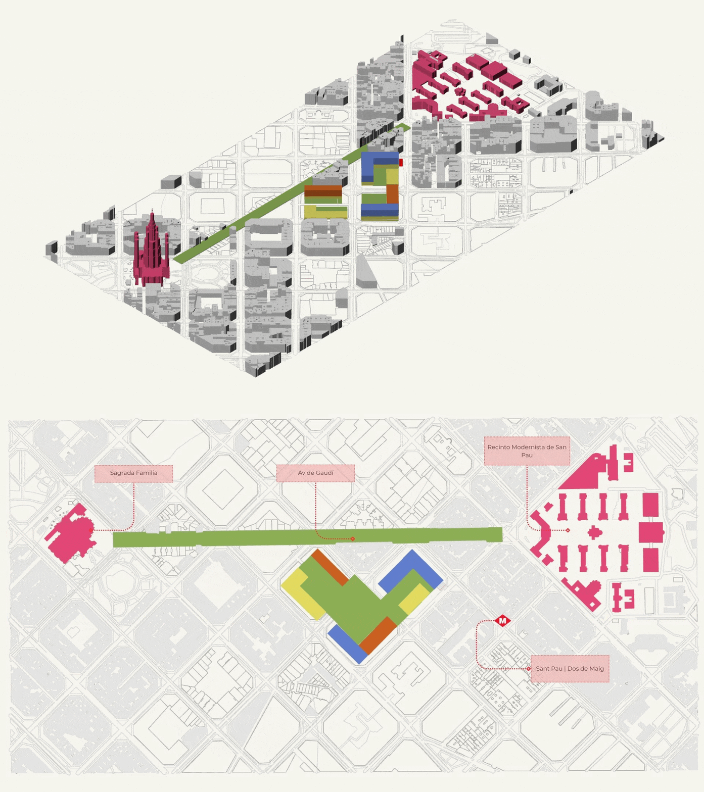
A building where urban circulation and retail coexist as a single system, redefining the mall as a node within Barcelona’s mobility network.
Master plan
The master plan redistributes the mall’s programme across a permeable urban block rather than a single enclosed structure. Ground floor retail activates street edges. A central public space replaces the conventional atrium. Vehicle access is consolidated to a single service corridor, separating deliveries and waste collection from pedestrian movement entirely. The reduced parking provision integrated with existing neighbourhood stock rather than built new is the plan’s most direct challenge to the original brief.
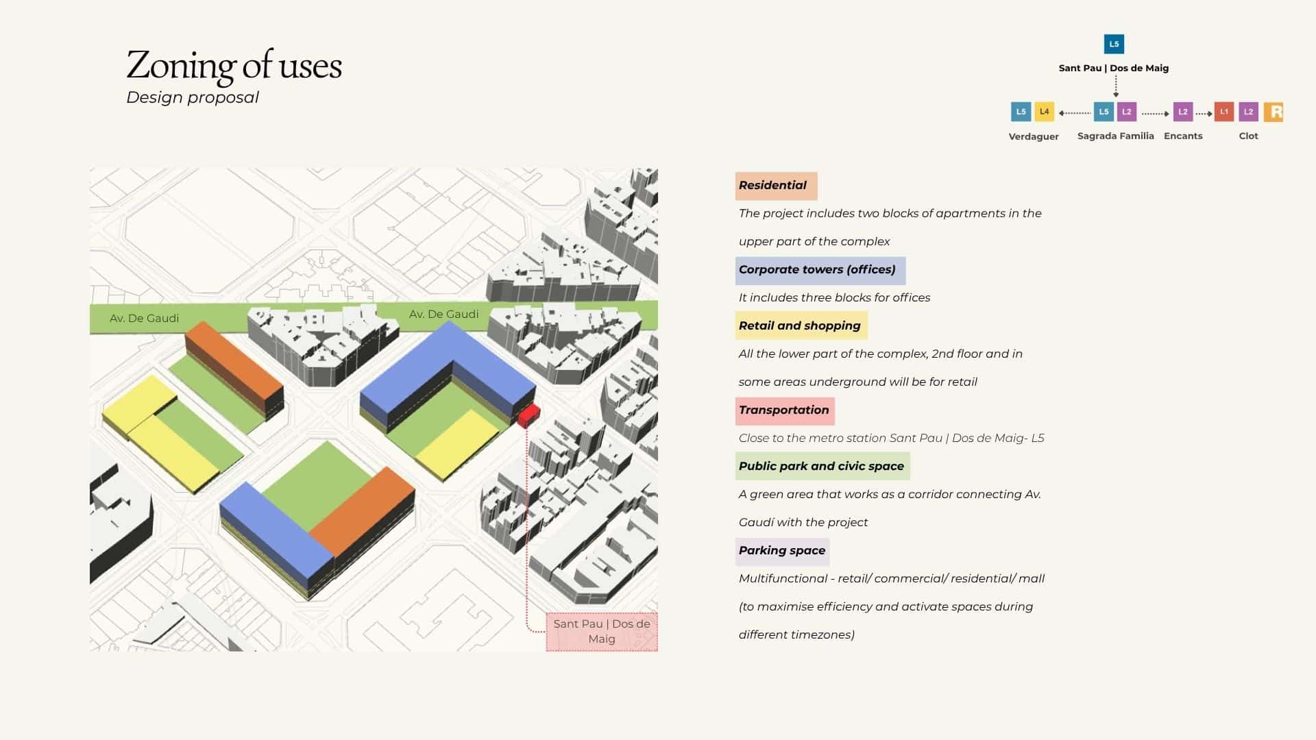
Zoning of uses
The zoning distributes retail, civic, residential, and mobility uses across the precinct in response to the surrounding urban context. Active retail frontages face the pedestrian network. Service and logistics zones are placed on the collector road edge. Public and civic uses anchor the corners that connect to the wider neighbourhood. The zoning is not a conventional mall layout, it is a piece of city that happens to contain retail.
Assessing Reach from the selected site
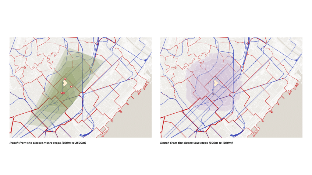
Isochrone analysis from the selected site reveals that significant residential and working population is reachable within 10 minutes on foot, 10 minutes by bicycle, and 15 minutes by public transport — without a car. This catchment, mapped against spending capacity data, demonstrates that the mall’s commercial viability does not depend on 6,000 parking spaces. The visitors are already there, connected by the networks that already exist.
Mobility Strategies
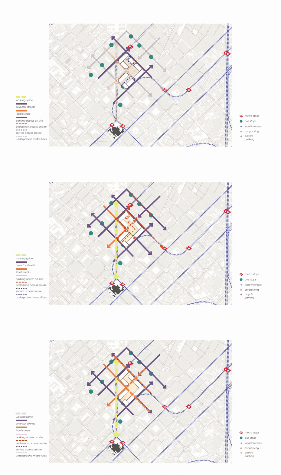
Map showing road heirarchies, pedestrian paths from the existing walking spine and public transportation stops, and service and emergency vehicular paths within the site from the collector streets.
Map showing proximity to nearby bicycle parking and car parking and introduced shuttle services from the parking to the mall, and proximity to existing malls, market spaces and cultural interests spots.
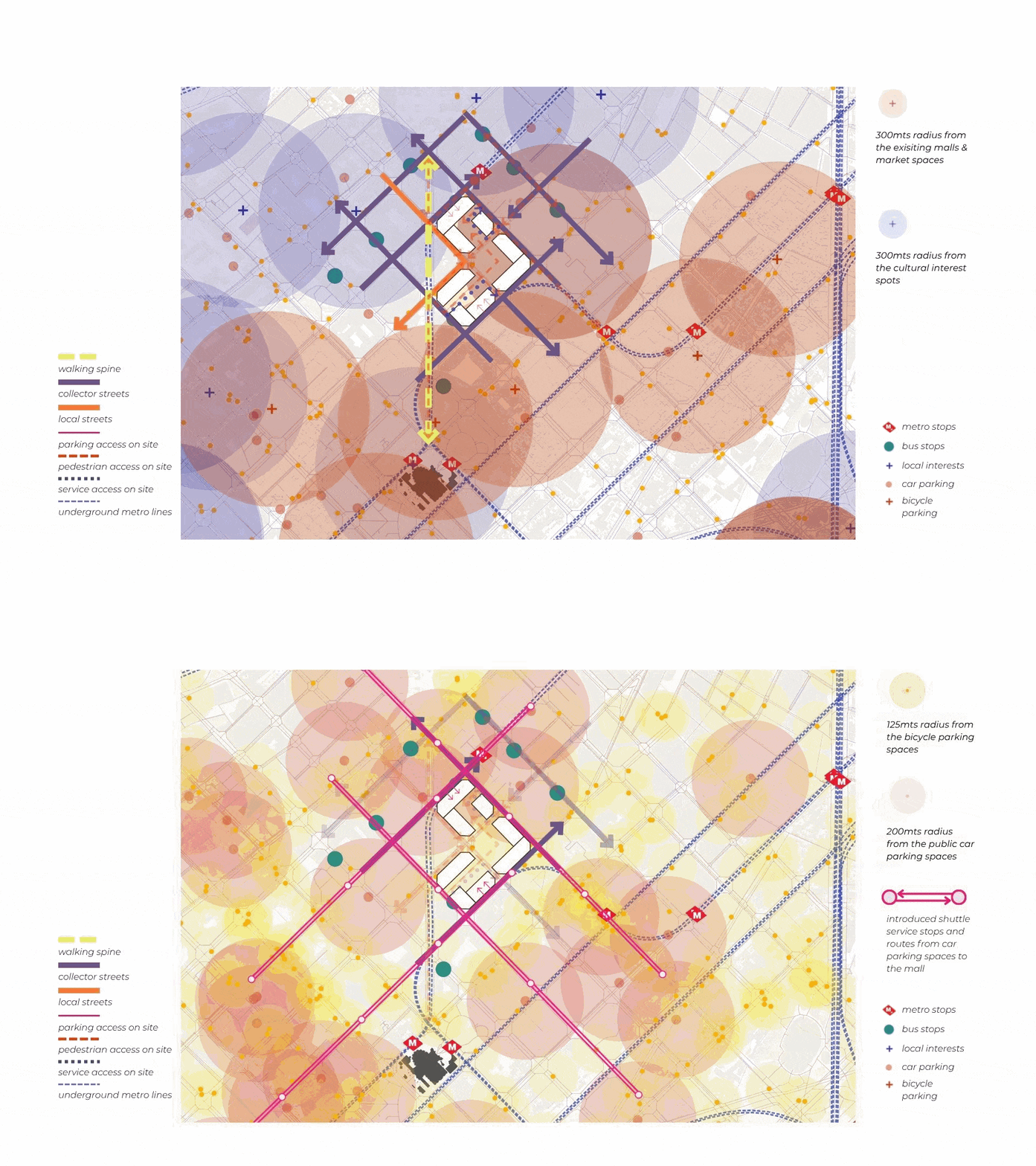
The mobility strategy for Barcelona’s Nexus is built on one principle: the mall arrives by metro, by bike, and on foot — not by car. Three strategies operationalise this vision. First, public transport integration ensures the nearest metro and bus stops become direct, legible entry points to the precinct. Second, a dedicated cycling corridor connects the site to Barcelona’s existing cycle network, with secure bicycle parking at every entrance. Third, vehicle access is strictly managed — limited to a single service route for deliveries and waste, operating outside peak hours, with no through-traffic. The result is a precinct that reduces, rather than amplifies, the vehicle pressure on one of Barcelona’s most sensitive residential neighbourhoods.
