
Rental Market and Vacancy Rates

Growth Rate in Real Estate Market

Income Status and Population Rates

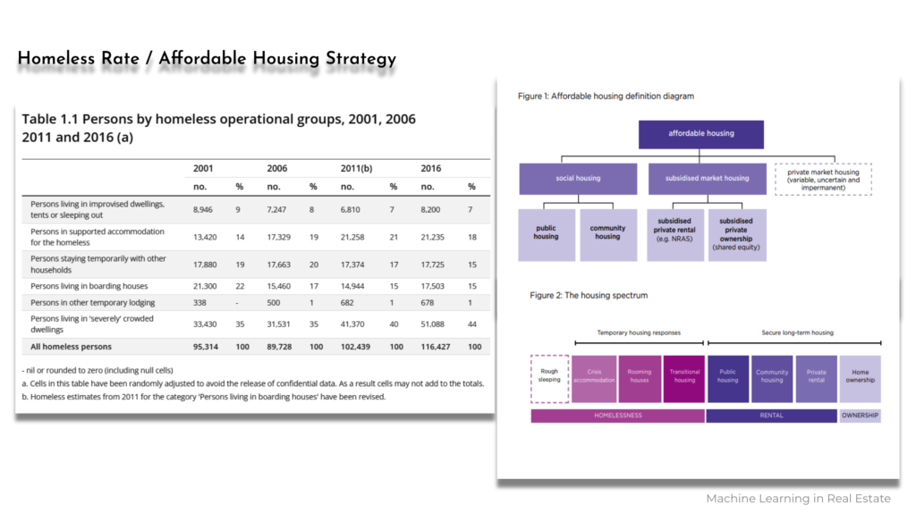
Homeless Rates and City of Melbourne Affordable Housing Strategy
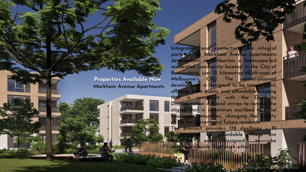
Available Affordable Housing Apartment
One of the existing affordable housing is the Markham Avenue Apartments which is located in Ashburton, a residential community in the City of Boroondara, just 12 kilometres south-east of Melbourne.
This provides 178 dwellings – 111 public and 68 affordable units.
Future Affordable Housing
The other affordable housing apartment that is coming to the market very soon is the Ascot Vale in Dunlop Avenue. This development has 200 accessible apartments in one-, two- and three-bedroom configurations and five fully accessible apartments for people with disabilities.

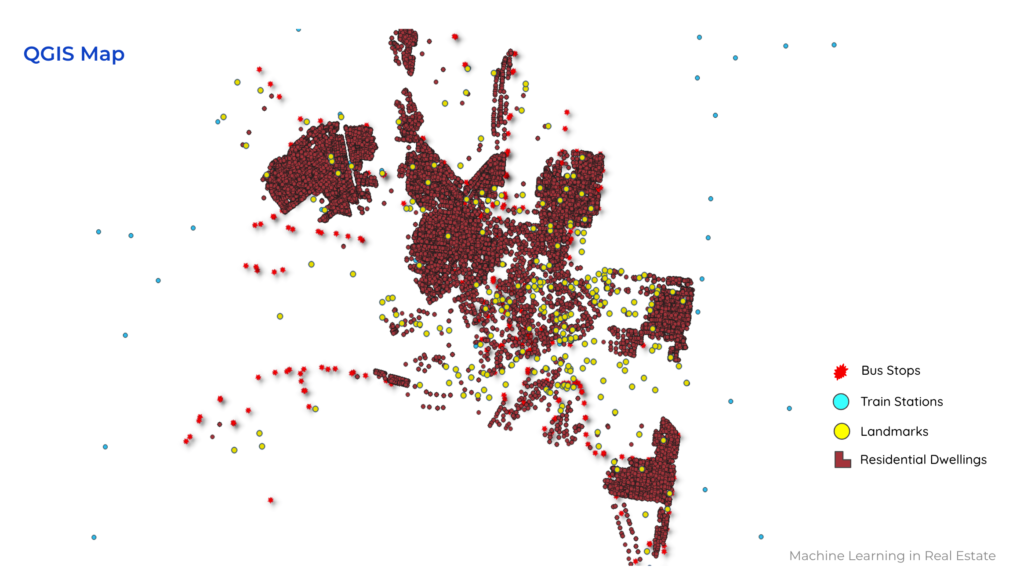
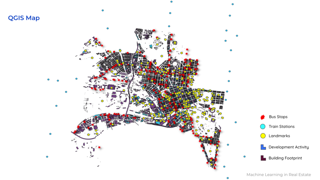
In general, to find the optimum location for affordable housing we had to find and extract all information about the Landmarks and places of interest, for example schools, theatres, health services, sports facilities, galleries and museums.

For the above reasons we first try to find the location of these landmarks in the city of Melbourne through QGIS. and in this slide we see the location of bus stops, train stations and landmarks.
Development activities in the city which it helps us to remove some of these lands that have already developed or under construction.
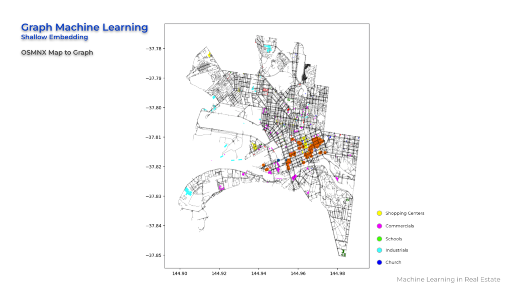
Although we looked at the QGIS, we also applied the Machine learning techniques like Shallow Embeddings in Graph Machine learning to find the location of shopping center, schools and retail or commercial spaces through the OSMNX map to graph.
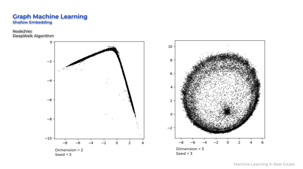
Here we used the Node2Vec technique and the reason that we tried different numbers is because the higher dimension allows for more expressive embeddings that can capture more complicated patterns and relationships in the graph.
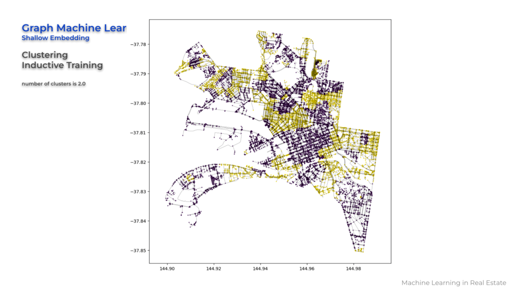
And then we applied clustering Inductive training to generate nodes by optimizing the random walks performed on the graph. And the reason we used this technique is because we can apply clustering algorithms, such as k-means or hierarchical clustering, on the embeddings to form clusters.
And after all we used Higher-order proximity preserved embedding. The reason that we used this model of embedding is because it aims to capture higher-order proximity information in a graph.
So basically as you can see in these three areas we have a higher-order adjacency matrix that represents the higher-order relationships between nodes, which effectively captures the common neighbourhood structures at different distances.
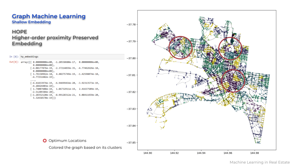
So as a result these three areas could be a potential locations for having a Affordable housing for people living in this area.