
When we think of biodiversity restoration, we often imagine vast forests or national parks. But what if it could begin on a balcony? A window ledge? A planter box?
This question shaped my thesis project, BEASTIE – the Biodiversity Engagement and Action Simulator for Thriving Inclusive Ecosystems. It is a data-driven simulator that helps citizens, building communities, and neighborhood groups turn everyday urban surfaces into microhabitats for birds, bats, butterflies, and more.
Why This Matters
We are currently living through the sixth mass extinction, driven by human activity. One million species are at risk. 75% of terrestrial environments and 66% of marine areas have been severely altered.
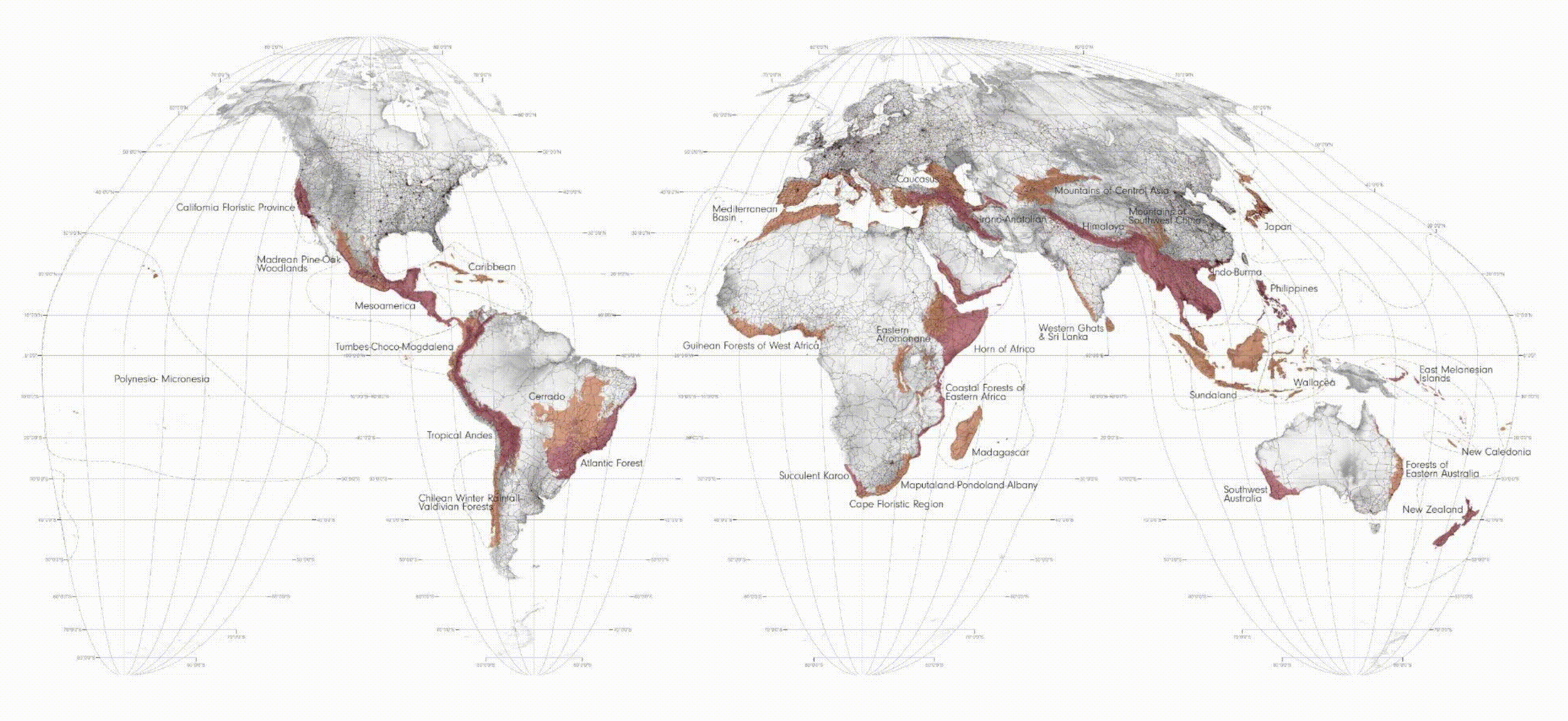
We often imagine biodiversity loss happening ‘out there’, in forests or oceans. But our cities are a key battleground. There have been notable decline on biodiversity population in the cities.
But if cities are part of the problem, they must also be part of the solution.
Cities are often seen as biodiversity deserts. But when designed right, they can become refuges. In fact, urban green areas can host more biodiversity than nearby agricultural landscapes. Design and engagement are key.
Biodiversity in Barcelona
Barcelona is 68% urbanized, suffering from urban heat islands, poor ecological connectivity, and loss of microhabitats.
And yet, it’s home to:
- 169 bird species
- 49 butterflies
- 387 biodiversity infrastructures already implemented by the city
Most biodiversity hotspots cluster near large green spaces like Collserola, Ciutadella, or Montjuïc. But many central urban areas remain underperforming despite their ecological potential.
BEASTIE addresses this gap, helping citizens target these spaces with species-specific, spatially adaptive interventions.
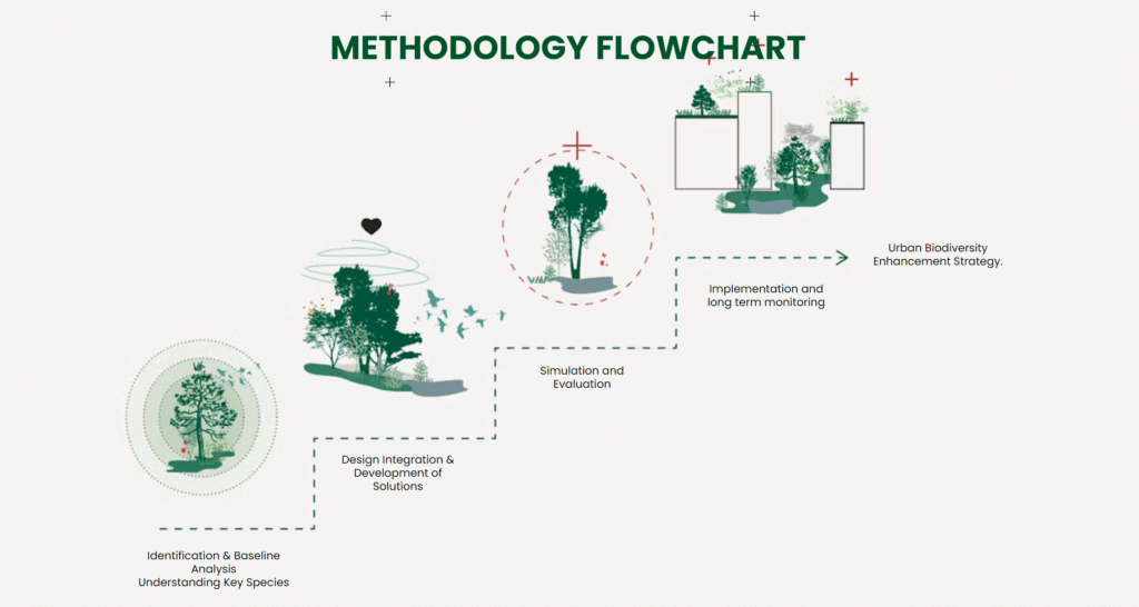
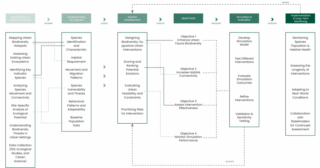
The BEASTIE Approach
BEASTIE asks: How can citizens become designers of urban biodiversity?
The simulator connects:
- Species needs
- Types of urban space
- Ecological scoring
- User-friendly biodiversity solutions
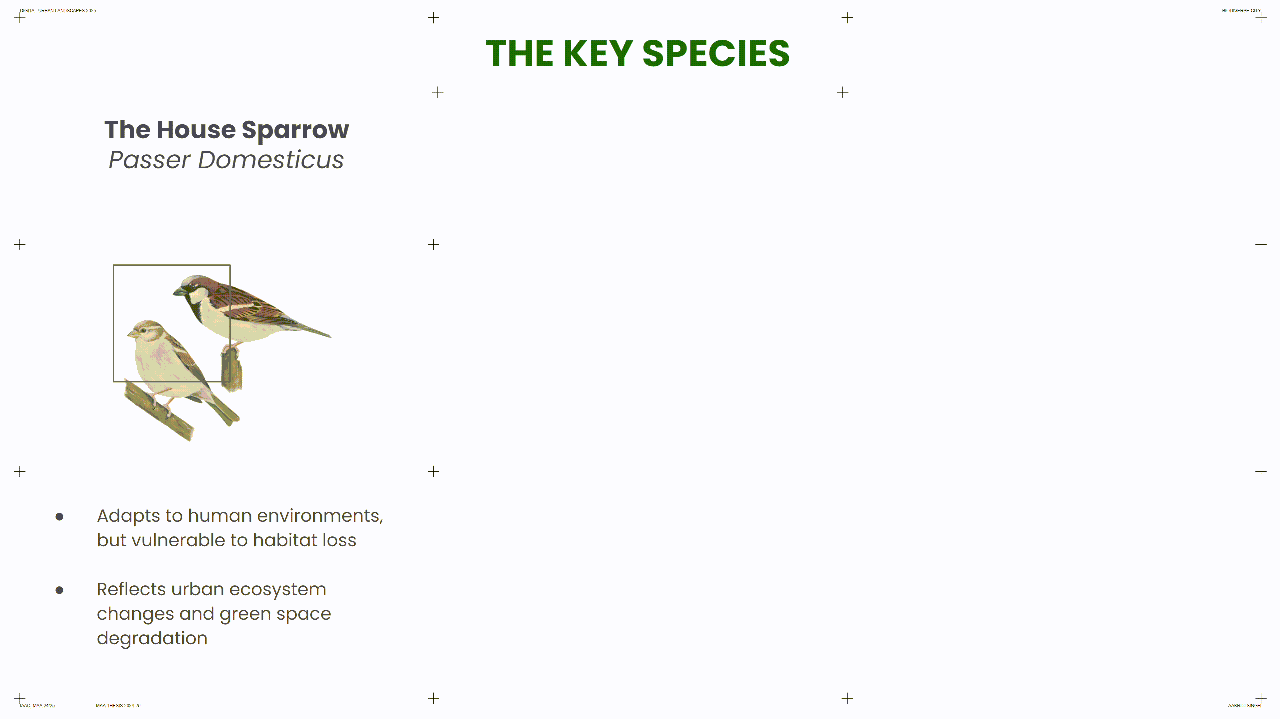
Who Is BEASTIE Designed For? The Species at the Center
The selection of three indicator species was based on their ecological roles, spatial diversity, and visibility within dense urban environments:
- House Sparrow: cavity-nesting bird sensitive to habitat loss
- Common Pipistrelle: a bat impacted by light and roosting site removal
- Scarce Swallowtail: a butterfly dependent on specific host plants
They each represent different layers of the city and ecological functions.
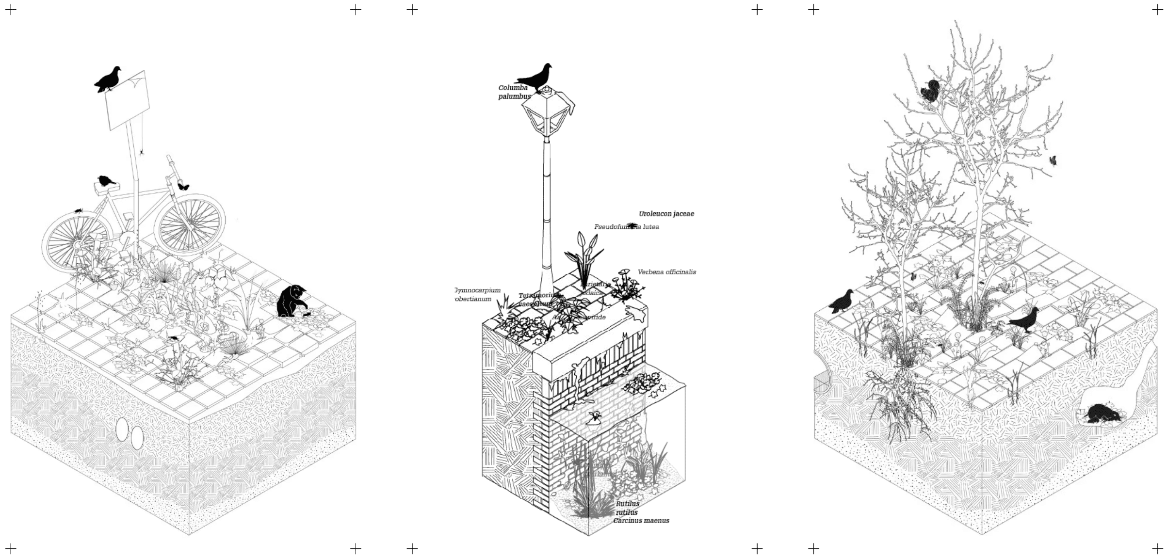
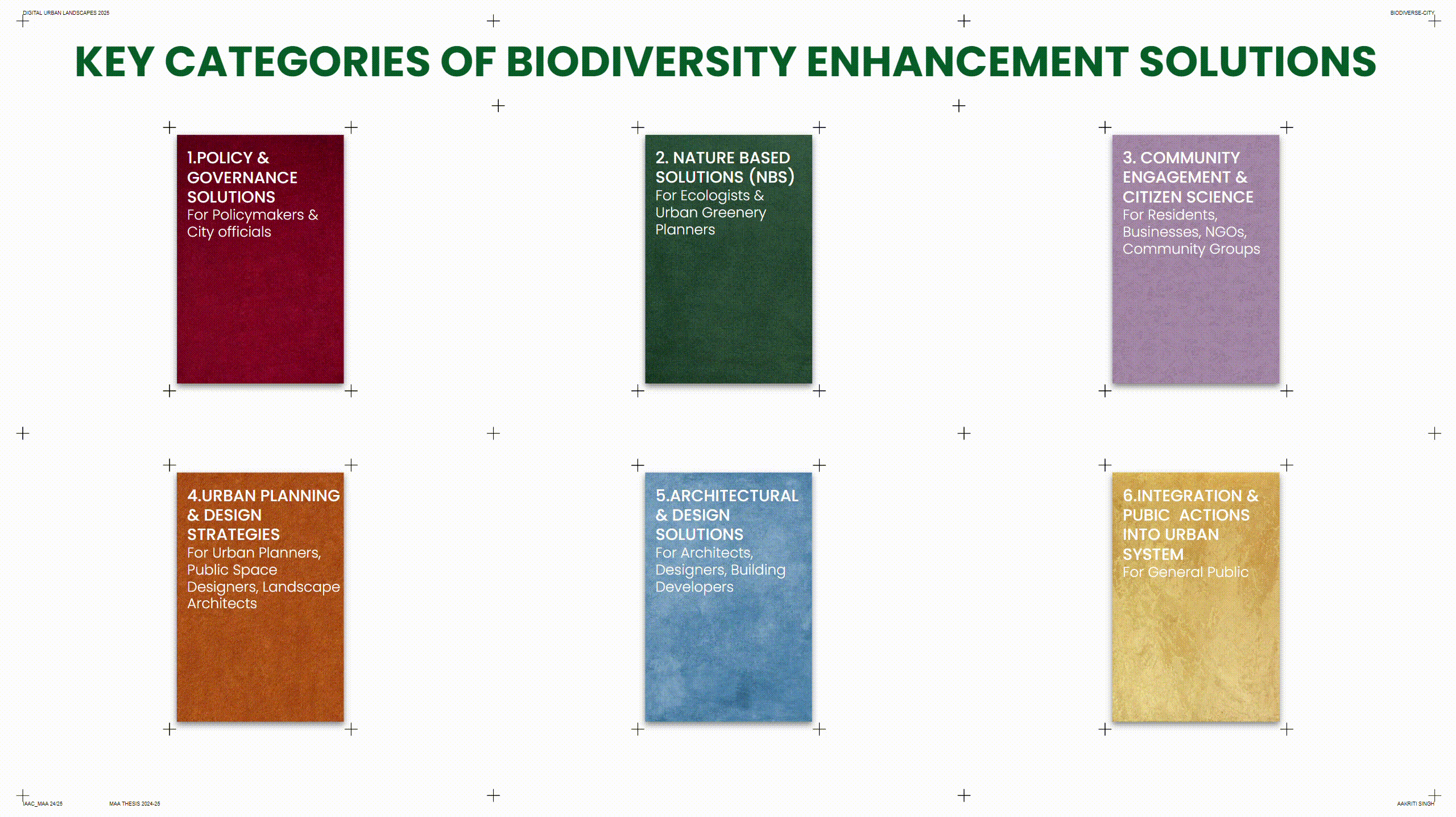
What Types of Solutions Exist?
Before narrowing down to actionable designs, solutions were first categorized into broader types based on scale, stakeholder, and implementation logic.
This thesis focused specifically on the final three categories, curating interventions that are accessible, replicable, and actionable at the everyday level.
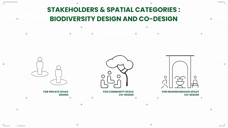
Who Shapes the City? Understanding Stakeholders and Their Spaces
BEASTIE supports three user levels:
- Private citizens : with balconies, rooftops, ledges
- Building collectives : sharing walls, gardens, entrances
- Neighborhood actors : working in streets, parks, bridges
The simulator adapts to the scale and agency of each stakeholder.
Urban space typologies were defined by examining how different user groups interact with built surfaces. These were structured into three main categories: private, community, and public, and then subdivided into 12 actionable subtypes, including terraces, planters, shared entrances, and bridge undersides, including terraces, planters, shared entrances, and bridge undersides.
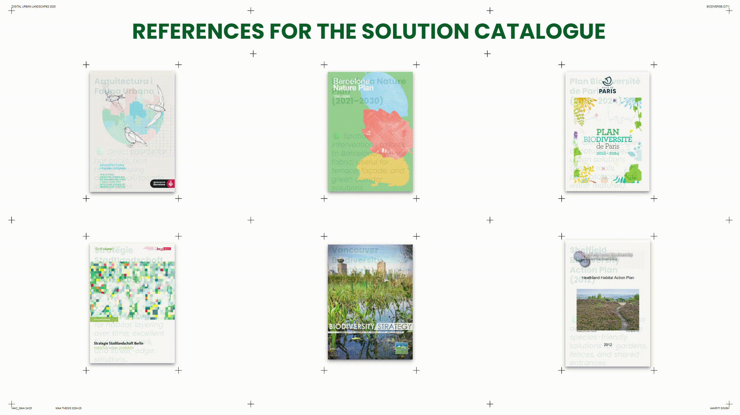
Where Did the Solutions Come From?
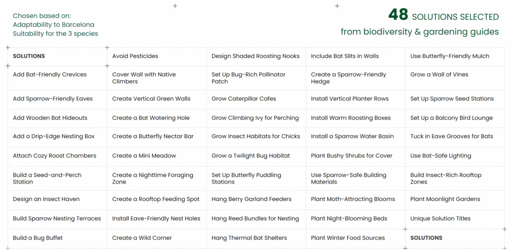
All solutions were selected by analyzing urban biodiversity guides, green infrastructure manuals, ecological datasets, and species-specific needs in the Barcelona context.
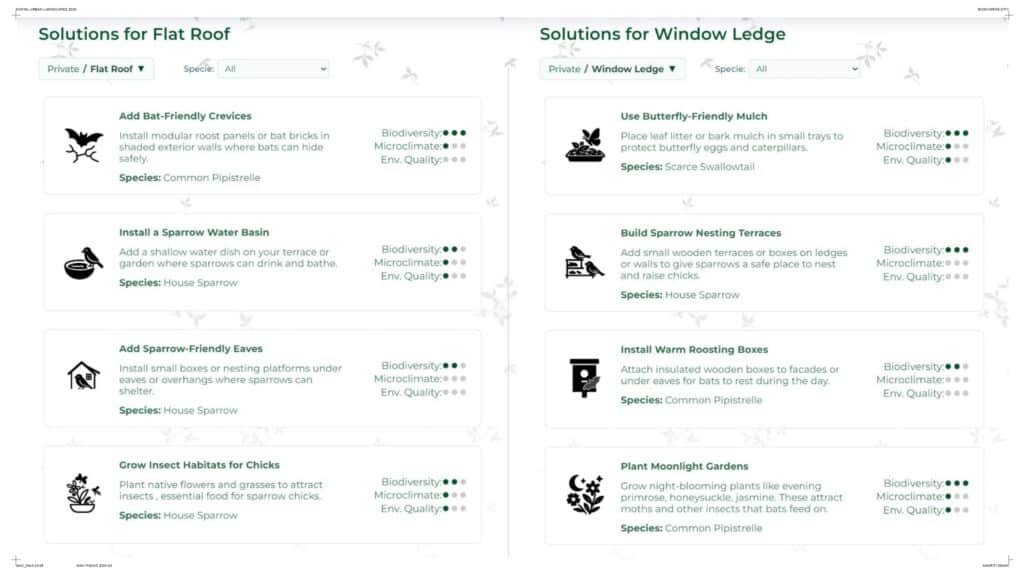
What Can Be Done?
A Solution Book of 48 curated interventions was then compiled, tailored to Barcelona’s biodiversity, climate, and building types.
Examples include:
- Bat crevice modules for facades
- Butterfly puddling trays
- Pollinator hedges
- Bug buffets and bird eaves
All solutions are rated by species, spatial fit, and effort level.
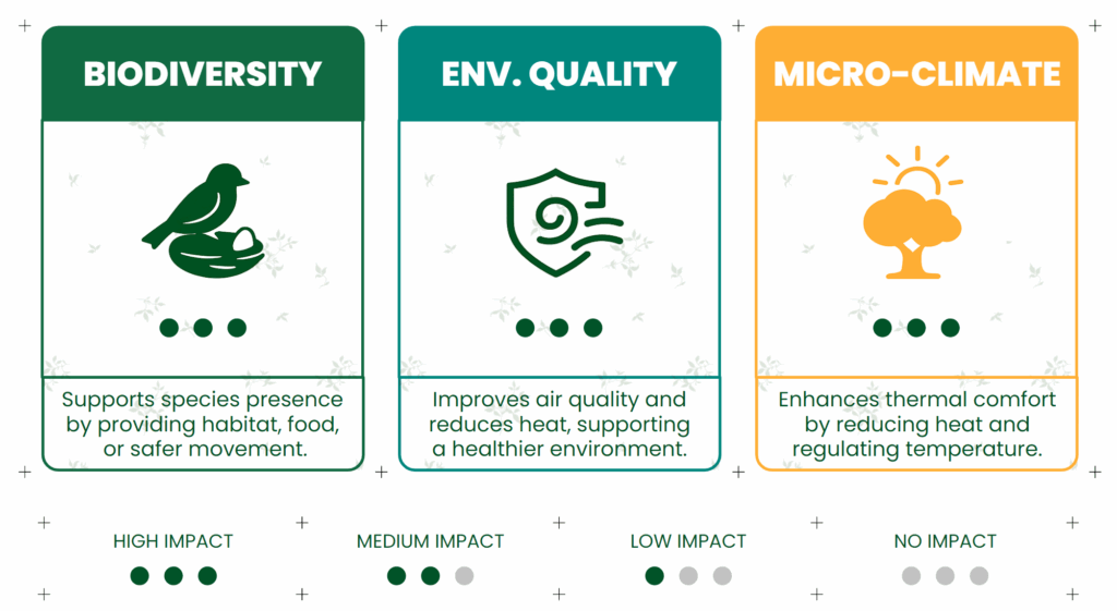
How Is It Measured?
Each solution is scored on three impact metrics:
- Biodiversity – supports nesting, feeding, reproduction
- Environmental Quality – improves air, reduces UHI, restores soil
- Microclimate – provides thermal comfort and shade
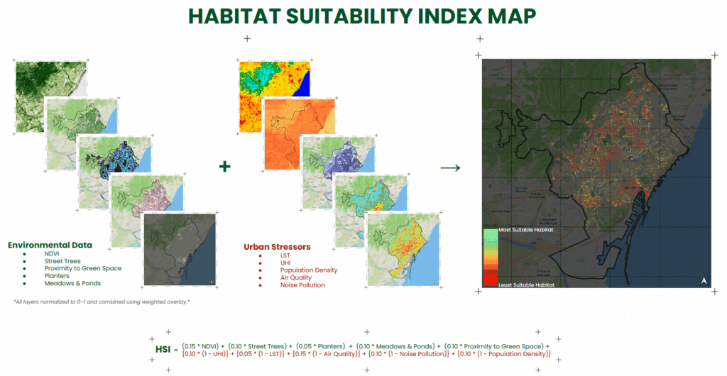
Where Should We Act? Understanding Habitat Suitability
To identify where biodiversity interventions would be most effective, a Habitat Suitability Index (HSI) was developed. This tool combines spatial layers that reflect environmental opportunities and stressors:
Positive layers include:
- NDVI (vegetation cover)
- Tree-lined streets
- Proximity to existing green spaces
Stressors include:
- Urban heat islands (UHI)
- Air pollution
- Noise
- High population density
These layers are weighted and combined into a composite index. The result is a city-wide map highlighting areas with high potential for ecological enhancement — allowing both individuals and planners to make data-informed decisions about where to act.
What the Simulator Does
BEASTIE allows users to:
- Choose their species of interest
- Input their space type
- Get a tailored list of interventions
- See visual and ecological feedback
From a balcony railing to a courtyard planter — BEASTIE makes restoration accessible.
A Future Vision
In the future, BEASTIE will:
- Expand to 50+ urban species
- Auto-generate fabrication files for habitat modules
- Connect to local suppliers and makers
- Integrate citizen science monitoring
It could evolve into a planning, teaching, and co-design tool for cities around the world.
Why It Matters
Just 1 square meter of green can support over 50 insect species.
If we restored even 10% of the city’s forgotten microhabitats, we could shift the balance toward a more thriving, inclusive ecosystem.
BEASTIE is more than a thesis. It’s a mindset — that biodiversity isn’t a luxury, but something we can build into the places we already live.
Even one square meter at a time.
