RE-frame and Connect
Public spaces in a city, such as pathways and non-constructible parcels, are not utilized to their full potential. As a result, they create voids and detachment of citizens from their city and do not provide any meaningful benefits to the community.
Using machine learning algorithms as a tool for public organizations to identify patterns in the data, we can cluster parcels and POIs based on their characteristics and proximity. This will help us to identify the optimal combination of nearby amenities that would attract community use and enhance the appeal of underutilized parcels. Ultimately, this approach can help to revitalize the community by creating more opportunities for public service and increasing the overall value of these public spaces.
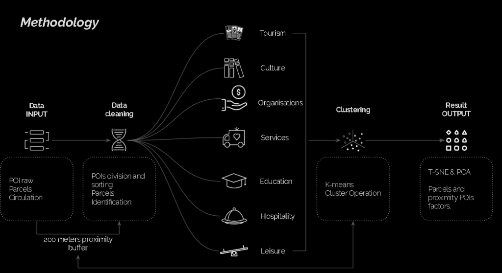
Dataset
Methodology
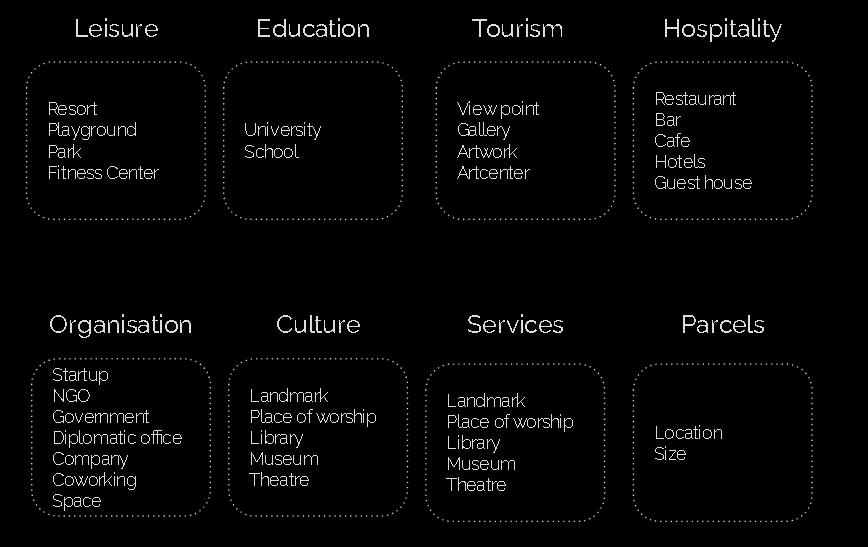
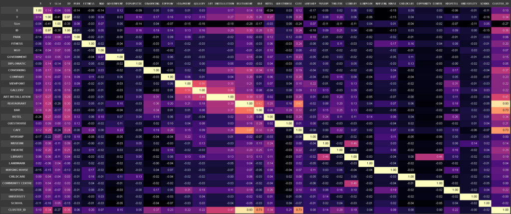
Correlation
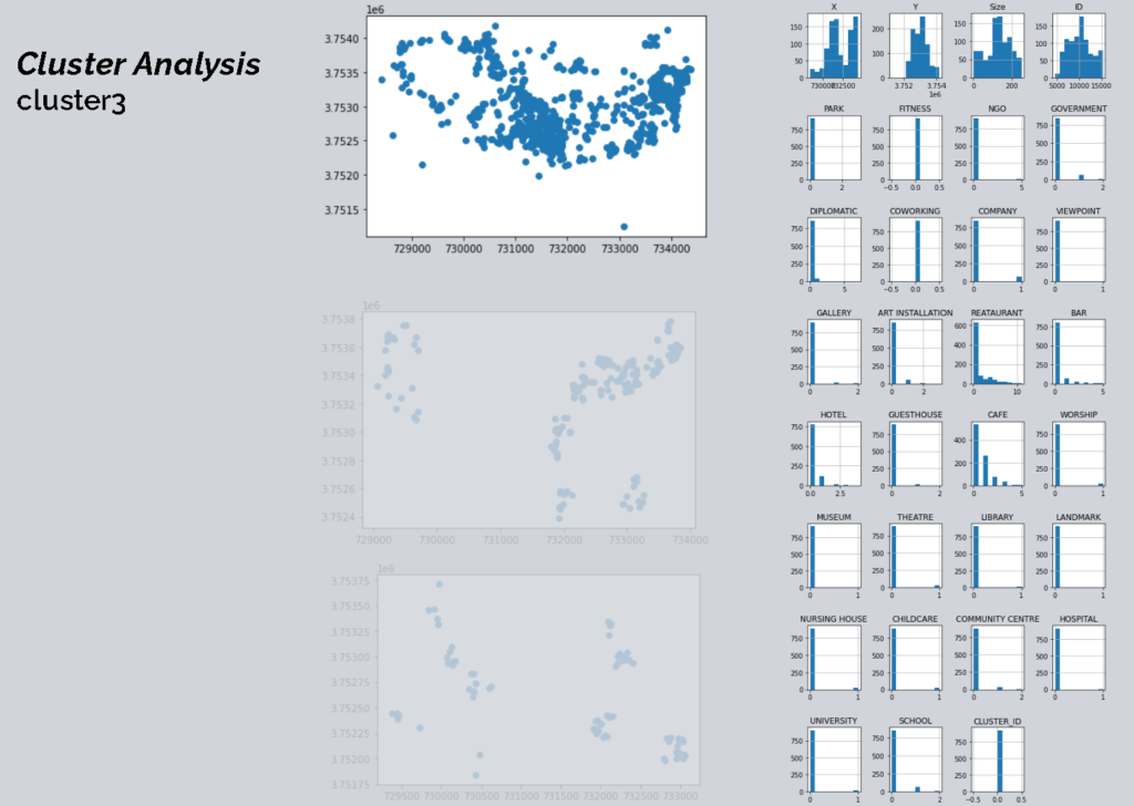
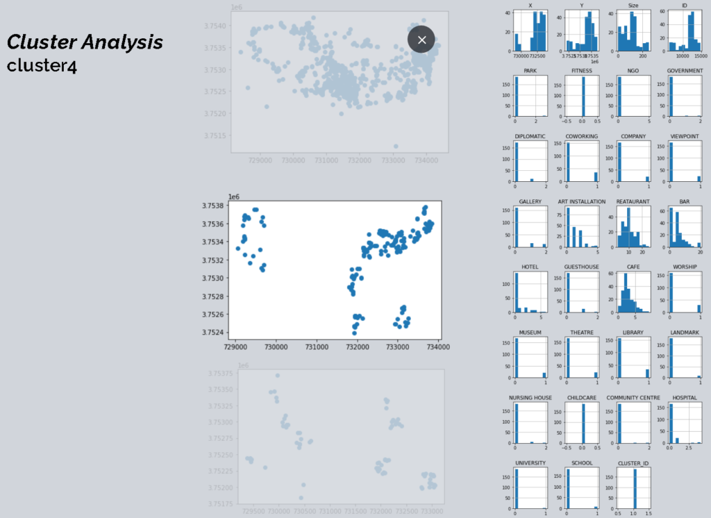
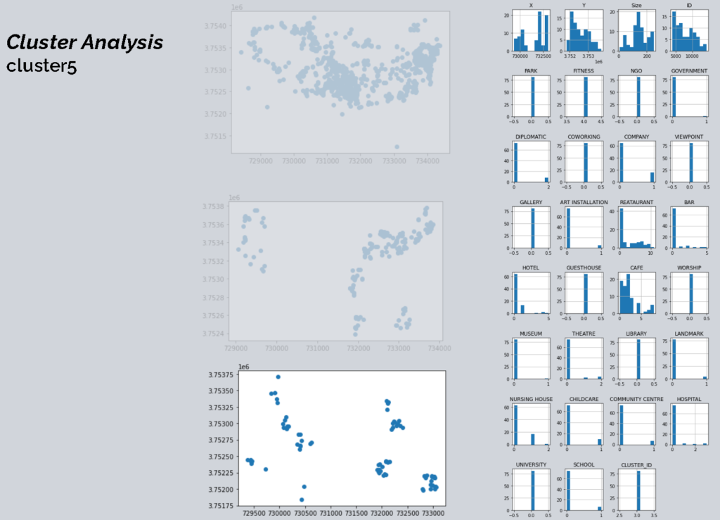
According to the correlation, Parcels and POIs are similar in distances and presence within 200 meters. Common characteristics that are similar or different are suggested. They represent the clustering of the parcels and the POIs.
Therefore it is critical to note that these features point to attributes such as restaurants, pubs, guest houses, and art installations that are part of the same cluster. This is because of their distance and proximity to similar parcels.
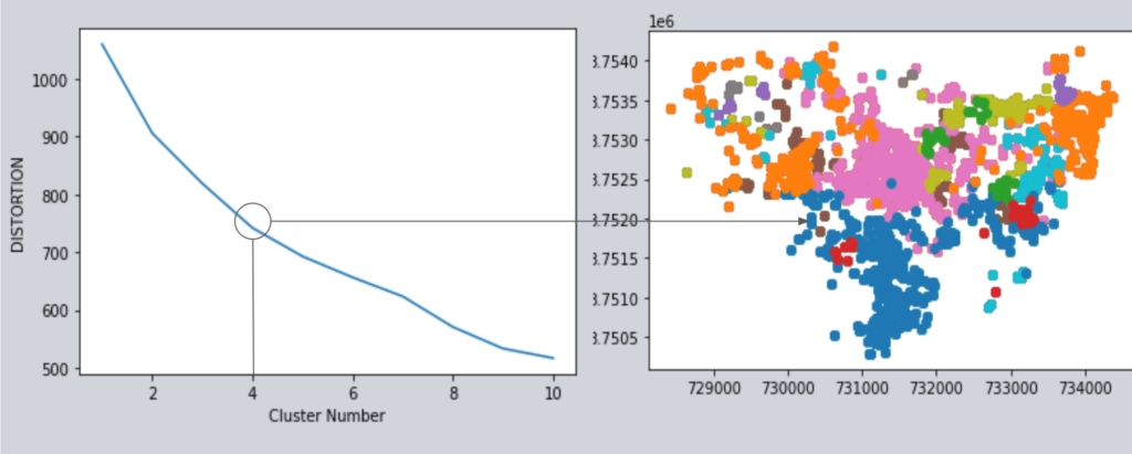
Elbow method cluster
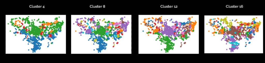
The result of the elbow methods is that cluster 4 is the most characterized one in terms of POIs and Parcels proximity.