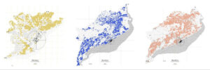
The Urban Data Workshop empowers students to leverage Grasshopper as a tool for cartographical purposes, georeferenced data manipulation, and urban analytics. A core focus of the workshop is the integration of Google Earth Engine’s extensive satellite imagery datasets to explore ecological, territorial, and urban dynamics at scale. Google Earth Engine (GEE) is a cloud-based platform that provides access to a vast repository of planetary-scale geospatial datasets. It hosts petabytes of satellite imagery data related to climate, land cover changes, and environmental indices, permitting an unprecedented study of the globe. Students will learn how to query, process, and integrate these datasets directly into Grasshopper, enabling sophisticated analyses and urban mapping via custom Python components. Additionally, the course introduces Decoding Spaces, a powerful Grasshopper plugin that facilitates advanced network studies and the importing of external datasets for enriched analysis. The combination of these tools empowers students to address complex urban challenges with data-driven insights and compelling visualizations. By the end of the course, students will have developed practical skills to expand Grasshopper’s potential, bridging design, data, and geography for impactful urban analytics and visualization.
Learning Objectives
At course completion the student will:
- Be able to access more than 35 years of satellite imagery via Google Earth Engine in Grasshopper
- Manipulate and combine data from different data source and data typologies
- Set up a flexible protocol to analyze different urban contexts in the world


