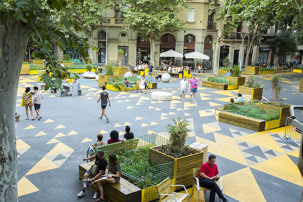
photo credits: CREDA
Syllabus
This course provides a practical introduction to analysing the complex urban challenges of Barcelona through a multi-scalar methodology, combining theory and practice to explore the relationship between local urban dynamics and broader city-wide issues. Students will engage in fieldwork to connect physical observations with available urban data, using data visualisation tools to interpret and present their findings. Through data analysis and system mapping, participants will explore how policies, historical trends, and socio-political contexts shape the city. By the end of the course, students will have a deeper understanding of Barcelona and the key data sources that help explain its urban dynamics.
Learning Methodology
For this type of exercise, a multi-scalar and participatory methodology is recommended, combining theory and practice to deeply understand urban contexts.
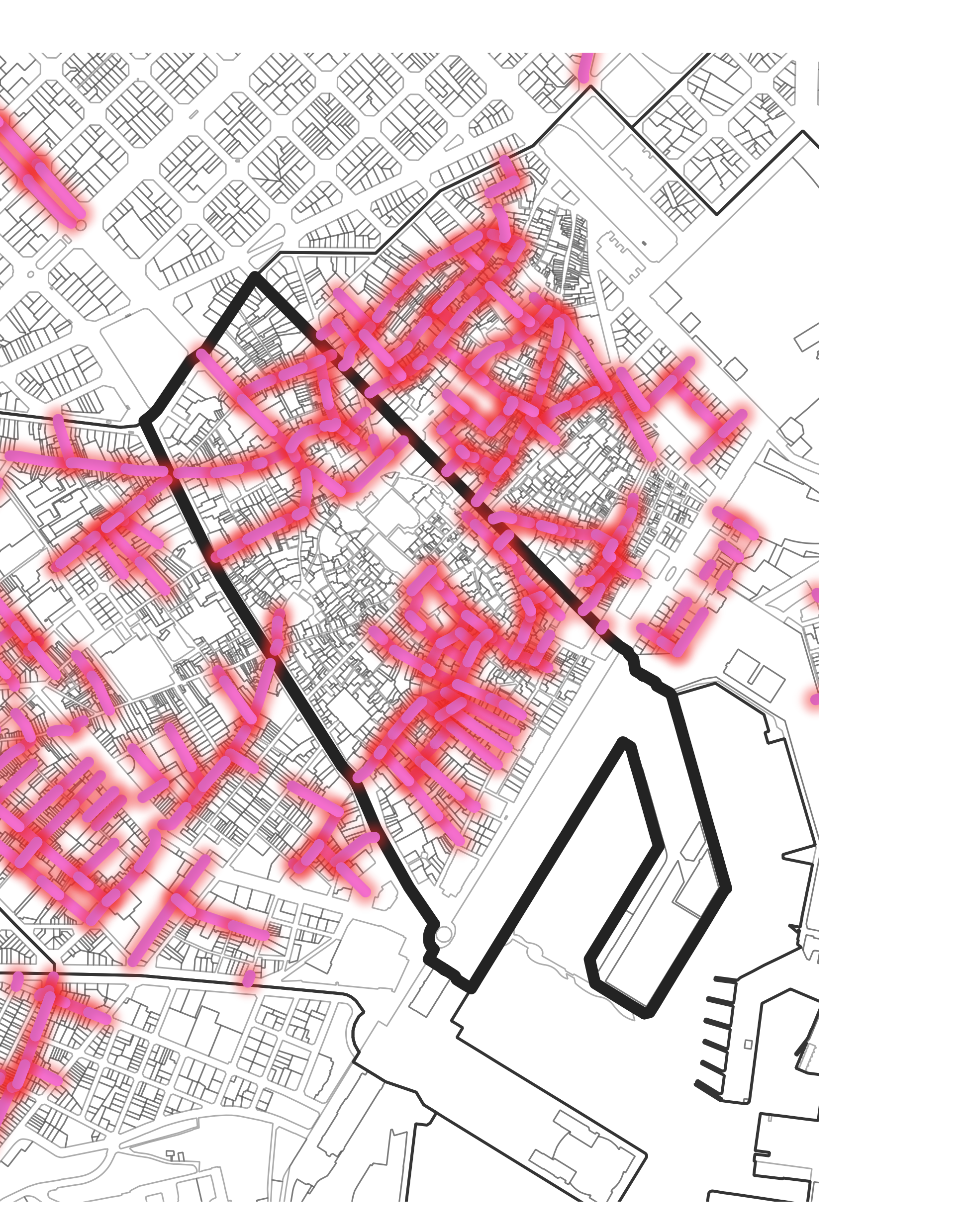
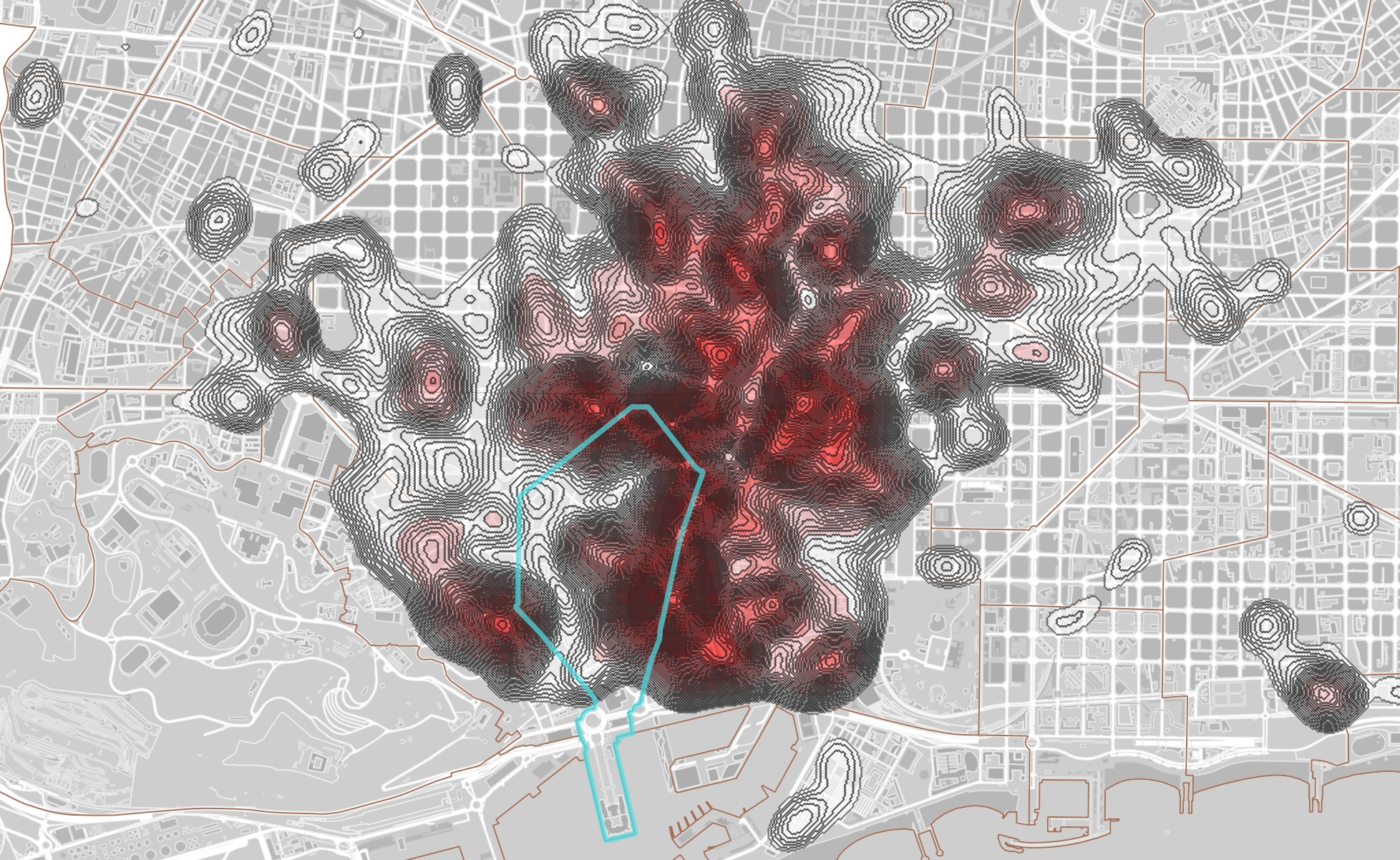
This methodology involves analyzing the chosen area at different levels. On the local scale, students will focus on the neighborhood or district, conducting a detailed examination of its physical and social characteristics through field observations and contextual data. At the urban scale, the findings will be linked to broader city-wide trends, policies, and challenges. Finally, at the global scale, students will compare the area with other cities, using benchmarking to identify best practices and draw meaningful parallels.
- Case Study-Based Learning
Each session will conclude with the review and discussion of case studies relevant to the topics explored. This approach allows students to apply theoretical concepts to real-world scenarios, fostering a critical understanding of urban challenges. By engaging in discussions, students will develop their individual perspectives while connecting the specific issues of a neighbourhood to examples from other cities. This ensures that students can bridge theory and practice effectively.
- Iterative and Collaborative Approach
Students will work in teams to create system maps, linking their observations and analyses with the city’s broader context. The iterative review process at the end of each session will encourage students to share their progress, receive feedback, and make necessary adjustments to their methods. Reflective learning will also be encouraged, with students regularly considering how data and context help refine their understanding of urban problems.
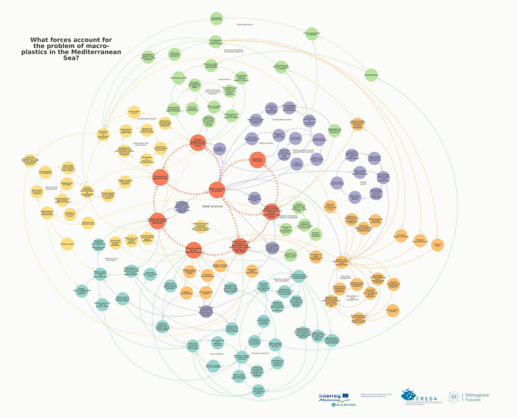
- System Mapping and Data Visualization
The methodology will incorporate tools for system mapping and data visualisation. These tools will allow students to illustrate how local and global challenges are interrelated, as well as how policies and broader trends impact the specific neighbourhoods studied. Visualisation techniques will support their ability to contextualise data and present their findings in a clear, impactful manner.
Learning Objectives
After the course, the student will achieve the following objectives:
- Deepen Knowledge of Barcelona: Students will gain a comprehensive understanding of Barcelona’s context, including its historical development, socio-political background, and contemporary urban challenges. This will include an exploration of the city’s evolution, key urban milestones, and the ongoing issues it faces, such as housing affordability, sustainability, and mobility.
- Contextualize and Interpret Data: Students will learn how to contextualise urban data within the broader framework of Barcelona’s policies, observations, and historical trends. This includes developing the ability to critically interpret data by connecting it with real-world policies and urban challenges, ensuring accurate and informed conclusions about the city’s development.
Develop Systemic Thinking Skills: Students will understand the importance of systemic thinking, focusing on the interconnected layers of information that shape urban environments. This involves recognizing how different sectors—such as transport, housing, and sustainability—are interdependent, and learning to synthesise these multiple dimensions when analysing urban dynamics and proposing solutions.