Credits: Re(naturing) BCN – MaCT 2020/21
Students: A. N. H. Naseer, H. Qatanany, L. Guimarães, M. J. Gonzalez, S. Coskun
Faculty: E. Rico, M. Marengo & I. Neri
Description
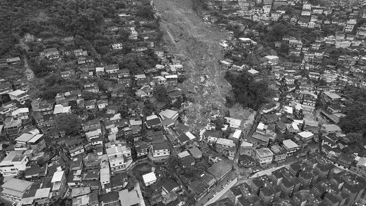
Across the globe, cities are facing the increasingly visible consequences of climate change, with floods and landslides ranking among the most destructive urban hazards. In Brazil, the city of Petrópolis offers a critical lens through which to study the layered vulnerabilities of urban settlements exposed to extreme rainfall, unstable topography, and unregulated growth. Located in the mountainous region of Serra dos Órgãos and historically shaped by both natural beauty and economic pressures, Petrópolis has become tragically emblematic of the risks associated with climate-induced disasters. The catastrophic flooding and landslides of February 2022, which resulted in hundreds of casualties and widespread destruction, underscored the need for deeper territorial understanding, risk mapping, and international knowledge exchange.
This workshop positions students within this urgent urban challenge, using Petrópolis as a real-case scenario to explore how multi-scalar mapping and comparative urban analysis can support climate adaptation efforts. Developed in collaboration with the local municipality of Petrópolis, the course invites students to generate a comprehensive diagnostic of flood vulnerability through the lens of spatial, climatic, infrastructural, and social data, prioritizing the construction of a critical, data-informed narrative that reveals the complex interplay of environmental risks and urban development in a highly sensitive territory.
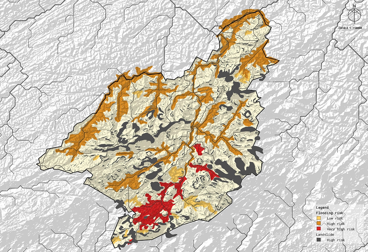
Students will be divided into four interdisciplinary groups, each focusing on a distinct dimension of the issue, ranging from climate and hydrology to terrain and topography, built environment and infrastructure, and patterns of social vulnerability and governance. Through collective analysis, the workshop will produce an integrated flood-risk mapping of Petrópolis, identifying key pressure points, high-risk zones, and socio-spatial conditions that exacerbate exposure to extreme events.
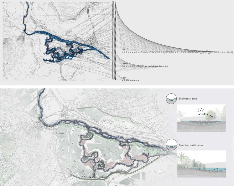
Moreover, a central component of the workshop involves identifying and analysing “twin cities”: urban areas worldwide that share geographic, climatic, or infrastructural similarities with Petrópolis. These comparative case studies will serve as a foundation for assembling a catalogue of existing flood mitigation strategies, grounded in real-world precedents. Rather than reinventing solutions, the workshop emphasizes learning from elsewhere: early warning systems in Medellín, water management techniques in Funchal, community-based resilience in Jakarta, or urban design adaptations in Niterói. Each group will curate one section of the catalogue, focusing on a specific type of intervention, such as technological systems, ecological infrastructures, spatial redirection strategies, or social engagement mechanisms.
The workshop culminates in the development of a collaborative publication in a magazine/newspaper-style report, that synthesizes the mapping, diagnostics, and catalogue of strategies into a visually rich and accessible format. This publication is intended not only as an academic deliverable, but as a communication tool for the municipal government and local communities, bridging analysis and action through visual storytelling. Through this short yet intensive course, students will strengthen their ability to navigate real-world data, extract insights from comparative urban research, and communicate complex spatial dynamics to diverse audiences. At its core, the workshop aims to train a new generation of urban professionals in reading and diagnosing risk-laden territories, making knowledge actionable in the face of climate urgency.
Learning Objectives
At workshop completion, students will:
● Understand the interplay between urban morphology, topography, water systems, and climate change in flood-prone cities.
● Develop further their spatial analysis skills using open-source tools and environmental datasets.
● Develop comparative analytical frameworks to identify “twin cities” and extract relevant strategies.
● Understand the socio-political dimensions of climate resilience in urban environments.
● Learn how to structure a design and policy-oriented narrative from data.
● Deliver a publication-quality piece of work that can inform local policy and public communication.