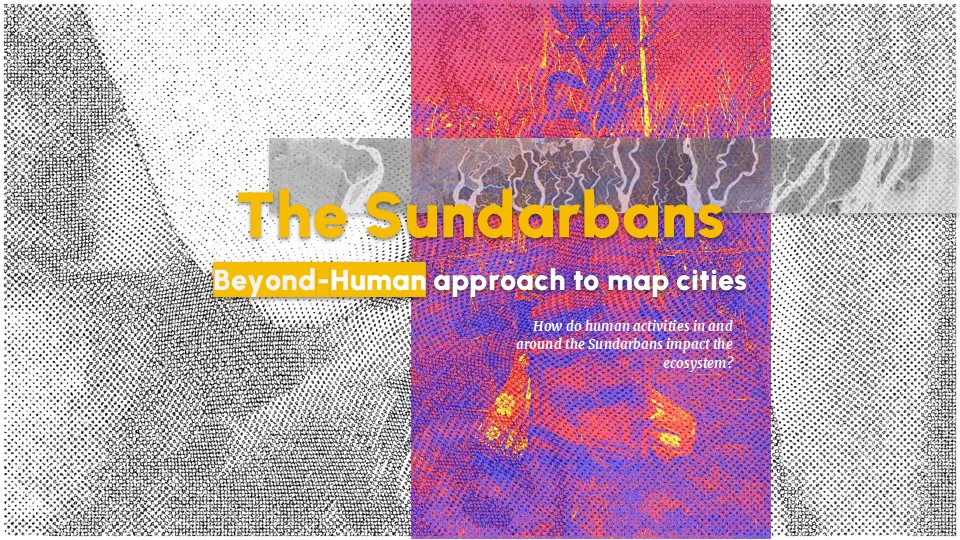
photo credits: I.Neri, E. DInarama, Cities Match-Making, 2024,
In The Routledge Handbook on Greening High-Density Cities ISBN 9781032331423
Description
In the Anthropocene, cities are thriving. For the first time in history, the urban population surpassed the rural one in 2006, marking an epochal shift that appears to be irreversible (United Nations, 2018)[1]. While many agree on this numerical predominance, a dramatically polarised figure emerges if we embrace specific definitions of urbanity, raising urban population to around 85% of the total share (Pesaresi et al, 2016)[2], not without receiving criticism (Angel et al, 2018)[3]. Controversies over a universally accepted definition of city represent an unresolved debate that has been fuelling social and architectural sciences for decades and has been reflected in an operational and political struggle. On one hand it becomes clear that cities are key nodes to address the urgent climate change, on the other hand the new forms of urbanisation that they are revealing challenge our already limited understanding of their functioning, leaving us with a blurry image of the relationship of causes and effects in action. As a consequence, a set of compelling questions arise. Is it a classical causal relationship that we should be looking for? In the digital renaissance, if quantum physics and the accelerating developments in AI technology are questioning the very base of human epistemology, is there a possibility to reconsider our theoretical framework to urban studies through code and data, and to consequently support and democratise the debate on ecological urban sustainability? How can we envision tools and methodologies to effectively observe the ephemerality of sustainability and the multi facets of the city? And finally, how can we leverage the same technologies to effectively include non-specialized stakeholders (i.e citizens) in the processes of ecological transition? Aiming to provide students with a robust framework to explore and create innovative urban representations, the course integrates technical skills with critical thinking towards an alternative lens to comprehend the manifold nature of cities.
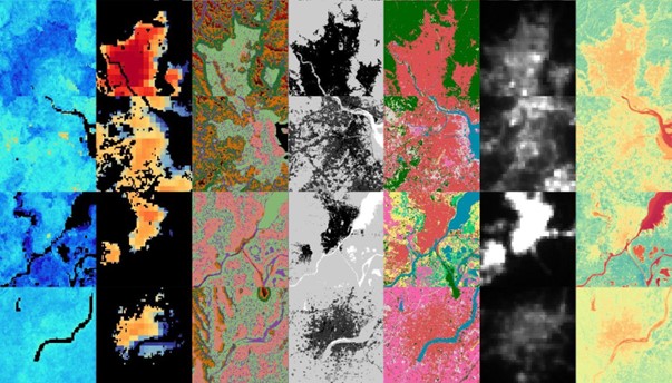
The course is structured around the challenges and opportunities presented by computational cartography. Students will engage with Grasshopper 3D, a powerful visual scripting tool, to produce data-rich cartographies that capture the ephemeral conditions of cities. The course invites students to question the data needed to represent urban phenomena, the role of proxies when data is scarce, and the strategies required to build complexity from simpler data layers. Moreover, it emphasises the creative and intuitive aspects of cartography, encouraging students to explore unprecedented ways of visualising cities. Finally, the course critically examines how cartographies can democratise urban discourse, enabling non-specialized stakeholders to engage in the debate on climate change and urban sustainability. By exploring how computational tools can visualise the complexity of cities, it contributes to the broader discussion of how we understand and manage urban environments in the face of global challenges.
Learning Objectives
The aim of the course is to equip students with the knowledge and skills necessary to create innovative computational cartographies that effectively represent urban dynamics. It provides a framework to critically analyse data, understand the complexities of urban environments, and utilise advanced tools to create meaningful visual representations. The core competencies are complemented with an exploration of creative and intuitive design processes and practical group exercises.
At course completion the student will:
- Fluently use Rhinoceros and Grasshopper 3D
- Produce data-rich cartographical outputs
- Critically analyse and select appropriate data to capture and represent urban dynamics
- Implements design interventions taking advantages of computational tools
[1] United Nations, Department of Economic and Social Affairs, Population Division (2018). World Urbanization Prospects: The 2018 Revision, Online Edition.
[2] Pesaresi, Martino, Michele Melchiorri, Alice Siragusa Thomas and Kemper. 2016. Atlas of the Human Planet – Mapping Human Presence on Earth with the Global Human Settlement Layer. EUR 28116. Luxembourg (Luxembourg): Publications Office of the European Union. JRC103150
[3] Angel, Shlomo, Patrick Lamson-Hall, Nicolás Galarza, and Alejandro Blei. 2018. “Our Not-So-Urban World.” Working Paper No. 42, The Marron Institute of Urban Management, New York University.