Credits: Remote sensing artisanal fishing vessels off the Gambian coast. LIMINAL 2024
From Afar explores the complex world of geo-spatial investigation, focusing on particular instances of violence and disruption across our contemporary grown and built environment. The course will demonstrate and investigate how methods of spatial, geostatistical and data analysis can be used to document, contest, mitigate and design for conditions of instability and injustice within the Anthropocene.
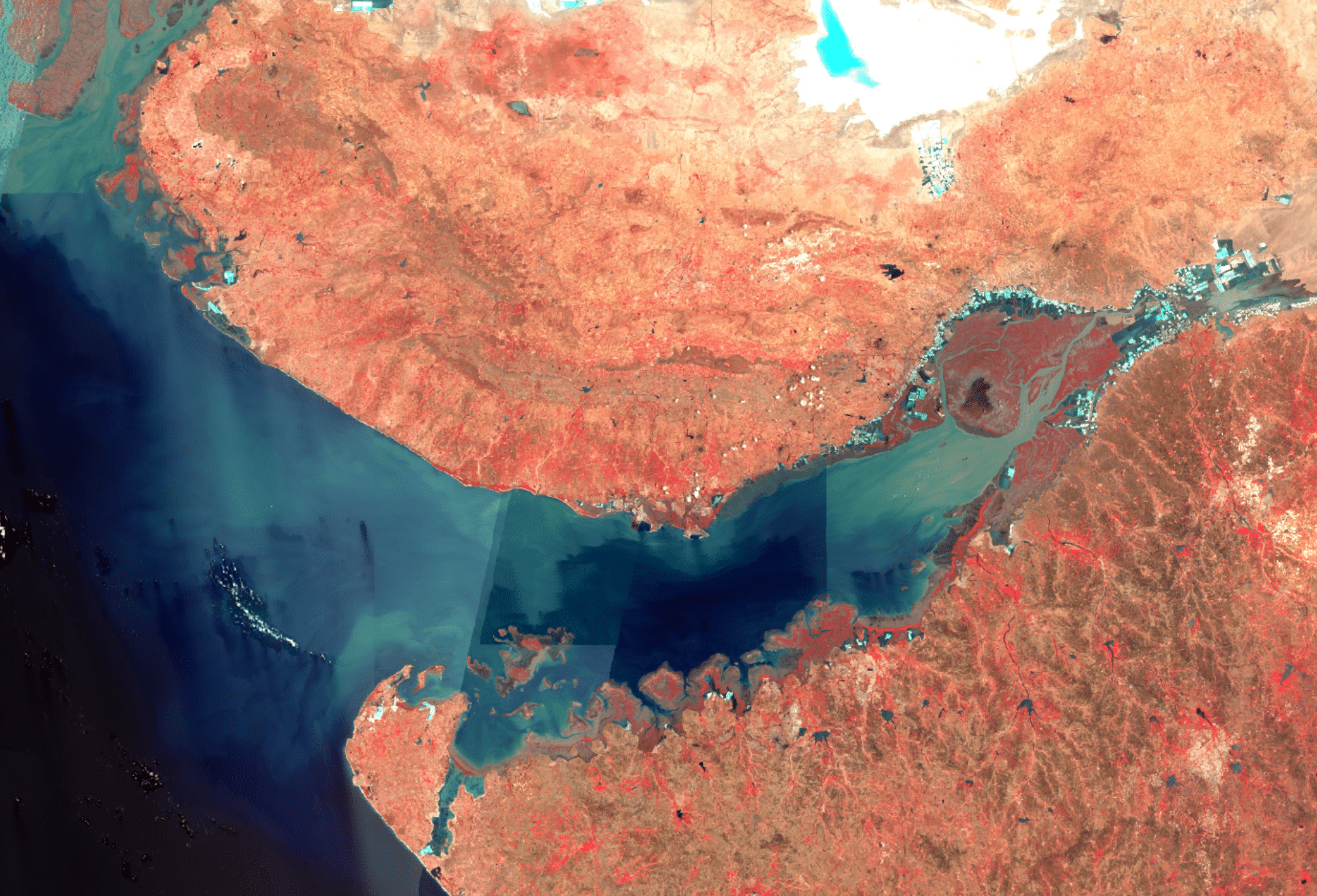
From Afar will ask students to critically reflect upon the infrastructures through which we perceive and investigate the world around us, as observers and actors within an increasingly complex web of media, sensory technologies and evidentiary practices. Through the development of public-facing analytical tools students will construct novel frameworks through which the Anthropocene and its effects can be studied. Topics such as floods, deforestation, sea level rise and wildfires will be situated within a wider context of networked cause and effect. The tools and methodologies developed in these group investigations will evidence the interaction of peoples, cultures, information, capital and ecologies which both shape, and are shaped by, the design of our contemporary world.
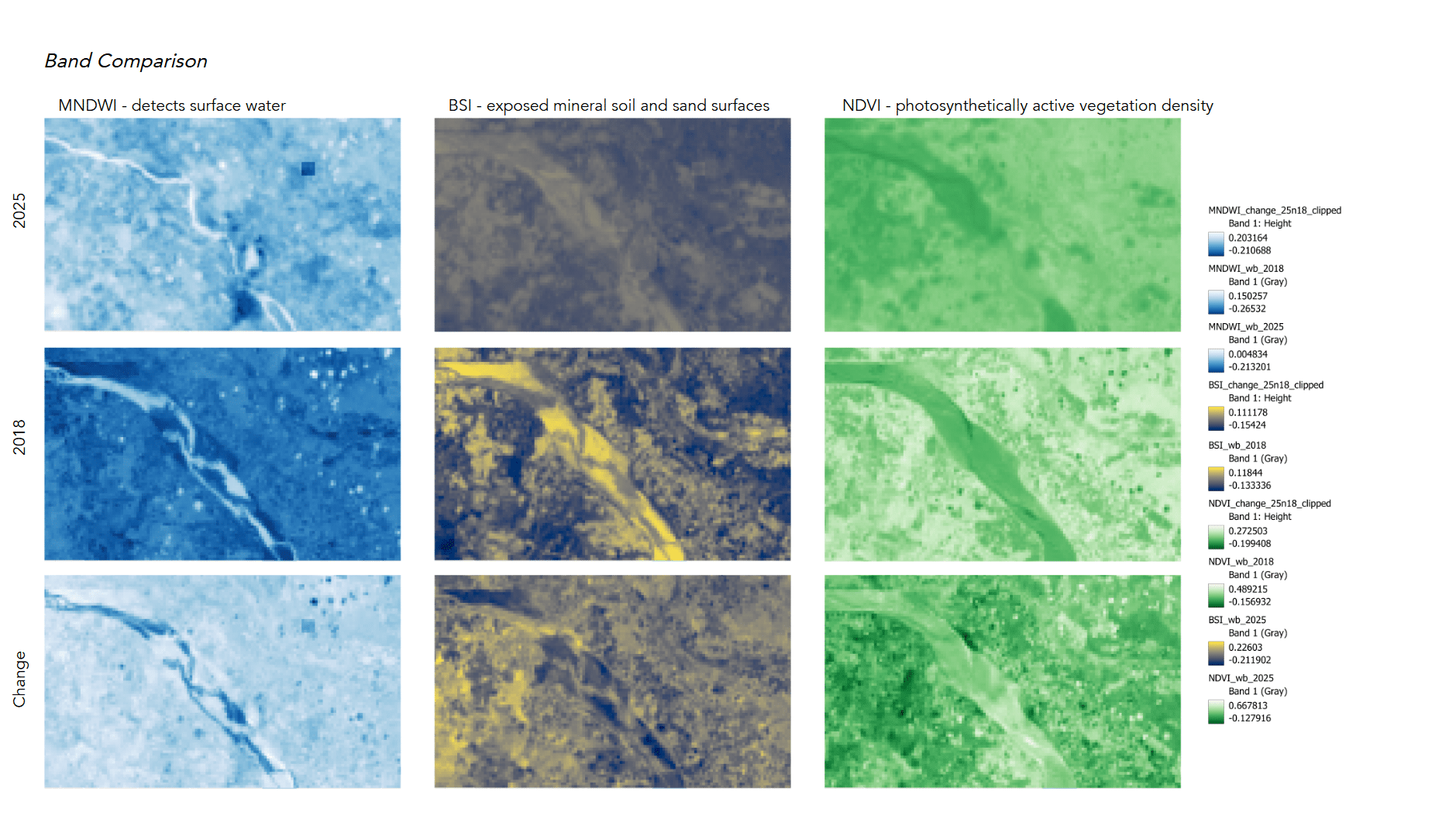
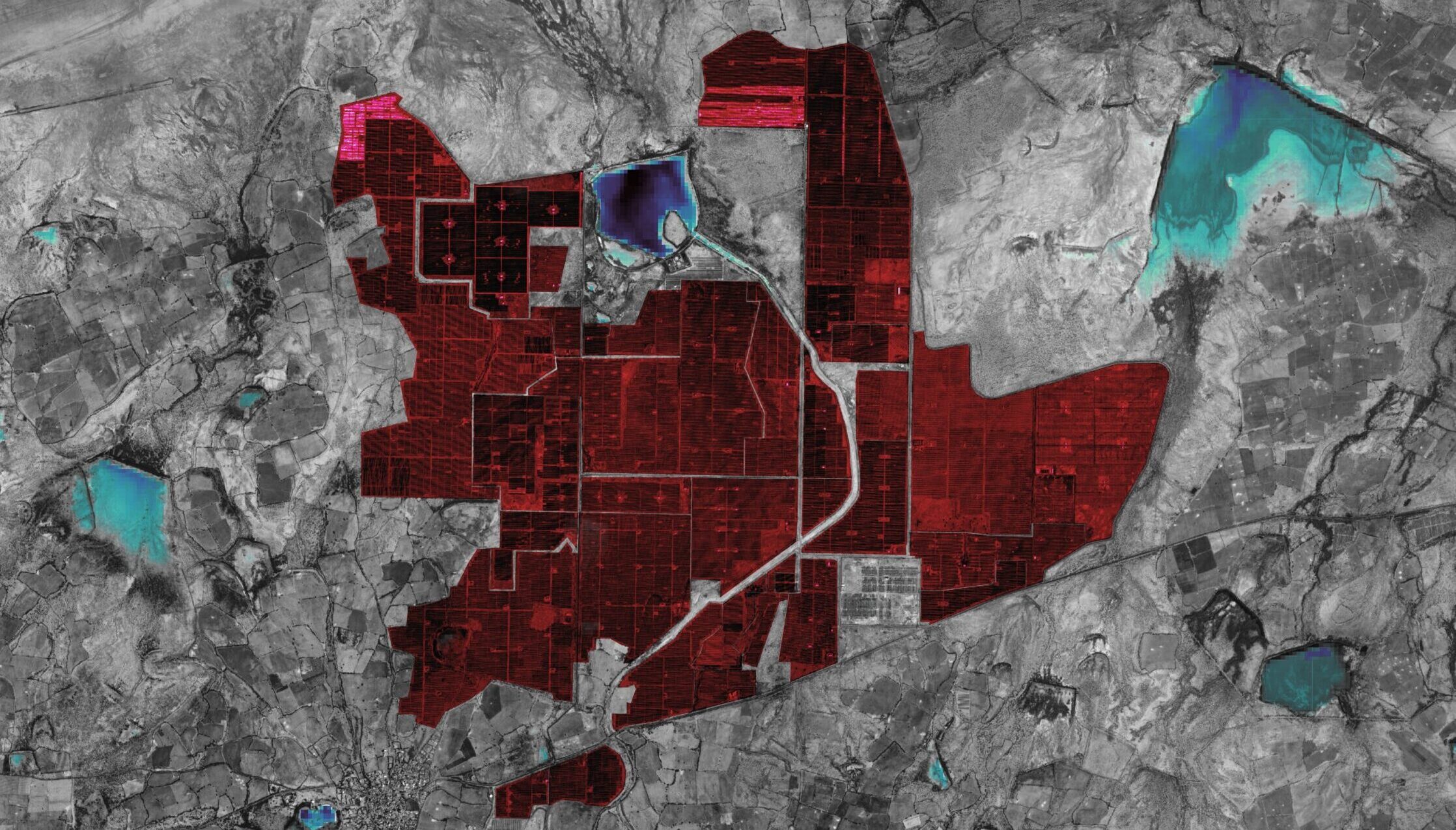
We’ll work with satellite imagery, machine learning workflows, and analytical methodologies during this course. In so doing, we’ll uncover geo-spatial trends and transformations that will be documented across various modalities. Introductions to and workshops with required software will form the basis of the course, with lectures and class discussions focusing on the politics of investigative methodologies and their application in real world contexts.
Learning Objectives
The course will explore the domain of open-source geospatial investigation through an overview of existing investigative methodologies and their practical application and deployment in real-life projects. At the same time, the lectures will be anchored by a series of group investigations that relate to the themes underlying the course’s curriculum. Each will concern itself with the design and development of emergent open-source tools and methodologies contributing to the study and investigation of social, climatological, and spatial injustice.
At course completion the student will:
- Discuss and criticize contemporary technological approaches to documenting and investigating violence in its many forms
- Develop visual communication skills and better understand its agency in the representation of designs, communities and conflicts
- Identify the interrelations between evidentiary processes and the production of space, understanding how open-source tools for urban analysis inform its design
- Conduct collaborative and interdisciplinary research combining humanities and social science methods with geospatial and statistical analytical practices
- Prototype and communicate replicable—data-driven—pipelines and machine learning toolkits towards the creation of open-source research tools