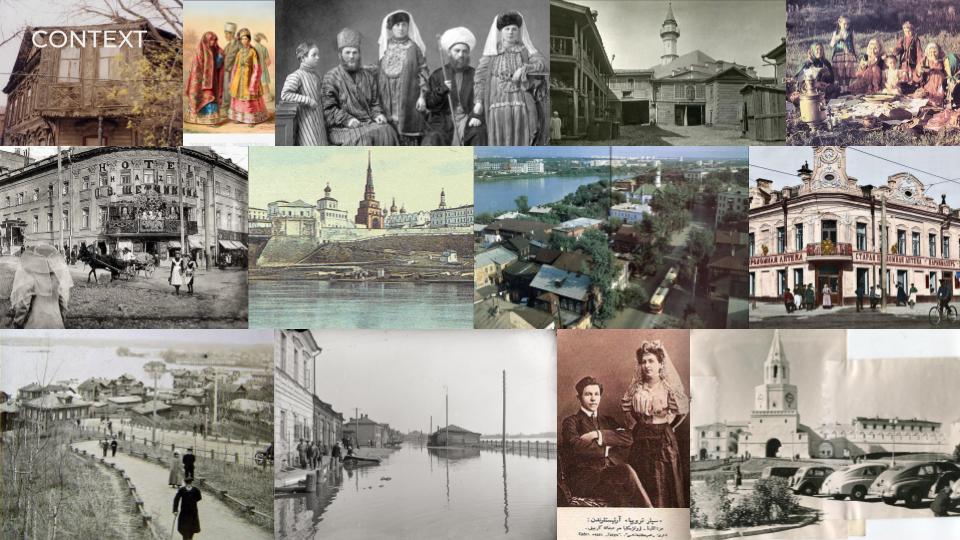
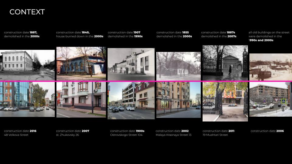
Here we have photos taken from the same point of view in different years. Most of the buildings were demolished before celebrating a milestone of the Kazan city in 2005. Instead of renovating, restoring and repairing the heritage, the government just decided to demolish not only independent buildings, but some residential neighborhoods.
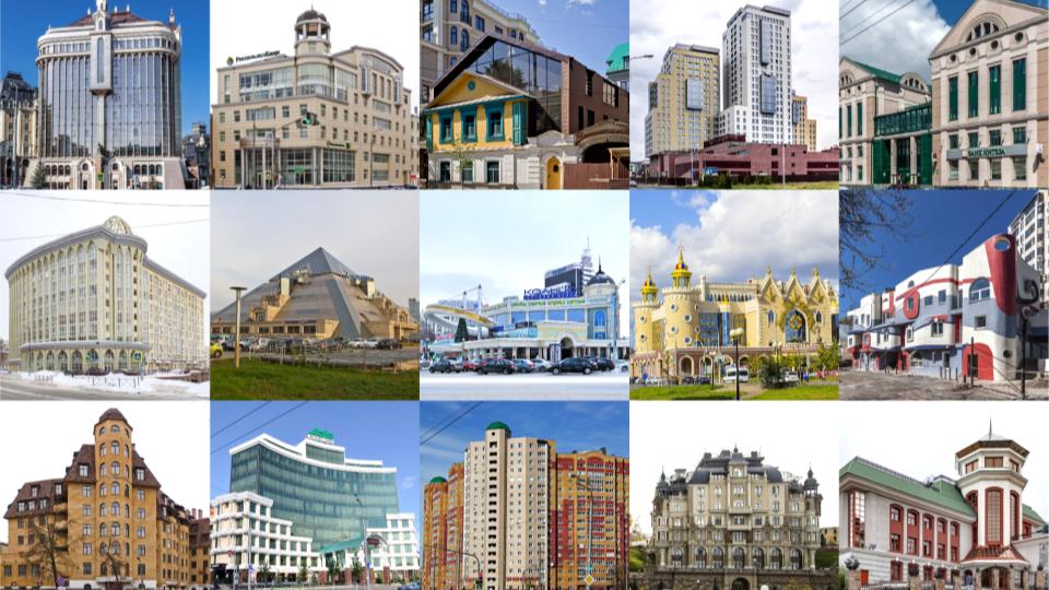
Here we have some examples of controversial design decisions in Kazan, In my opinion, city architects were not consistent in selecting the design of the newly built buildings as they didn’t match the rest of the assembly
For instance, a concert hall in the shape of a pyramid, theater as a sand castle, glass bursting out of ancient ruins and local Gaudi.
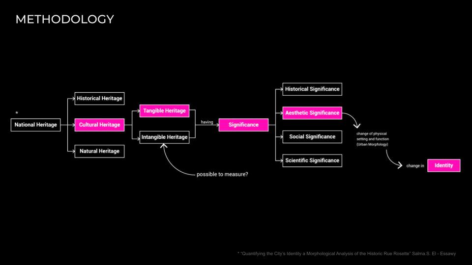
As an architect and as a citizen of this city, I suppose that the design solutions chosen by the city urban planners are not the most appropriate for this location as they spoil the aesthetics of the place and they break the fabric of the city, disrupt the energy and the vibes of the historical city center that used to attract a lot of tourists and had been the best travel destination.
I have a strong belief that every city has its own identity and it should be evolving over the years and resonate with people’s understanding of what and how the city center should look like.
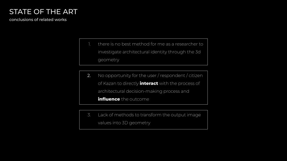
Over the next few slides, I’m going to focus on a few projects with similar ideas to mine, but not exactly.
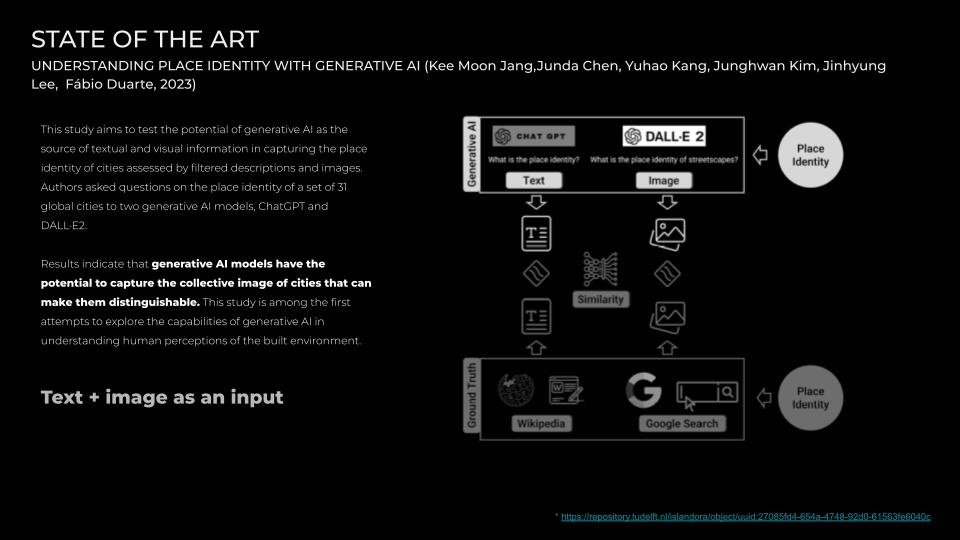
First one explores and compares outputs of textual and visual information in capturing the place identity of 31 global cities. The findings indicate that generative AI models have the potential to capture the collective image of cities that can make them distinguishable. However, it works only with texts and images, without involving 3d.
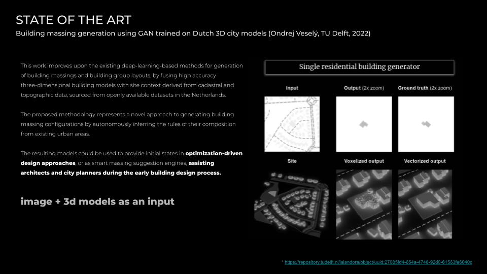
The second project describes a method for generation of building massings and building group layouts, by fusing high accuracy three-dimensional building models with site context derived from cadastral and topographic data, sourced from openly available datasets in the Netherlands. This project is very useful in terms of detailed explanation of workflow and methodology, but it is not aimed to explore city identity and develop this concept, which can bring another level of discussion.
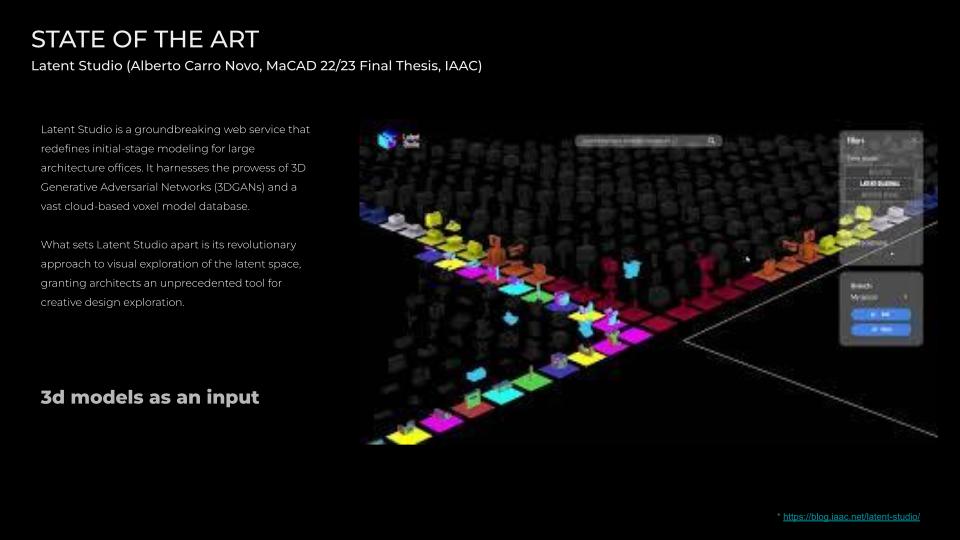
Next project is from last year’s thesis projects, from MaCAD, which initially inspired me to explore 3d generative adversarial networks as an approach to explore architecture and deconstruct the shape itself.
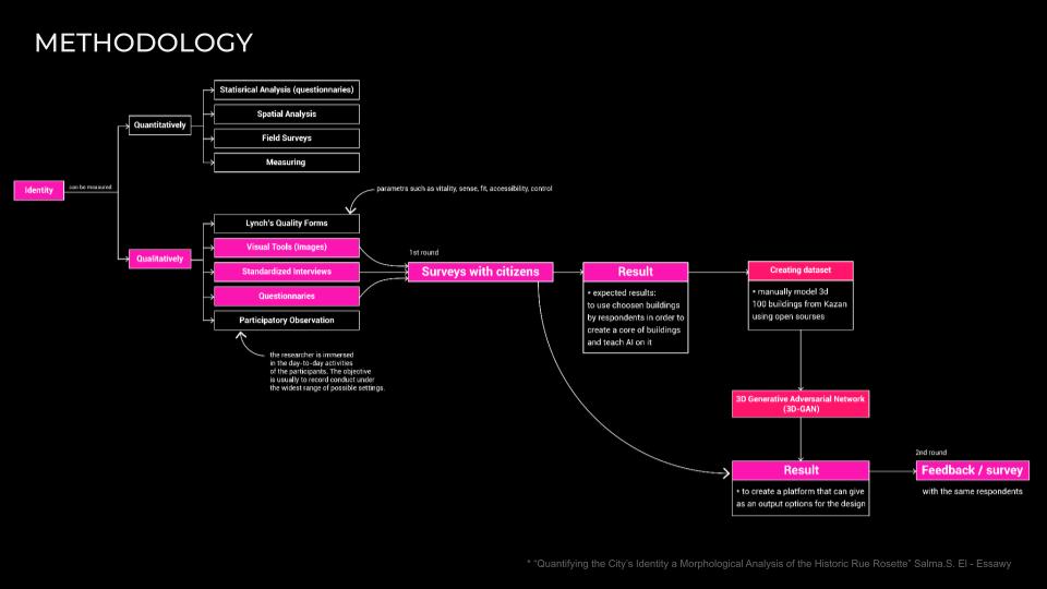
The qualitative method includes questionnaires and interviews with the target group. In the case of research on architectural identity and the efficiency of the product being created, the target audience is primarily the architectural community, real-estate developers, academicians and officials, because I believe that they can give more clear results. Also for the survey I didn’t add very famous landmarks and sights. Because citizens are surrounded most of the time with residential buildings, not landmarks.
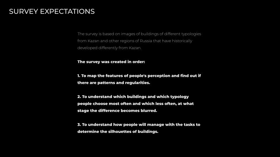
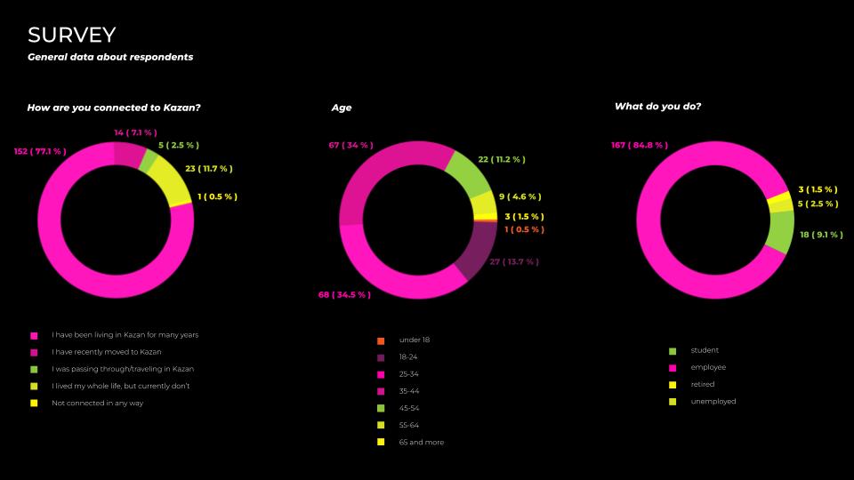
218 respondents were asked. The majority of people from the telegram chat with 7000 subscribers, who are interested in architecture in kazan, discuss the problems and news. There are architects, professors, researchers, and very curious people.
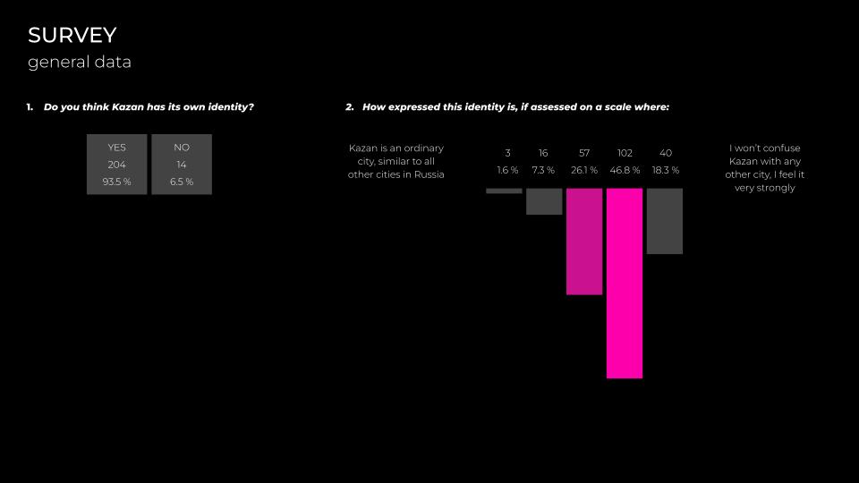
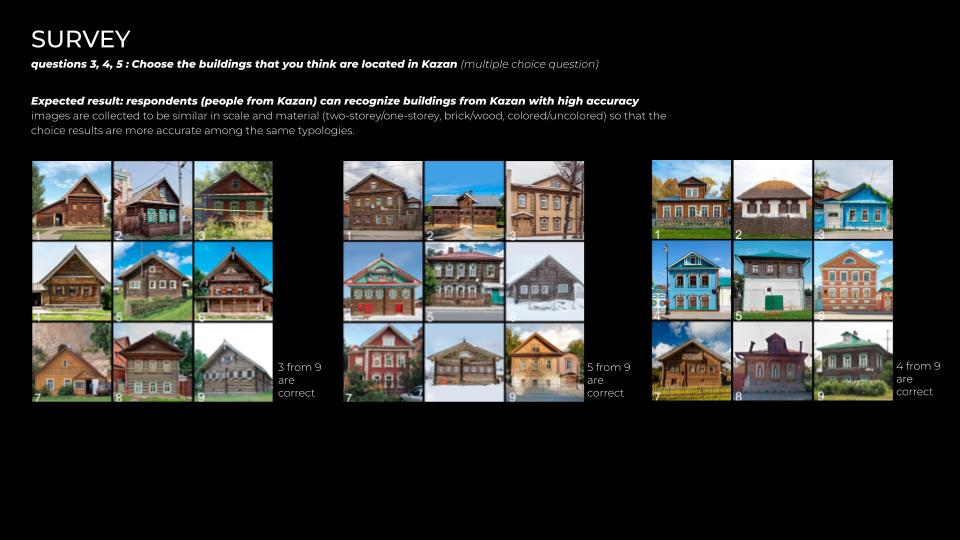
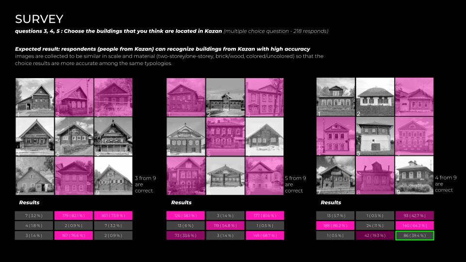
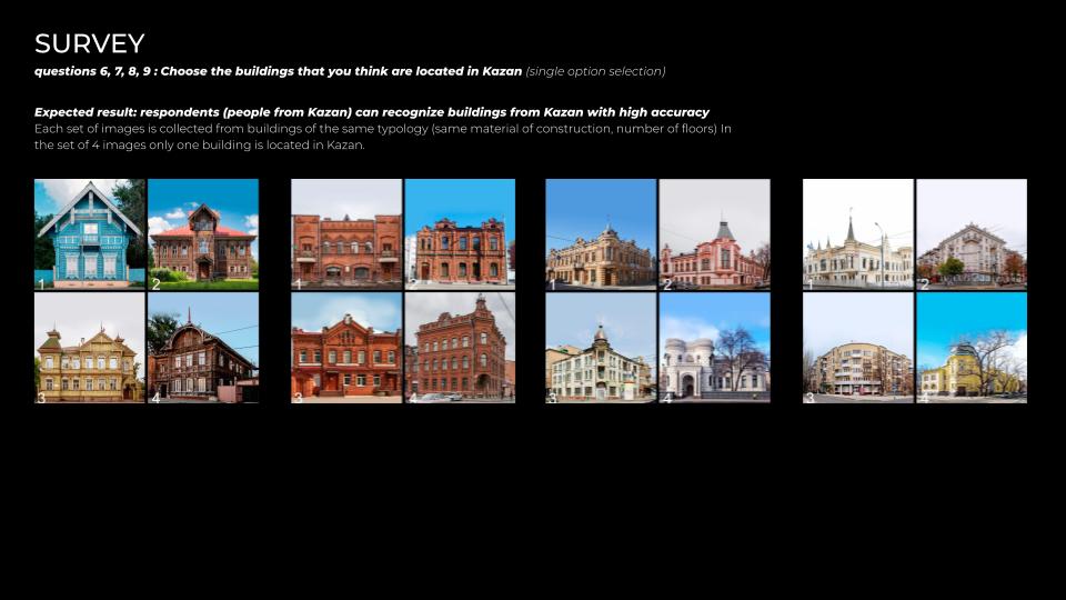
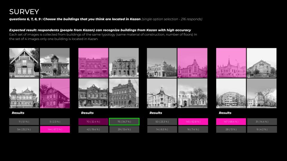
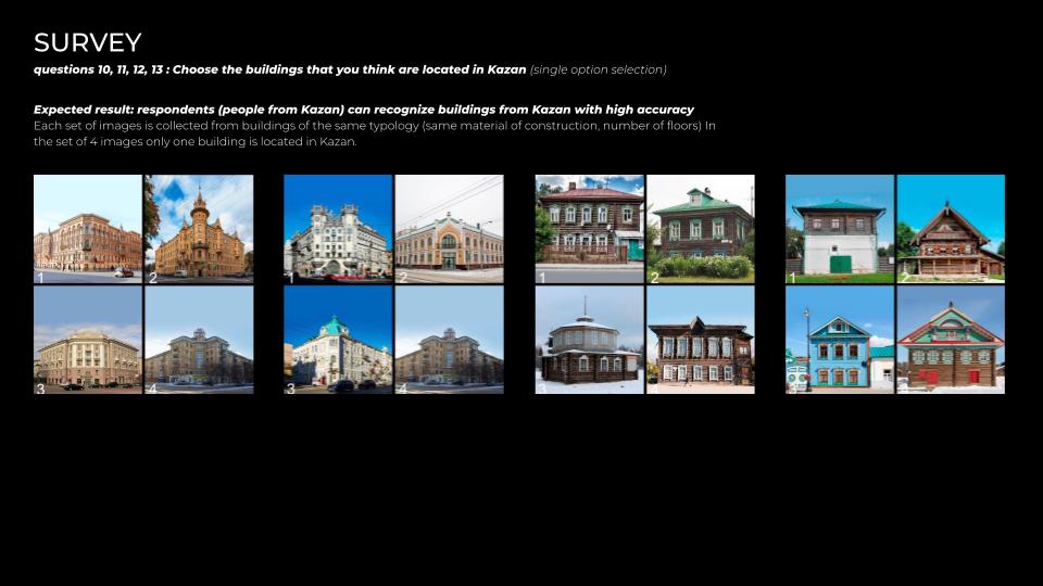
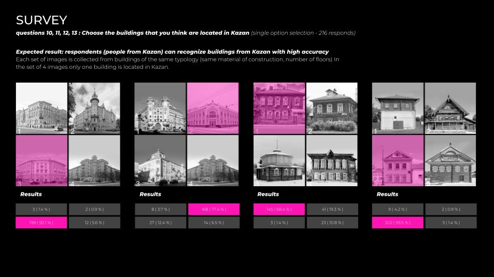
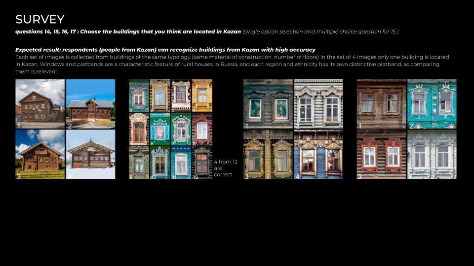
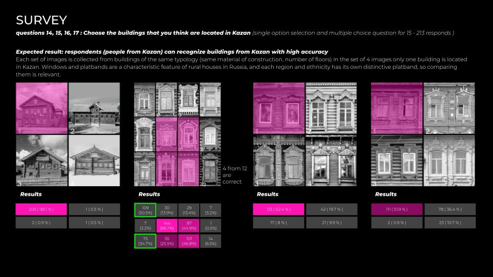
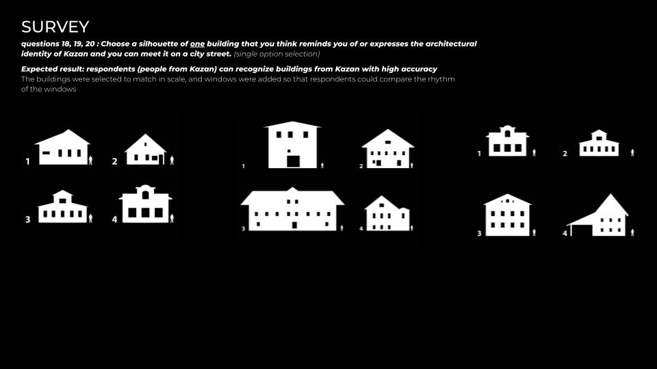
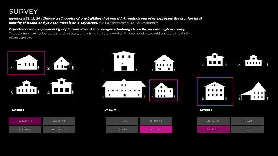
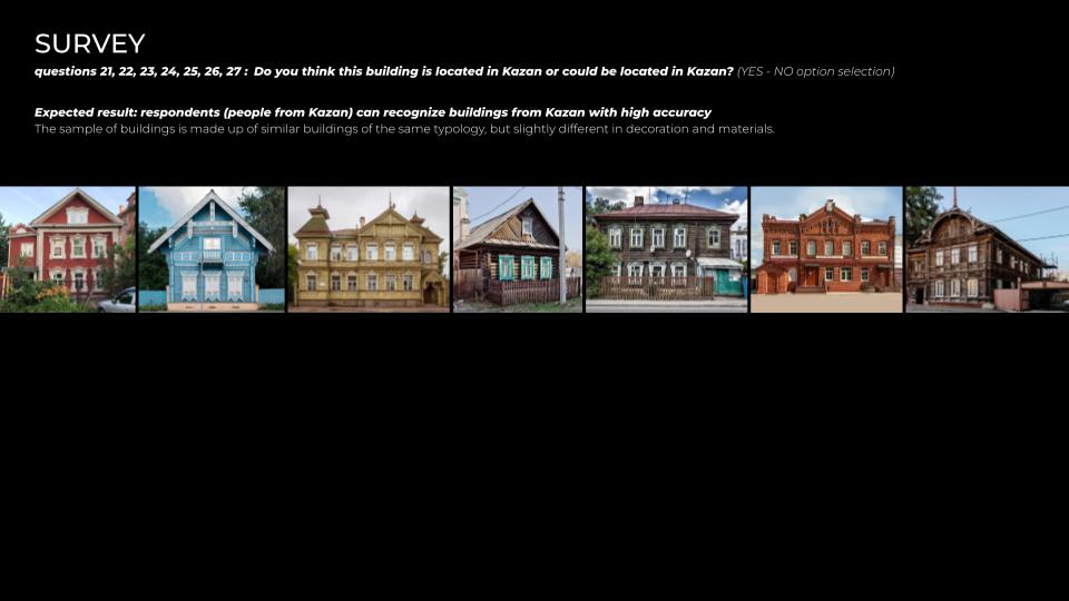
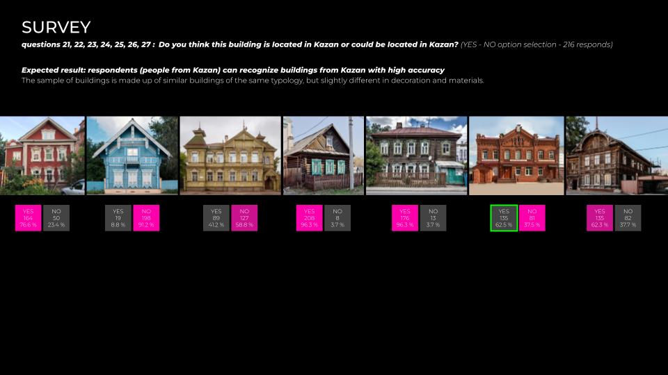
Shortly about conclusions of the survey. As we can see there are some similarities in the chosen houses:
- Material is mainly wood;
- One-storey house with symmetrical facade with three windows;
- Two-storey house with symmetrical facade with four windows;
- The roof inclination angle is 30 degrees;
- Rich decoration on the windows of residential houses
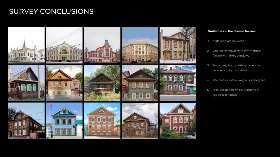
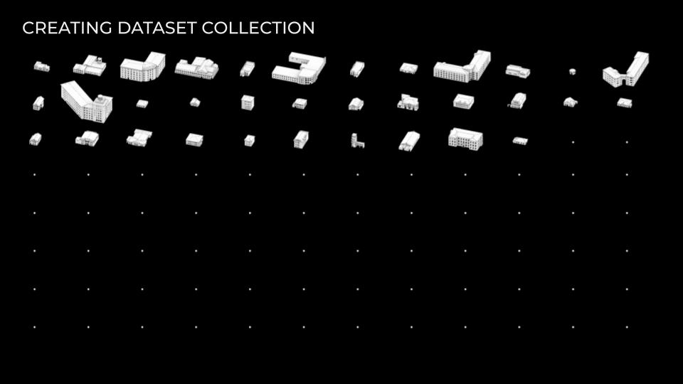
Moving to the next part of the project. First of all, which buildings should I choose for training the AI? I base my dataset on the buildings from photos that people chose and from the same typology. Then, I found a document with a list of buildings called “a list with objects of protection of the historical settlement of Kazan”, which includes historically valuable city-forming objects in the amount of 431 buildings. So I chose some from this list as well.
Second, there is no open source with 3d models of the buildings in Russia in general and Tatarstan specifically, so it is impossible just to connect 3d models into the script. I had to create all 3d models manually using open maps sources articles.
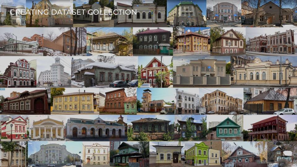
Here we have 34 models and I expect myself to complete these models to fulfill empty points and I have to complete 100.
