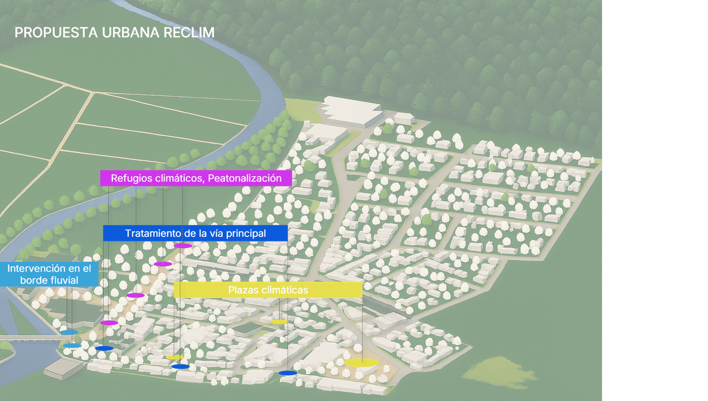
St. Julian’s – Environmental Analysis Research
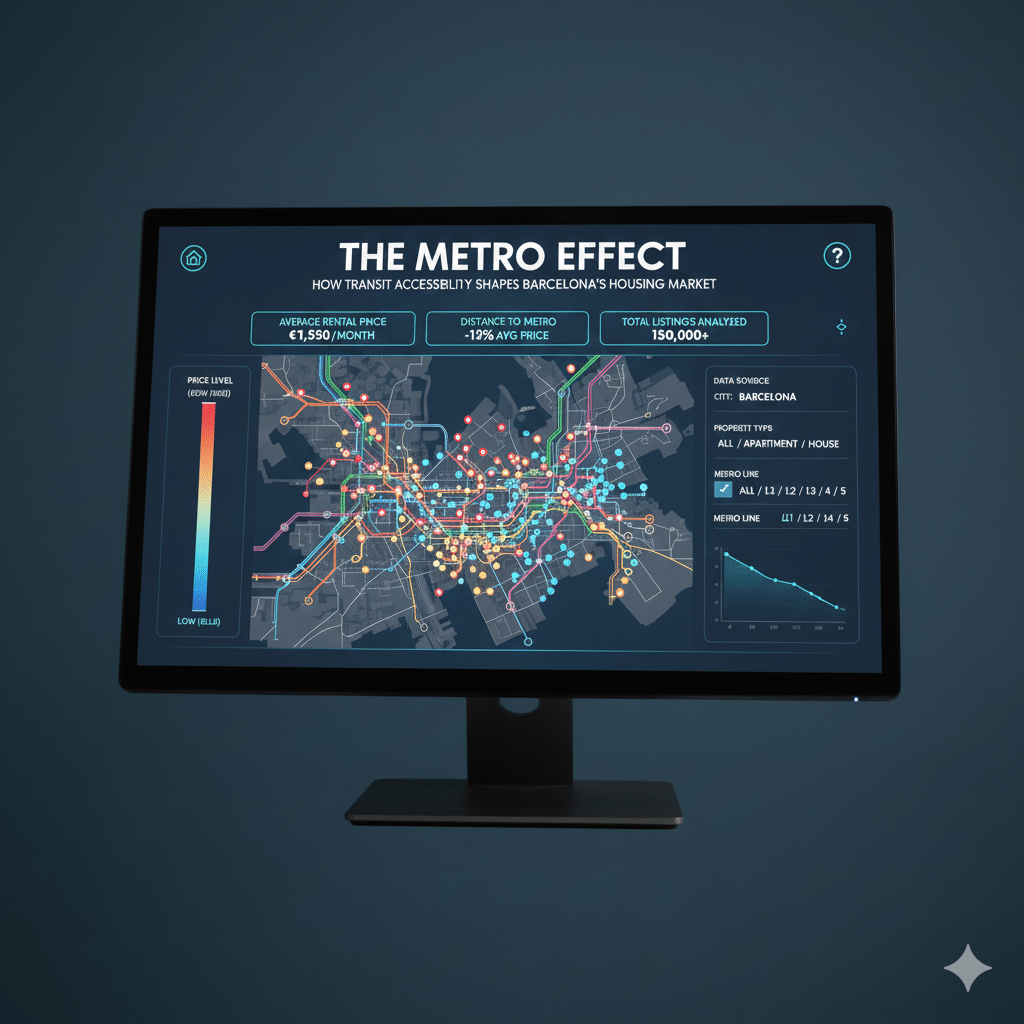
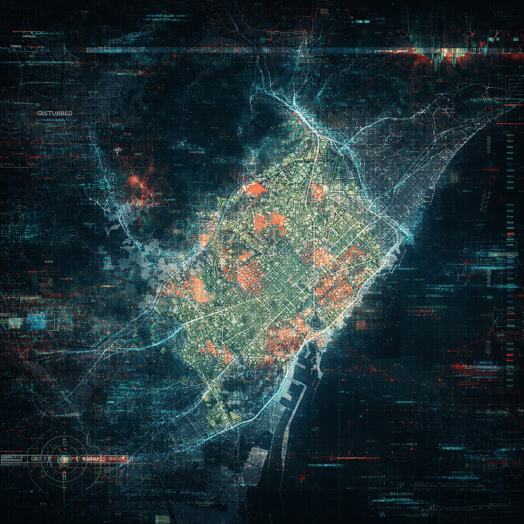
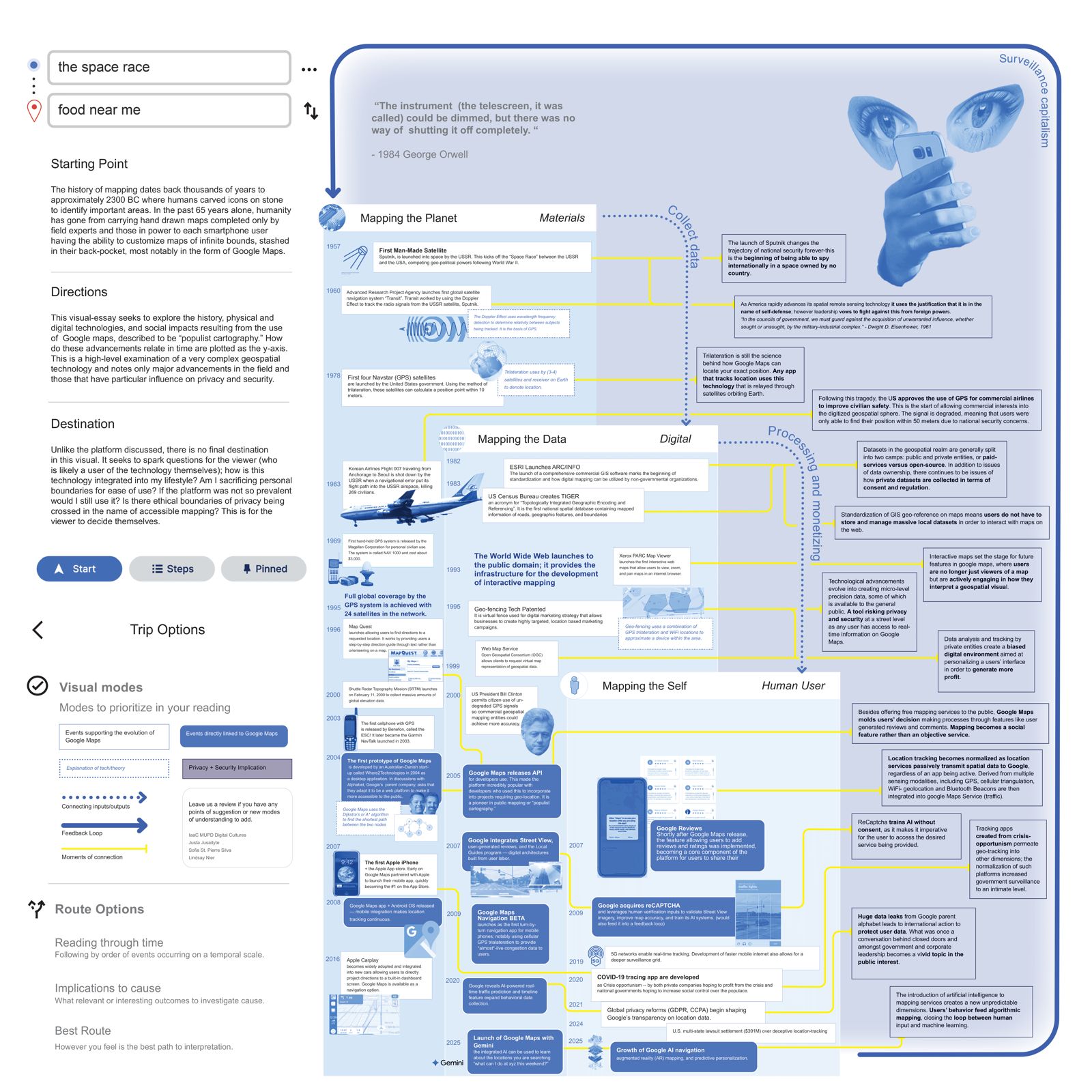
Saint Julian’s City in Malta Saint Julian’s is Malta’s nightlife and tourism epicenter (Paceville), causing extreme population density and infrastructure strain in summer. Its coastal development makes it highly vulnerable to climate change impacts like sea-level rise, while its energy-intensive industry contributes to Malta’s emissions. Environmental Analysis to Inform Design Environmental Analysis Workflow The workflow … Read more