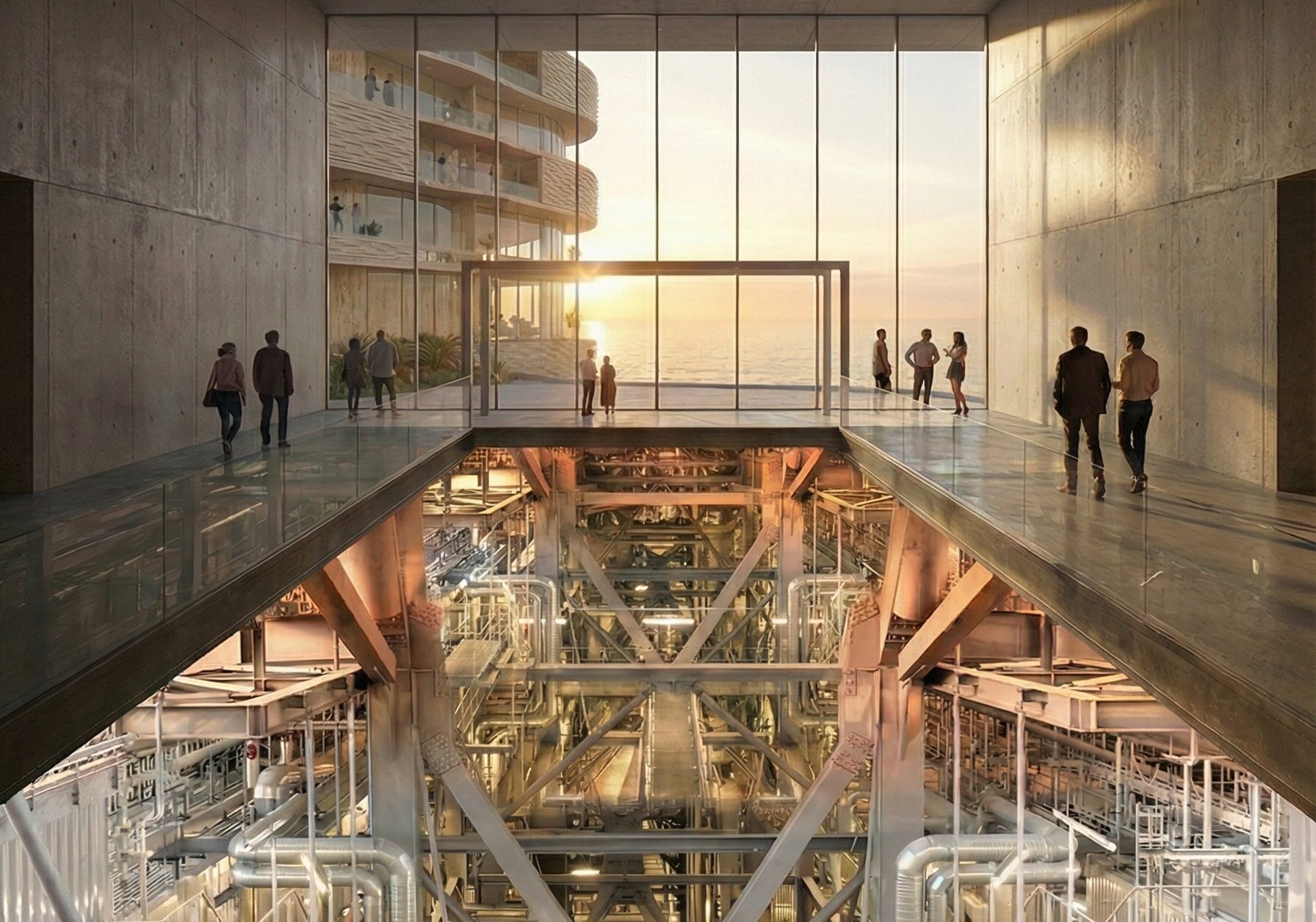
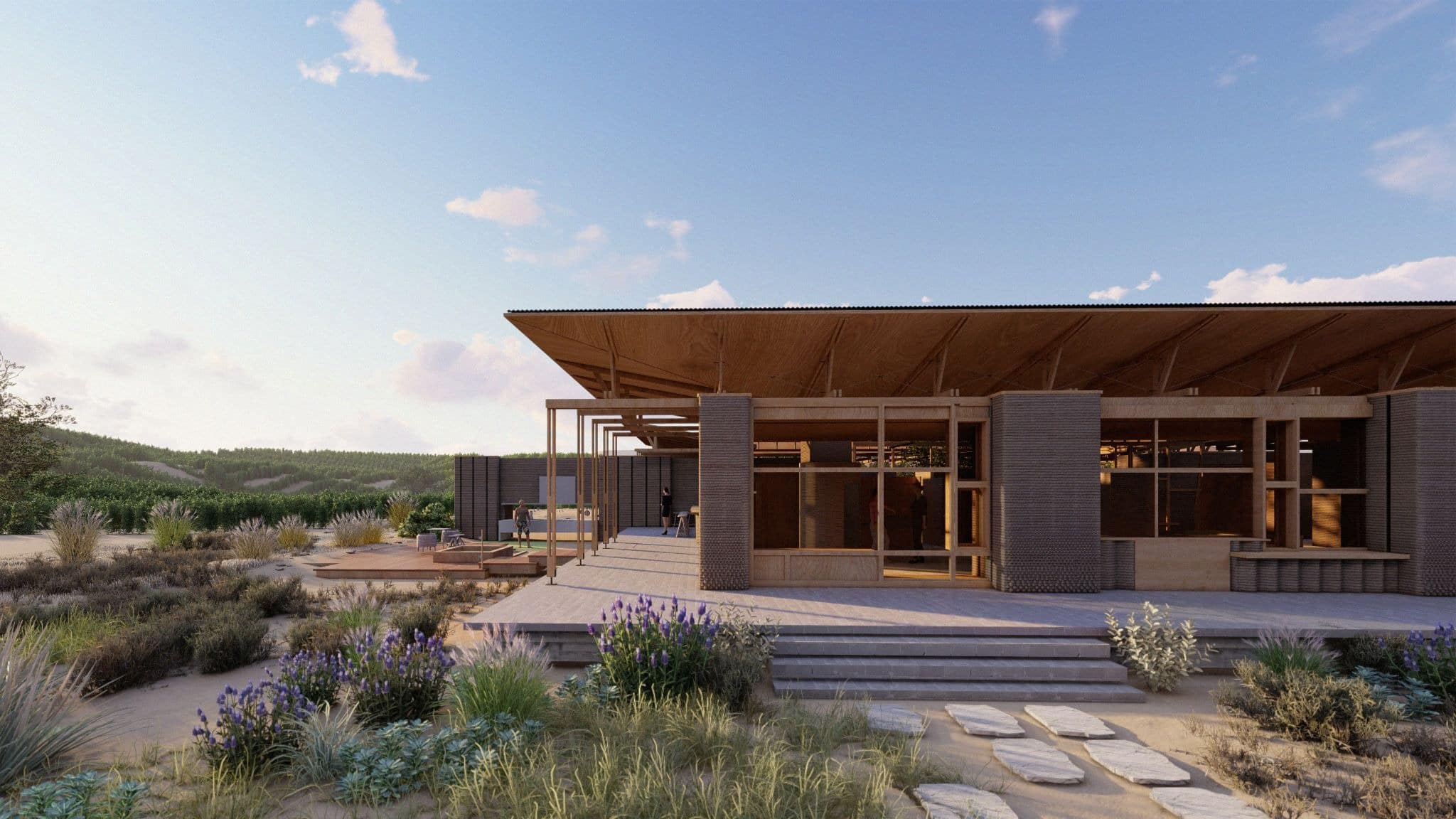
Connexió (Connection)

Santa Coloma de Gramenet, located to the north of Barcelona, is bordered by the Besòs River on the west and the Marina Mountain Range on the north. The city’s terrain features an irregular relief that rises to 303 meters at Mount Castellar, its highest point, a topographical character also visible within Parc dels Pins. The … Read more

Wildlife Integrating Landscape Design Artificial Intelligence – WILD.AI — Term_III

CONTEXT DYNAMICS METHODOLOGY ANALYSIS By subtracting different scenarios from one another: The differences start to become clear as to what areas are consisently lost vs what areas are inconsistently lost. The latter being the one where planners and ecologists should focus their efforts the most if aiming to potentialize action. The figure becomes even clearer … Read more

Andromeda

Andromeda

Andromeda is a Rhino-native copilot that turns briefs, context, and massing into a single, interpretable graph so designers can enrich masterplans, evaluate KPIs, and bake results back to Rhino, without leaving their workflow. Built for early-stage masterplanning, it aims to raise social value, connectivity, accessibility, and overall urban quality by unifying data, guiding program allocation, … Read more

Urban Climate on Graphs: From Form to Comfort

ABSTRACT This thesis investigates the relationship between urban development patterns and outdoor thermal comfort, with a focus on Mean Radiant Temperature (MRT), a key factor in calculating the Universal Thermal Climate Index (UTCI).  While graph-based approaches have long been used in spatial analysis (e.g., space syntax, circulation networks), this research extends the application of graph … Read more

Territorio en Cura:

El drama socioambiental de la explotación de sal gema en Maceió y la reimaginación de este territorio Resumen Este trabajo analiza el colapso geotécnico y socioambiental causado por la minería de sal-gema en Maceió, Brasil. A partir de datos técnicos, mapas producidos por la autora y relatos comunitarios, propone una lectura crítica del territorio y … Read more

ACTIVOS URBANOS EVOLUTIVOS

Sobre latencias y oportunidades del abordaje de la vacancia en la Ciudad de Mendoza RESUMEN La problemática de los pasivos urbanos, definidos como terrenos subutilizados o infraestructuras obsoletas dentro del tejido urbano, constituye un fenómeno global con implicaciones territoriales y socioeconómicas a escala local. La expansión urbana no planificada, caracterizada por patrones de crecimiento de … Read more

RECLIM – Regeneración Climática Urbana Evolutiva

Generando Infraestructuras múltiples para la transformación de barrios vulnerables Introducción En las últimas décadas, el crecimiento urbano ha estado marcado por una desconexión progresiva entre las ciudades y los sistemas naturales que las rodean. Esta tendencia ha propiciado una expansión urbana descontrolada, acompañada de una intensa explotación de recursos naturales y la ocupación de ecosistemas … Read more

Skate {able} city

Redefinir el espacio público desde el skateboarding: hacia una Integr{able} City En las ciudades contemporáneas, el diseño del espacio público tiende a responder a lógicas de especialización funcional, segmentando sus usos y trazando bordes rígidos entre actividades. Esta fragmentación limita la convivencia, reduce la espontaneidad y empobrece la diversidad de apropiaciones que constituyen la esencia de … Read more

INTERACTIVE LIGHTSCAPES

Creating Charismatic and Safer Public Spaces through Light RESEARCH QUESTION: How can experiential lighting features — ones that create interactive, changing, and flexible environments– be used in public spaces in order to create senses of community, safety, and improved mental and emotional health? HYPOTHESIS: If we integrate interactive lighting solutions as permanent fixtures in public … Read more

GG Worlds [v.2]

Introduction: From Words to Worlds Game design is one of the most creative fields in digital media today but for most developers, turning ideas into immersive worlds remains slow, expensive, and overwhelming. Especially for independent creators, level design, the art of shaping the physical and emotional journey of a player, is often the most demanding … Read more

EMI: Engine for Morphological Integration

An algorithmic roadmap that converts self-organized settlement morphology into clean-energy action: the Energy-Morphology Index mines open roof- and density data, ranks each building’s readiness, and matches “Ready / Promising / Not-Ready” clusters to modular solar toolkits—turning self-organized settlements into engines of energy justice

EcoNodes

EcoNodes is an AI-driven urban planning platform designed to identify and prioritize the city’s most heat-stressed and impervious junctions for strategic green interventions. By combining satellite imagery, street view segmentation, and environmental datasets, EcoNodes highlights the urban nodes that lack vegetation, suffer from poor air flow, or trap excessive heat. The tool empowers planners to … Read more

Spatial Data to Economic Intelligence

Using Street View and Remote Sensing methods to infer ground level socio-economic realities The Challenge: The Urban Data Blind Spot Urban economies are dynamic, fast-evolving systems—but the data used to understand them is often static, delayed, or incomplete. In many cities, a significant share of economic activity unfolds beyond the reach of traditional measurement frameworks, … Read more