Modifying terrain slope to optimize drainage and building footprint.
Can we optimize cut and fill for terrain modification to optimize water drainage and maximize building footprint?
The “Sponge City+” toolkit is a Grasshopper-based platform that helps architects integrate low-impact development (LID) strategies into early-stage urban design. Tested on three Chinese university campuses, it combines runoff volume calculations, flood risk visualization, and multi-objective optimization to balance hydrological compliance with construction costs. Ultimately, it bridges the gap between spatial design and water management engineering.
Xu, K., Yu, X., Weng, H., Wu, S., Huang, R., & Mo, W. (2025). Sponge City+ toolkit: Parametric approaches for sustainable water management and urban design. Sustainability, 17, 9485. https://doi.org/10.3390/su17219485
The Pseudo Code

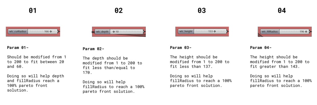
Defining Parameters for Optimization
Amount of Cut (Excavation Depth): This parameter dictates the vertical reduction applied to the site’s highest points and ridges. By calculating the maximum depth of earth to be removed, the solver effectively “decapitates” steep, unusable elevations, converting extreme highs into viable, leveled ground for building footprints while reducing the velocity of runoff that would typically cascade down steep gradients.
Radius of Cut (Excavation Extent): Operating in tandem with the cut amount, this parameter defines the horizontal spread of the excavation around the high points. A larger cut radius carves out broader, more expansive plateaus. The algorithm must balance this radius to maximize flat surface area without triggering a massive, cost-prohibitive volume of displaced earth.
Amount of Fill (Addition Height): This parameter targets the site’s lowest points—the natural gullies, valleys, and depressions where water naturally accumulates and poses severe flood risks. By defining the vertical height of earth added to these low zones, the solver actively raises the topographical “floor,” eliminating deep pooling areas and ensuring the terrain remains safely above the localized flood plain.
Radius of Fill (Addition Extent): This parameter defines the horizontal spread of the added earth radiating outward from the lowest points. It is critical for establishing continuous, gentle slopes. By manipulating the fill radius, the algorithm seamlessly blends the raised depressions back into the surrounding terrain, creating unified, continuous gradients that effectively shed water toward designated drainage zones rather than trapping it.
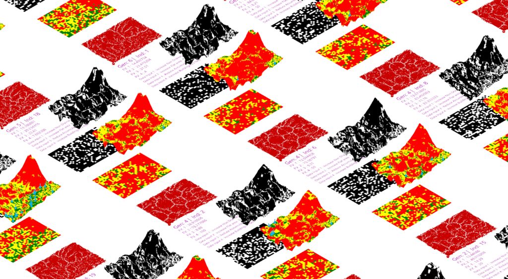
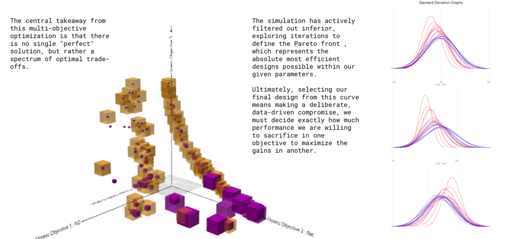
Pareto Front Solution Graphs
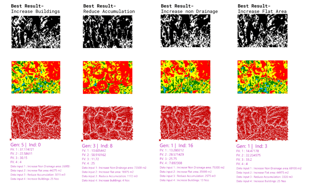
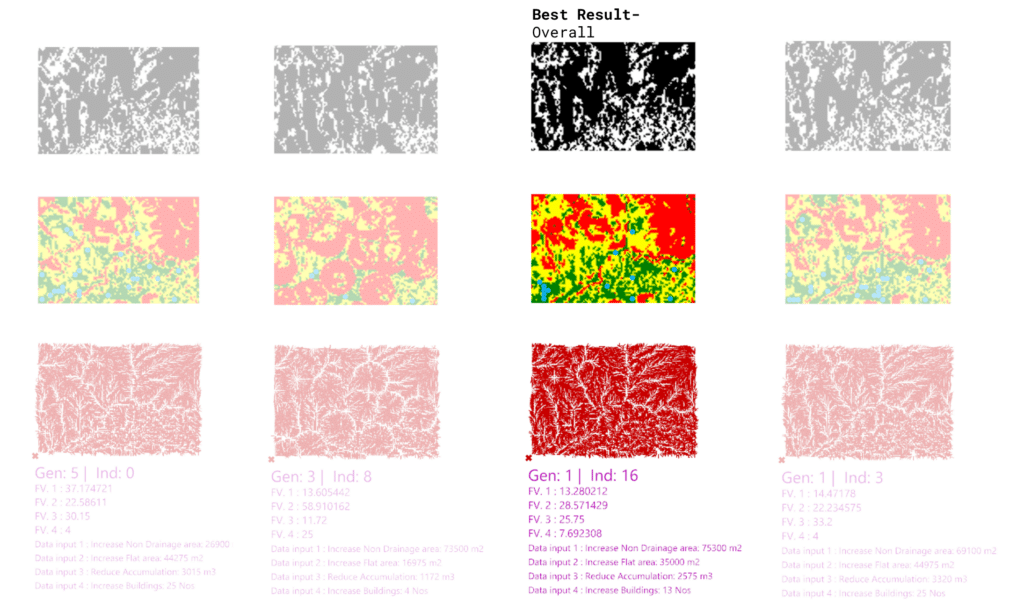
The Pareto Solutions (109 out of 400)
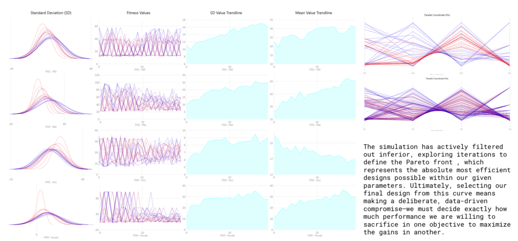
Generating 109 Pareto-optimal solutions from a population of 400 (a 27% yield) is a highly significant result that validates the health of my evolutionary simulation. It demonstrates that my four terrain and drainage objectives are fundamentally competing, preventing the algorithm from prematurely collapsing into a single, mediocre compromise. Instead, the solver successfully maintained genetic diversity and thoroughly explored the boundaries of the site’s design space. Ultimately, having such a robust and diverse set of non-dominated options gives me a massive advantage, allowing me to use qualitative human judgments—like specific spatial aesthetics or unquantifiable site constraints—as the final tiebreaker without sacrificing quantitative hydrological performance.
Comparative Analysis
Data Visualization using Orange
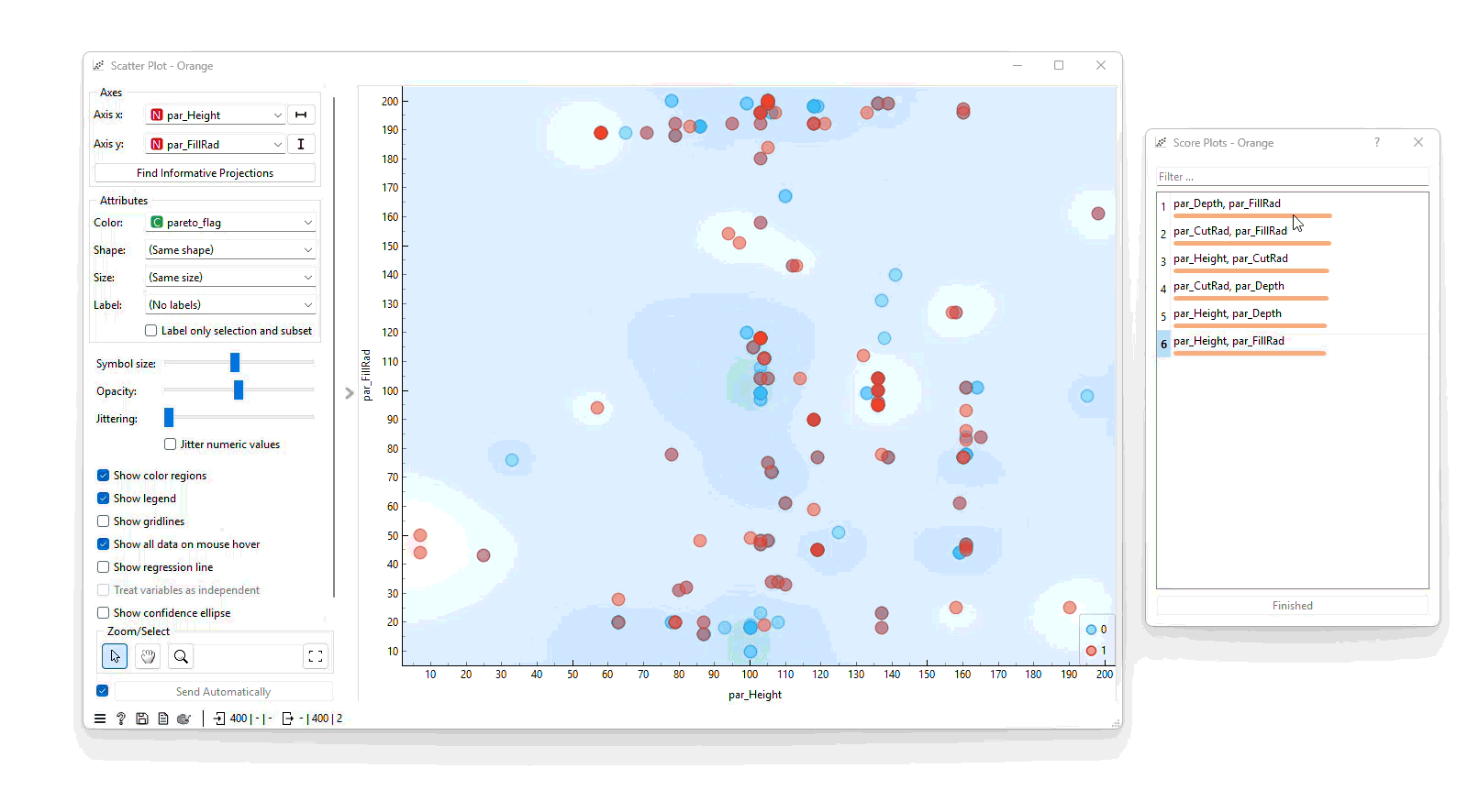
Using Orange software to visualize these Pareto Fronts, informative projections show some clusters of Pareto Front solutions but they are mostly scattered. This could be because of the number of fitness objectives that are running simultaneously and causing lesser clusters. The solutions would be to either reduce the number of objectives or change conflicting objectives.
Data Tree of Pareto Solutions
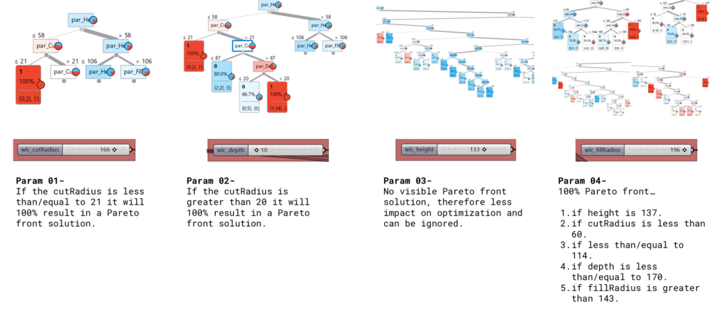
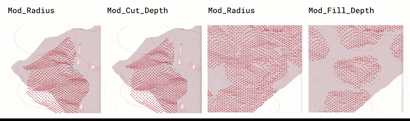
Parameter Modifications