Intro
What’s your first impression of Tokyo?
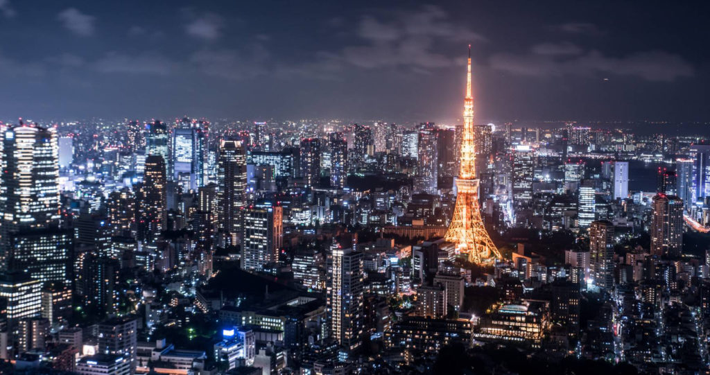
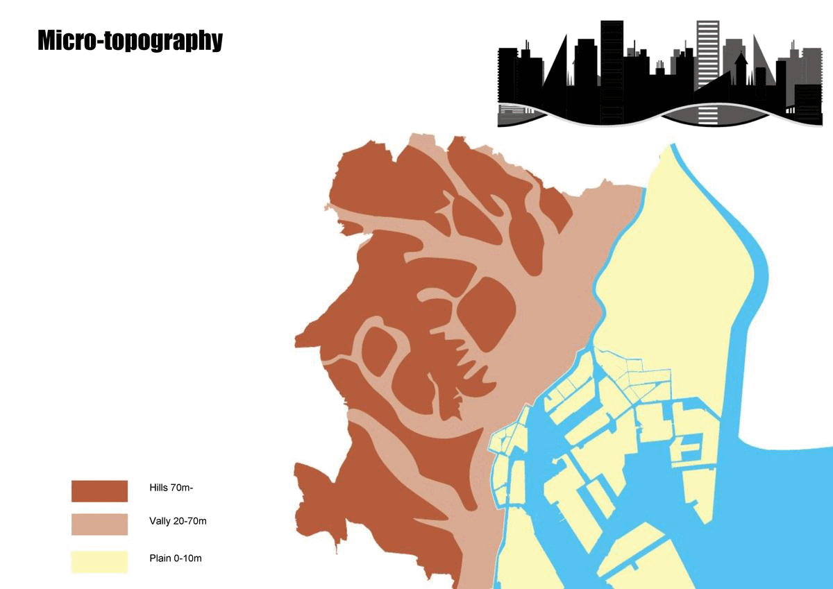
A lot of people would say skyscrapers, high-technology, cherry blossoms, etc. When we search for pictures of Tokyo, we can see high-rise buildings filling the city horizontally. This could give people the impression that Tokyo is flat. However, Tokyo is a city with a lot of hills. We can capture some hints from Japanese animations, the hills in Tokyo become the background of beautiful views. This is the micro-topography of Tokyo. The particular topography gives people chances to have unexpected adventures in the city.
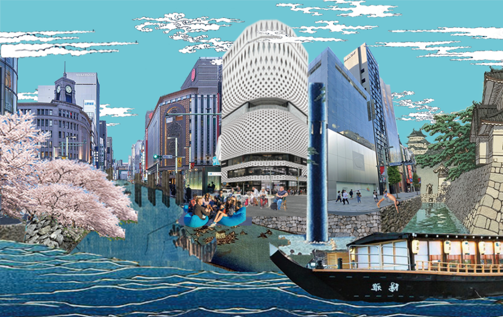
Also, do you know Tokyo had a developed river system 100 years ago? Tokyo looked like Venice in the Ukiyo-e from the Edo period. The rivers played an important role in the development of Tokyo. Tokyo became the important transfer point between ocean shipping and river shipping, which encouraged the development of the economy and business, but also made the area along the rivers developed into a lively neighborhood. However, the fast development of Japan forced Tokyo to fill in a lot of river courses, turning them into roads. This gives us a new factor to examine this city. Should we bring the river back to Tokyo and the daily life of the Tokyo people?

Analysis
Tokyo is divided into two sides by the Sumida River, the east side is mainly flat, and the west side is hilly. Hills and valleys are the main attractions in this topography. Parks are primarily designed on the hilltop, and the valleys became the cultural landmarks, forming a subculture phenomenon unique to Tokyo and even Japan.
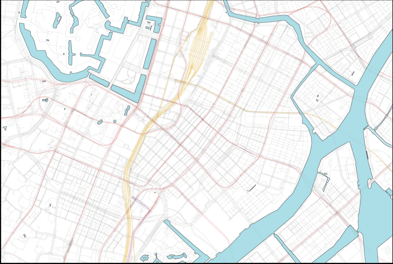
The conceptual mapping of the city is conducted in three main strategies: river, park and culture&history. For river, the existing river system is mapped, and the park as well. This formed the existing green-blue system, which is highly broken and fragmented. For culture&history, the famous landmarks are mapped. These shape the culture clusters in Tokyo.
There are also other problems in Tokyo. Some rivers are artificial, which have dead water and stink easily in summer after the system was destroyed. The city also has a very serious heat island problem. Nevertheless, Tokyo residents don’t have too much nature to enjoy. These problems drive us to reconsider how to create rivers that people could enjoy more and improve the sustainability of the city.
Proposal


Combining the natural elements and cultural elements, we have our design proposal: bring the river back to Tokyo. We recreate some rivers according to the micro-topography and history. The rivers run naturally along valleys and basins, connecting the parks and famous landmarks. With this river system, tourists can have a new way to explore the city, and the locals can enjoy nature more as well.

For a micro-scale proposal, we focus on the area near Tokyo Station which is one of the most famous commercial districts in Japan. It’s been busy and lively since the Edo period. But this area was full of rivers and canals in history. We change several roads to rivers to add some natural elements to the commercial scenario to renature the center of Tokyo, and avoid the metro lines and highways at the same time. We design different models for roads with different widths, with turning lanes to rivers rather than the whole road, to lower the impact of eliminating roads.