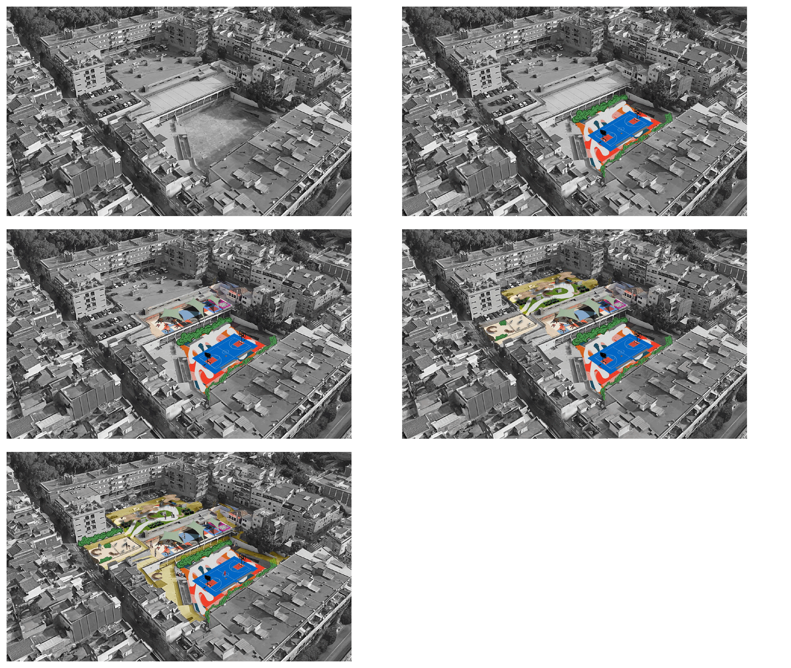
This project focuses on establishing a community-centered public space in Santa Coloma. Situated at Block Illa de Raval, a designated “green finger” of the Pinta Verde initiative, the project seeks to improve accessibility, enhance social engagement, and address infrastructural needs based on local context and community input.
At the project start, several assumptions guided the approach: we assumed that residents would be interested in engaging in social activities, would accept some increased noise from public use, and that local government entities would provide financial and logistical support. Throughout the design process, insights emerged: the concept of “co-creation” required more defined structure in both presentation and implementation to facilitate effective community engagement. Public space redesign is inherently iterative and cannot be fully realized in a single Iteration, flexibility in planning is essential to allow for community-driven adaptations over time. Inclusivity should get prioritized to mitigate risks of gentrification, which could impact accessibility and affordability for current residents. Collaboration across the diverse academic backgrounds of MaCT, MAA and MDEF provided multiple perspectives and enhanced the project’s problem-solving approach.
The methodological framework for this project comprises both onsite and offsite analyses, structured as follows:
- Onsite Analysis
- Observation and Documentation
- This phase involves a systematic photographic survey of critical site features, observations of human movement patterns, and initial stakeholder identification, with an emphasis on mapping the spatial dynamics and interactions within the site.
- Interviews
- Interviews are conducted with a range of stakeholders, including site users, local business owners, and relevant government officials, to gain insights into the multifaceted usage and perceptions of the site.
- Observation and Documentation
- Offsite Analysis
- Data Processing and Initial Spatial Analysis
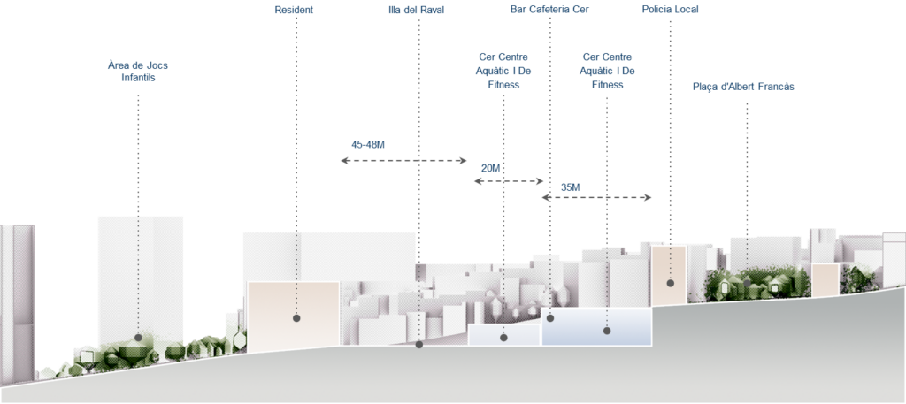
- Collected onsite data undergoes preliminary analysis to identify spatial divisions within the site. The site is segmented into three primary zones to facilitate targeted intervention planning.
- Stakeholder Mapping and Needs Assessment
- A detailed stakeholder map is developed, highlighting key actors and delineating their respective needs and challenges related to the site.
- Spatial Mapping and Flow Analysis
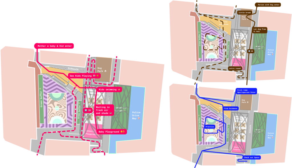
- Using GIS software and spatial analysis tools, site features, human movement patterns, and other relevant data are mapped onto a site map, illustrating the relationships among various spatial elements.
- Data Processing and Initial Spatial Analysis
- Vision and Intervention Development
- Spatial Configuration
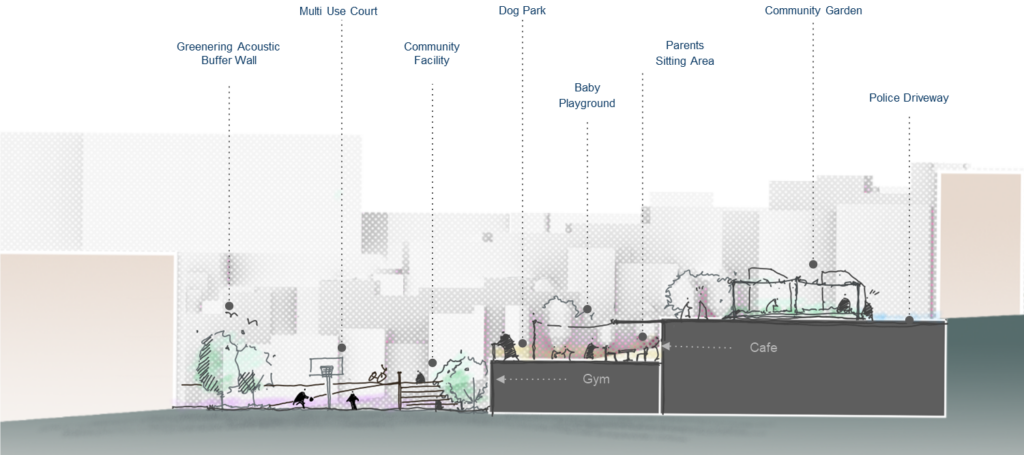
- A sectional diagram is created to depict proposed spatial reconfigurations, demonstrating how the site will be subdivided to optimize its functionality, accessibility and interconnectivity.
- Visualization of Stakeholder-Aligned Features
- A series of visual representations are developed, highlighting new spatial features in direct response to identified stakeholder needs, ensuring the interventions align with the diverse requirements of the site’s users.
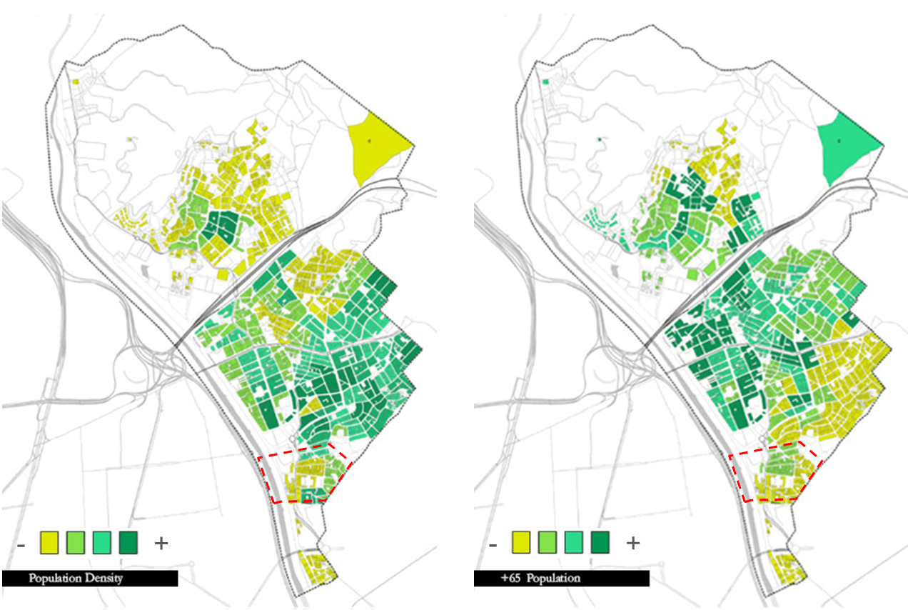
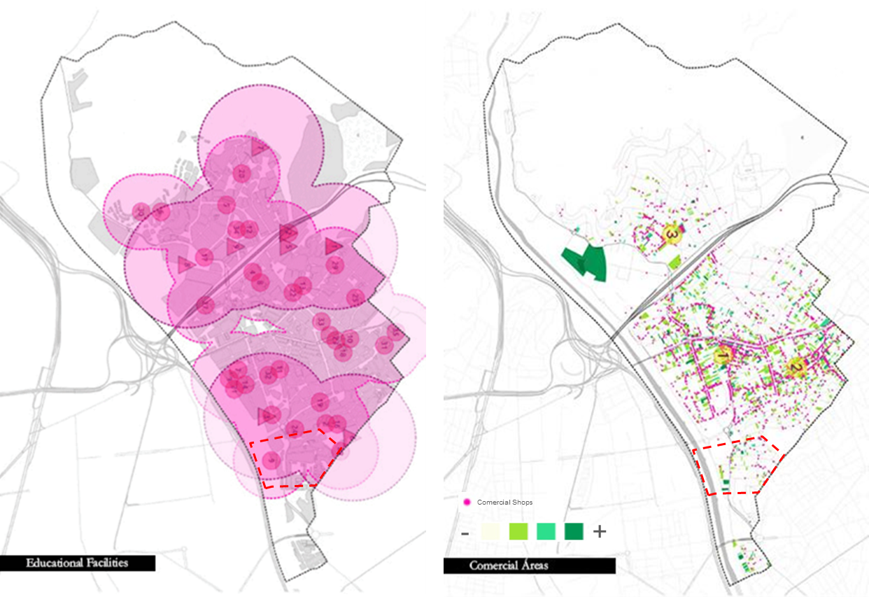
The research highlighted several structural and demographic challenges in the area. The steepness of streets, public transport options, and lack of commercial and social facilities restrict accessibility. The community primarily comprises young families, low-income households, and an increasing immigrant population. Despite these limitations, residents demonstrate a strong community connection and informal organizational structures, reflecting a solid foundation for engagement in public initiatives.
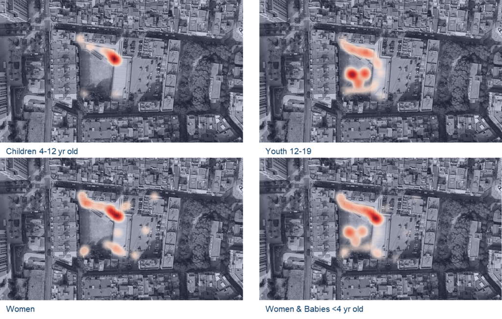
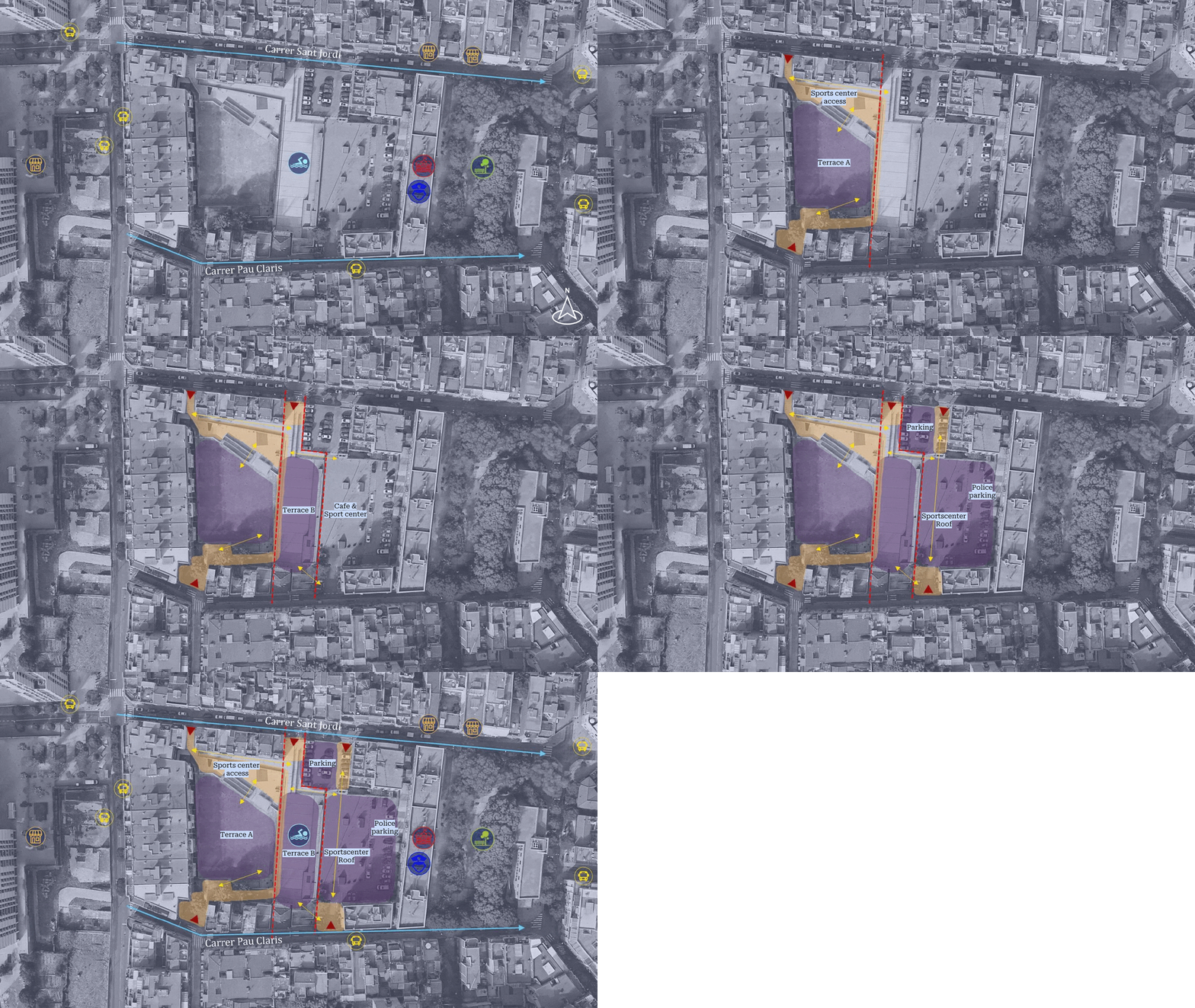
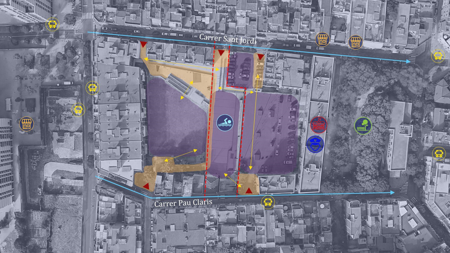

The design proposal introduces a multi-functional extension adjacent to the Aqua Sports Center, featuring a modular, multi-sport surface adaptable for diverse uses, including sports, workshops, markets, and other events. This flexible facility would complement the sports center’s limited operating hours and include a permanently accessible area. The rooftop of the sports facility would house a community garden and dog park, while increased greenery would contribute to noise reduction and provide shade, enhancing the site’s environmental sustainability.
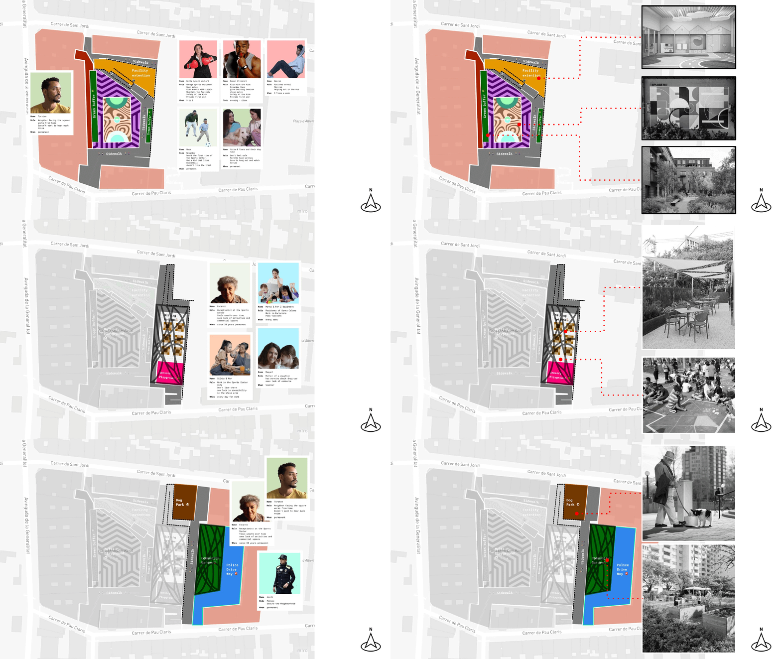
Community engagement is fundamental to the implementation approach. While the initial collaborative Multi-court design provides a foundation, ongoing adaptations—such as determining specific sports and event programming—will be community-driven, allowing residents to shape the space over time according to their needs and preferences.
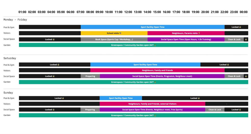
To achieve and sustain these outcomes, the project requires governmental funding for both construction and continued support. A dedicated team of social workers would be essential to maintaining resident engagement and ensuring the space remains responsive to the evolving needs of the community.
Conclusion
The Illa de Raval co-creation project aims to create a flexible, inclusive public space responsive to local needs, offering a model for community-driven urban development.
