Credits: DataTHINK 2025.
Description
Digitalization and AI have become ubiquitous and pervasive, shaping the ways we think, design, and experience our urban environments. As the fields of architecture, urban history, design, and social sciences grapple with these rapid changes, we see an urgent need to engage critically and proactively with these transformations—assessing both the limitations and the potential of emerging digital tools and practices.
This new edition of the Datathink block seminar, involves lectures, presentations, visits, and a collaborative hackathon. Participants will work with theme-oriented scenarios and urban visual data in hands-on and participatory sessions. The seminar will highlight how AI, machine learning, and advanced digital infrastructures can be harnessed more responsibly, with an emphasis on governance, spatial justice, and citizen participation.
The seminar is co-organized by Digital Visual Studies (a Max Planck Society project hosted at the University of Zurich), the UNESCO Chair in Urban Landscape at the University of Montreal, and the Institute for Advanced Architecture of Catalonia (IAAC) in Barcelona.
Exercise
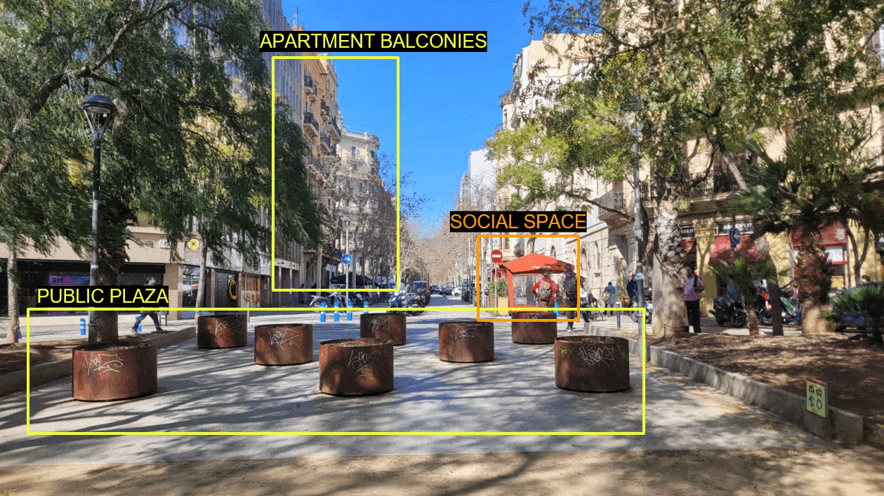
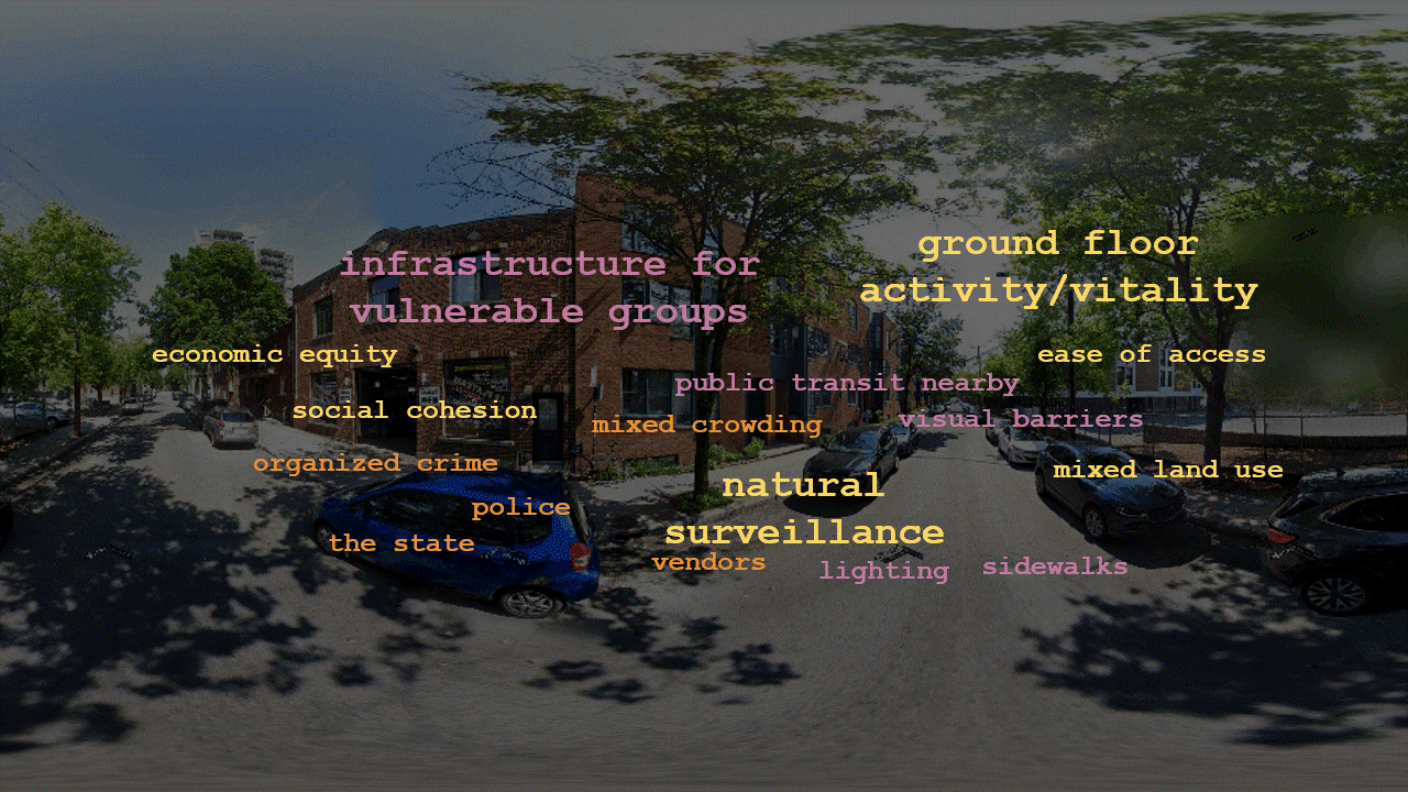
The aim of the workshop is to question, support, and assess a VLM for urban studies.
The workshop is organized in three consecutive sessions: Ai & cities, Visual Urban Studies and Urban LLM that together support the model’s tuning. More precisely, the first day functions as a general introduction and warm up, the second day discusses the set of questions to tune the VLM, the third day provides feedback on the current state of the model via participant’s personal experience of the cities. In this regard, participants are invited for the duration of the seminar to make a photo campaign of the city and document urban conditions that are relevant to discuss.
Keywords
Artificial Intelligence, Tech Governance, Visual Language Model, Multimodal Urban Studies.