Enhancing walkability and mobility in Riyadh
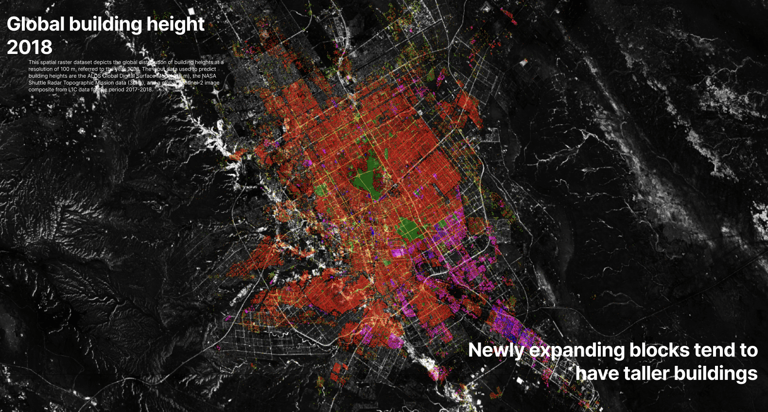
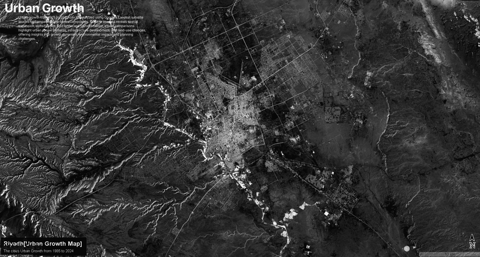
Riyadh is at a pivotal moment in its urban evolution. As one of the fastest-growing cities in the world, its reliance on cars has resulted in congestion, pollution, and a lack of safe, accessible routes for pedestrians and cyclists. Our masterplan aims to transform the city’s mobility landscape by integrating sustainable, efficient, and child-friendly transportation solutions that prioritize people over cars.
Community at the center of city making
Riyadh’s current urban form is shaped by a regular street network that defines the fabric in which the community lives. However, true to its name—Riyadh, the plural of rawdah—it was historically the community that shaped the city’s spatial structure. The heart of each block once served as a gathering space, both spiritually and socially. With this new mobility scheme, we aim to refocus on the community and its central spaces, recognizing that mobility not only serves the people but also fosters growth and strengthens social bonds.


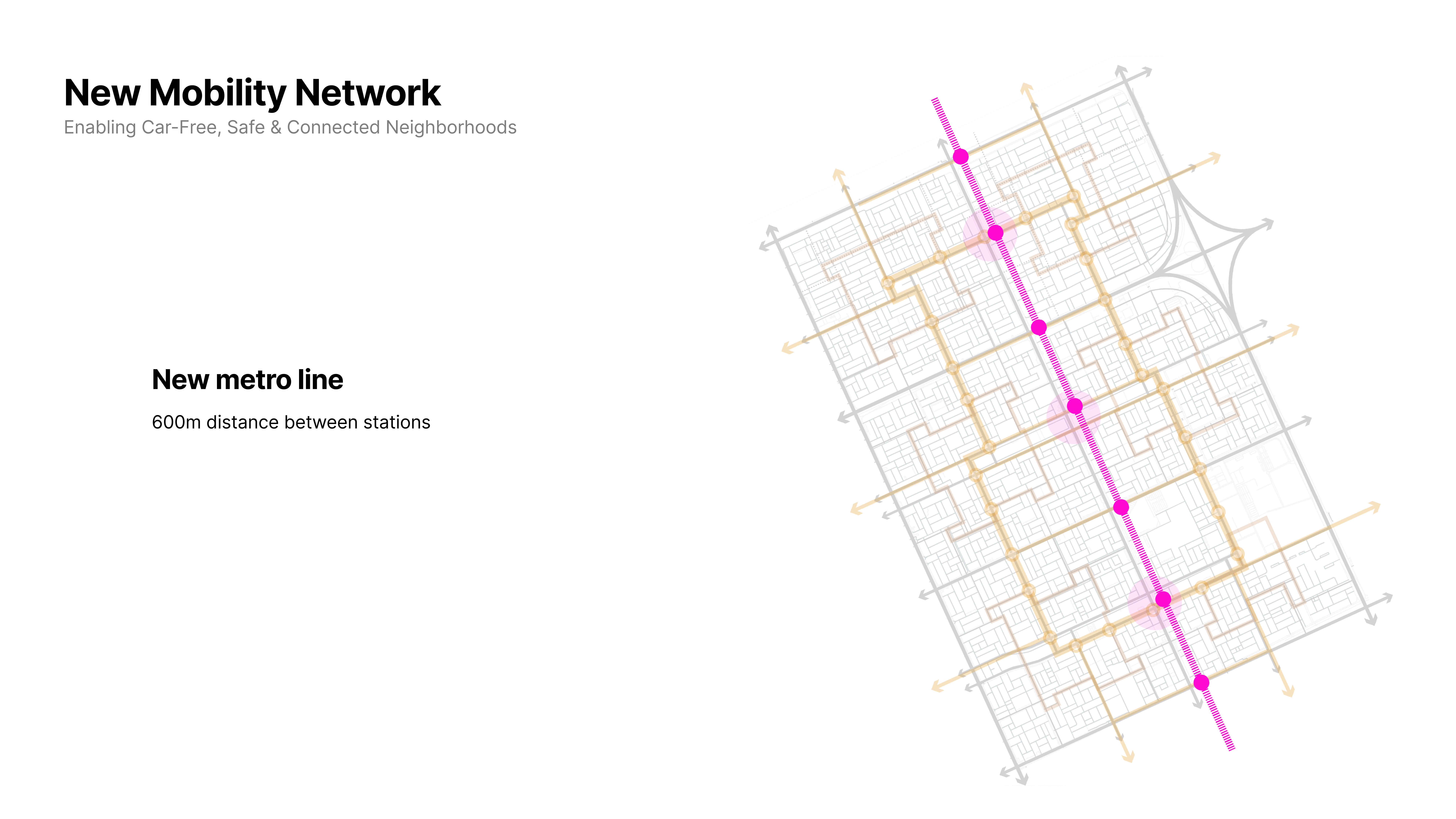
New Mobility Scheme: The Nervous System of the City
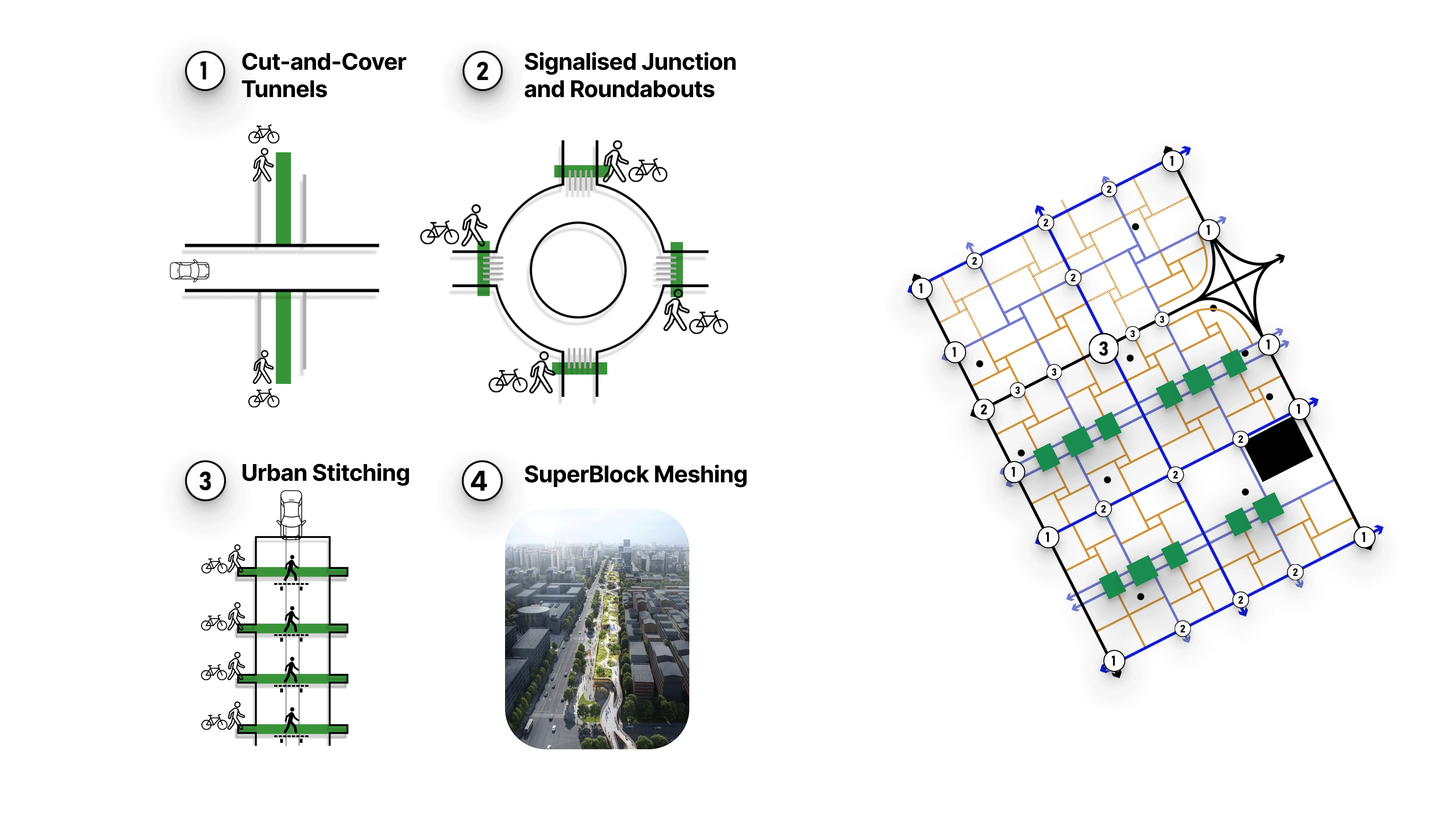
The current transportation system in Riyadh creates stark inequalities in travel time. Driving remains the fastest mode, while public transport, walking, and cycling lag far behind. Our proposal seeks to eliminate this imbalance by implementing cut-and-cover tunnels, urban stitching techniques, and a restructured road hierarchy that fosters connectivity and seamless movement across the city.
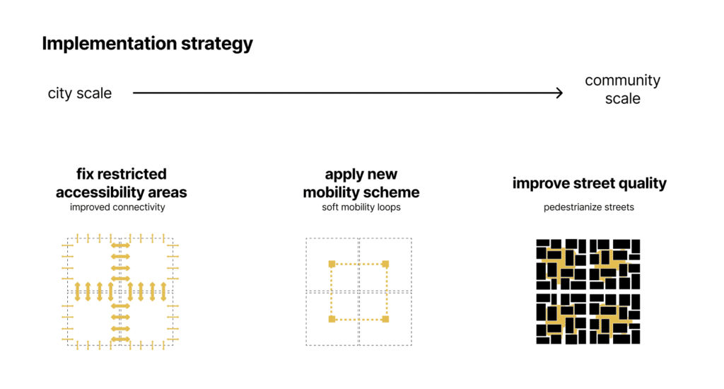
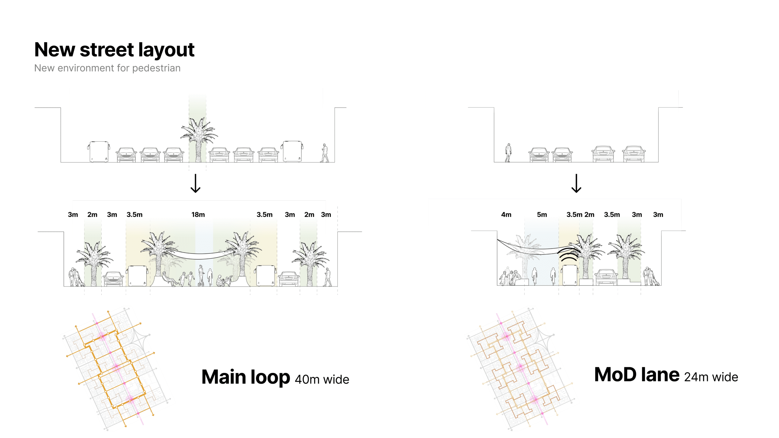
Pedestrianising Local Roads & High Streets
- Car-Free School Zones: A 5-minute walking radius around schools ensures children can walk and bike safely.
- Wide Sidewalks & Crossroads: At least 2 meters of pedestrian space with well-designed intersections enhances walkability.
- Low-Speed, High-Safety Design: Strict speed limits and physical measures (like raised crossings and curb extensions) slow down traffic.
- Active Public Spaces: Encouraging local commerce, playgrounds, and social interaction, making these streets the heart of the community.
Optimising Minor Arterials
- Strategic Roundabouts & Transit Flow for a Balanced Urban Network
- Reducing U-Turn Inefficiencies: Eliminating long detours and allowing smoother, more intuitive navigation.
- Maintaining Traffic Flow: Roundabouts prevent stop-and-go congestion common with signalized intersections, especially for arterial roads.
- Prioritizing Transit & Cycling: Keeping buses on major collectors while ensuring metro stops on minor arterials are well-connected improves last-mile connectivity.
- Safer Multi-Modal Integration: Cyclists can navigate roundabouts more safely with proper lane design, while pedestrians benefit from strategic crossing points at metro-collector intersections.
Major Collectors as Urban Veins
- Closed-Loop Transit for Connected Communities
- Closed-Loop Circulation: Ensures efficient, predictable movement within neighborhoods while reducing unnecessary traffic.
- Multi-Modal Integration: Connecting pedestrians, cyclists, and local transit to metro stations and high streets enhances urban accessibility.
- Traffic-Calming Measures: Roundabouts, crossroads, and speed limits help control flow and make streets safer for all users.
Seamless Motorway Stitching: Beyond Car-Centric Infrastructure
- Cut-and-Cover Tunnels: Rather than deep tunneling, strategically bury roads under mixed-use developments, parks, or transit hubs.
- Green Caps & Land Bridges: Instead of visible overpasses, design landscaped decks that blend with surroundings, hosting plazas, walkways, and even micro-mobility routes.
- Multi-Layered Urban Fabric: Align underground roads with multimodal transit corridors, ensuring walking and cycling are the priority.
- Porous City Grids: Avoid funneling all movement onto a few large corridors by creating a network of smaller, interconnected roads with traffic calming.
Ensuring School Accessibility & Safety
To ensure that schools are within a reasonable walking distance for students, we are implementing Schools Catchment Areas based on a child’s average walking speed of 1.07 meters per second. Each catchment represents the area a child can reach within a 15-minute walk (1,530 meters total), helping to visualize accessibility and guide urban planning decisions.
In addition, we are identifying Restricted Accessibility Zones, where roads or infrastructure create barriers to safe walking routes. These obstacles not only limit accessibility but also highlight high-risk areas for traffic incidents. By mapping these barriers, we can prioritize infrastructure improvements such as safer crossings, pedestrian-friendly pathways, and enhanced school zone protections.
Encouraging Active Mobility: The Role of Gamification
A critical aspect of our initiative is incentivizing walking, cycling, and public transport use among children and parents. Inspired by The Bike Bus, a successful initiative in Portland where students cycle together in a festive, safe environment, we are introducing:
- Gamified Mobility Apps: Children and families earn points and rewards for sustainable travel choices.
- Themed Bike & Walk Buses: Schools organize group commutes with music, social engagement, and safety in numbers.
- Real-Time CO2 Tracking: A dashboard displaying the environmental impact of reduced car trips, fostering a collective commitment to sustainability.
- Safe Routes to School: Enhanced pedestrian crossings, protected bike lanes, and designated car-free zones around educational institutions.
A Future-Proof City
By integrating technology, sustainability, and urban design, Riyadh has the opportunity to lead the way in rethinking mobility for future generations. Our masterplan is not just about transportation—it’s about fostering a healthier, more connected, and more livable city where children can walk to school safely, families can breathe cleaner air, and public spaces are designed for people, not just vehicles.
The road to a sustainable Riyadh begins with bold steps today. Join us in building a future where movement is seamless, safe, and enriching for all.