SeisNAV
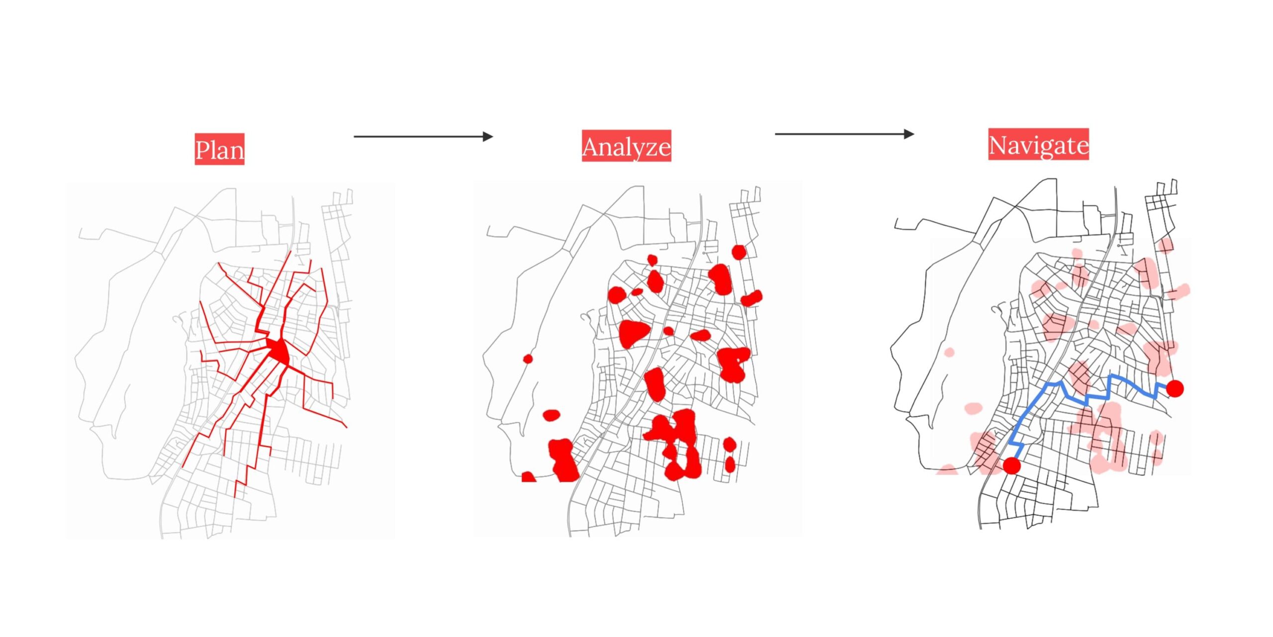
Abstract: Natural disasters, especially earthquakes, often leave roads blocked, buildings collapsed, and maps outdated, making navigation and response efforts highly challenging, That’s where we operate. Our project SeisNAV is an AI-powered platform that combines satellite imagery and computer vision to detect collapsed structures and road blockages, providing real-time mapping and navigation tools for disaster response … Read more