The MaCAD is a unique online programme training a new generation of architects, engineers and designers ready to develop skills into the latest softwares, computational tools, BIM technologies and AI towards innovation for the Architecture, Engineering and Construction (AEC) industry.

Vehicle Crash Prediction in New York City

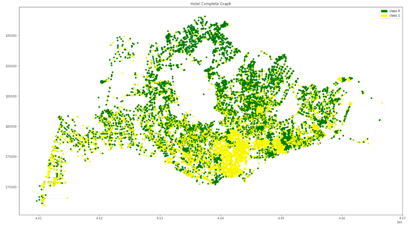
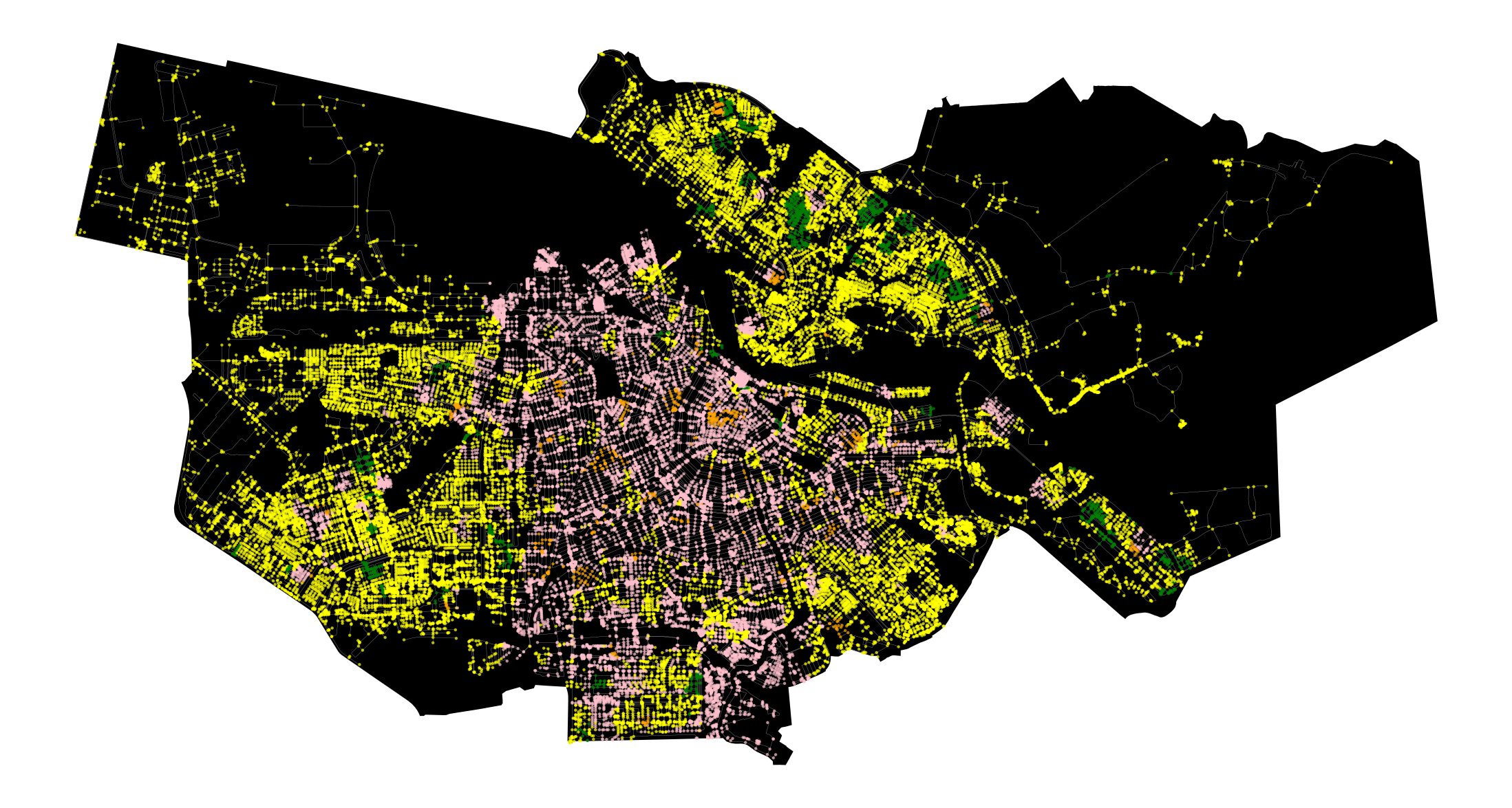
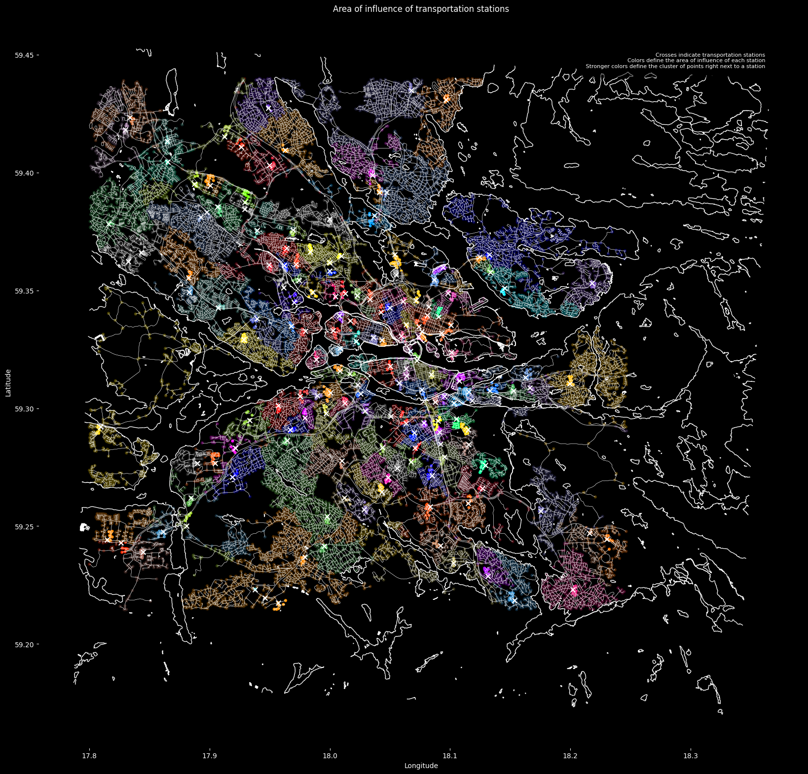
Project Aim In this project we aim to predict the type of vehicle crash that can be foreseen in the city of New York based on the traffic volume, using Graph Neural Networks (GNNs). To develop this machine learning model we use 3 different datasets. The model could hold potential if developed further, to be … Read more

Hotel Prediction for Singapore

Our project derives from our observation that in Singapore, most of hotels are located along the east and southeast areas near Changi Airport. There are very few hotels on the west side of Singapore. We also take into account on factors that tourists and visitors consider when making a reservation. These factors include public transportation, … Read more

To bike or not to bike?

Bike route classification using Graph Machine Learning The goal of the project was to develop a graph machine learning model that would predict existence of bike routes in Singapore based on collected geodata. Because the bike routes were represented by graph edges, that was also our classification type. Data Exploration & Research Topic We choose … Read more

Rental Price Predictor – Amsterdam

Introduction Accurate prediction of rental prices poses a significant challenge in dynamic real estate markets such as Amsterdam. Our research project explores the use of graph-based machine learning to improve the accuracy of such predictions. This methodology could be of interest to various actors in the real estate sector, including brokers, investors, and urban planners. … Read more

Spatial Analysis of Airbnb Real Estate

Our goal was to predict the relationship between the tourist activity zones and the airbnb rentals. Tourism is vital to Spain’s economic growth, with Barcelona as a key contributor, accounting for over 12% of the country’s GDP. TOURIST ANALYSIS AND DATA Tourist spots and zones can be broadly classified to tourist amenities – transits, bus … Read more

Dataset Our database contains more than 181,000 rows, each with comprehensive information. The primary database includes 17 variables, though not all are necessary for our analysis. The most crucial data points are location (latitude and longitude), type of food establishment, type of inspection, inspection results, and risk level. As the person who uploaded the database … Read more

MY PARKS : Predicting Miami City’s Parks Scores based on Amenities and Businesses

Miami Parks Prediction GraphML Project

Rethinking Urban Spaces Parks and green areas are critical in cities as they provide spaces for people to meet, interact, and find a social life. They contribute significantly to the mental and physical well-being of residents, offering a natural respite from the urban hustle. Project Summary: According to google reviews, the most important factor for … Read more

Project Sentinel: Predicative analysis of street lighting and safety

Greater Manchester, one of the largest and most vibrant urban centers in the UK, is characterized by its substantial student population and a dynamic economic landscape. With approximately 120,670 university students during the 2021/22 academic year and a significant number of these individuals studying at the University of Manchester and Manchester Metropolitan University, the region … Read more

Predict Yelp Ratings based on Urban Data using GML

Hypothesis The goal of this research was to investigate if open spatial data could predict Yelp ratings utilizing graph machine learning (GML) methods. We hypothesize that urban phenomena, events, and objects will indicate customer reviews and popularity, and therefore, could be used predict ratings. In particular, we perform edge classification using the DGL library. For … Read more

Metro Station Prediction in Stockholm

This post describes the development of a method to predict metro station locations using Graph Neural Networks (GNNs). Our journey began with a challenge familiar to urban planners: how to strategically place new metro stations to optimize transportation networks. In this case the city of Stockholm was used as testbed. The Challenge of Data Imbalance: … Read more

100-Year Flood Risk Road Intersection Classification

Flood Risk Classification

Beginnings Our project’s concept is to develop a classification model that identifies street intersections (graph nodes) in Stockholm, Sweden, susceptible to flooding during a 100-year flood event. Based on our initial research, we found that graph machine learning operates at three levels: the graph, its edges, and its nodes. With access to a 100-year flood … Read more