The MaCAD is a unique online programme training a new generation of architects, engineers and designers ready to develop skills into the latest softwares, computational tools, BIM technologies and AI towards innovation for the Architecture, Engineering and Construction (AEC) industry.

Filters

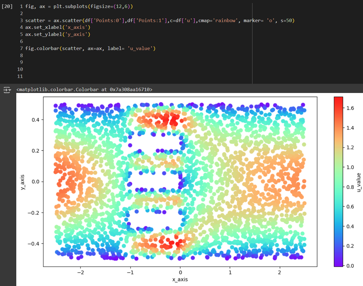
Urban Wind Flow Modeling with PINNs

Overview PaperLink WIP – This study specifically explores Physics-Informed Neural Networks (PINNs) and Computational Fluid Dynamics (CFD) to analyze pedestrian wind comfort. It aims to integrate these neural network models into a web application using Three.js and other tools. By utilizing data from OpenWeatherMap, and OpenStreetMap, the project aims to support real-time simulations and visualizations … Read more

Climate Sensitive Facade Intervention for Urban Heat Island Mitigation

Research Questions: Can climate sensitive facade interventions reduce the intensity of the Urban Heat Island effect within urban blocks in arid climates?“ Research Goal: The goal is to propose simplified, climate-sensitive facade interventions in highly urbanized cities that reduce energy loads by mitigating Urban Heat Island (UHI) effects, while complying with climate-resilient regulations. These interventions … Read more

BIMConverse – GraphRAG for IFC Natural Language Queries

Introduction BIM and Cloud Adoption The construction industry is still experiencing a digital revolution led by the widespread adoption of Building Information Modeling (BIM) and cloud computing technologies. BIM has established itself as the central tool for the digital planning, construction and management of buildings, while cloud computing is transforming collaboration and data access. Studies … Read more

Code – VIZ

We embarked on a fascinating journey through the latest advancements in Image Synthesis and Language Models within the Architecture, Engineering, and Construction (AEC) industry. The course highlighted the transformative potential of generative AI, enabling architects, engineers, and designers to push the boundaries of traditional design processes, streamline workflows, and tackle complex challenges in groundbreaking ways. … Read more

Skin Sense

Skin Sense is a project that aims to help users optimize the thermal comfort of their interior spaces by applying skin shaders. Why implement this? What can skin sense help the user with? Once the designer designs the skin for the building facade it has to be analyzed for indoor comfort. To analyze indoor comfort … Read more

Barcelona Program

Block Classification This project aims to classify urban blocks in Barcelona, focusing on the districts of Saint Martí and Eixample, based on their dominant functions. By identifying the primary uses of these urban blocks, we can gain insights into the spatial organization and functional distribution within the research area. Saint Martí and Eixample, two vibrant … Read more

DF Predictor (cGAN)

DF Predictor aims to revolutionize daylight prediction in architectural design by implementing the conditional generative adversarial network (cGAN) Pix2Pix to predict daylight factors, motivated by the need to improve efficiency and accuracy in daylight analysis. Daylight factor analysis, an integral part of the early design stages and mandated by building codes, is typically lengthy due … Read more

Rental Price Predictor – Amsterdam

Introduction Accurate prediction of rental prices poses a significant challenge in dynamic real estate markets such as Amsterdam. Our research project explores the use of graph-based machine learning to improve the accuracy of such predictions. This methodology could be of interest to various actors in the real estate sector, including brokers, investors, and urban planners. … Read more

migrAItion

Studying migration is crucial for urban planners and architects to anticipate and accommodate the influx of people into cities, ensuring the development of robust infrastructure that can support this growth. As migration patterns shape demographic changes, understanding these trends allows cities to plan for adequate housing, transportation, healthcare, and educational facilities. This foresight is essential … Read more

3D-SOLIDS: COMPONENTS CLASSIFICATION

3d Component Classification tool

Abstract 3D-SOLIDS Component Classification tool utilizes machine learning to optimize the placement of essential 3D components such as walls, doors, windows, floors, and railings in residential floor plans. By analyzing spatial features and architectural attributes, it automates and enhances the design process, ensuring accuracy, consistency, and compliance with building standards. This tool aids architects and … Read more

Dataset Our database contains more than 181,000 rows, each with comprehensive information. The primary database includes 17 variables, though not all are necessary for our analysis. The most crucial data points are location (latitude and longitude), type of food establishment, type of inspection, inspection results, and risk level. As the person who uploaded the database … Read more

FacAid + Chatbot

In a world where urban areas are predominantly developed and the heat island effect is intensifying, the construction industry significantly contributes to environmental challenges. Instead of focusing on tools that promote new construction, our goal is to provide a tool that analyzes existing buildings and suggests improvements. This approach aims to enhance sustainability and mitigate … Read more

Project Sentinel: Predicative analysis of street lighting and safety

Greater Manchester, one of the largest and most vibrant urban centers in the UK, is characterized by its substantial student population and a dynamic economic landscape. With approximately 120,670 university students during the 2021/22 academic year and a significant number of these individuals studying at the University of Manchester and Manchester Metropolitan University, the region … Read more

100-Year Flood Risk Road Intersection Classification

Flood Risk Classification

Beginnings Our project’s concept is to develop a classification model that identifies street intersections (graph nodes) in Stockholm, Sweden, susceptible to flooding during a 100-year flood event. Based on our initial research, we found that graph machine learning operates at three levels: the graph, its edges, and its nodes. With access to a 100-year flood … Read more

Genius Loci

View some of the collected data here: Street Types and Property Information Genius Loci was inspired by the work the of Sarah Williams in her book ‘Data action – Using data for public good’. In today’s data-driven world, the use of data has become increasingly pervasive, shaping various aspects of our lives from policymaking to … Read more

DeCARB

Introducing DeCARB: An easy-to-use tool that calculates Embodied Carbon, End-of-Life Carbon, and Total Cost for any rectangular massing geometry. Quantifying emissions from material extraction to disposal can guide architects and engineers in selecting low-carbon materials and methods early in the design process. With a focus on reducing environmental impact and aligning with green building standards, … Read more

THERMO CHILL – A WEB APPLICATION

INTRODUCTION As we all know that Global warming, caused by the greenhouse effect, is leading to an increase in Earth’s average temperature and the rise in sea levels. Due to the increase in temperature, we are succumbed to high indoor discomfort. Which can be correct by different air conditioning systems. This leads to the increase … Read more

Machine Learning in Architectural Practice and BIM

We’ve witnessed a fascinating shift from conventional to computational approaches, responsive designs, and the era of automation. Machine Learning, a term buzzing everywhere these days, has made its mark in our industry as well. In architecture, ML, a subset of artificial intelligence, utilizes data to tackle challenges in computer-aided design by simulating various design alternatives … Read more

Democratized design to combat climate catastrophe.

As we move further into the 21st century, our chances of averting climate change have all but disappeared. Analysis shows that global temperatures now sit 1.1? above pre-industrial levels and are set to rise to 1.5? by the early 2030s (Jotzo and Howden, 2023). This rapid increase in temperatures has led to loss of land … Read more

First step towards circular reconstruction. Damage assessment and material mapping of buildings in Ukraine through ground imagery processing.

An apartment building explodes after Russian army tank fire in Mariupol, Ukraine, March 11, 2022. (AP Photo/Evgeniy Maloletka)

Intro Russian full-scale invasion of Ukraine, which started on 24.02.2022, is the biggest war in Europe since WWII. It took the lives of dozens of thousands of Ukrainians a brought massive destruction [1] and ecological catastrophes. Some cities are completely erased. A massive piece of land is still occupied. This war and its consequences are … Read more

Superblock BCN

A Multidimensional Study of the Superilla My research starts from observing human behaviour. Often when we face a change in our lives, especially when it wasn’t planned, we feel resistance and it takes time before we accept and embrace it.  As you probably know Barcelona in the last few years lived some changes in its … Read more