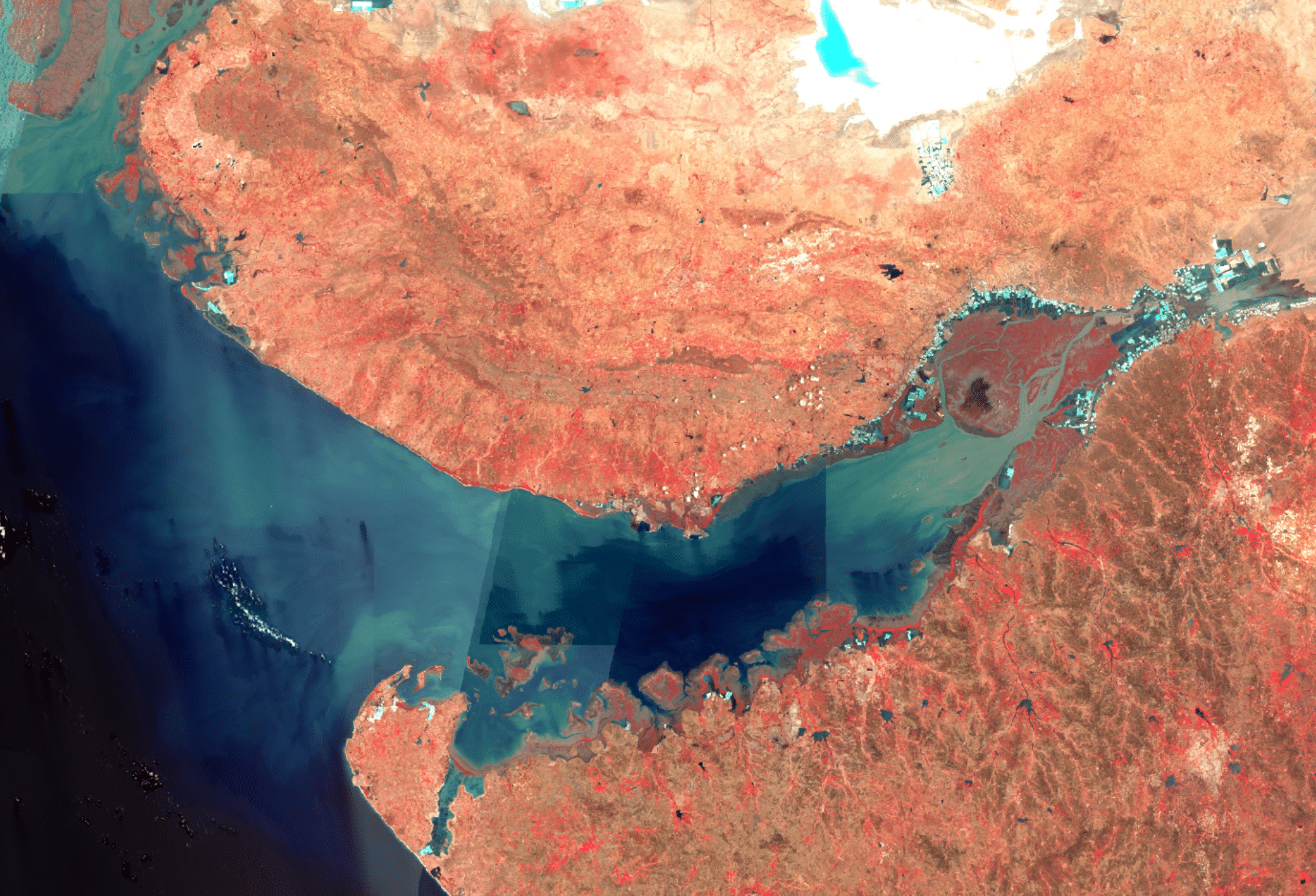
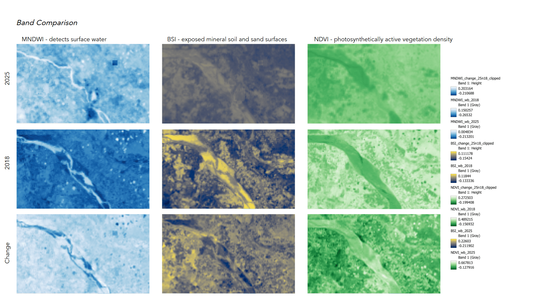
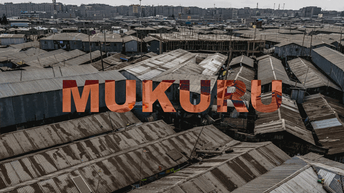
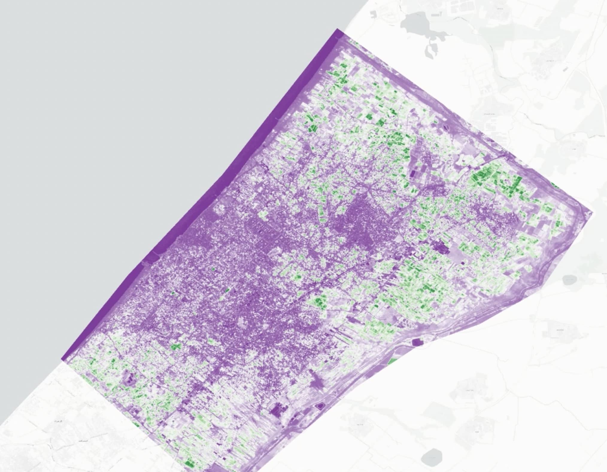
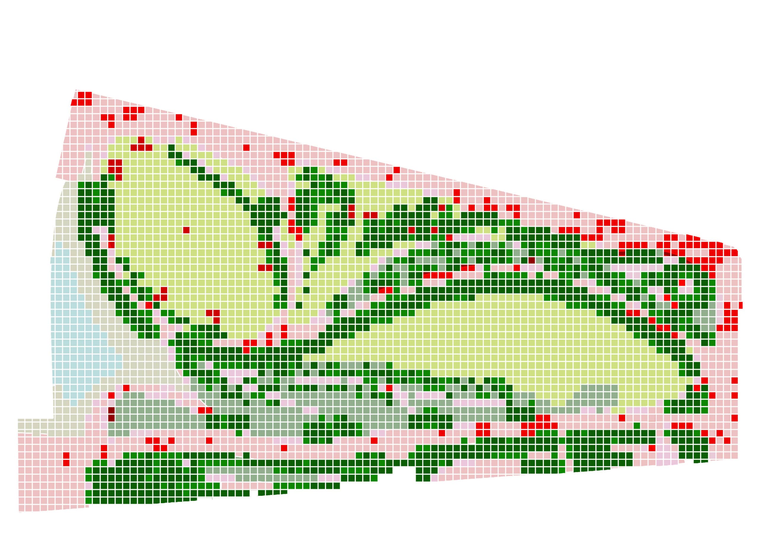
The Master in City & Technology’s academic structure is based on IAAC’s innovative, learn-by-doing and design-through-research methodology which focuses on the development of interdisciplinary skills. During the Master in City & Technology students will have the opportunity to be part of a highly international group, including faculty members, researchers, and lecturers, in which they are encouraged to develop collective decision-making processes and materialize their project ideas.

Filters
Course

When Design Becomes Data

The Computational Evolution of CAD and BIM (1750–2025) Ultimately, the diagram presents visualization as an evolving infrastructure of thought. What began as an act of representation has become a computational process: an interface where information, material, and intelligence continuously negotiate the making of space. The Tool The tool we propose represents the next evolutionary step … Read more

 Land in the Physical World and the Metaverse

The research visualisation map shows the meaning, value, and governance of land shift as it transitions from the physical world into the metaverse. It treats land not as a static material object but as a socio-technical construct whose definition changes with different forms of infrastructure, ownership systems, and human–technology relationships. In the physical world, land … Read more

Cities in Pixels: Mapping, Moving, and Meaning in the Digital Era

In the age of digital urbanism, cities are no longer understood only through streets, buildings, or neighbourhoods—they are interpreted, navigated, and governed through layers of pixels, data points, and algorithmic models. Our visualization project, Cities in Pixels: Mapping, Moving and Meaning in the Digital Era, examines this transformation using Geographic Information Systems (GIS) as its … Read more

Wi-Fi’s Watching

A genealogy and spatial analysis of Wi-Fi technologies since 1970 Many digital technologies do not only float in a “cloud.” People may use and not see these systems during their day-to-day life, but we learned in our digital cultures course that these technologies are grounded in material systems with real environmental footprints and nuanced social … Read more

Inclusive Wayfinding

This project focuses on accessibility and orientation between nearby schools and Parc dels Pins in Santa Coloma de Gramenet. It emphasizes children and inclusion. Through co-creation with local schools, the design tests inclusive wayfinding strategies using sensory and tactile signage. These aim to improve safety, visibility, and spatial awareness. The process brings together children, educators, … Read more

Our Sprint Through Parc dels Pins

We had an incredible, whirlwind five days co-creating public spaces with Pablo Muñoz, Luisa Torres, Josefina Ovalle Parot, and the amazing community of Santa Coloma de Gramenet. It felt like a rapid-fire game—running around the park, talking to people, collecting stories, analyzing data in GIS and Grasshopper, figuring out who to design for, and then … Read more

Connexió (Connection)

Santa Coloma de Gramenet, located to the north of Barcelona, is bordered by the Besòs River on the west and the Marina Mountain Range on the north. The city’s terrain features an irregular relief that rises to 303 meters at Mount Castellar, its highest point, a topographical character also visible within Parc dels Pins. The … Read more