WORKSHOP 3.2 _ REFLECTION
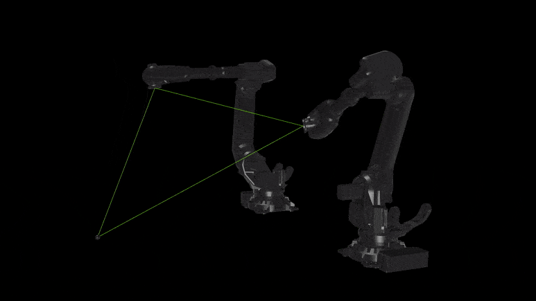
“Precision becomes poetry through reflection and sound.” Reflection is an immersive installation that explores the potential of precision and reflection between two robotic arms through synchronized movements. Equipped with mirrors, the robots become both instruments and performers. Concept: The law of reflection The law of reflection states that the angle of incidence is equal to … Read more