
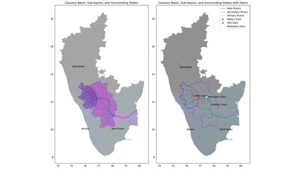
The Cauvery basin is not just a river; it’s an intricate ecosystem that supports diverse flora and fauna and sustains the livelihoods of farmers in both Karnataka and Tamil Nadu. Our hypothesis posits that the proposed Mekedatu dam, far from being a panacea, is an unnecessary venture that could further destabilize this delicate balance. The data speaks volumes about the fluctuating patterns of water availability and the already significant impact these have on the agricultural sectors reliant on the Cauvery’s waters.
Methodology
Our analytical journey begins with Python, a versatile programming language at the forefront of data science and analytics. Here’s how we approached our investigation:
Data Collection:
- Rainwater Data: Obtained from meteorological departments and satellite observations to analyse precipitation trends over the past decade.
- Reservoir Levels: Sourced from water resource departments, detailing historical reservoir capacities and usage patterns.
- Cropland Areas: Agricultural department reports and satellite imagery provided insights into the changes in agricultural land use affected by water availability.
Analytical Process:
- Pre-processing: Data cleaning and normalization to ensure accuracy and comparability.
- Analysis: Employing statistical methods to identify trends, patterns, and correlations in the data sets. Time-series analysis was particularly crucial in understanding how variables have changed over time.
- Visualization: Creating charts and graphs to visually represent our findings, making the data accessible and understandable to a broad audience.
Data-Driven Insights
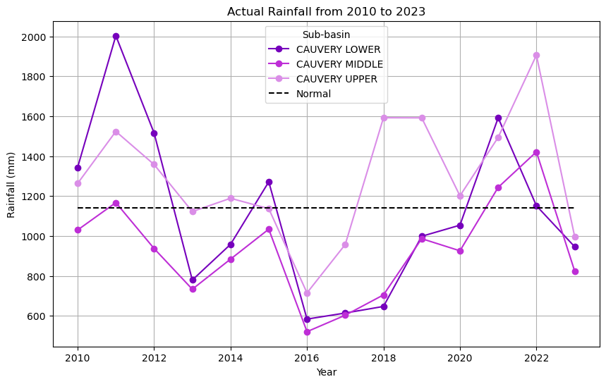
- Rainfall Variability: Significant shifts in rainfall patterns, attributed to climate change, underline the unpredictability that already challenges water management in the basin.
- Reservoir Levels: Declining water levels in reservoirs indicate the strain on existing water resources, exacerbated by existing infrastructure and management practices.
- Impact on Croplands: Fluctuations in cropland areas due to water scarcity reveal the precarious situation for agriculture, the backbone of the region’s economy.
Rainfall Variability: The rainfall trendline shows high variability with periods of deficit and excess, which complicates water management strategies.
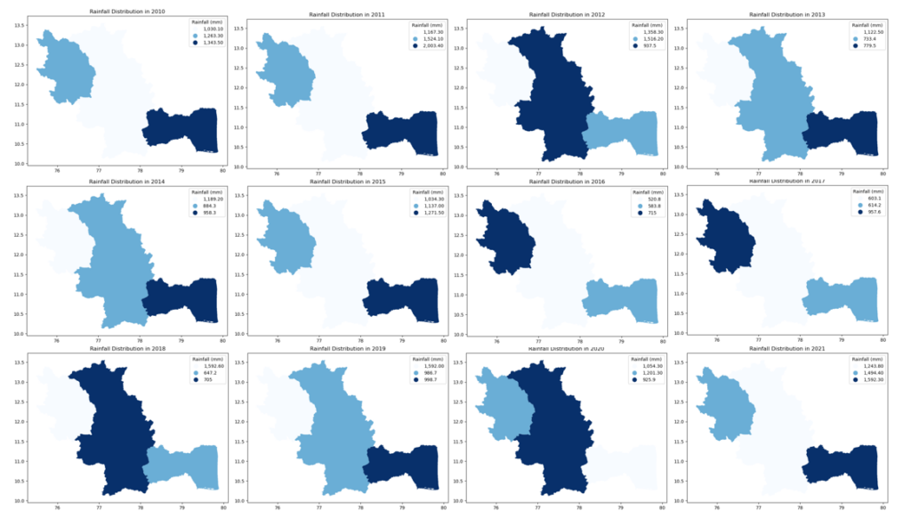
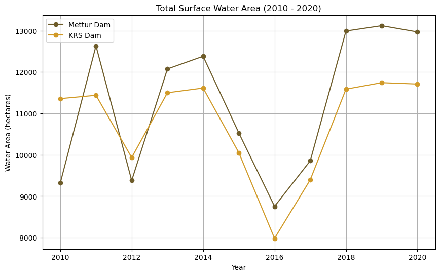
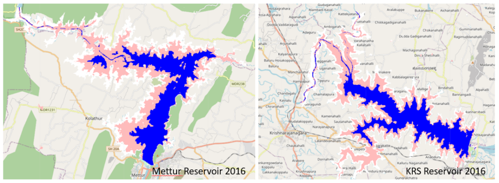
Reservoir Levels: The graphical representation of water areas around major reservoirs indicates a variable pattern, which is not conducive to the stability required for sustainable agricultural planning.
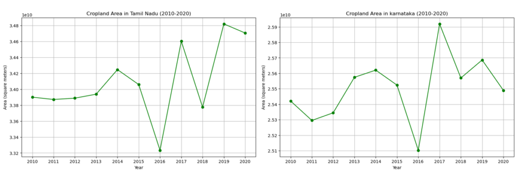
Fluctuating Croplands: Both Karnataka and Tamil Nadu have experienced significant fluctuations in cropland areas, likely attributed to inconsistent water distribution.
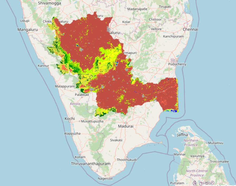
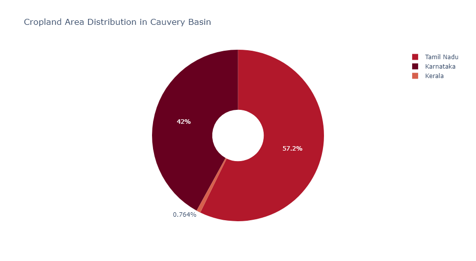
Cropland Area Distribution: Tamil Nadu accounts for a larger percentage of the Cauvery basin’s cropland, followed by Karnataka, with Kerala holding a negligible portion. This suggests a heavy dependence on Cauvery waters for agriculture in these states.
Conclusion: The Path Forward
The evidence laid out through our analytical work suggests that the solution to the water woes of the Cauvery basin does not lie in the construction of new infrastructure like the Mekedatu dam but in innovative water management strategies. Enhanced rainwater harvesting, sustainable agricultural practices, and updated inter-state water sharing agreements stand out as viable alternatives.
