
VenustaMeter
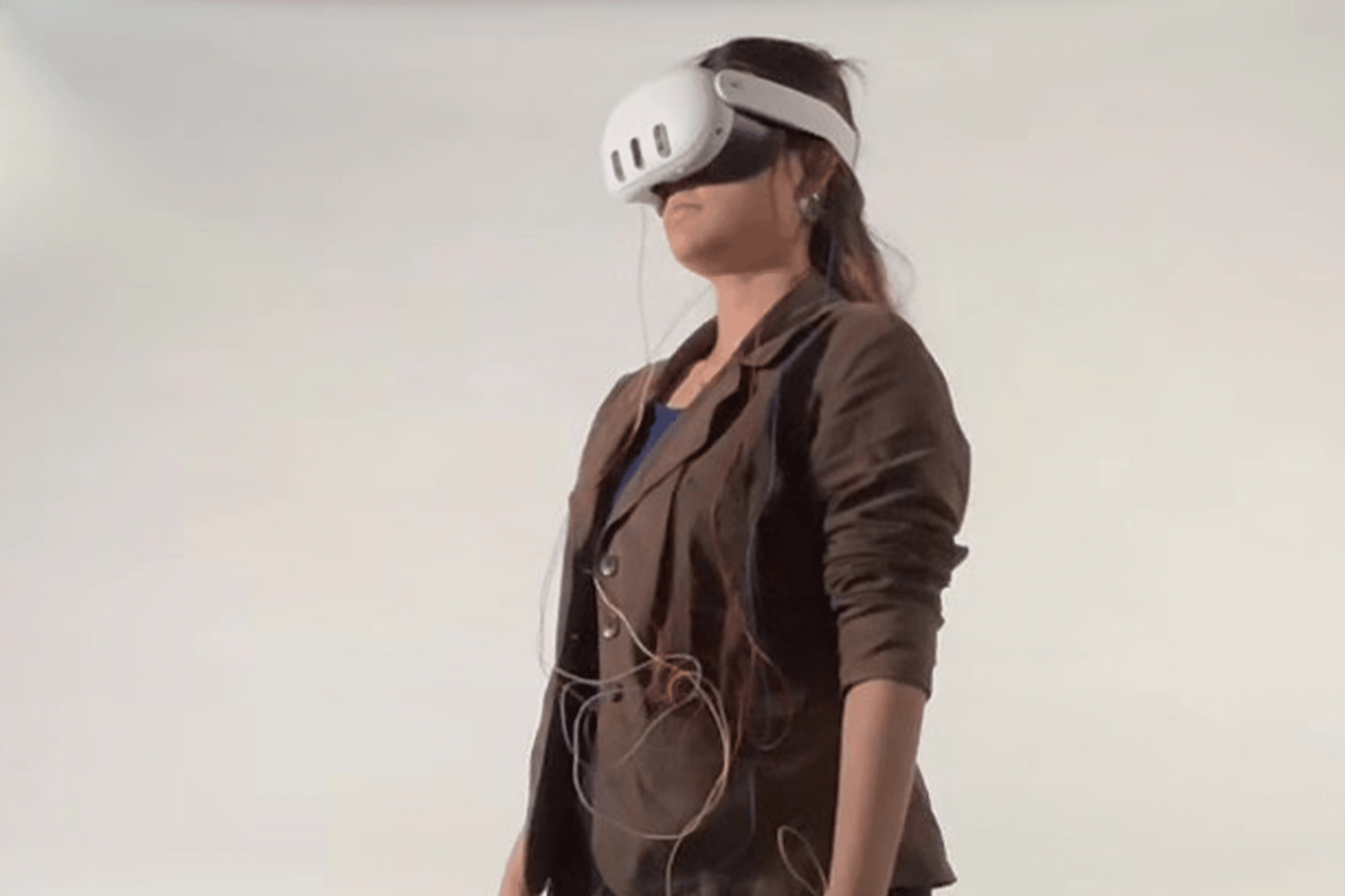
Quantifying the Opposite of Boredom For decades, architectural design has relied on intuition. Client feedback and peer reviews are inherently subjective, and by the time you can gather real human response data on a facade, the building is already standing. But what if we could predict whether a building will be visually engaging before a … Read more
BioSpatial-Intelligence:
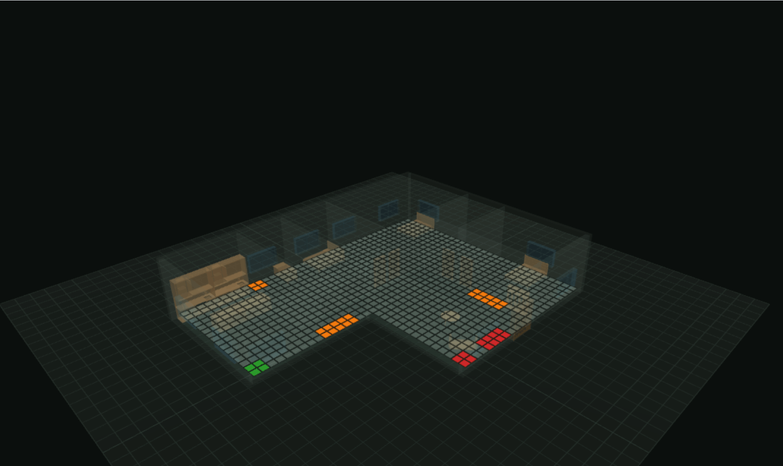
ML-Driven Plant Placement for Adaptive Architecture BioSpatial Intelligence explores how machine learning can support planting decisions in architectural spaces. The project starts from a simple design question: when we design a building, how can we decide which plants belong to which environmental conditions? Instead of relying only on intuition, we developed a workflow that reads … Read more
FloodPrint
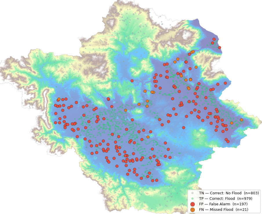
Objective Traditional flood risk maps take months to produce, are updated only every few years, and are too coarse, they might say a whole district is at risk without telling you which specific street or field will actually be underwater. “We are going to predict whether any given location in Thessaly, Greece is Flood-Prone or … Read more
Project Michigan
Using climate clustering, vernacular precedent research, and evolutionary optimisation to create climate-responsive design typologies when no established local precedent exists Overview Lovingly named after the very first test location, Project Michigan is a tool that provides climate-responsive design guidelines when no local vernacular precedent exists. Through scraping climate data and global vernacular information, it helps … Read more
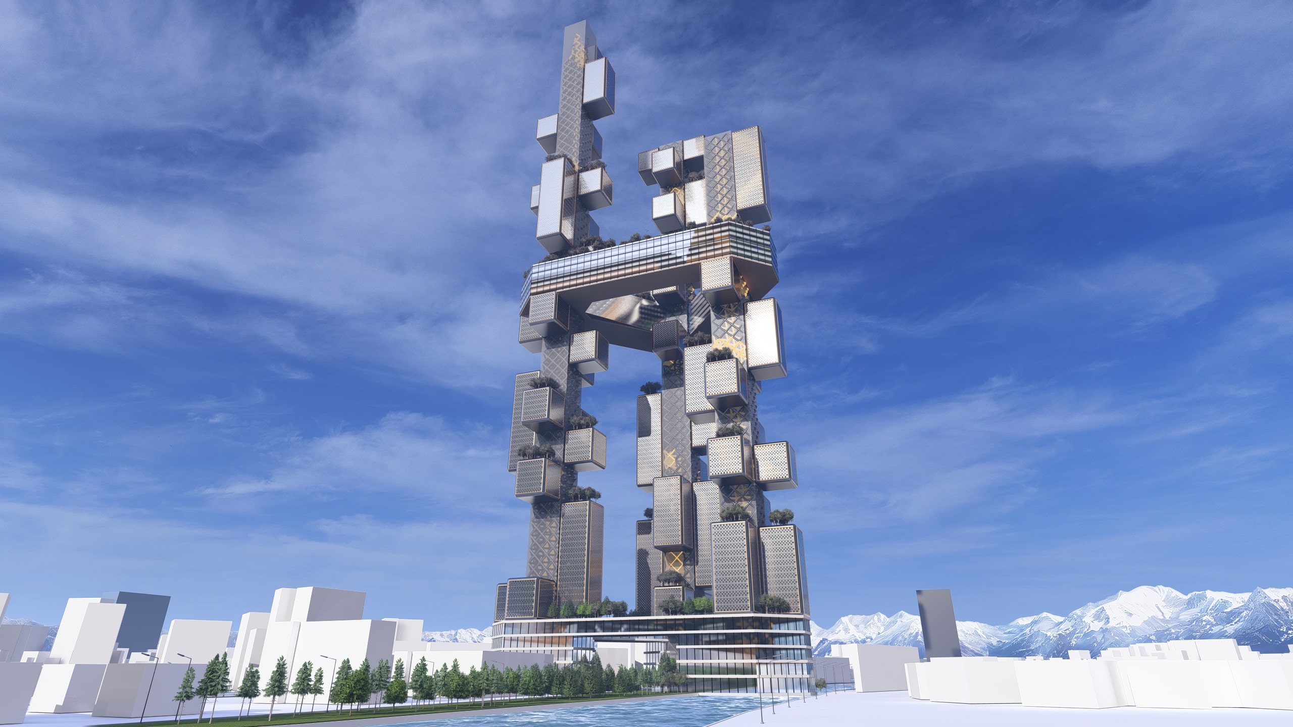
HB02: Urban Congestion as Catalyst
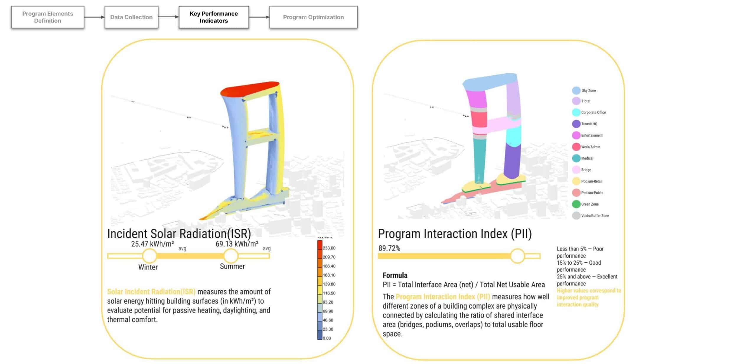
Program Team Hyperbuilding 02 proposes a program-integrated transit hub that reorganizes fragmented mobility networks, shortens commute times, and anchors a high-density mixed-use urban core to improve accessibility and urban performance. The design concept for Hyperbuilding 02 begins with a problem: fragmented mobility networks that create inefficiency, congestion, and poor urban accessibility in high-density environments. Rather … Read more
Beyond the Dashboard: Building Information Modelling as Socio-Technical Governance in Smart Cities

Introduction The smart city stands at a conceptual crossroads. On one side, we encounter an optimistic narrative: Building Information Modelling (BIM), digital twins, and integrated urban dashboards promise unprecedented visibility into city systems, enabling data-driven governance, resource optimization, and responsive urban management. On the other side, a more sobering reality: these sophisticated technical infrastructures often … Read more
VenueAnalyst: Building a Cloud-Based SaaS for Stadium Sightline Diagnostics
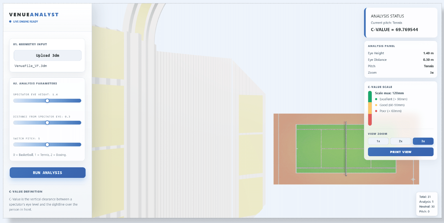
From Jakarta to Data: Automating the Perfect View with VenueAnalyst What started as a design studio project for a floating, flood-resistant stadium in Jakarta quickly evolved into a computational challenge: How do we prove a stadium actually works for the fans? While many architects focus on generating new forms from scratch, the reality of the … Read more
The Heart of the Vertical Machine – A Data-Driven Urban Organism
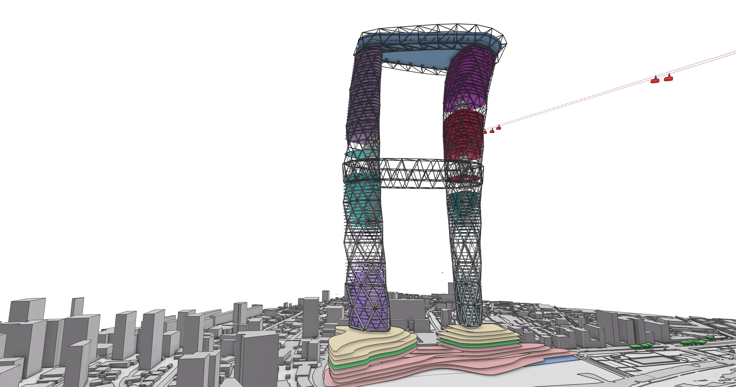
HB02: The Heart of the Vertical Machine 1. Project Overview 1.1 HB02 within the Vertical Machine In the pursuit of reimagining high-density urban living, our collaborative team developed Hyperbuilding 02 (HB02), also known as “The Heart”. As part of a larger 3-million-square-meter urban organism, HB02 serves as the vital circulatory engine, pumping life, data, and … Read more
Breathing Mass – HB01 – Structural/Facade
A vertical ecosystem in Santiago where architecture, wind, and energy converge. The hyper Lung captures, cleans, and redistributes polluted air through a breathing core, transforming the tower into living infrastructure that breathes with the city! THE ALVEOLAR SPINE – THE LUNG ANALOGY The core of Hyper building 01 is defined by the Alveolar Spine. Taking … Read more
Designing a Time-Responsive Tower: A Data-Driven BIM Workflow
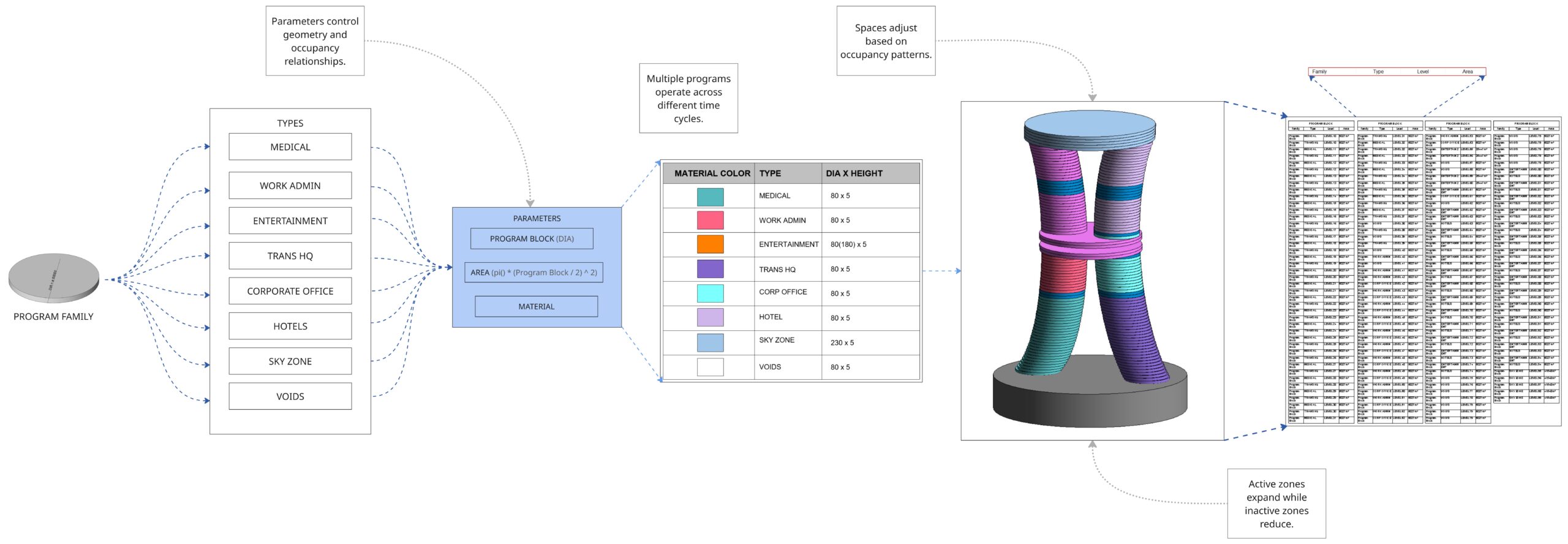
Hyperbuilding 2 functions as the transportation heart of the Vertical Machine, chanelling 20,000 passengers hourly while coordinating energy, logistics, and information flows across the entire urban system. Our team tackled the Program development for HB02, using Revit and Rhino Inside Revit to build a parametric system where occupancy data directly generates architectural form. The studio … Read more
Automated workflow to extract KPIs from versioned models in Speckle
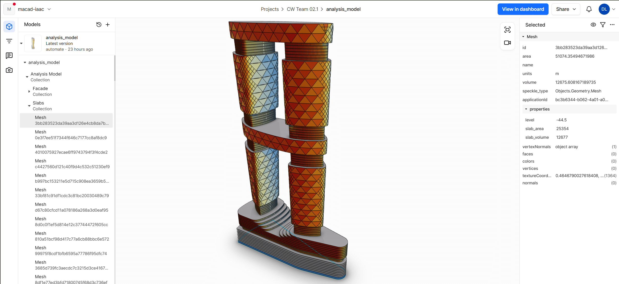
Automated Workflow for KPI Extraction from Versioned Models in Speckle Why KPI Tracking Breaks Down During Iterative Design In the current studio workflow, KPI extraction and performance evaluation depend on repeated manual operations across design iterations. This slows down feedback, introduces version mismatch risks, and disconnects analytical outputs from the model itself. This tool was … Read more
FluxFaçade

Our project is Flux Façade, a collaborative workflow for data-driven parametric façade design.The project was developed by Team 3.2 as part of the Collaborative Workflow Seminar in the Master in Advanced Computation for Architecture. Flux Façade focuses on improving how environmental analysis and façade geometry interact within the design workflow. Problem Statement In large architectural … Read more
When Models Talk Back: Real‑Time KPIs in Collaborative Workflows

The Problem No single source of truth for KPIs In our studio workflow, KPIs are everywhere and nowhere at the same time. Each team tracks performance in its own way—some in Grasshopper scripts, some in spreadsheets, some buried inside models—and none of these sources fully agree with each other. Because updates are slow and fragile, … Read more
Parametric Engineering: Collaborate with Structural Data on the Cloud

Topic brief In the AEC industry, building analysis workflows often operate in isolated software environments, causing structural data to lose meaning once it leaves its original authoring tool. This study argues that the value of structural analysis depends not only on computational accuracy, but on the ability of its outputs to remain consistent as they … Read more
Automated Scan-to-BIM workflows through artificial intelligence: A Conversation with Václav Nežerka
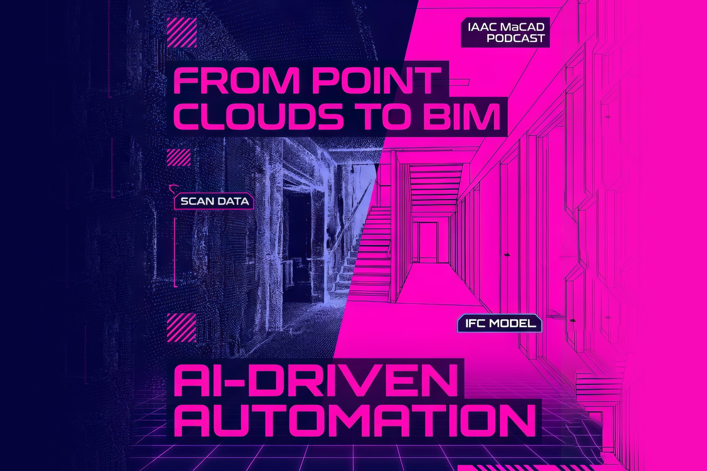
From Point Clouds to Digital Twins: Inside the Cloud2BIM Workflow The Architecture, Engineering, and Construction (AEC) industry is currently undergoing a major technological shift. We are witnessing a definitive transition from manual, labor-intensive site measurements to AI-driven scan-to-BIM workflows. The goal is clear: to unlock the digital potential of existing buildings by creating high-fidelity records … Read more
