Cities on the Edge

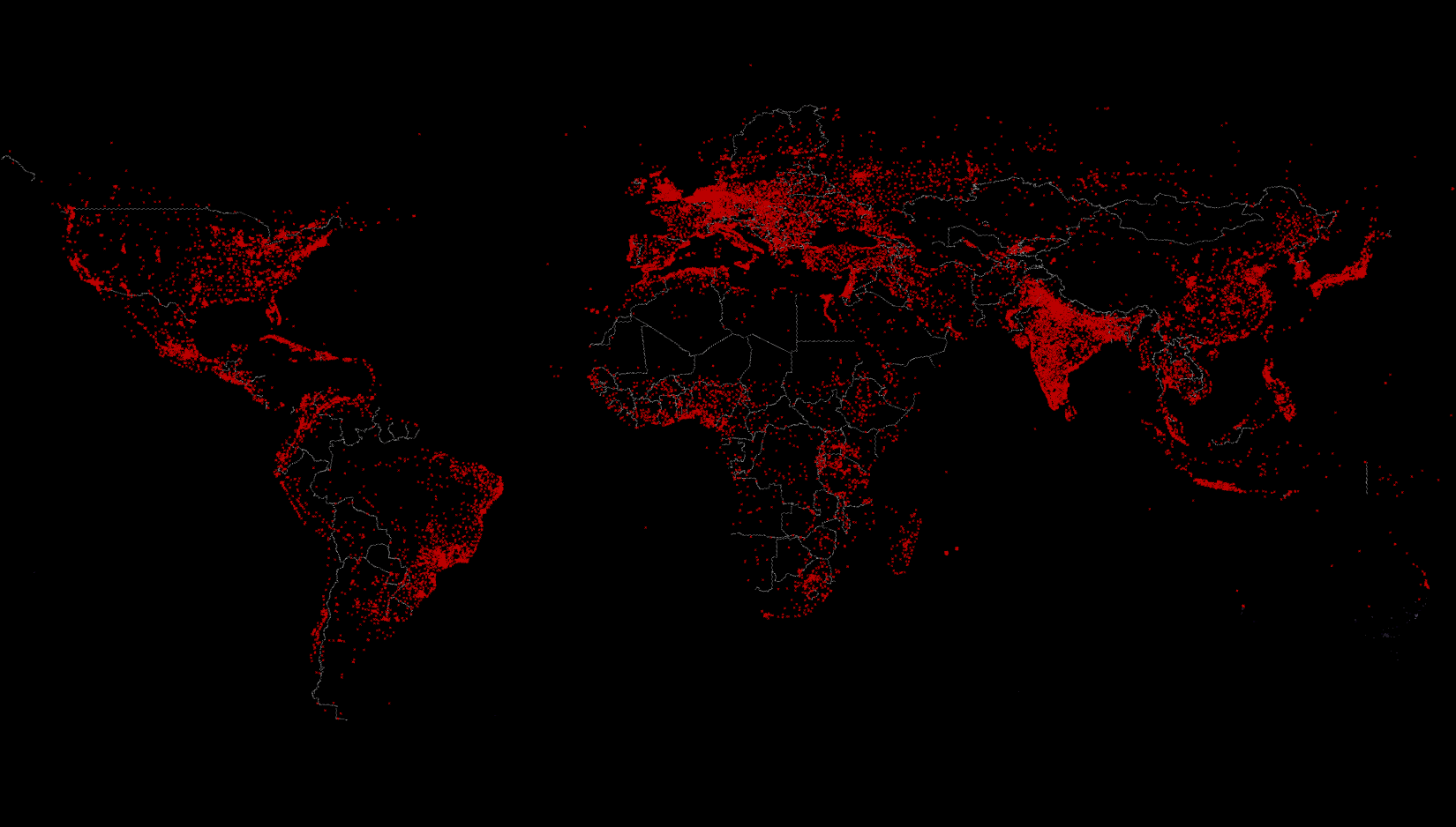
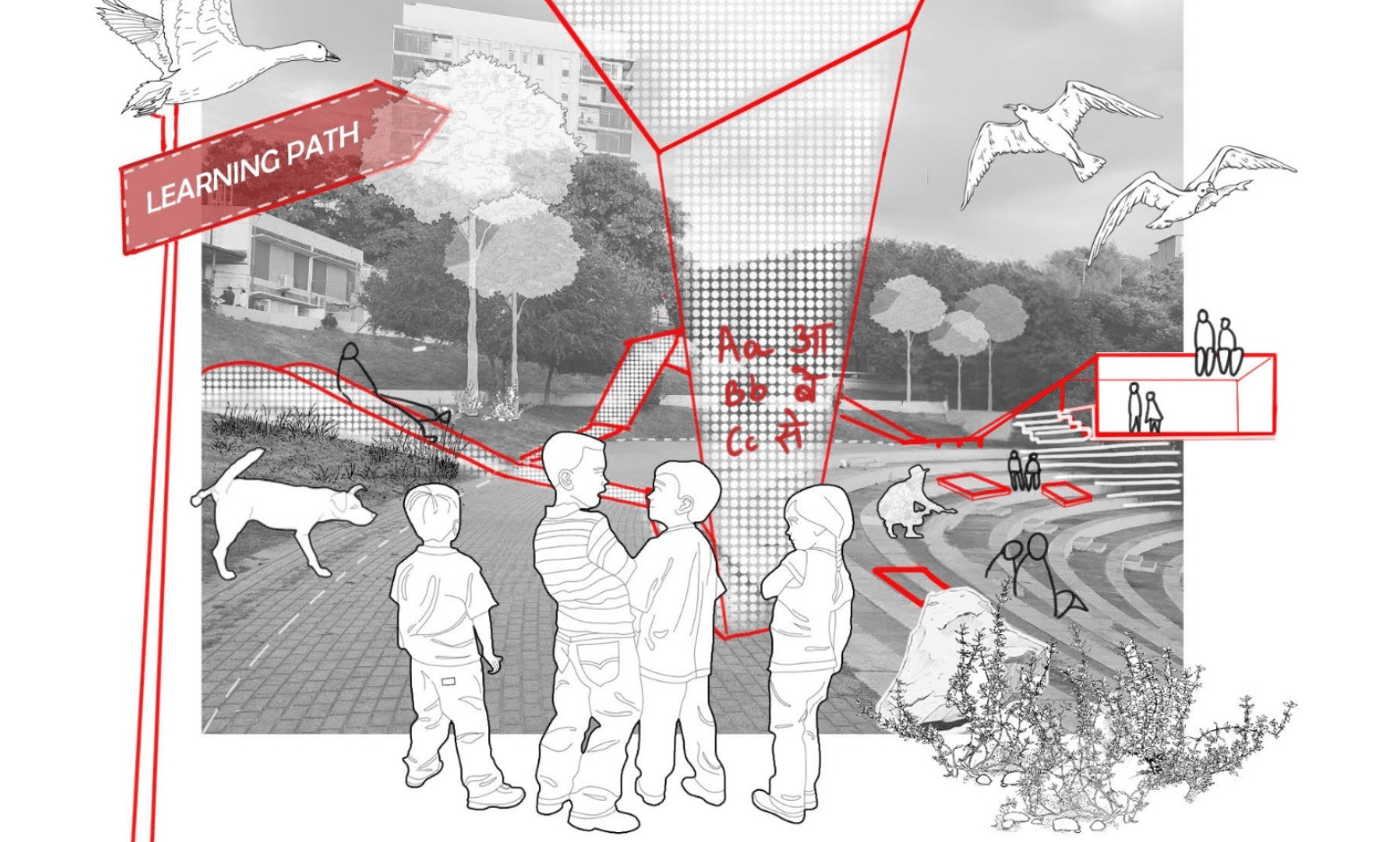
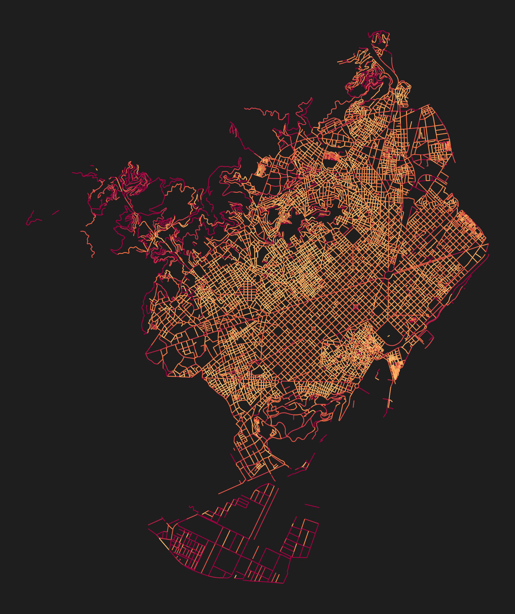
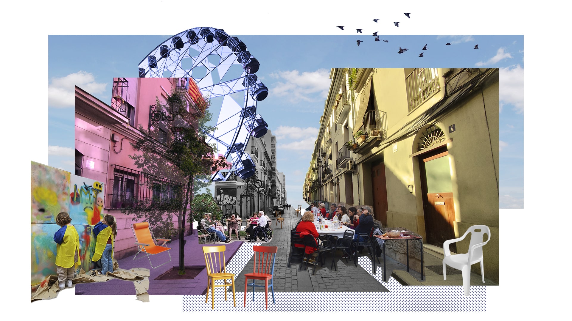
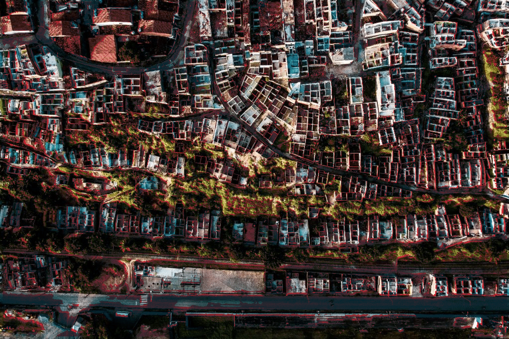
How borders shape frontiers of urban life? I. Introduction Borders are often perceived as abstract lines on maps, yet they deeply shape how cities grow, connect, and fragment. Cities located along international borders experience unique spatial, social, and political conditions that distinguish them from inland urban areas. This project investigates borders not as static lines, … Read more

What’s happening to our downtowns ? 

Abstract : In recent years, urban cores across the world have entered a period of uncertainty. Accelerated by the COVID-19 pandemic and the widespread adoption of hybrid work, many central business districts (CBDs) have experienced declining footfall, rising commercial vacancy, and shifts in social life—while others have demonstrated surprising resilience. This project investigates how foundational … Read more

$pot Finder

Opening a business is a bold investment. Factors (many out of business owners’ control) can determine whether or not local businesses thrive or struggle. Location matters, especially for businesses that depend on foot traffic. But the bigger questions are tough to answer: where should the business open? What is a fair rent to expect? Which … Read more

Topographies of Work

This drawing explores how architecture transforms when it stops imposing its order and allows the forest to define its own conditions. It explores a shift from “building in a forest” to “building as a forest”. In the drawing Valldaura Lab is not an object placed in the forest, it is an interpreter of the forest … Read more

Cities in Pixels: Mapping, Moving, and Meaning in the Digital Era

In the age of digital urbanism, cities are no longer understood only through streets, buildings, or neighbourhoods—they are interpreted, navigated, and governed through layers of pixels, data points, and algorithmic models. Our visualization project, Cities in Pixels: Mapping, Moving and Meaning in the Digital Era, examines this transformation using Geographic Information Systems (GIS) as its … Read more

Connexió (Connection)

Santa Coloma de Gramenet, located to the north of Barcelona, is bordered by the Besòs River on the west and the Marina Mountain Range on the north. The city’s terrain features an irregular relief that rises to 303 meters at Mount Castellar, its highest point, a topographical character also visible within Parc dels Pins. The … Read more

Wildlife Integrating Landscape Design Artificial Intelligence – WILD.AI — Term_III

CONTEXT DYNAMICS METHODOLOGY ANALYSIS By subtracting different scenarios from one another: The differences start to become clear as to what areas are consisently lost vs what areas are inconsistently lost. The latter being the one where planners and ecologists should focus their efforts the most if aiming to potentialize action. The figure becomes even clearer … Read more

Urban Climate on Graphs: From Form to Comfort

ABSTRACT This thesis investigates the relationship between urban development patterns and outdoor thermal comfort, with a focus on Mean Radiant Temperature (MRT), a key factor in calculating the Universal Thermal Climate Index (UTCI).  While graph-based approaches have long been used in spatial analysis (e.g., space syntax, circulation networks), this research extends the application of graph … Read more

Diálogos Urbanos (04)

Prácticas afectivas en la interfaz público-privada de Ciutat Vella – València 1_ PRELUDIO Diálogos Urbanos surge en la intersección entre un proyecto de investigación, un registro coreo-carto-biográfico, una interfaz de reflexión sobre la ciudad que habito, y algunos puntos de fuga hacia imaginarios futuros desde una práctica de diseño que recupere la dimensión afectiva y … Read more

Territorio en Cura:

El drama socioambiental de la explotación de sal gema en Maceió y la reimaginación de este territorio Resumen Este trabajo analiza el colapso geotécnico y socioambiental causado por la minería de sal-gema en Maceió, Brasil. A partir de datos técnicos, mapas producidos por la autora y relatos comunitarios, propone una lectura crítica del territorio y … Read more

EMI: Engine for Morphological Integration

An algorithmic roadmap that converts self-organized settlement morphology into clean-energy action: the Energy-Morphology Index mines open roof- and density data, ranks each building’s readiness, and matches “Ready / Promising / Not-Ready” clusters to modular solar toolkits—turning self-organized settlements into engines of energy justice

Computing Risk and Planning Resilience from Afar

Computing Risk & Planning Resilience from Afar is a remote-sensing–driven investigative study to read, identify and address underlying vulnerabilities associated with landslide risk in urban India. The project aims to develop replicable analysis workflows for compounded risk calculation—making visible what often remains hidden enabling actionable insights in places where institutional data is frequently outdated or … Read more

Woman & Water in Rundu: a mobility justice framework

Ndama, the fastest-growing informal settlement in Rundu, Namibia, faces critical challenges in water accessibility shaped by gender, age, income, and spatial isolation. With women disproportionately responsible for water collection under unsafe and inequitable conditions, our study combines interviews and spatial data to map intersectional vulnerabilities. We developed an interactive tool that simulates real-world constraints—heat, crime, … Read more

La Memoria del Agua

Soluciones sostenibles para contaminación y escasez hídrica en Villa Carlos Paz. ¿Cómo pueden las Soluciones Basadas en la Naturaleza, desde un enfoque de diálogo entre lo preexistente y lo propuesto, contribuir a mitigar simultáneamente la escasez y la contaminación hídrica en Villa Carlos Paz, sin modificar los cursos y cuencas hídricas naturales existentes y promoviendo … Read more

AQUA.NEST

AQUA.NEST: An AI-Powered Decision Support Toolbox for Adaptive Urban Design Using Nature-Based Solutions in Flood-Exposed Coastal Cities Coastal urban flooding is emerging as one of the most urgent climate challenges of our time. Without strong adaptation, annual flood damages could reach €930 billion globally by 2050, even with improved infrastructure (OECD, 2020). Rising sea levels and … Read more

Investigating [Grain Farming] – Deforestation, and Political Conflict in the Amazon

“The Amazon rainforest, often called the ‘lungs of the Earth,’ is rapidly disappearing. But this isn’t just an environmental crisis—it’s a geopolitical and economic issue. In the heart of this transformation lies [Mato Grosso], Brazil’s largest soy-producing state. Its key location fuels both economic growth and ecological destruction, leading to tensions over land use, trade policies, and environmental governance.” … Read more