
Cities face complex challenges, amplified by the unparalleled urban growth testing traditional municipal and regional boundaries. Cities have evolved into metropolitan regions, complicating the optimization of city services, e.g. transportation, infrastructure, and public service.
The evolution of cities and their urban forms are ever-evolving in a direction that induces higher car dependency and longer commuting distances. This development pattern implies more traffic, higher greenhouse gas emissions and more air pollution. Moreover, it signifies an increase in the costs of providing public services that are key for cities competitiveness, resiliency, and quality of life. A comparison of cities challenges provides the opportunity to learn from different cases and to gather critical evidence to improve spatial planning and policy implementation.
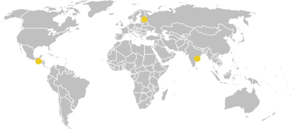
These three cities’ are located on three continents with three different cultures, coinciding with five urban challenges. And although solutions may vary in the specific implementation because of their political and cultural intricacies, they can derive from the same theoretical base.
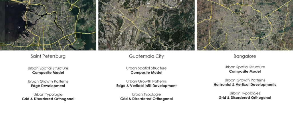
CITY COMPARISON

Cities worldwide are trying to progress towards the compact city and functional mix, but almost none have ended land take.
(Cortinovis et al., 2019)
Pattern and the City
Patterns in nature and anthropological environment as a consequence of evolution are visible regularities of form found in the natural world.
These patterns recur in different contexts and can sometimes be modelled mathematically. Natural patterns include symmetries, trees, spirals, meanders, waves, foams, tessellations, cracks and stripes.
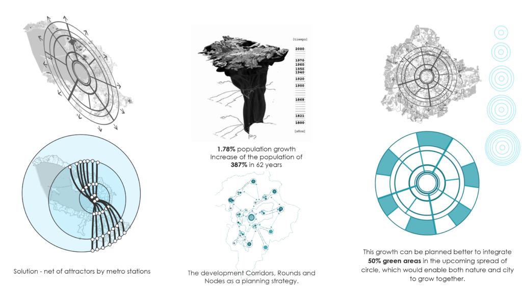
Our cities were formed in approximately the same geopolitical conditions as a polycentral model. Under this condition, they can be brought to the pattern of development – the Golden Ratio, which is a mathematical ratio. It is commonly found in nature, and when used in a design, it fosters organic and natural-looking compositions that are aesthetically pleasing or even “perfect” to the eye of a human or an animal.

Knowing the direction of the vectors and curves of the pattern (in our case, spiral curves) we can predict the future development of cities.
We can add the necessary repeating sections to these patterns to find similar solutions to our different urban challenges.
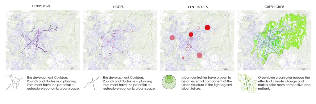
Urban Challenges
Uncontrolled spatial growth
Urban mobility
Use of urban spaces including greenery
Management of vehicular traffic
Promote economic development and competitiveness
UNCONTROLLED SPATIAL GROWTH
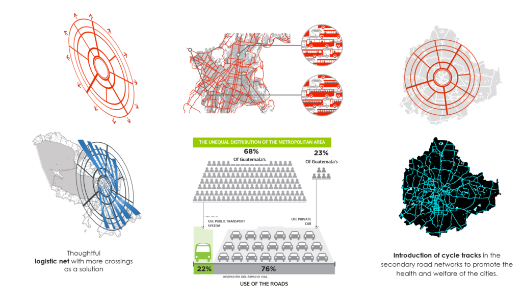
URBAN MOBILITY & vehicular traffic
GREENERY IN URBAN SPACES

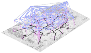
CONCEPTUAL PROPOSAL

WIRELESS ELECTRICITY
development and competitiveness
Proposal – Wireless electricity (Necessity for a smart infrastructure due to the spatial growth of the city). The illustrations depict a possible incorporation of the devices to create a wireless electricity transmission network. It would help with the physical infrastructural space allocation in the regions which would possibly expand further.
This would be possible using several methods- one of it would be laser transmission (the most efficient DC-to-laser converters have been shown to be solid-state laser diodes like those used commercially in fiber optic and free-space laser communication. Laser transmission allows a photovoltaic receiver to receive laser beams and generate electric power from the same. The merit of laser-based power transmission is that laser beams can be controlled more easily for long-range wireless electrical transmission).
