
En La Calle is a board game for 2–4 players aged 8 and above, set in the streets of Bosa-Apogeo, Bogotá — a neighbourhood home to some of the highest school density in the city and the largest school in Bogotá by enrolled students, yet streets that were never designed with children in mind.
En La Calle puts children in those streets and asks them to think, use the right tools, and act to get through safely. On every turn, players draw a Danger card representing a real street hazard — and must play the right Safety card from their hand to beat it and keep moving. It introduces a vocabulary for kids to better navigate the streets.
Objective
Be the first player to collect both of your colour tokens on the board — then reach the school.
- Start at the Home tile with 3 Safety cards in hand
- Move along the board and collect your 2 colour tokens placed on different routes
- Beat Danger cards using matching Safety cards to keep moving forward
- Once both tokens are collected, race to the School tile to win
Set up
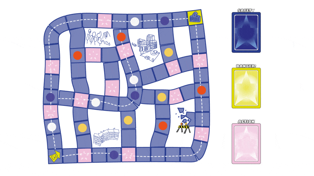
Each player picks a colour and places their pawn on the Home tile.
The board has more token spots than players— before the game starts, each player places their 2 colour tokens on any 2 available token spots on the board. Tokens must be on different routes.
Players choose their spots in turn order (youngest first).
Shuffle the Safety cards together into one face-down deck.
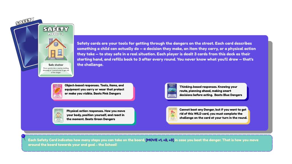
Deal 3 Safety cards to each player — this is your starting hand. You must always have at least 3 Safety cards at a new turn.
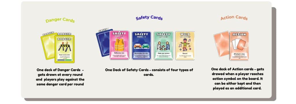
Shuffle the 10 Action cards into their own separate face-down deck — place it on the marked Action tile spot on the board.
Place the Danger card deckface-down on the Danger tile spot on the board.
Turn oder
- Round 1 is started by the youngest player. All others follow clockwise.
- Round 2 is started by the next player clockwise from the youngest. Each new round the starting player advances one seat clockwise.
- Within each round, every player takes their turn in clockwise order.
- When a player finishes playing, they refill the Safety cards if necessary and say aloud: “I’m done!”— this signals the next player to begin their turn.
- After all players have completed their turn, the round ends and the next Danger card is pulled.
On your turn
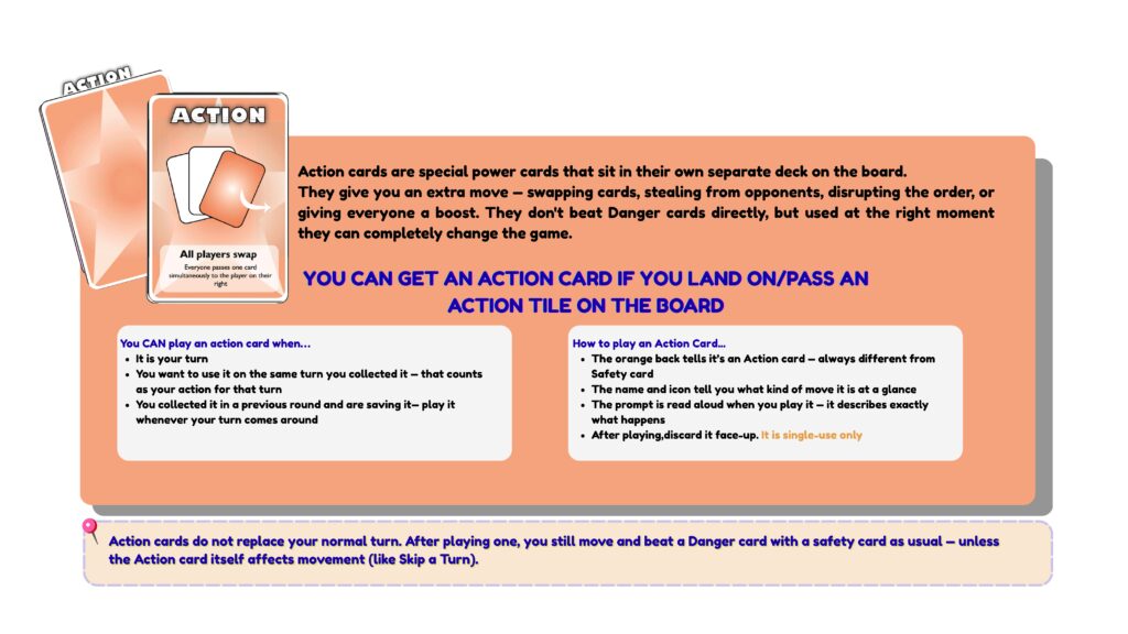
- Play an Action Card (optional) – If you are holding an Action card, you may play it at your turn.
- Land on a Tile – see what happens when you land on a specific tile:
- Your colour token – Pick it up and keep it with your pawn
- Another player’s token – Nothing, pass through
- Action tile – Pick up the top Action card , hold as your extra card or use it on your turn
- 🏠 Home / 🏫 School No effect — pass through or finish
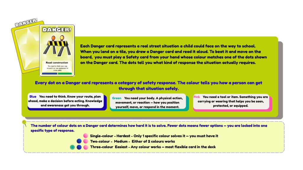
- Beat the Danger – Play one Safety card whose colour dot matches any dot shown on the Danger card.
- ✅ Match → move the steps on the board ❌ No match → do not move on the board
- Announce aloud when your turn is finished. The next player clockwise now begins their turn.
- Refill hands with a safety card
From play to participation
En La Calle is designed as a street literacy tool — cultivating spatial literacy in children who navigate urban space daily but hold no formal voice in how it is designed, and surfacing their embodied knowledge of the neighbourhood as a form of expertise that institutional planning systematically overlooks.
After playing, children are invited to draw one danger they recognise from their own route to school. This simple act is itself a form of qualitative data gathering — not about locating hazards on a map, but about understanding what actually makes the journey to school feel unsafe from a child’s own perspective. What they draw reveals what no spatial dataset can: the perceived, sensory, and emotional dimensions of navigating a city that was never built for them.
At its core, the game teaches children that getting through the street safely is not about luck — it is about thinking ahead, being prepared, and knowing what to do when something goes wrong.
