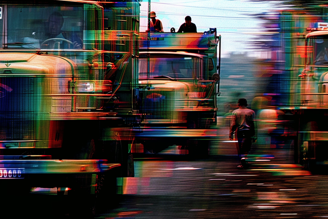
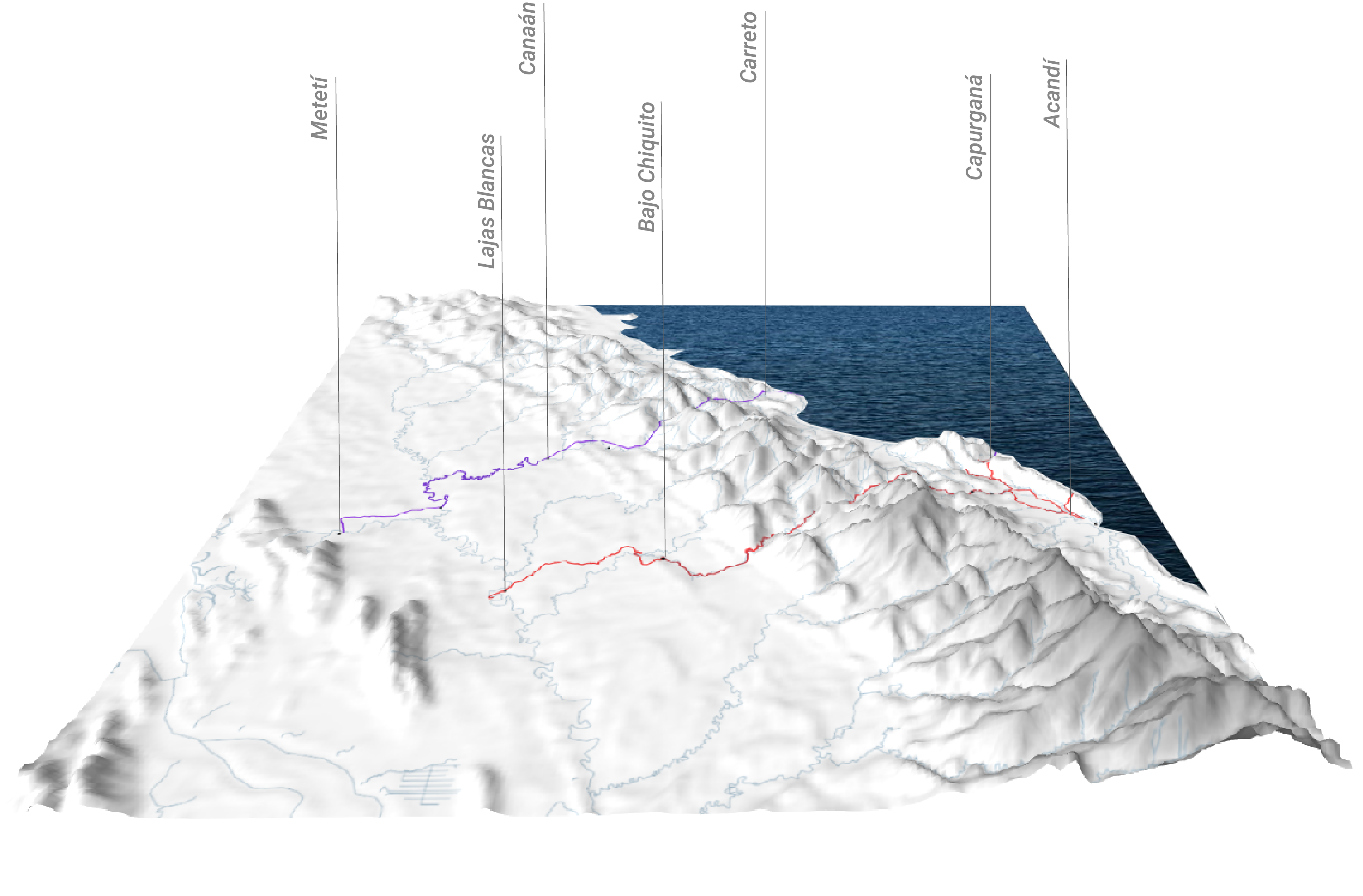
photo credits: Teddy Cruz – The Political Equator
Description
Summary
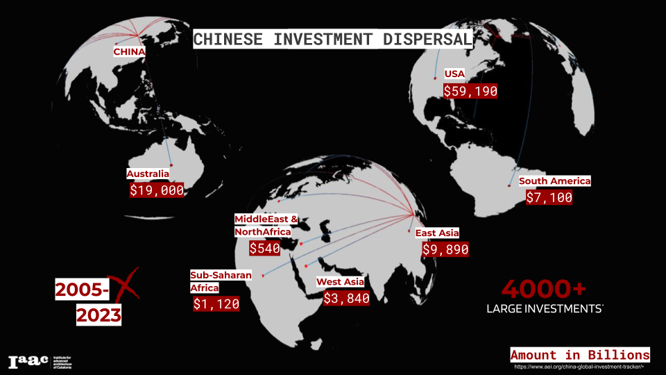
Networked Flows explores the spatial politics of mobility and the forces that shape it, focusing on particular instances of conflict and disruption across our contemporary landscapes of both migration and contestation. The course will demonstrate and investigate how methods of spatial, geostatistical and data analysis can be used to document, contest, mitigate and design for conditions of mobility within the Anthropocene.
Outline
As observers and actors within the city, mobility instinctively prompts us to think about the infrastructure that facilitates the movement of people and goods. For the purposes of this course, we invite students to consider less literal, but no less real, dimensions of mobility as a framework through which the Anthropocene and its effects can be studied: we’ll be focusing on the intersection of conflict and mobility as a mechanism to explore the flows of peoples, cultures, information, capital and ecologies which both shape, and are shaped by, the design of our contemporary world.
With this definition in mind, we can claim that mobility (and equally immobility) has always been intertwined with the shifting landscapes of technology and conflict—from recent conflicts and planetary-scale events such as COVID-19 to the technological developments of World War II which continue to shape our globalized supply chains. When discussing the design of future mobilites we’ll engage and operate within the complex geopolitical conditions of our modern world, whilst reimagining the definition of mobility and its role in the socio-political landscapes of our urban environments; past, present and future.
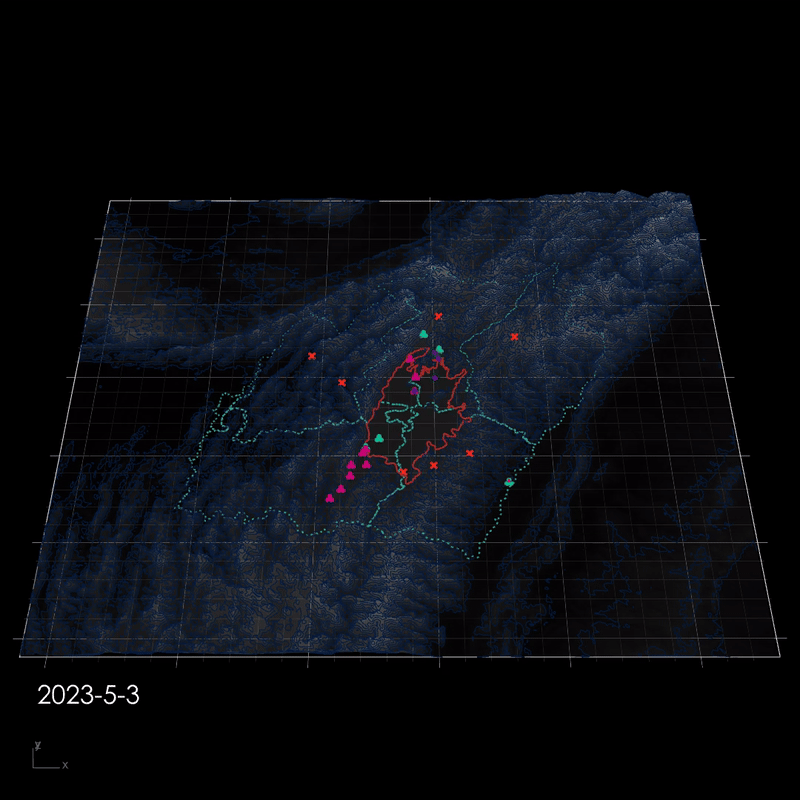
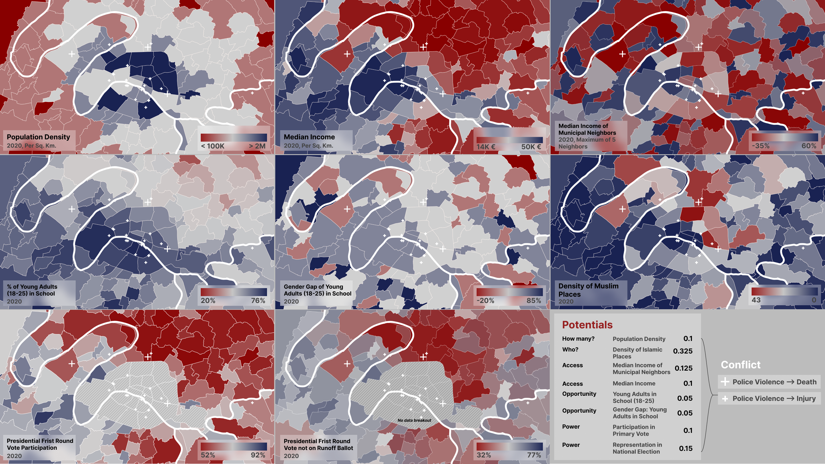
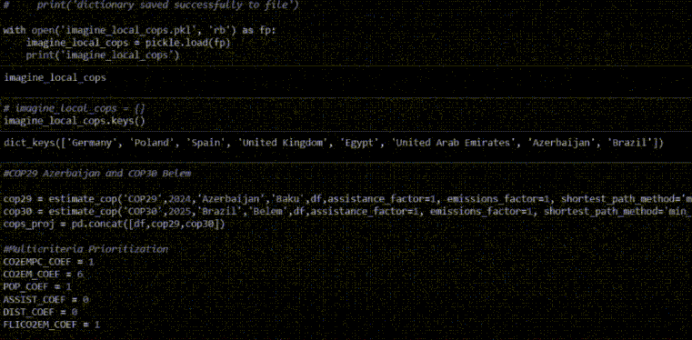
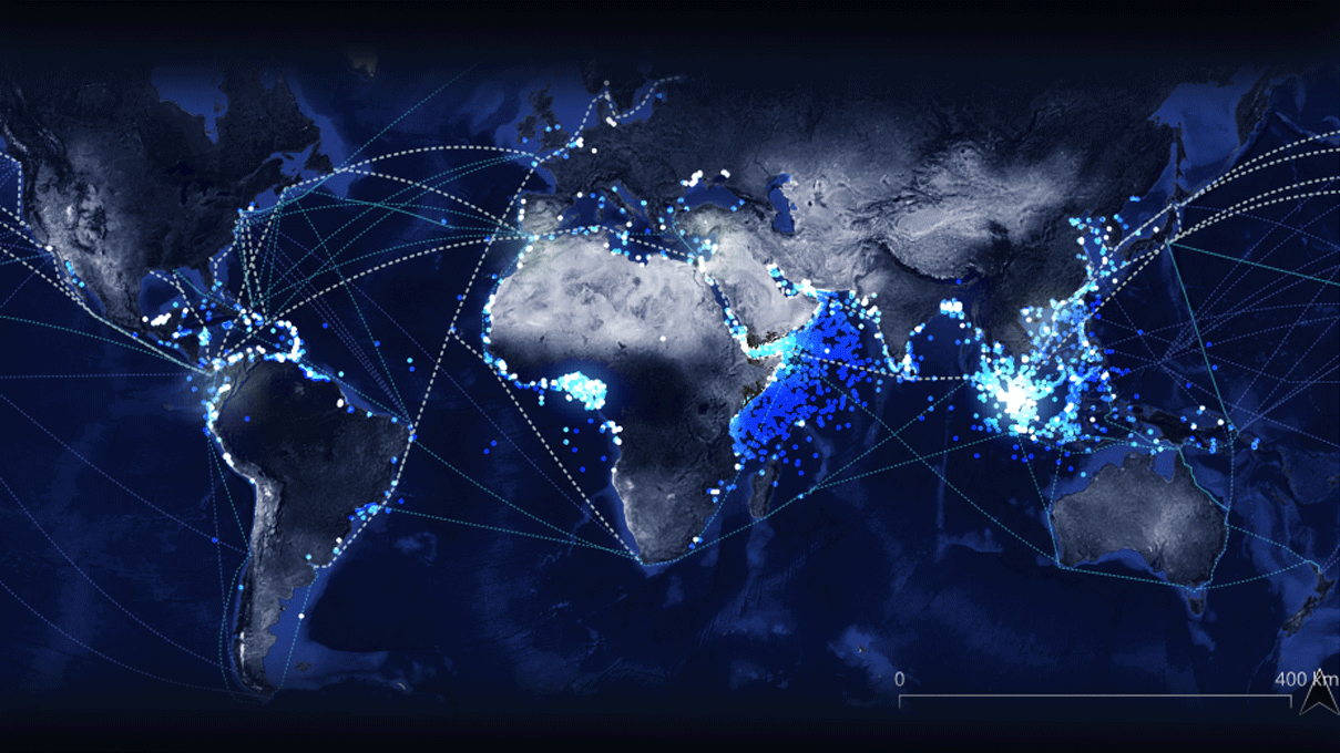
In this course, we will explore a variety of forensic methodologies that will allow us to map the effects of conflict onto both human and non-human infrastructures, across a spectrum of scales, cartographies, and temporalities. We will apply systems level-thinking throughout our engagement with open-source datasets, remote sensing techniques, and frameworks for data visualization. In turn navigating across visual, geospatial, temporal and relational vectors to inform our understanding of the operative forces that shape future mobility and the right of movement.
The course will allow students to address a wide range of questions such as:
- How can we understand and register violence in its many different guises?
- How are conflicts and systems of mobility intertwined?
- How can we critically engage with various technologies and methods in order to reconstruct events of conflict?
- How might infrastructures and systems of migration be transformed so as to mitigate the suffering they generate?
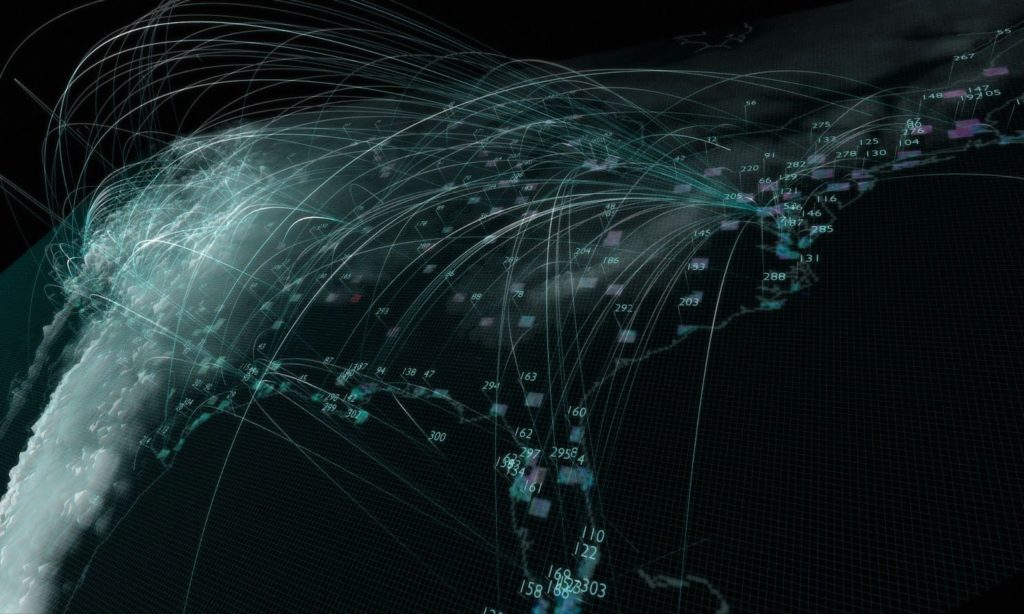
photo credits: Warning Office – Test Sites
Learning Objectives
Following successful completion of the course, students will have acquired an overview of existing forensic methodologies and specialized in the ones that pertain to their research focus and areas of interest. Outcomes and objectives include but are not limited to;
- Discuss contemporary literature and approaches to mobility, asylum, climate violence and spatial practice.
- Critically read news, social media, maps and other visual devices to understand their agency as socio-spatial devices for design.
- Identify the interrelations between the production of space, conflict and mobility, and how spatial analysis in turn can offer a means for analyzing and contesting it.
- Conduct collaborative interdisciplinary research combining humanities and social science methods with creative practice and visual representation.
- Discuss inextricably theoretical, political and methodological questions in relation to the different tools and methods used to register traces of conflict.
- Use of Exploratory Spatial Data Analysis (ESDA), Geovisualization (GVIS) and data visualization technologies through the use of interactive notebooks such as Observable and Jupyter Notebooks.