
We want to invite you to witness the city through a lens often overlooked, how people navigating urban spaces shaped by “intersectionalities”.
This is a story about how people experience cities—specifically, the everyday places where we wait to catch a bus, hop on a train, or cross the street. These spots might seem ordinary, but for many, they’re spaces where safe, comfort, and freedom meet with fear, judgment, or even danger.
By using interactive webmap and real stories we want to visualize what often goes unnoticed: the extra steps someone takes to avoid a dark alley, the tension of ignoring a catcall, or the relief of finding a well-lit bus stop. It’s not just about transportation—it’s about how race, income, disability, and identity shape who feels welcome in public spaces, and who doesn’t.
People perform
[different tasks] and have
[different travel patterns].
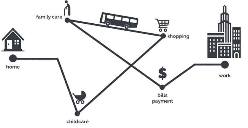
[Intersections] Boarding points for public transportation.
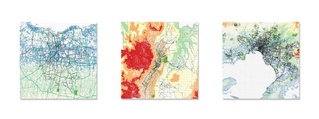
Comparing three cities [Jakarta] | [Quito] | [Melbourne]
Through the lens of Jakarta, Quito, and Melbourne, we explore how inequality is woven into the fabric of everyday urban mobility. In Jakarta, dense traffic and informal transport reveal struggles for dignity. In Quito, steep terrain and insecurity shape how and when people move. In Melbourne, polished infrastructure masks the silent exclusions felt by many. This isn’t just about buses or trains—it’s about who feels safe, visible, and welcome in public space. Using interactive maps and real stories, we invite you to notice what often goes unseen—and to ask: whose city is it, really?
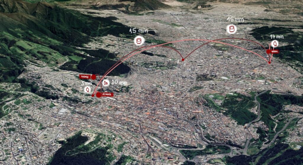
[Jakarta]
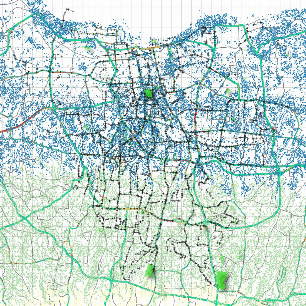
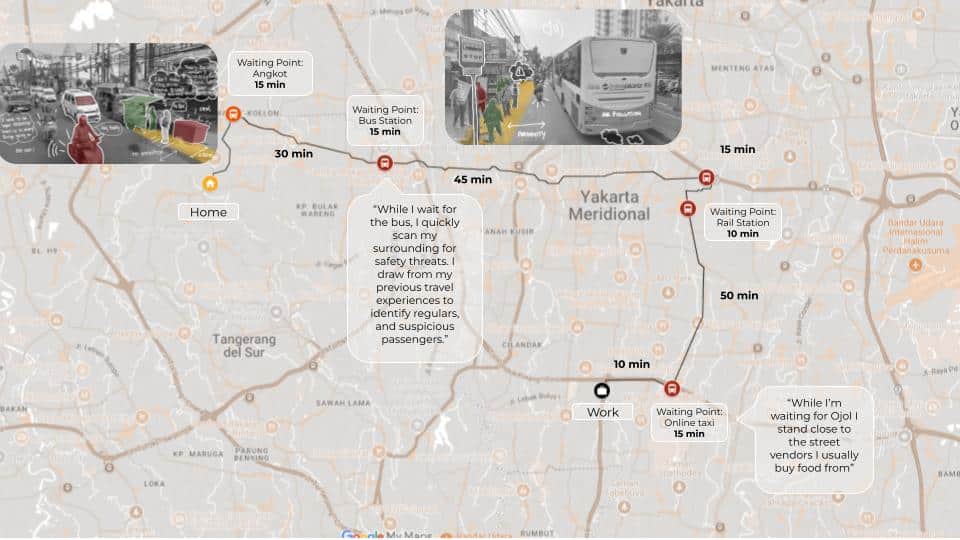
Jakarta, the rhythm of daily life is set by dense traffic, limited pedestrian paths, and informal transit networks like ojeks and angkots. For many, getting around means adapting to unpredictability—dodging motorbikes on sidewalks, waiting for transport without shelter, or walking long distances in the heat. These challenges aren’t felt equally. For women, the elderly, and the disabled, the city’s movement patterns come with added layers of risk—catcalls, uneven pavements, lack of ramps, or fear after dark. In Jakarta, navigating public space reveals how mobility is shaped not just by roads and vehicles, but by power and exclusion.
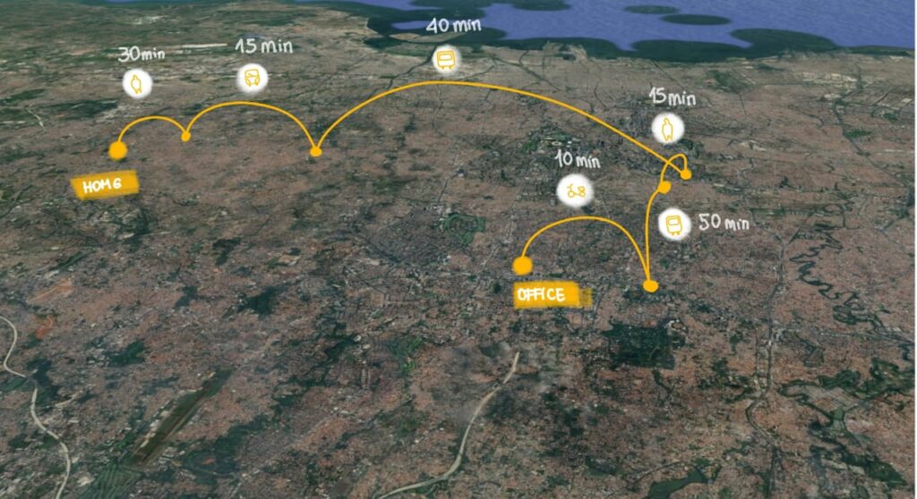
[Quito]
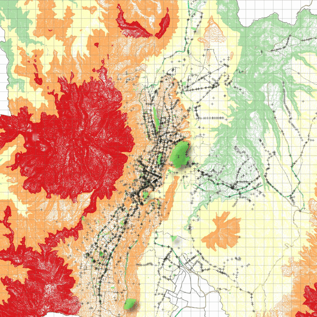
Quito, nestled high in the Andes, is a city of steep hills, sharp altitude, and fragmented urban sprawl. Its geography alone presents barriers—but these are compounded by uneven infrastructure and insecurity in public space. Narrow sidewalks, poorly lit streets, and limited transport options in peripheral neighborhoods make everyday movement a challenge. For women, youth, and low-income residents, the simple act of getting from one place to another often means weighing risk and visibility. In Quito, mobility is more than access—it’s about navigating fear, negotiating terrain, and constantly adapting to a city that doesn’t move the same for everyone.
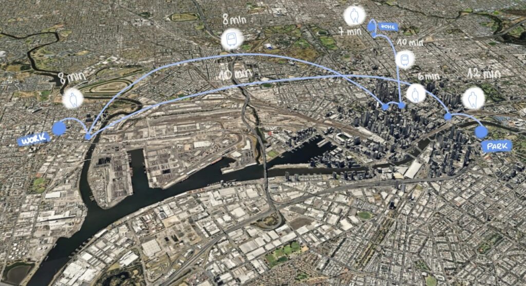
[Melbourne]
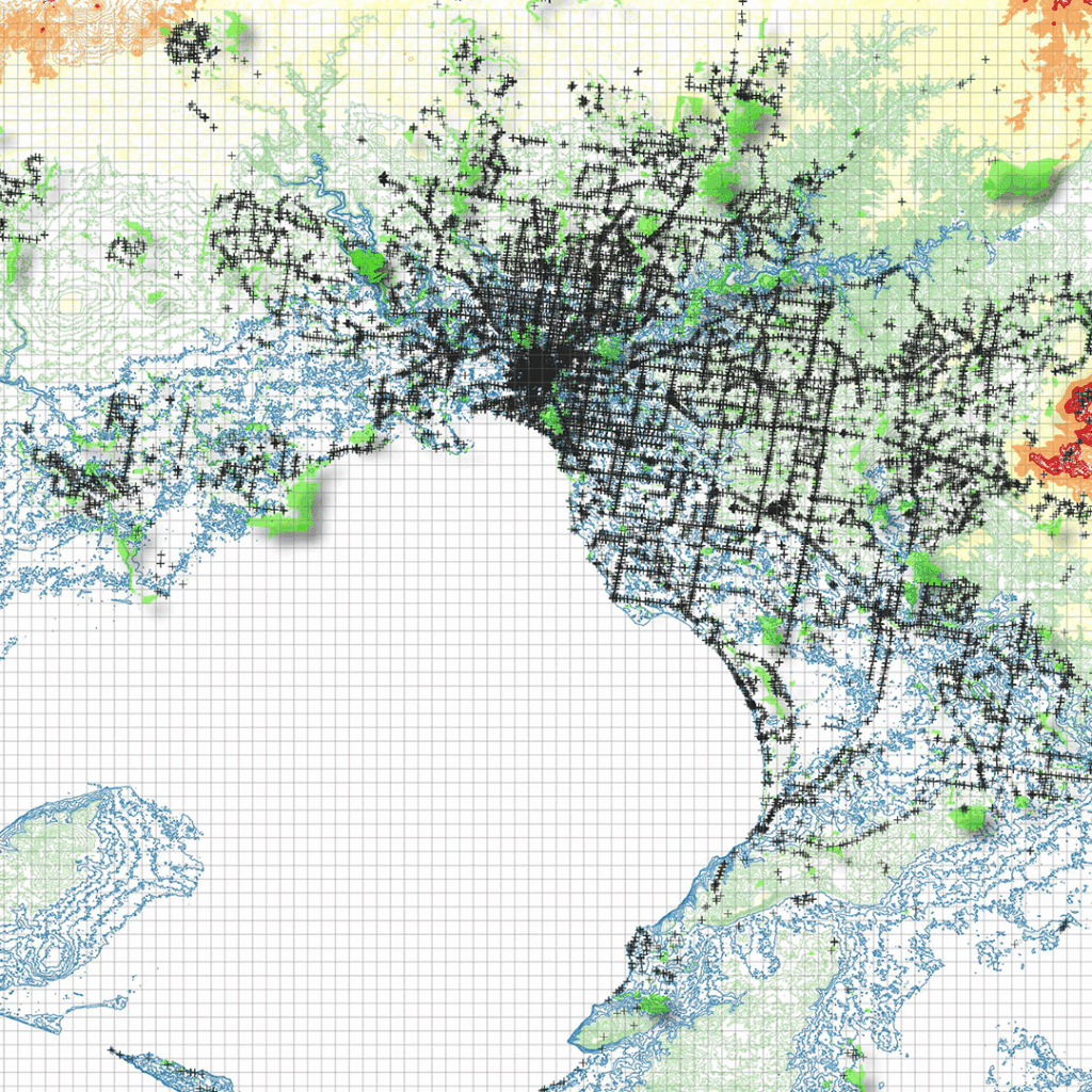
Melbourne is known for its efficient public transport and well-maintained streets, yet beneath this polished surface lie subtle barriers that affect who feels safe and welcome. Clean trams and orderly stations coexist with experiences of exclusion—racial minorities, gender-diverse individuals, and lower-income commuters often face discrimination, discomfort, or invisibility. Even in well-designed spaces, microaggressions, lack of inclusive design, and social inequalities shape how people move through the city. In Melbourne, mobility is not just about infrastructure, but about belonging—who is seen, heard, and protected in public spaces.
Cities are usually planned from [above] but lived from the [ground].
We represented the pattern mobility route of three personas, one per each country, from her/ his homes to their final destination. From the analysis we found out that the most vulnerable point along the path are the waiting points, street intersections and parks. Due to the data availability, and the time of the workshop (one week), we focus on the waiting points.
Reclaiming the Commute: A Webmap to Capture Movement, Memory, and Mobility Gaps
What does your daily commute [feel] like?
Is it a breeze, a blur, or a battle?
Across cities worldwide, mobility is not just about getting from point A to B — it’s about how the journey shapes our time, stress, and access to opportunity. But too often, these experiences go unseen in official data, especially for those navigating fragmented public transport, unsafe crossings, or long waits in overlooked neighbourhoods.
This interactive webmap lets anyone, anywhere, submit their personal journeys . From annotated images and audio clips to location-tagged descriptions of movement challenges. You can record the sound of a busy intersection, upload a photo of a dangerous transfer point, or describe a long detour you take just to reach work or school.
This is more than a map. It’s a bottom-up data layer that brings voices and stories into urban planning. It gives residents — especially those often left out of mobility policy — a space to document mobility struggles, identify gaps, and connect across cities.
By collecting these micro-experiences, we’re creating a shared resource to:
- Highlight transport inequities and underinvested areas
- Empower communities to advocate for better services
- Inform urban planners and policymakers with hyperlocal, lived data
