
What is EVOL?
EVOL is a site maximum building volume evaluator, designed for architects, designers, developers, and anyone interested in quickly assessing a site’s building potential. By integrating zoning regulations, solar exposure considerations, and urban density parameters, EVOL provides an efficient and interactive method to visualize the maximum buildable volume for a given site. Instead of manually researching zoning laws and calculating constraints, users can rely on EVOL to automate this process, making early-stage project assessments significantly more accessible and precise.
How Does it Work?
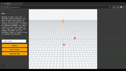
Using EVOL is simple, efficient, and user-friendly, allowing anyone to generate accurate zoning envelopes in just a few steps:
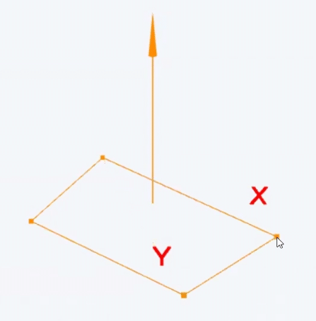
- Draw the Site Outline – Users define their site’s boundary directly on a 3D canvas, ensuring a counterclockwise drawing direction for proper calculations. The interactive interface allows precise adjustments and intuitive sketching.
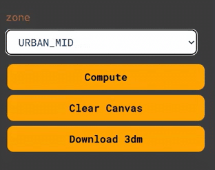
- Select the Zone Type – Choose the appropriate zoning category based on location: dense urban, mid urban, suburban, or rural. Each preset comes with built-in parameters such as setbacks, maximum heights, and exposure limits.
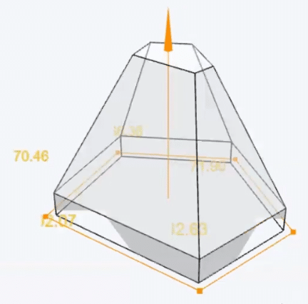
- Compute the Building Volume – With a single click, EVOL processes the input data and generates a maximum building volume or zoning envelope, taking into account predefined setbacks, sunlight exposure planes, and land-use regulations.
Key Features
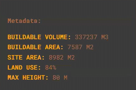
- Real-time Site Analysis – EVOL provides instant feedback on buildable volume, setbacks, maximum height, and zoning envelope constraints, eliminating the need for time-consuming manual calculations.
- Data Insights for Decision Making – The app offers additional key metrics such as site dimensions, rough land use distribution, buildable volume, and height restrictions, helping architects and planners make informed decisions.
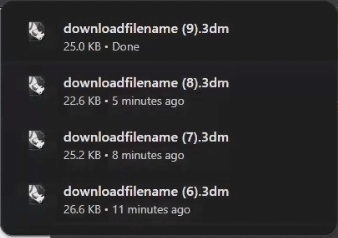
- 3D Model Export for Further Development – Users can export their final zoning envelopes as 3DM files, making it easy to import them into Rhino, Grasshopper, or other design software for continued development.
- Interactive Editing and Iteration – The clear canvas feature allows users to refine and adjust their site configurations before finalizing results, encouraging experimentation and flexible decision-making.
Future Enhancements
EVOL is designed with future adaptability in mind, paving the way for additional functionality:
- 3D World Map Integration – Instead of manually drawing site boundaries, future iterations could allow users to input their site’s actual geographic coordinates, automatically fetching property dimensions and zoning data.
- Custom Zoning Data Import – Enhancing zoning presets by integrating official city or regional zoning databases, allowing users to apply precise regulations specific to their project location.
- Advanced Sunlight & Shadow Analysis – Implementing real-time solar exposure simulations to better predict shading and daylight impact on different building massing options.
By streamlining the early-stage feasibility analysis of architectural projects, EVOL promises to improves efficiency, accuracy, and accessibility in the planning process. Whether used for conceptual site exploration, initial project feasibility studies, or regulatory compliance checks, this tool provides designers, developers, and urban planners with a powerful solution to evaluate building potential with just a few clicks.
