Concept
In a world where urban areas are predominantly developed and the heat island effect is intensifying, the construction industry significantly contributes to environmental challenges. Instead of focusing on tools that promote new construction, our goal is to provide a tool that analyzes existing buildings and suggests improvements. This approach aims to enhance sustainability and mitigate the environmental impact of current structures.
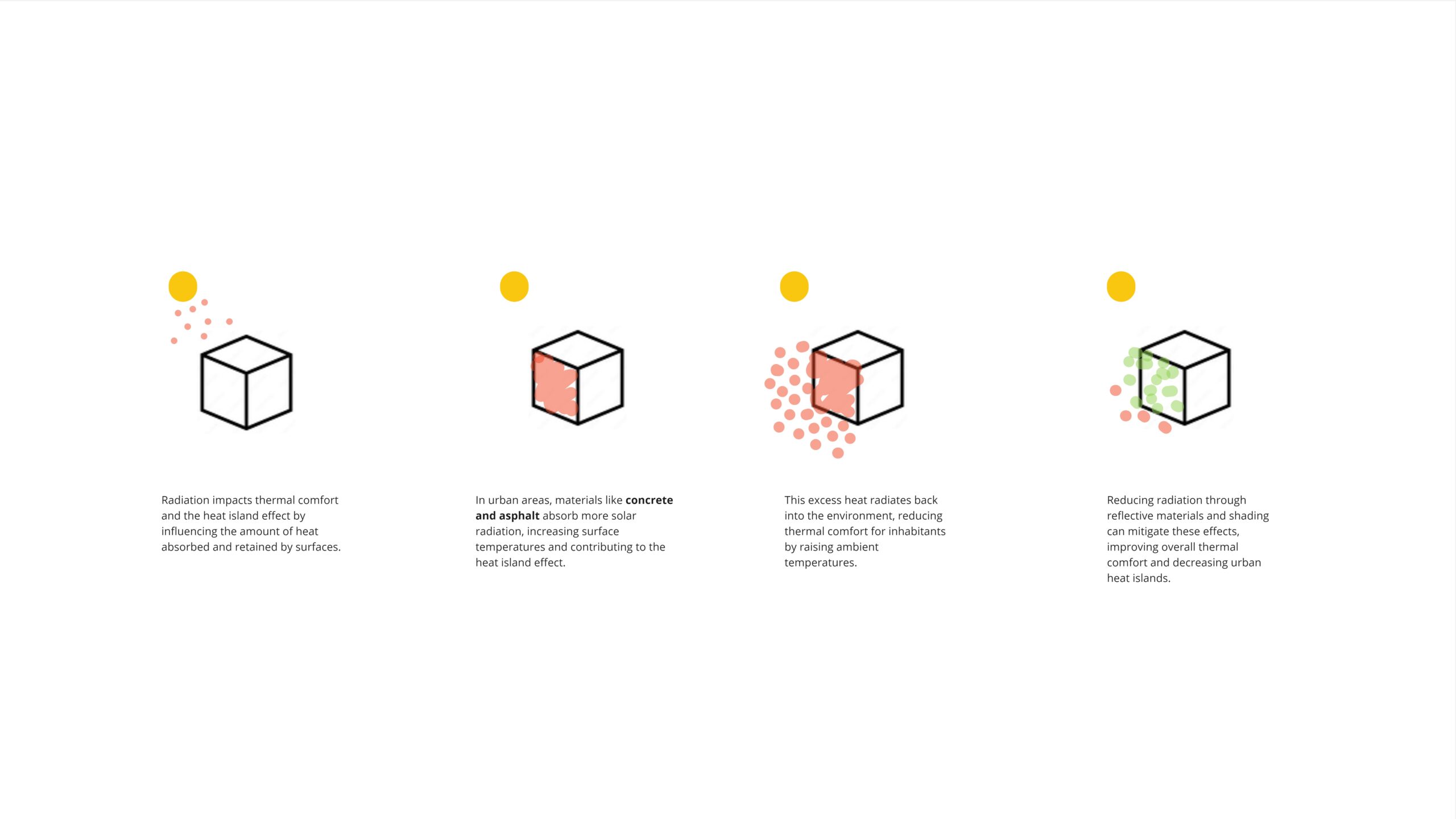
Radiation impacts thermal comfort and the heat island effect by influencing the amount of heat absorbed and retained by surfaces. In urban areas, materials like concrete and asphalt absorb more solar radiation, increasing surface temperatures and contributing to the heat island effect. This excess heat radiates back into the environment, reducing thermal comfort for inhabitants by raising ambient temperatures. Reducing radiation through reflective materials and shading can mitigate these effects, improving overall thermal comfort and decreasing urban heat islands.
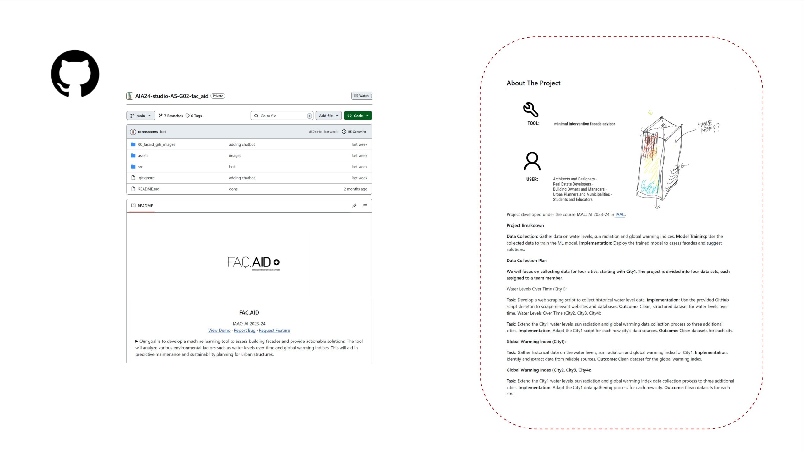
FacAID serves as a minimal intervention facade advisor tailored for architects, designers, real estate developers, building owners and managers, urban planners and municipalities, as well as students and educators. This tool enables quick radiation analysis of buildings and subsequent assessment of suitable vegetation species based on climatic zones.
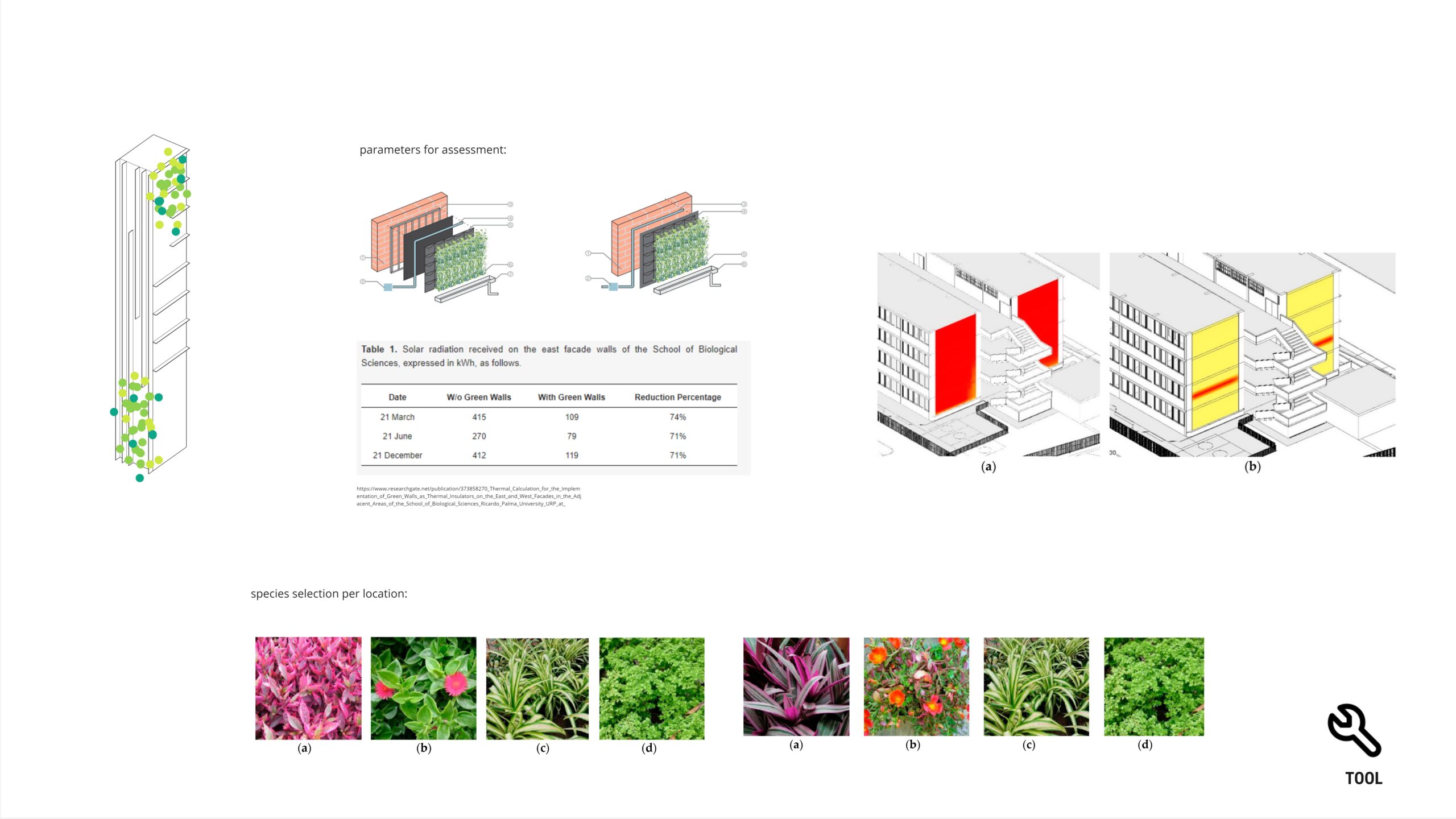
The criteria use for assessment was based on experimental studies due to the limited research available in this area. We focused on this approach to fill the gap in existing literature and provide robust insights. Learn more about these studies by clicking on the following link.
Project Methodology
The data obtaining approach using Python was attempted but not fully developed. Instead, synthetic data was generated via Grasshopper Ladybug in the following manner.
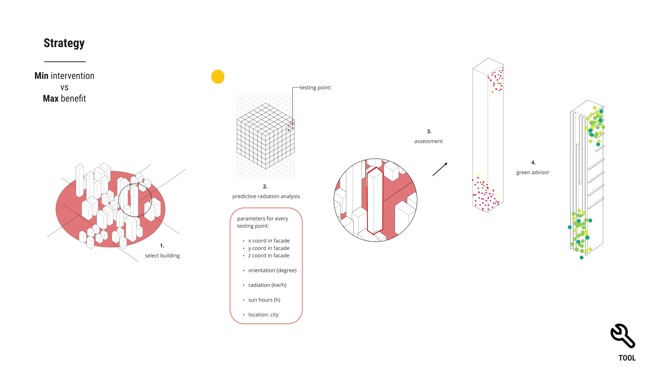
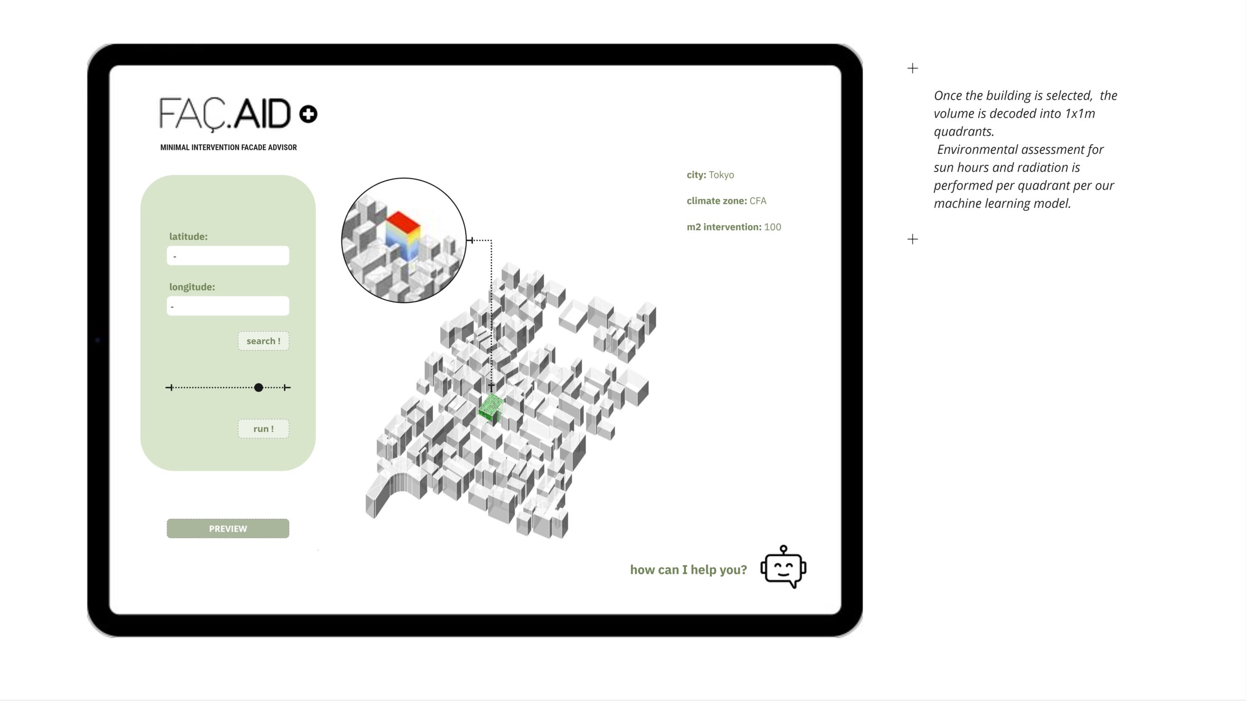
Synthetic data was generated as follows: Several buildings from the same location were selected for sun hours and radiation analysis. Testing points were positioned at 1m2 quadrants per facade orientation. Additionally, the geometrical position and normal vector of each testing point’s center were exported to aid the model in understanding orientation.
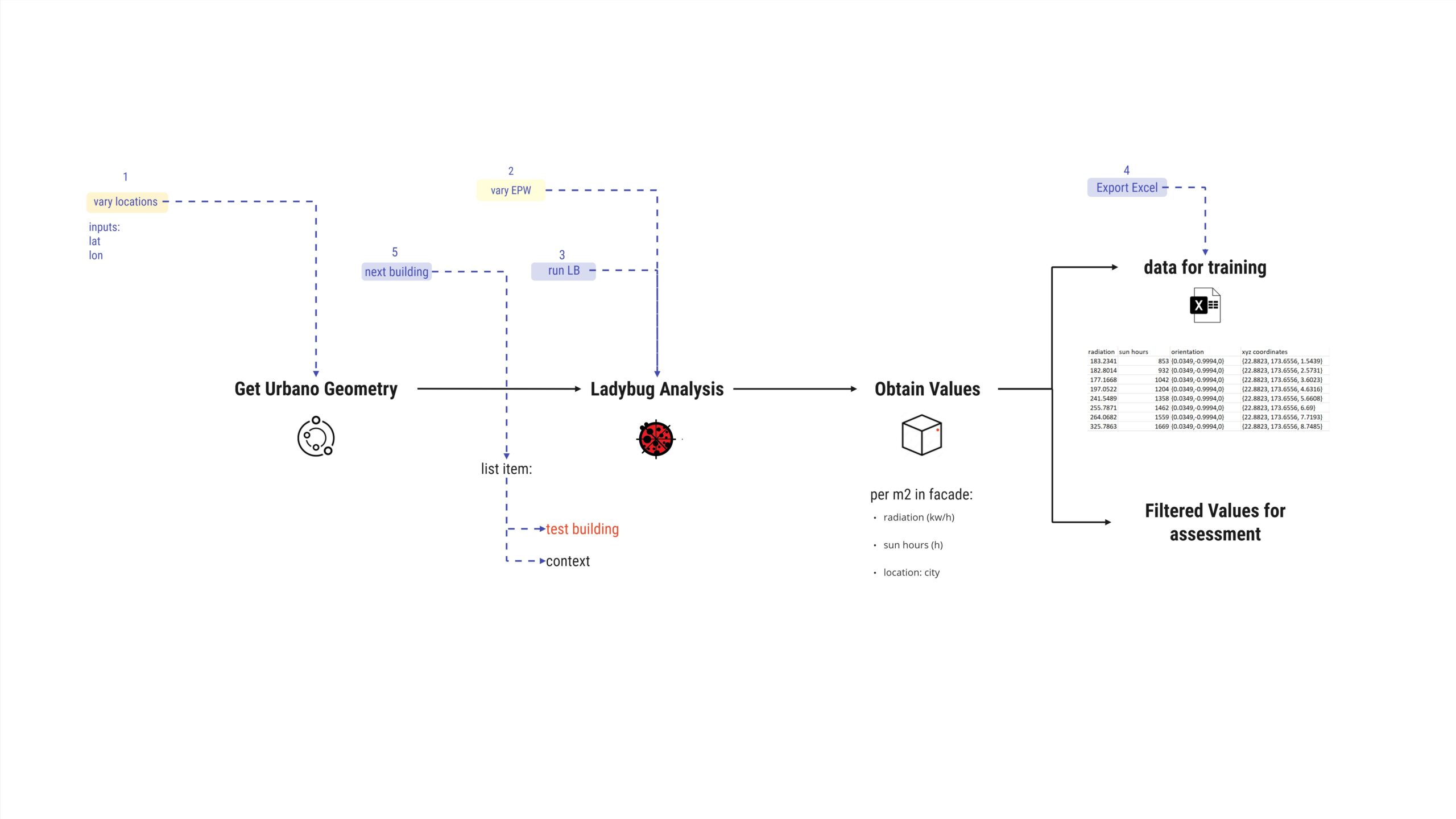
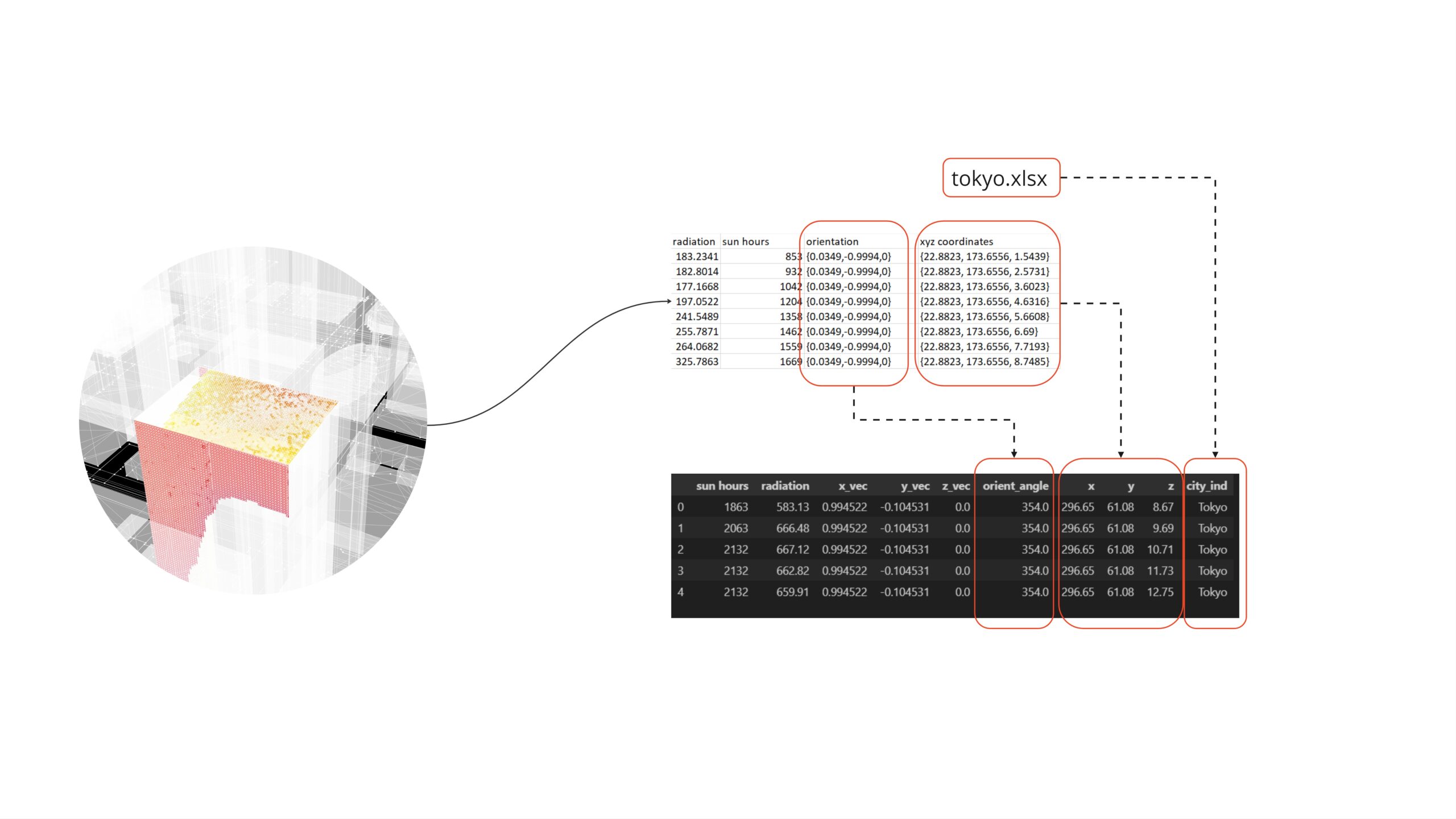
The data was encoded as follows: The normal vectors of the surfaces were transformed into angles, representing their orientations and directional properties. The x, y, and z coordinates of points on each facade were treated as distinct variables to convey spatial positioning information. Additionally, the city names where data was collected were included as categorical variables, to be later dummy encoded. This conversion will create binary indicator variables for each city, enabling the model to distinguish and interpret different locations effectively.
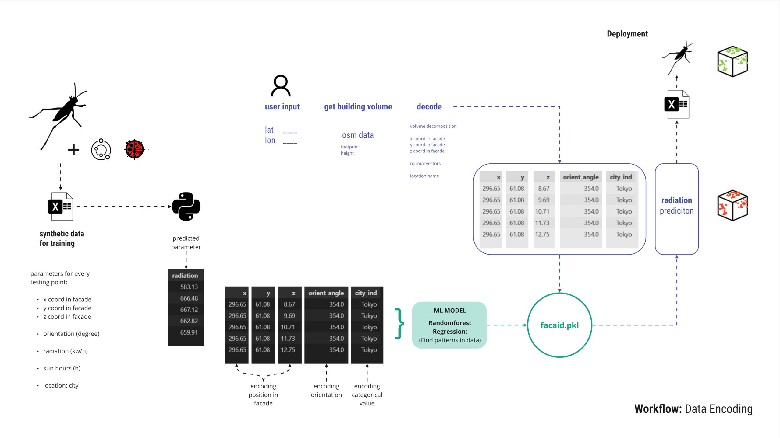
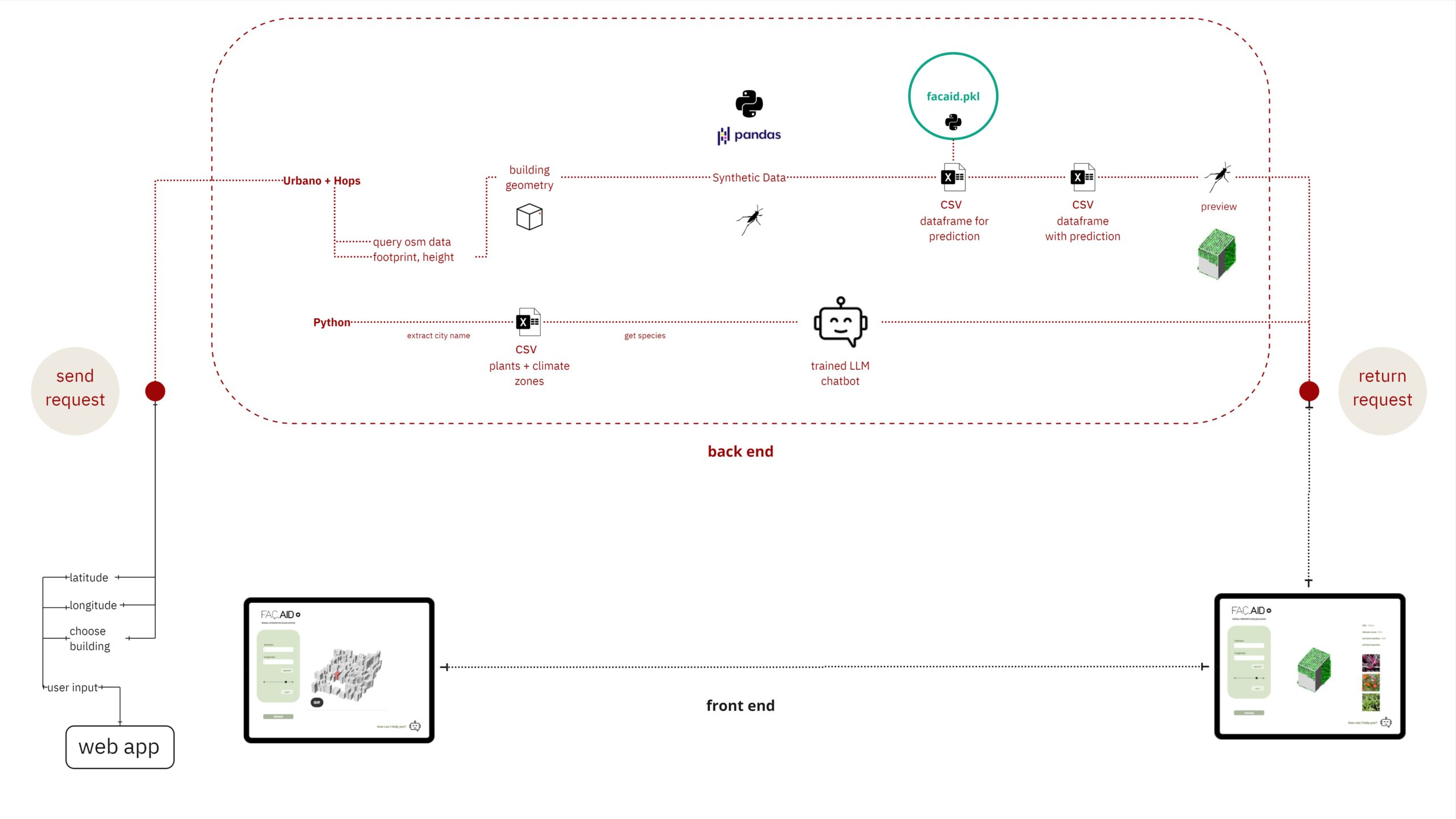
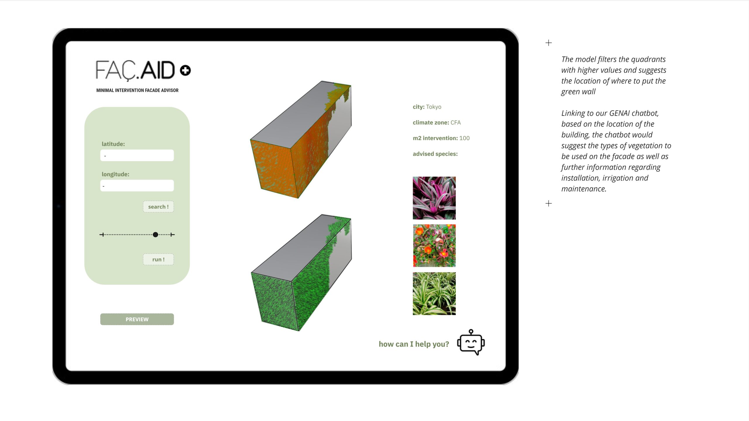
Following the model creation process and outlining user interaction, the trained model, derived from synthetic data, is exported as a .pkl file. Users interact by providing latitude and longitude coordinates. In the background, building geometry is decoded to extract its footprint and height, enabling retrieval of the x, y, and z coordinates and normal vectors essential for prediction. The resulting dataframe with predicted radiation values is fed back into Grasshopper to reconstruct the testing mesh and assess the location’s suitability for a green facade.
This breakdown illustrates the front-end and back-end of FacAID. Users interact with the model through a web app, where they can preview areas of intervention and suggested species after all back-end processes have been completed.
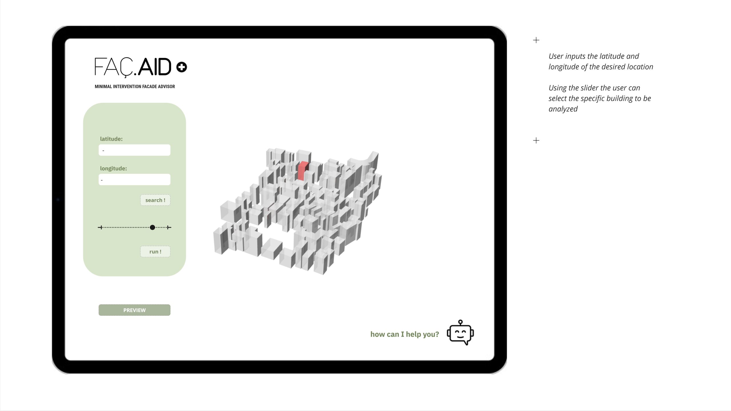
User interfase – use case
The following outlines step-by-step how users are intended to interact with FacAID:
Deployment
The project and model reside in a GitHub repository, accessible to all users. The README provides explanations for straightforward usage. This stage marks an ongoing progression towards the development of a more user-friendly application.