Introduction
This project aims to investigate the extent to which different facade material choices can influence the urban heat island effect in the surrounding area.
Urban Heat Island
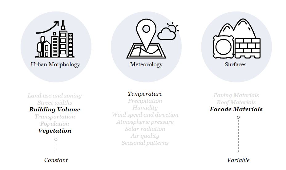
There are many factors that affect urban heat island and the three main branches are urban morphology, meteorology and surfaces.

Out of all the factors three were selected to be investigated in the project: building volume, vegetation and facade materials. Building volume and vegetation will be kept as a constant while facade materials will be variable.
Project Overview
Context
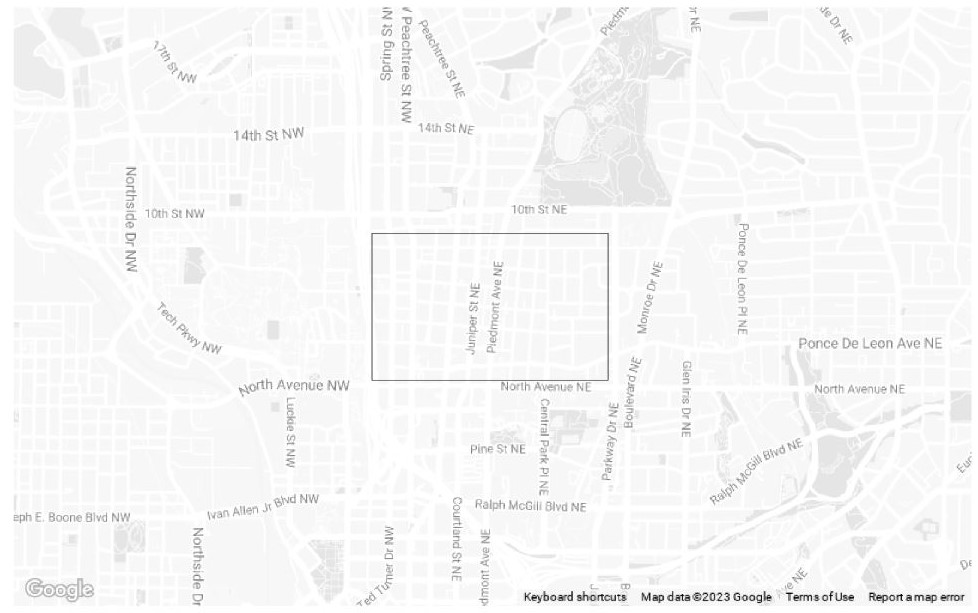
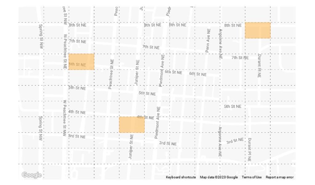
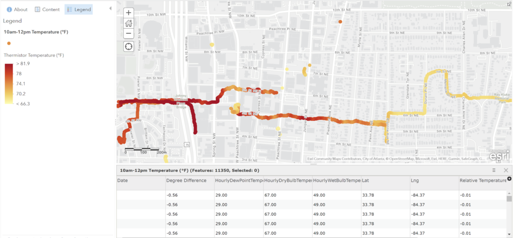
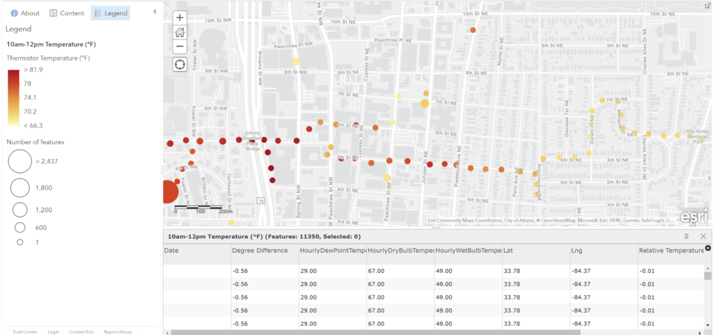
The context is chosen as Atlanta, where Urban Heat Island values were available as an open data.
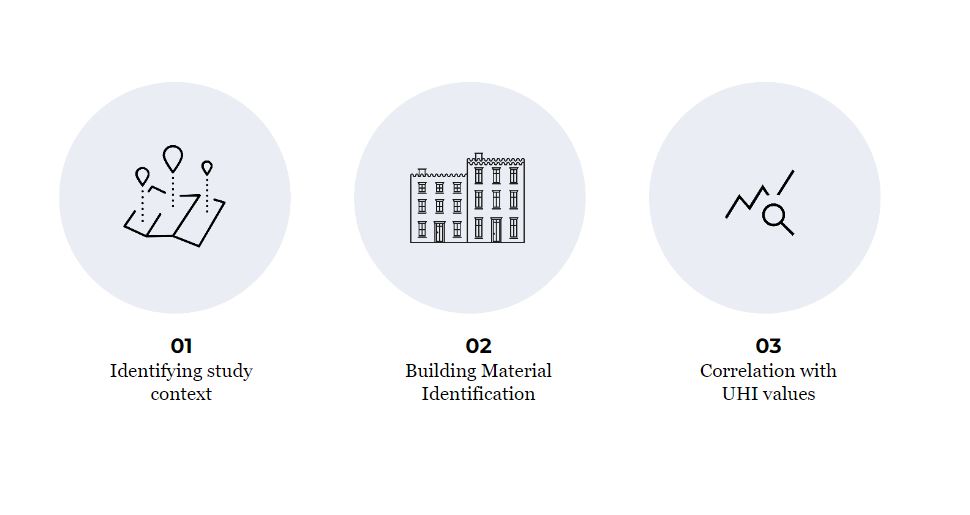
In order to start examining the facade material’s effect on urban heat island, the context is divided into parts.
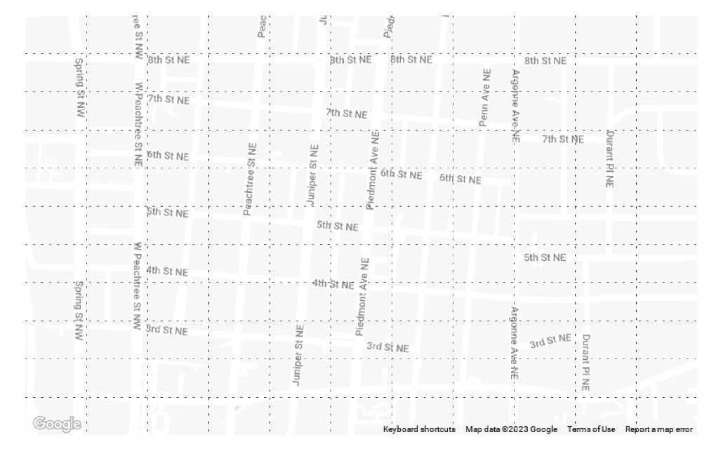
Three regions with different UHI values were selected to be compared and evaluated.
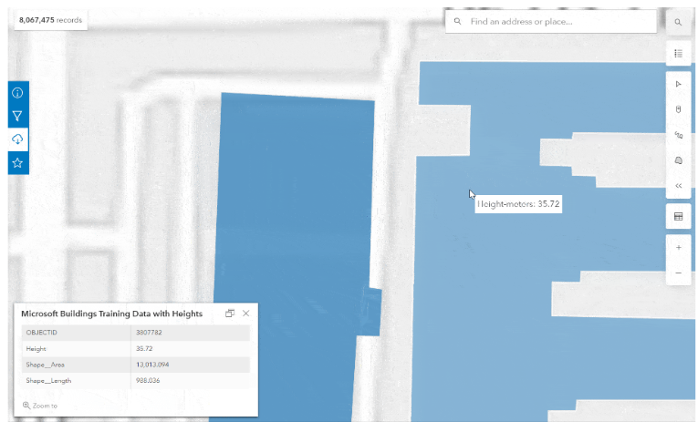
Urban Density Map
In order to understand the urban density, a map with building area and height information was utilized.
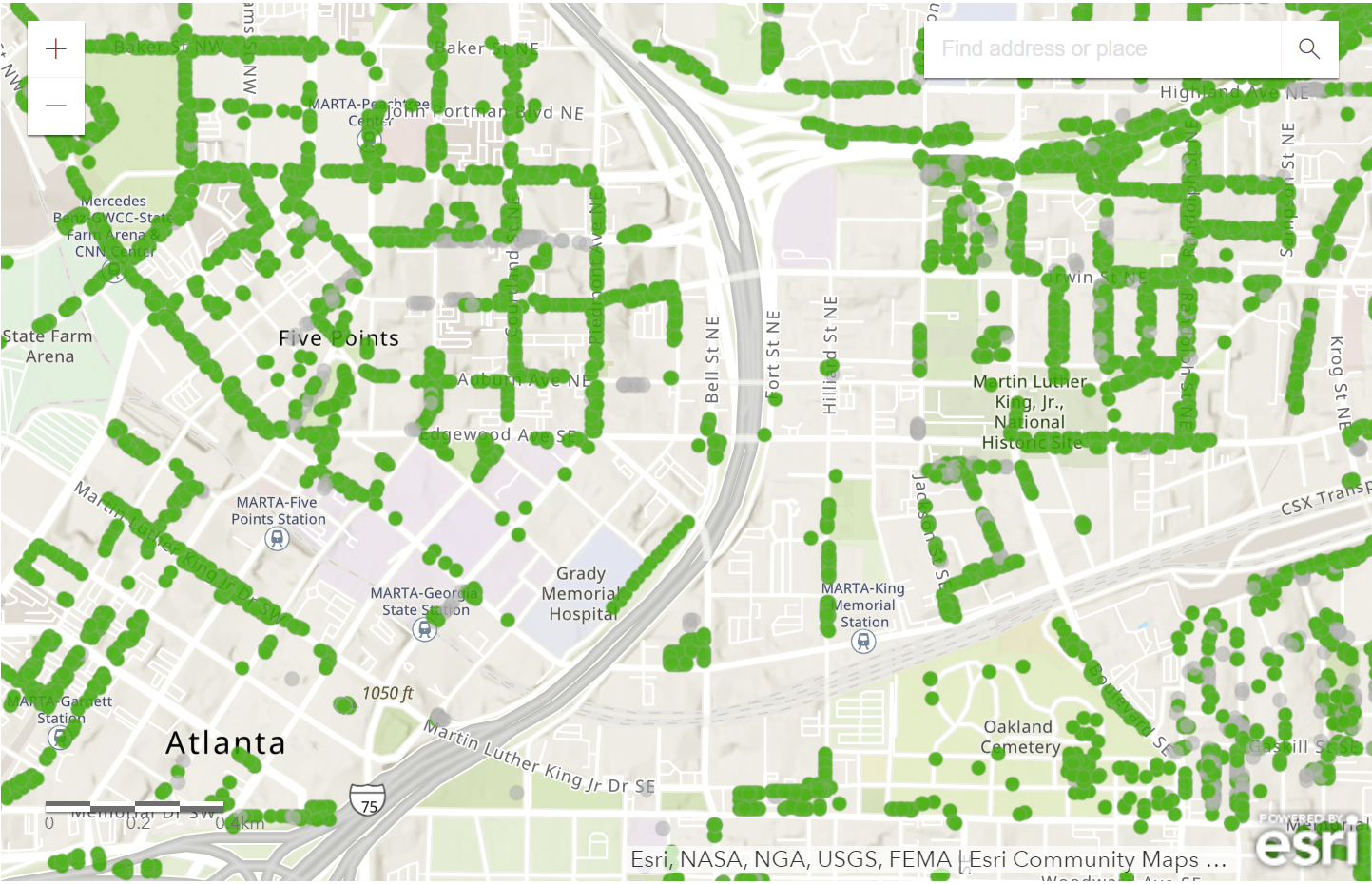
Tree Inventory Map
UHI Values
Selected regions’ temperature values such as, hourly dry and bulb temperature, relative temperature and degree difference were listed. These information were analyzed and recorded in different time frames.
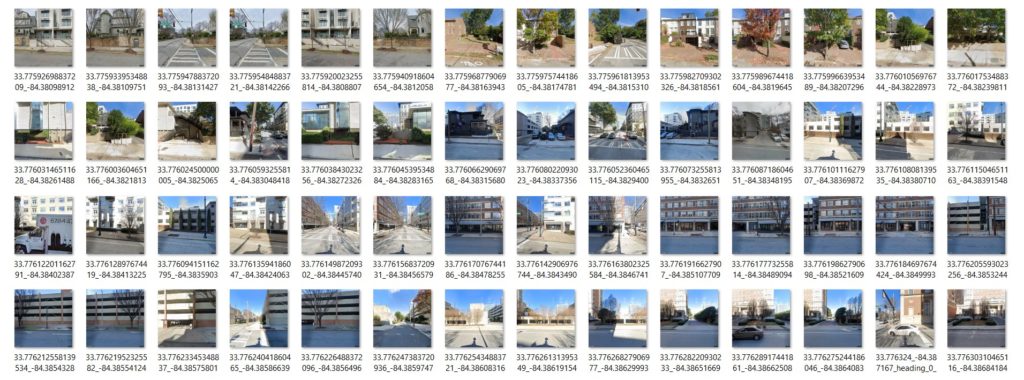
Street View Imagery
Street level imagery dataset was created for the selected street with UHI values mentioned above. In order to create this dataset start path latitude & longitude, end path latitude & longitude, camera location with respect to building, camera view angle from north, camera pitch angle, camera field of view parameters were used.
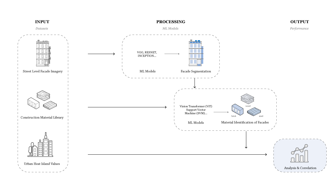
Methodology
Main datasets that will be used are street level facade imagery, labeled construction material library and the UHI values for the selected regions. First step will be to start by removing the background and high occlusion images from the street level imagery dataset. And then Segment the facade images based on colors and textures to attain the different materials. Secondly, material dataset will be used to classify which materials are being used on facades. In the chosen region a total area of each material that is being used will be attained. Lastly, those values with the existing UHI will be correlated to prove the hypothesis.