
Oerliker Park in Zürich, Switzerland is not a natural forest that slowly emerged over time. It is a designed urban ecology: structured, calculated, and deliberately designed among buildings and former industrial sites. Even though the park may read as “natural” with its trees, parks like Oerliker are often designed primarily around human use. But parks can be home to many species: flora, fauna, and fungi. This course pushed us to slow down and look more closely at who these spaces are really built to support. By shifting our perspective toward non-human life, we began to ask:
How would designed ecologies change if they were designed less for human-centred use and more to support and amplify biodiversity and ecological restoration?
INTRODUCTION
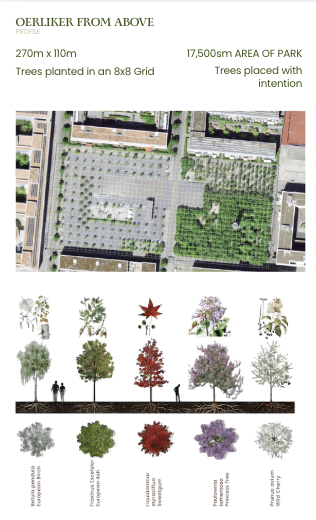
Oerliker Park Also known as “Blauer Turm” is a post-industrial urban park developed in Zürich-Oerlikon during the district’s transition from rail- and industry-dominated land to a dense mixed-use neighborhood. The project is often cited as an early European example of designed ecology embedded within urban regeneration, rather than a decorative green space added after development.
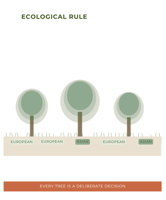
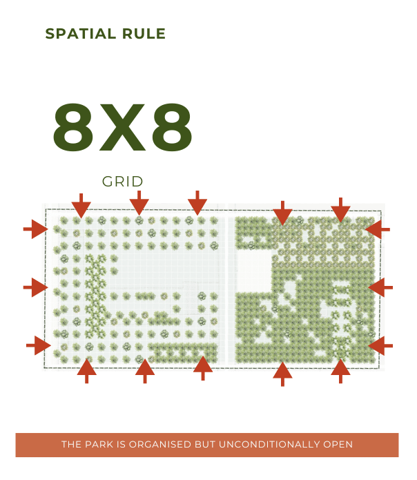
As seen from above (or from the top of the blue tower, which architecture alludes to the industrial history of the area) the trees are located following a 8×8 grid logic over a 17,500 square meter area, considering species from all the region: Betula pendula, European Birch; Fraxinus Excelsior, European Ash; Liquidambar styraciflua, Sweetgum; Paulownia tomentosa, Princess Tree; Prunus avium, Wild Cherry.
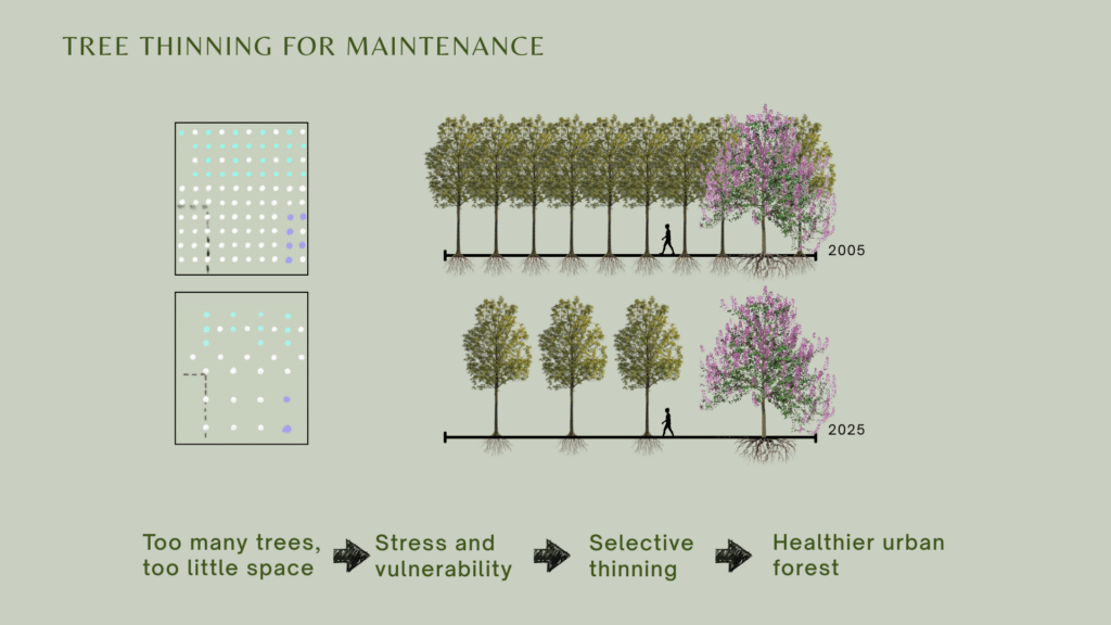
Tree Thinning
The chronology of the park tells its own story. For its opening, about 1000 young trees were planted in a 4×4 grid, twice tighter than the 8×8 grid we find today in the park. Its designed was thought to in phases, in order to reflected the regions slow transition from an industrial area to the residential and lived space it is nowadays. These phases are known as tree thinning, which is a selective removal of trees over time to allow roots to grow deeper and canopies to spread uninterrupted. However, in 2008, the very human controlled development of this park faced the spread of a fungi previously unknown to the region – the spread of the Hymenoscyphus fraxineus. This led to an unfortunate dieback of around 400 ashes in the wester section of the park. In order to prevent the spread of any future diseases or fungi, the soil was revived and strengthened by introducing 7 new species from 4 different regions of the world.
Soil Composition
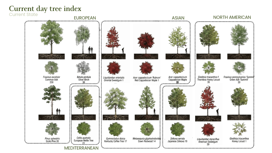
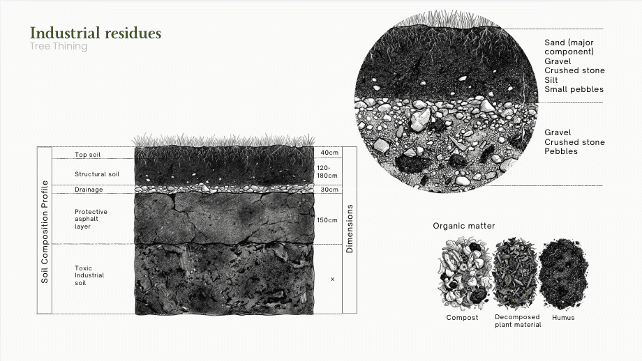
What once was an industrial part of Zurich, has now become a residential and lived neighborhood. Its transition was embodied within the concept of the park. Looking at its soil composition, the toxic residues in the original soil were isolated by placing a thick layer of asphalt. However, 2008, a fungi outbreak put in peril and killed one half of the park. Almost 400 of the Ashes in the west-wing of Oerliker had to be removed. The hymenoscyphus fraxineus spread had just spread through Zurich and European cities for the first time, and a proved effective method of increasing tree biodiversity on site was adopted to prevent future outbreaks. This process of introducing more tree species was completed in 2018. The park went from its initial 5 species — Betula pendula, European Birch; Fraxinus Excelsior, European Ash; Liquidambar styraciflua, Sweetgum; Paulownia tomentosa, Princess Tree; Prunus avium, Wild Cherry — to its current day 14 species, presented in image 5.
METHODOLOGY
The research was structured around two parallel analytical tracks that together mapped the park from its physical morphology down to patterns of use and occupation.
The first track focused on park morphology and the tree canopy, understanding how the park was designed, the tree catalogue and the evolution of the park. The second track focused on human occupancy, ground coverage, and movement paths.
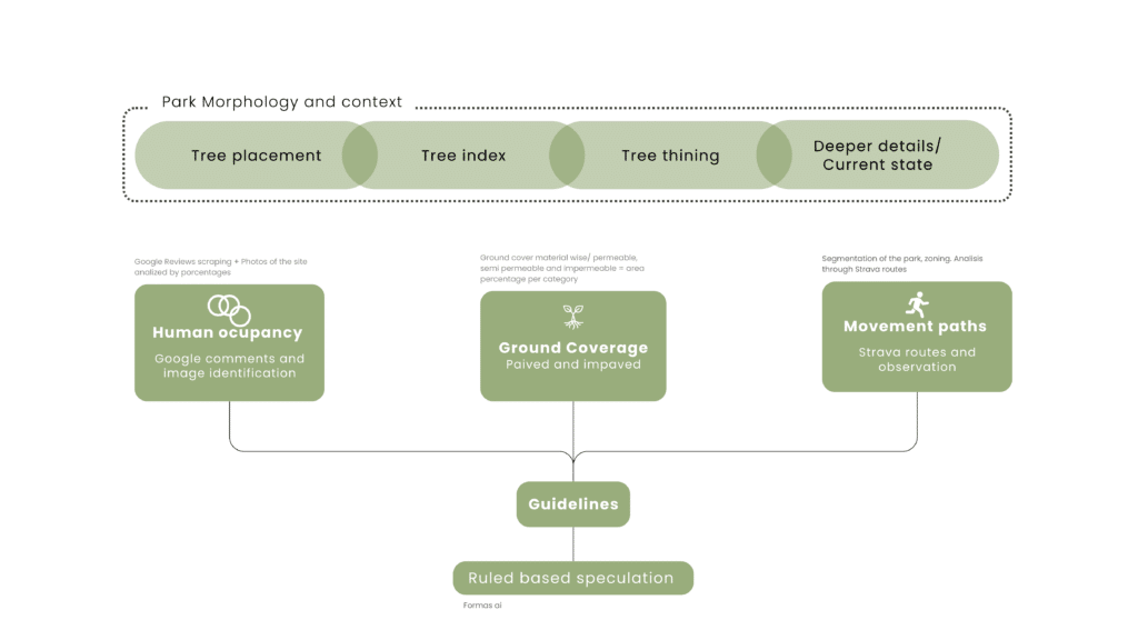
Human Occupancy
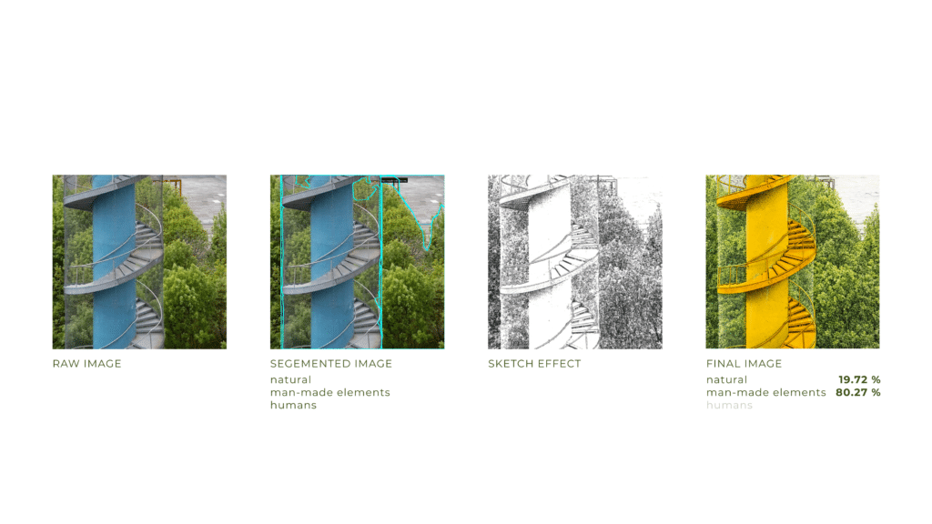
Human occupancy was analyzed through two methods: Google Reviews scraping, which gathered user-generated descriptions of how people experience and use the park, and image segmentation of site photographs using AI tools. Each photograph was processed to identify and quantify the percentage of the visual field occupied by natural elements, man-made elements, and humans respectively.
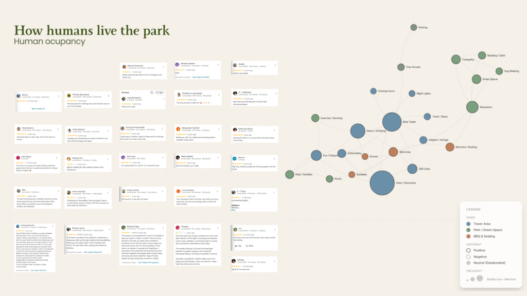
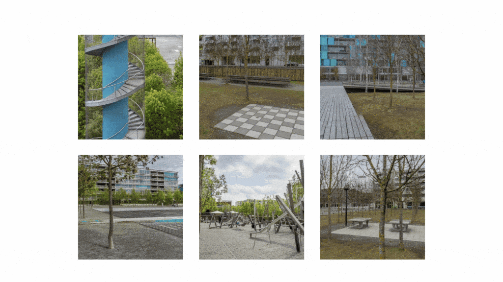
This was applied across three spatial zones identified within the park dense, transition, and sparse producing a comparative picture of where human and built infrastructure concentrates relative to ecological presence.
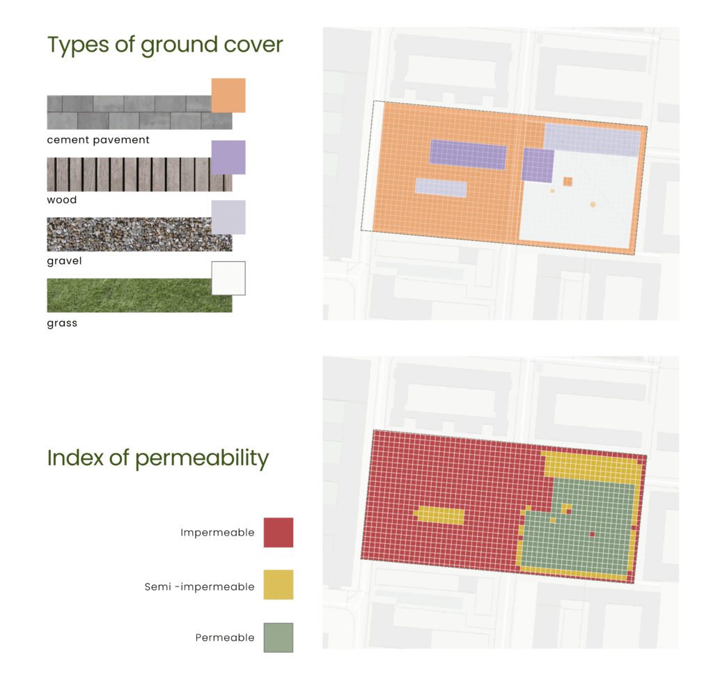
Ground coverage
Ground coverage was mapped by classifying all surface materials across the park into four types — cement pavement, wood, gravel, and grass — and then re-categorizing them by permeability into impermeable, semi-impermeable, and permeable zones, spatially quantifying the ecological capacity of each area.
Human Occupancy
Movement paths were traced using Strava route data and direct observation, mapping how people actually circulate through the park and overlaying those routes onto the permeability map to reveal where human movement and ecological sensitivity directly conflict.
The synthesis of these two tracks — canopy morphology combined with ground-level occupancy, surface permeability, and movement patterns — produced the three core guidelines that fed into the rule-based speculative design phase, where Formas AI was used to generate speculative visualizations of what the park could become under different ecological rules.
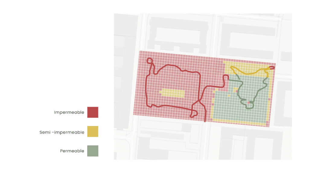
The primary pervious zone of the site functions as a circulation and recreation surface rather than a protected ecological core. Human occupation overlaps with the highest permeability surfaces, reducing their ecological restoration capacity.
GUIDELINES
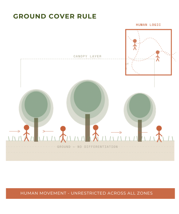
After studying our park we identifyied a set of rules the design follows in the overall image of its design, rules that are attached to its core and ideally should not be moddifyied. Identifying this rules is essencial for the further proposals of this project, deliming what we cannot do gives us a margin of what we can work with.
An example of this rules is the next one:
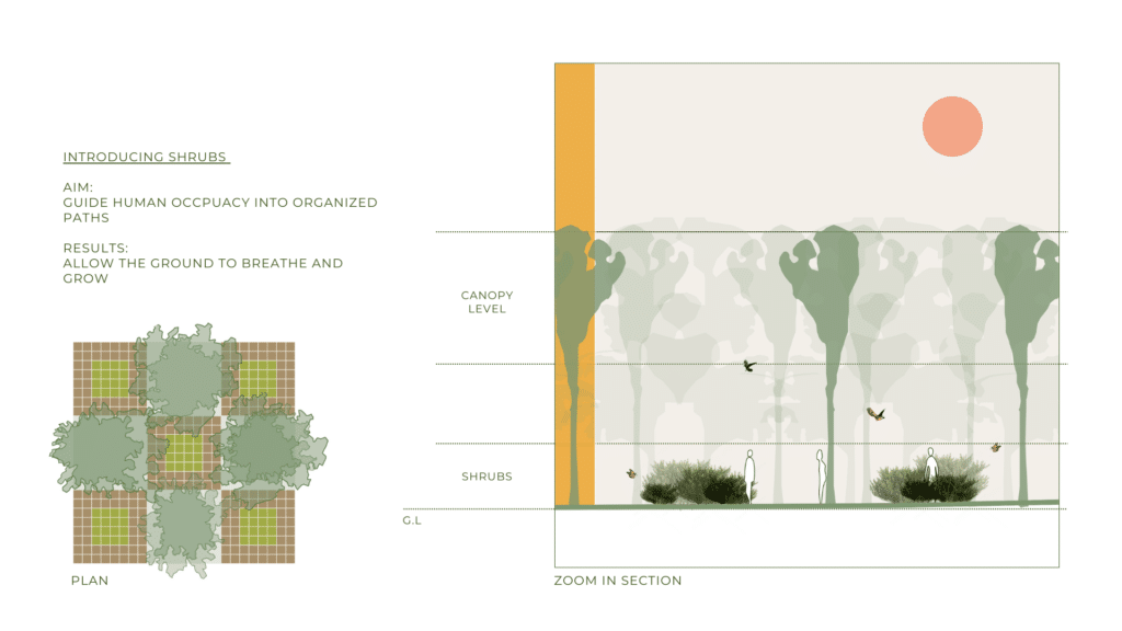
Guideline A1 – Dense understory limits disturbance and supports habitat continuity
Conclusion – Allowing dense and layered vegetation reduces trampling, noise, and edge disturbance, creating uninterrupted habitat zones for birds, insects, and soil organisms.
Recommendation – Maintain and intensify dense shrub and sub-canopy layers in non-circulation zones to create ecological cores where human access is visually possible but physically discouraged.
The proposal is deliberately simple: introduce dense shrub and sub-canopy vegetation in non-circulation zones and allow it to establish without regular clearance. The shrubs do not build walls — they build conditions. And at the shrub layer itself, flowering species introduce seasonal nectar and pollen sources that the existing tree canopy does not reliably provide, attracting insects and the birds that feed on them. The result is not a collection of added species but a set of new ecological relationships — the connective tissue of a functioning ecology that transforms the ungoverned space between human activities from a neutral void into an active, inhabited, third layer.
RULE-BASED SPECULATIVE DESIGN
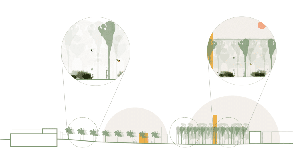
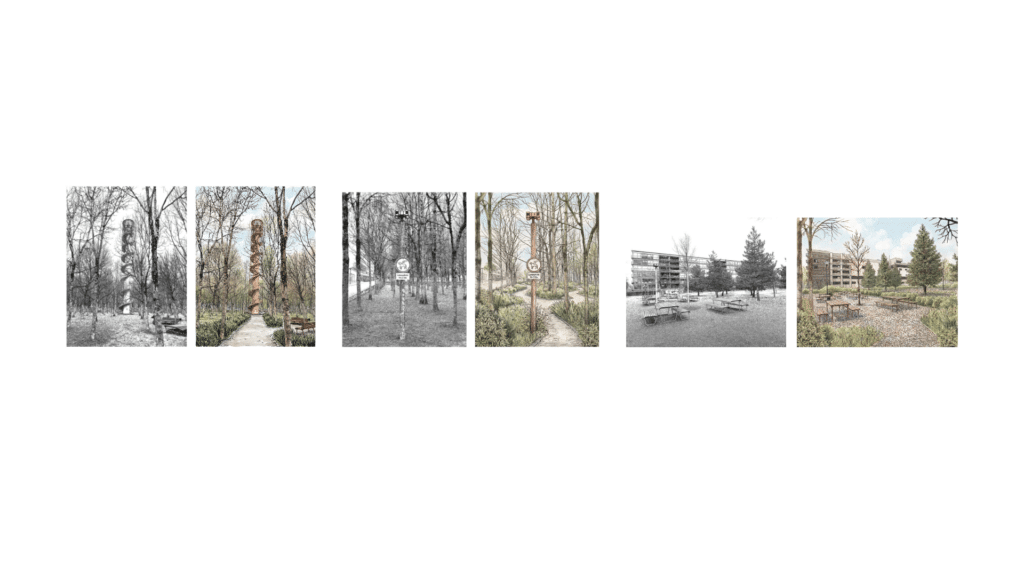
To bring these proposals into a tangible spatial reality quickly and accessibly, the team used Formas AI to generate a series of speculative renders of the park under the proposed ecological rules. The renders served as rapid visual arguments, a way of communicating what the dense vegetated zone and the sparse vegetated zone could feel like once the shrub layer is introduced.
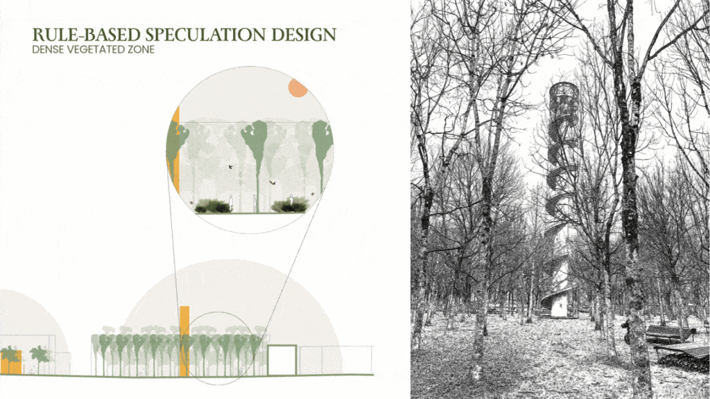
These images are not prescriptive designs but rule-based speculative design an imaginative solution to explore possibilities to reduce human occupancy within the park, and its effect on biodiversity. For this exercise, we imagined the calculated introduction of shrubs, alongside well defined paths intended to guide human behavior across the park. Reducing human footprint on the soil, would allow the soil to breathe and its vegetation to grow denser.
Author notes
Our team had the opportunity to isit the park. We entered around 9 AM on an overcast morning in February, joining dog walkers, parents with strollers, and kids making their way to the swing set. That north-south divide is one of the more striking things about the park. The northern half has a denser, more intentional grid of mature trees, mossy and grassy ground cover, and gravel paths with rocks that double as informal tree guards. The southern half feels more open and exposed, with wooded permeable surfacing and benches oriented in different directions – some facing inward toward each other, some turned outward. The two halves are separated by a road with painted bike lanes and traffic (mainly a bus line) running through it, which gives the park an interesting yet maybe unintended fragmented feel. Garbage cans with doggy waste bags are everywhere (I counted five from where I was sitting). The climbable blue chimney tower both reference the industrial history of the site, while providing a new perspective to the Alps and the trees below. There are far more humans I spotted between 9 am and 11 am than birds or any species my eyes could spot. A father we spoke with mentioned he comes regularly with his children precisely because it’s close to home. He noted the summers get really hot, particularly on the southern end near the play structure, where the trees are noticeably younger and thinner.
Oerliker Park Zurich North « Landezine International Landscape Award LILA. n.d. https://landezine-award.com/oerliker-park/.
Weilacher, Udo, ed. 2005. “Oerliker Park in Zurich.” In In Gardens: Profiles of Contemporary European Landscape Architecture. Birkhäuser. https://doi.org/10.1007/3-7643-7662-7_21.
