 Urban Data introduces students to the practice of exploring and analyzing urban data, focusing on how to gather, examine, compare, and communicate geospatial information. The course provides a practical entry point to geospatial analysis using Python, the most widely adopted scripting language in data science, thanks to its accessible syntax and extensive ecosystem of libraries.
 Deforestation, Land Cover, & Urbanization In Brasil – Dashboard
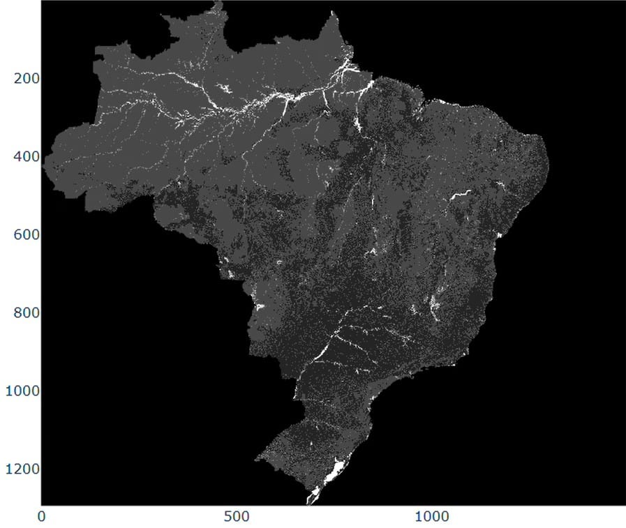
Deforestation Raster Map – 2024 The visualization depicts accumulated and annual deforestation patterns in Brazil from 1985 to 2024. The accumulated dataset shows a continuous rise in total deforested areas, reaching over 140 milllion hectares. Annual trends reveal strong fluctuations, with peaks in the late 1980’s and mid-2000’s, followed by decreases and renewed variability in … Read more