sen.city – Sense urban heat and plant cooler futures for everyone
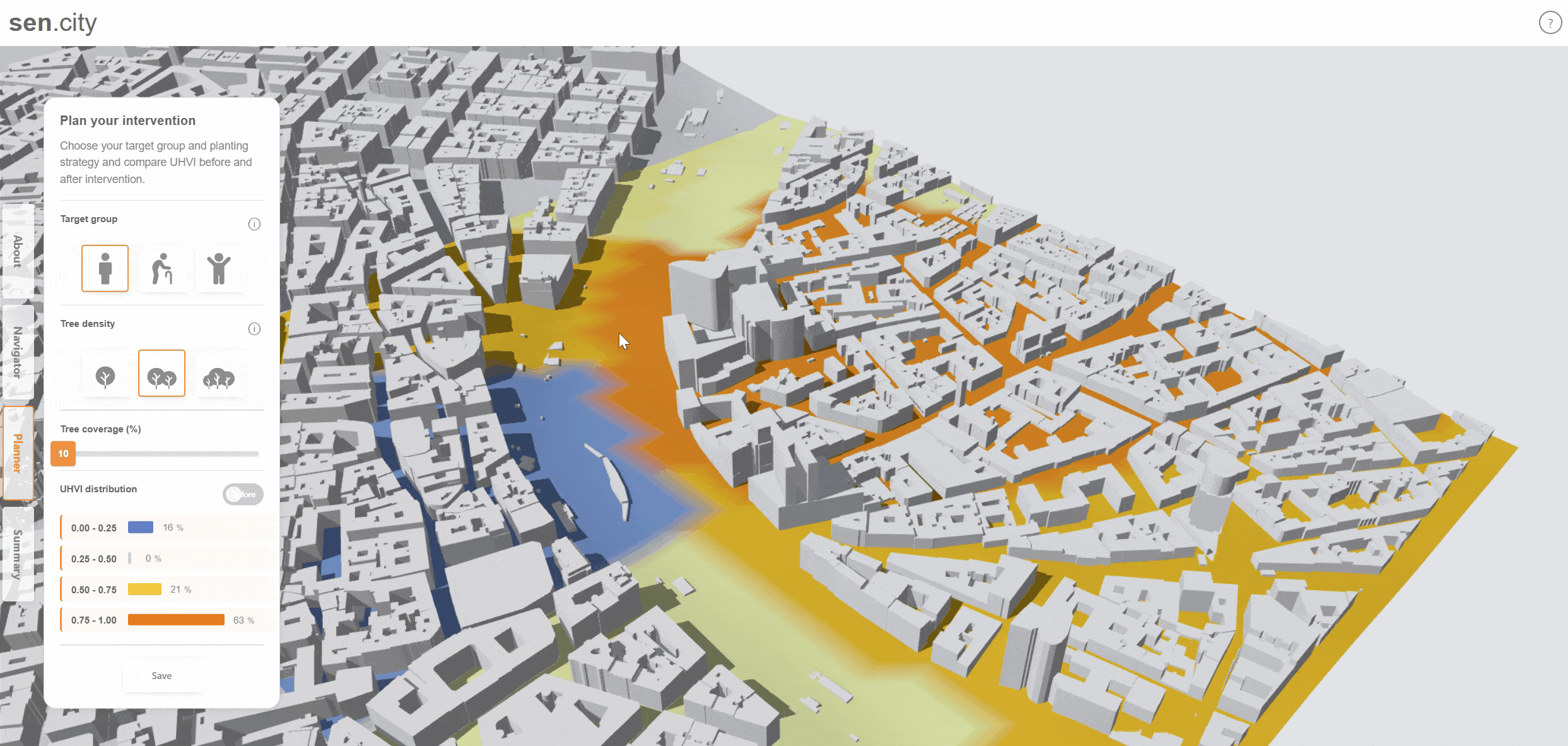
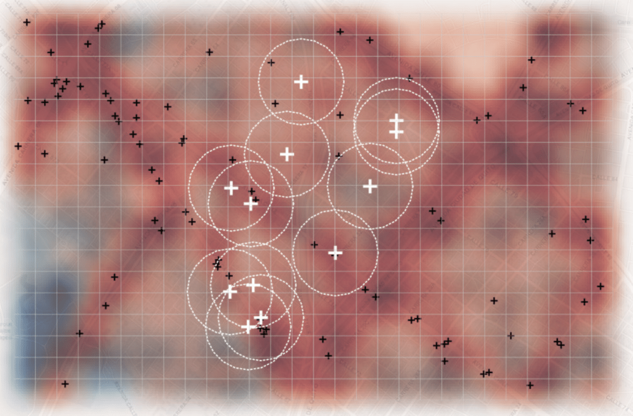
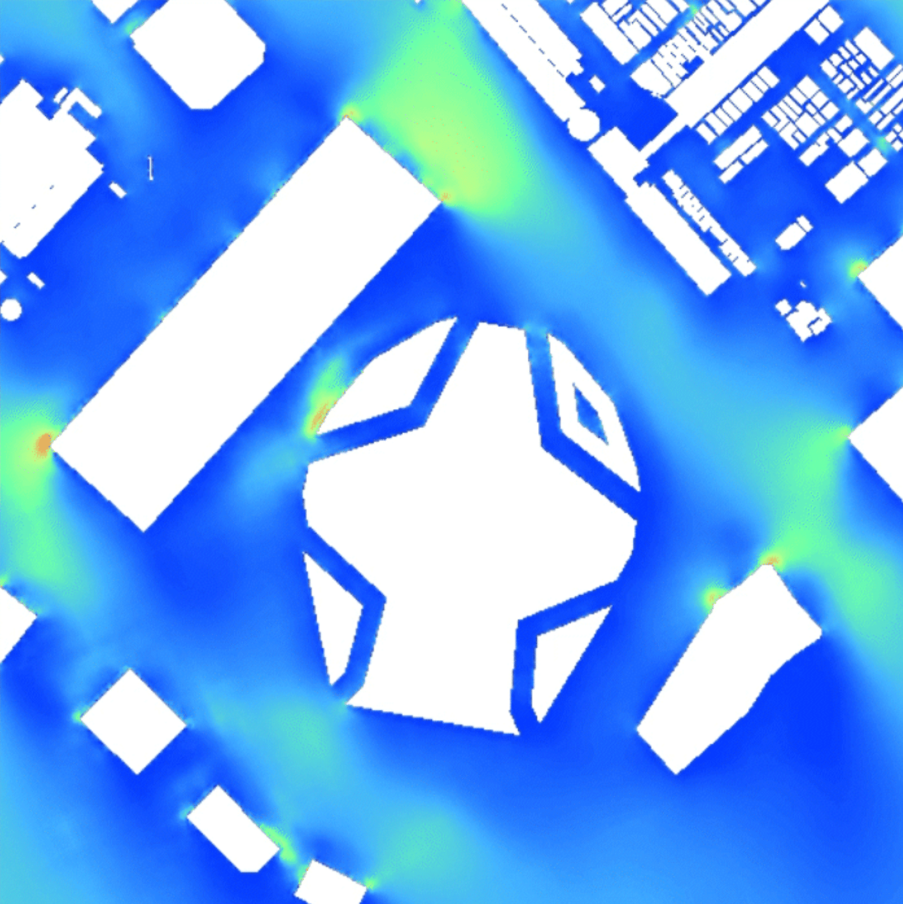
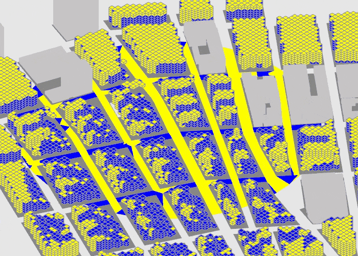
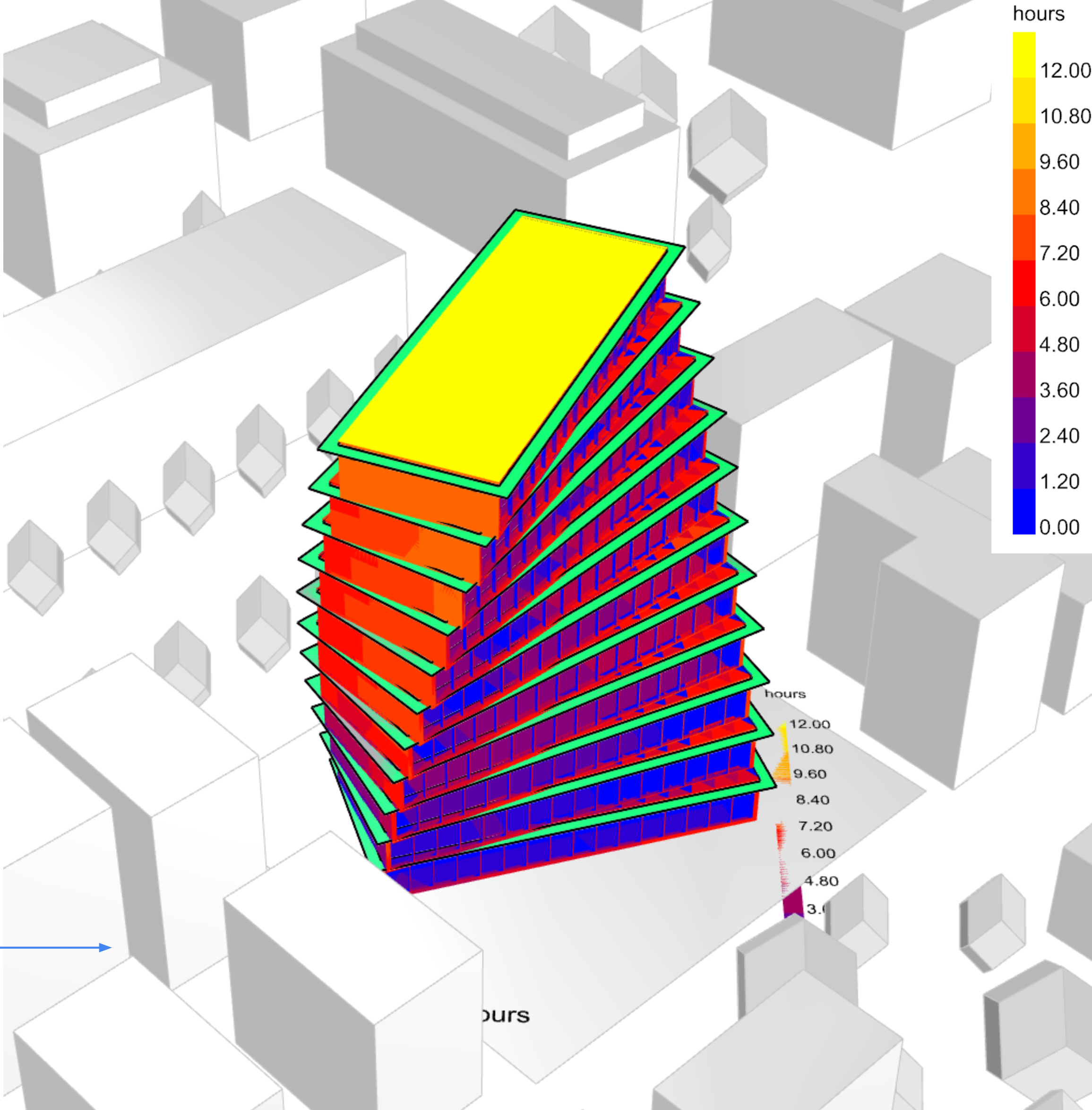
Cities are warming rapidly, and dense urban centers feel it the most — especially areas with little shade or vegetation. Heat doesn’t affect everyone equally: groups like the elderly, youth, and people with health conditions are far more vulnerable. Problem Statement Most existing tools focus on UTCI, the Universal Thermal Climate Index. It measures how … Read more