
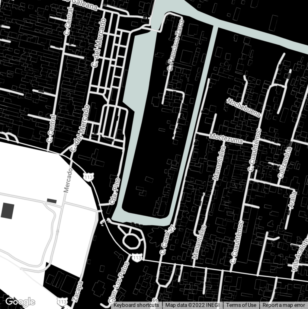
Site Location: Xochimilco, Mexico

Xochimilco is a borough of Mexico City. The borough is centered on the formerly independent city of Xochimilco, which was established on what was the southern shore of Lake Xochimilco in the pre-colonial period.
Today, the borough consists of the 18 barrios, or neighborhoods, of this city along with 14 pueblos, or villages, that surround it, covering an area of 125 km2 (48 sq mi). The borough is in the southeastern part of the city and has an identity that is separate from the historic center of Mexico City, due to its historic separation from that city during most of its history.
Xochimilco is best known for its canals, which are left from what was an extensive lake and canal system that connected most of the settlements of the Valley of Mexico. These canals, along with artificial islands called chinampas, attract tourists and other city residents to ride on colorful gondola-like boats called trajineras around the 170 km (110 mi) of canals. This canal and chinampa system, as a vestige of the area’s pre-colonial past, has made Xochimilco a World Heritage Site.
San Jerónimo, Xochimilco,
16420 Ciudad de México, CDMX
Lat: 19.42°
Lon: -99.15°
Köppen Climate: Cwd (Subtropical Highland)
What is the origin of Xochimilco?
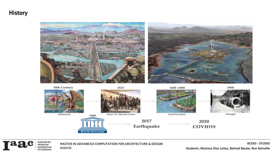
The origins of Xochimilco date back to the Mesoamerican Preclassic Period when its shores and islands were home to various peoples. At the beginning of the Postclassic, Xochimilco was an important area that was subdued by the Aztecs in the 15th century. After the arrival of the Spanish, Hernán Cortés decided to only keep Xochimilco as the only place in Mexico City that still functioned through canals and chinampas, they were allowed to retain some of their local traditions and their identity as a people. The population continued to be mainly indigenous, so the intervention of the children, grandchildren and descendants of the natives facilitated control of the neighborhoods and towns dependent on this capital. Xochimilco was a food bastion for the capital and other riverside towns; In the 17th century, more than a thousand trajineras entered daily, a flow considered unique in the world at that time and which it maintained for a long time.
The Porfiriato is a term given to the period when General Porfirio Díaz ruled Mexico as president in the late 19th and early 20th centuries, during this time one of the most important works for this place was the construction of the aqueduct that piped the springs of Xochimilco, to supply water to Mexico City, since it lacked sufficient supply, he tried to drained the canals of Xochimilco and that damaged the whole area. With the aim of rescuing and preserving its resources, in 1986 the rural and lake area of ??Xochimilco as a prelude to the declaration of Xochimilco as a “Cultural and Natural Heritage of Humanity” by UNESCO.
Manifesto
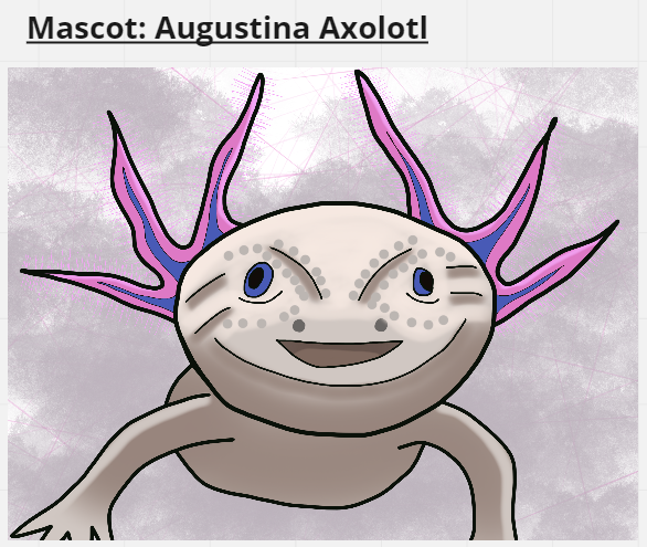
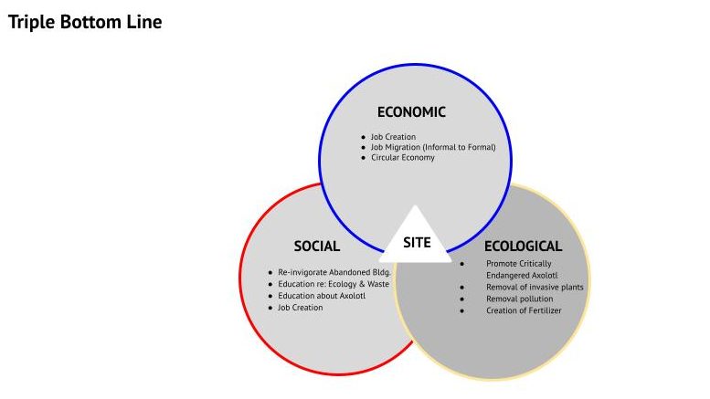
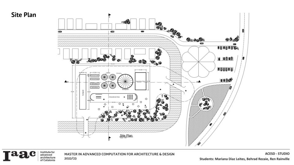
This project is devoted to the Axolotl, which lives in the canals of Xochimilco. After years of trash pollution and chemical fertilizers, the introduction of invasive plants and fish the axolotl is threatened, listed as Critically Endangered. The axolotl is an amazing creature with the ability to regenerate their limbs and even organs. The axolotl’s regenerative quality is the basis of our project, where a mini biogas facility will help process waste and educate the public. Placing this facility on this site is important because of the existing tourist trade of the Trajineras, a frequented attraction on weekends for those in and around Mexico City and some foreign tourists. Removal of trash and invasive organics from the canals will aid in natural regeneration through composting (returning valuable inputs to local farmers instead of chemicals) as well as generating energy and heat from biogas produced in a bio-digester which can handle a variety of waste.


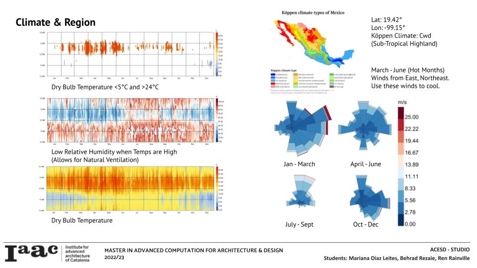
Using ladybug tools we understood the climate as subtropical, it’s overall hot all year long. When its hot, the humidity is low, we propose natural ventilation as a potential option for our project.
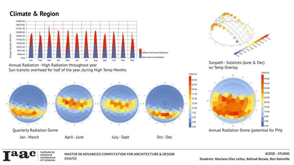
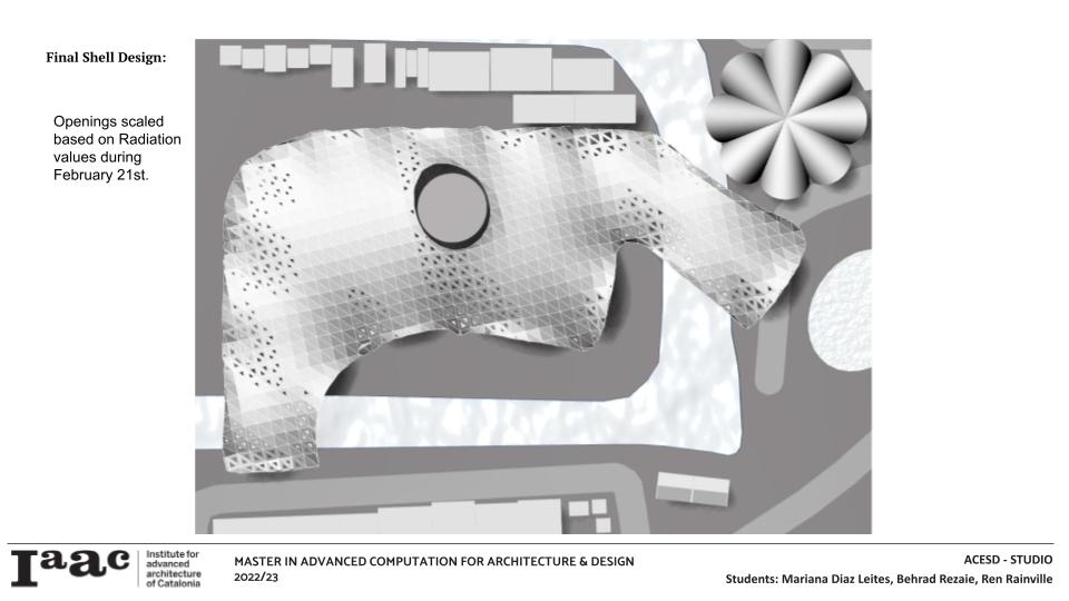
The dominant wind comes from the north east where the private area of the project and the compost are. Radiation is mostly right over head so the shell is right above and it gives that protection while the sides are open.
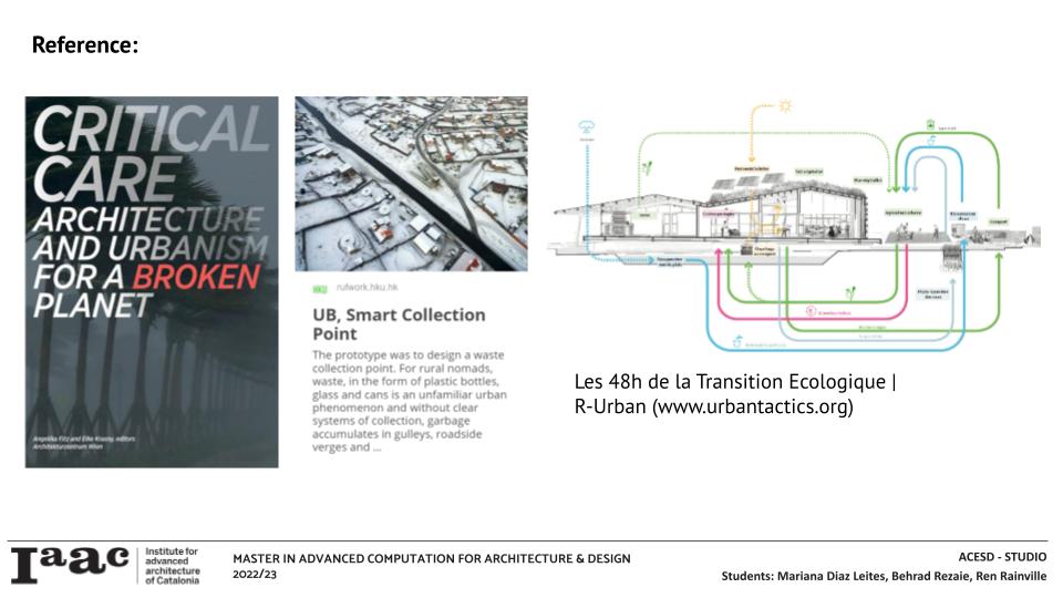
While planning the project, we explored references and realized that the regenerative concept is something that cities need.
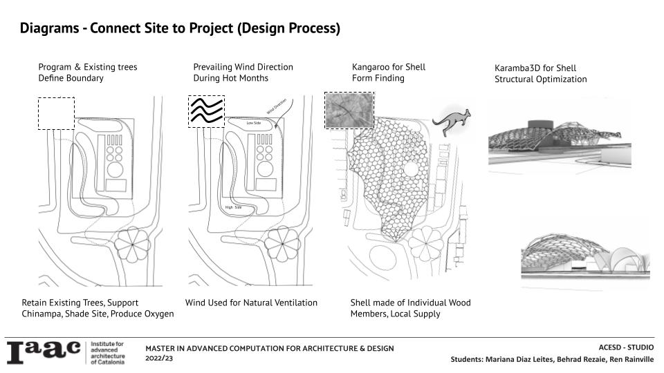

The project program is based on respecting nature as much as possible, the chinampas depend entirely on the support of the trees anchored to the water, so we took it into account and in addition to turning it into a regenerative place, we placed a shell where only certain support points touch the ground, just like Felix Candela does with his neighboring building.
The program consists of a place to eat / lounge, an educational area, compost for the community, a biogas factory for energy, gas, fertilizer and food waste / invasion of water lilies from the canals.


Inspired by how Félix Candela also intervenes on the site, on the other side of the lake.

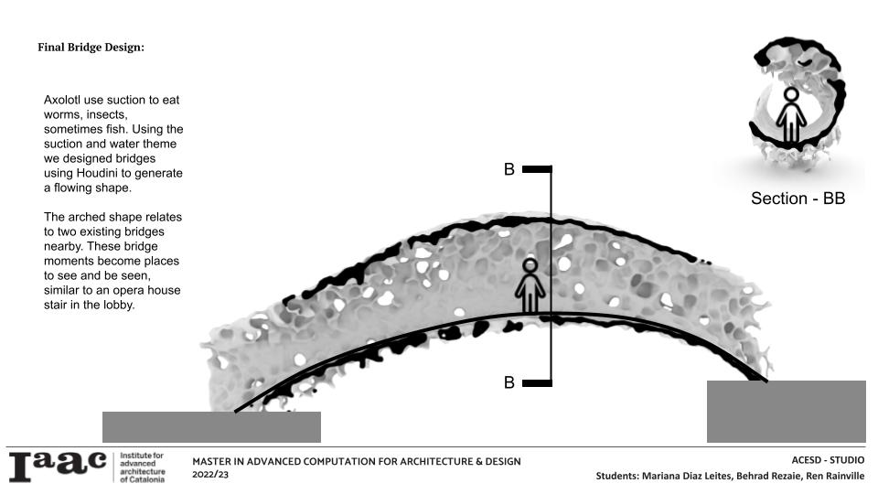
To make the project more accessible and connect the two main sides of the area, we propose two bridges. One will be from the main street where the restaurant Los Manantiales de Félix Candela is located and a park with green areas On the East side there will be the other brdige where there is the pier for locals and tourists to take a boat ride in a trajinera.

hhh
References:
https://i.pinimg.com/originals/0c/42/04/0c42049f2c4efab1b1bed25ad378a6f0.png
Pin on Architecture
www.pinterest.es
https://i.pinimg.com/originals/e9/10/8c/e9108cf6a1a75488b2baad4f70fb8878.jpg
Pin de Urbanity Mobiliario en Architecture & Spaces | Felix candela, Arquitectura clásica …
www.pinterest.es
https://es.wikiarquitectura.com/index.php/Archivo:Los_Manantiales_(4).jpg
Mexico: Mexico City – Xochimilco
https://www.mexicolore.co.uk/aztecs/spanish-invasion/encounters-countdown-4
https://www.journeymexico.com/itinerary/axolotls-and-chinampas-in-xochimilco
Flow diagram of the full-scale biogas plant. | Download Scientific Diagram (researchgate.net)
Thank You!
