
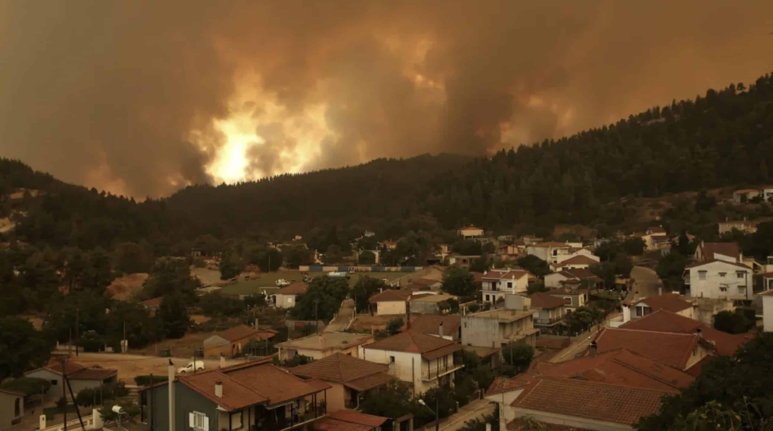
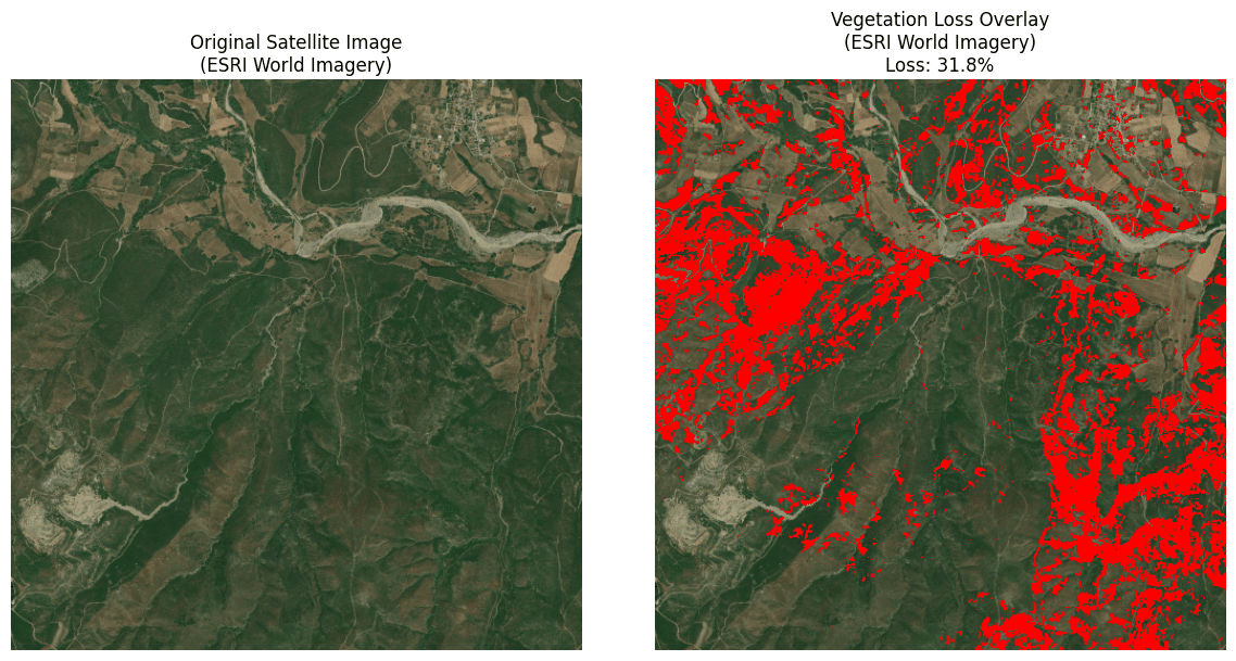
This project focuses on Evia, Greece, where devastating wildfires in the summers of 2021 and 2023 caused massive environmental damage. This is only an example, but this pipeline could be applied to any wild-fire affected area. Our aim is to quantify green loss and monitor post-fire ecosystem recovery. Thus we compare satellite imagery from key dates (July 2017 and July 2023) to assess vegetation changes.
Two methods are used: high-resolution RGB analysis from OSM imagery for surface material detection, and multispectral analysis from Google Earth Engine (GEE) for calculating vegetation indices like NDVI.Key performance indicator (KPIs) is the percentage of vegetation loss and regain, helping us measure the fire’s environmental impact and guide reforestation and prevention strategies.
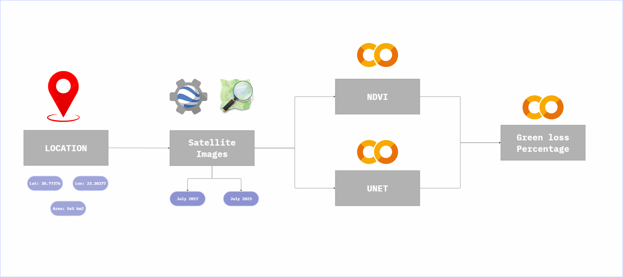
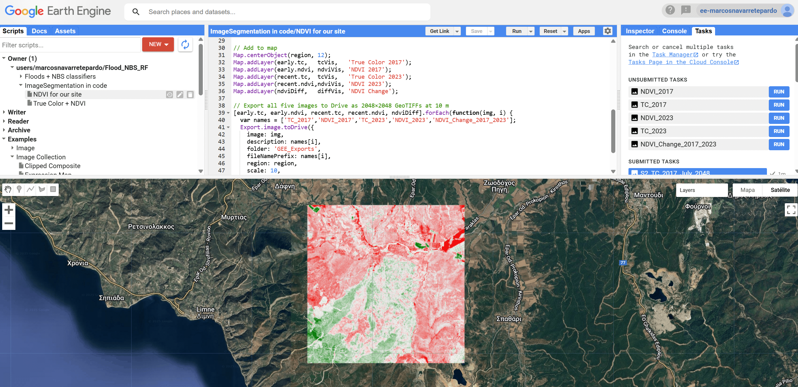
The first step was to create a Google Earth Engine code for retrieving NDVI data for 2017 and 2023, the code also generated the difference between them in geotiff format, giving increased and lost NDVI trends. Geotiffs are then imported for treatment in this code, thorugh Open-CV.
We managed to combine NDVI loss data with U-Net’s forest segmentation results to define a final KPI: forest areas that lost NDVI between 2017 and 2023—likely representing zones affected by wildfires.
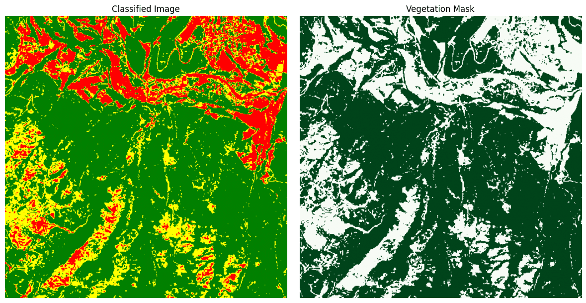
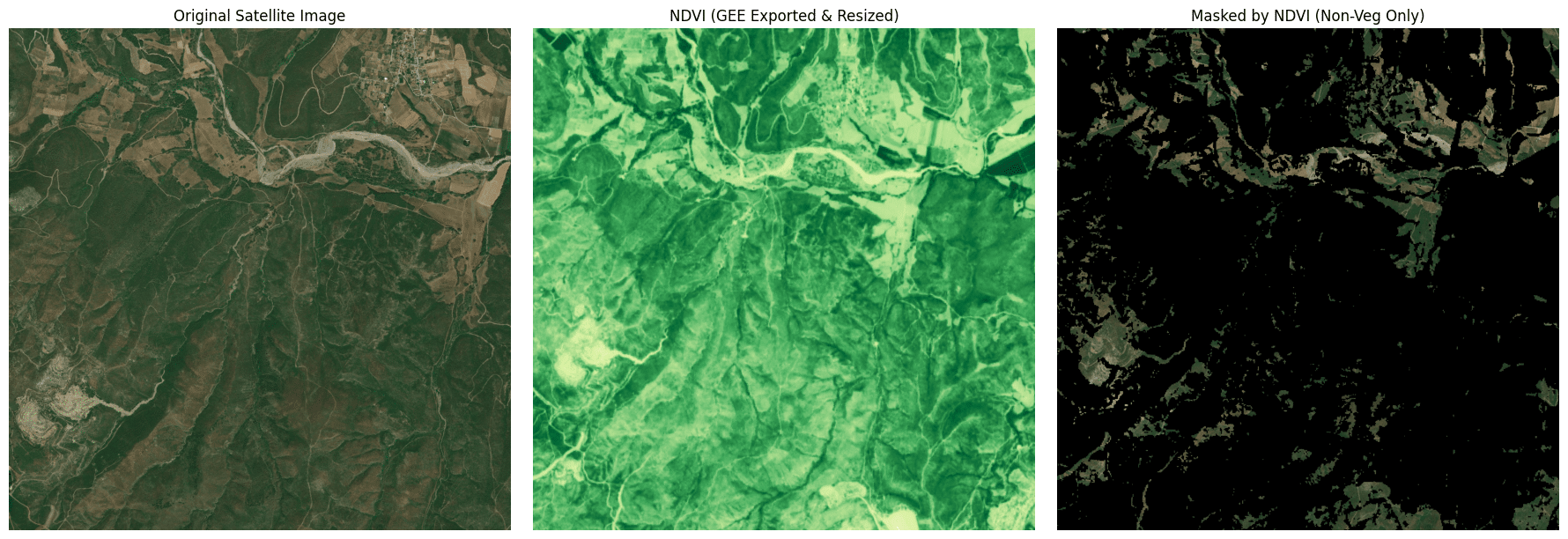
Since U-Net often confused crops with buildings we attempted to correct this by subtracting NDVI greenery from the U-Net results to isolate non-vegetated (potentially urban) areas, but the misalighnment that might be caused by a projection error because mismatching procedures between GEE and OSM prevented accurate overlay. Thus we decided to get only vegetation from UNet classification because we are 100% sure that it is the forest. Later we are combining vegetation layer with NDVI trend (2017-2023) to analyse the forest loss.
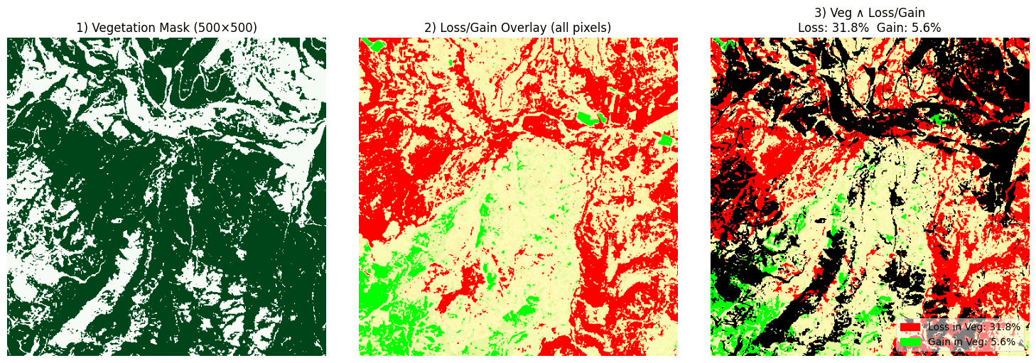
The final analysis showed a significant vegetation loss of up to 31.8%, with only 5.6% regain, indicating the wildfires were devastating and highlighting the urgent need for replanting and ecological restoration efforts.
