
Context
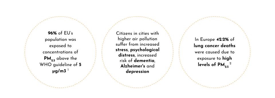
1 (2022) Europe’s air quality status 2022 [Preprint]. European Environment Agency. Available at: https://www.eea.europa.eu/publications/status-of-air-quality-in-Europe-2022/europes-air-quality-status-2022
2 WHO global air quality guidelines. Particulate matter (PM2.5 and PM10), ozone, nitrogen dioxide, sulfur dioxide and carbon monoxide. Geneva: World Health Organization; 2021. Licence: CC?BYNCSA?3.0?IGO
Problem Statement
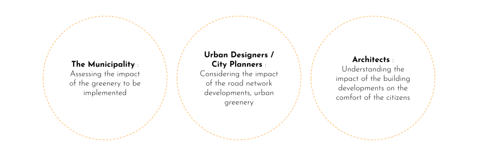
Urban designers and city planners are not able to predict the impact of the developments planned in the urban environment on the air comfort of the development zone.
Solution
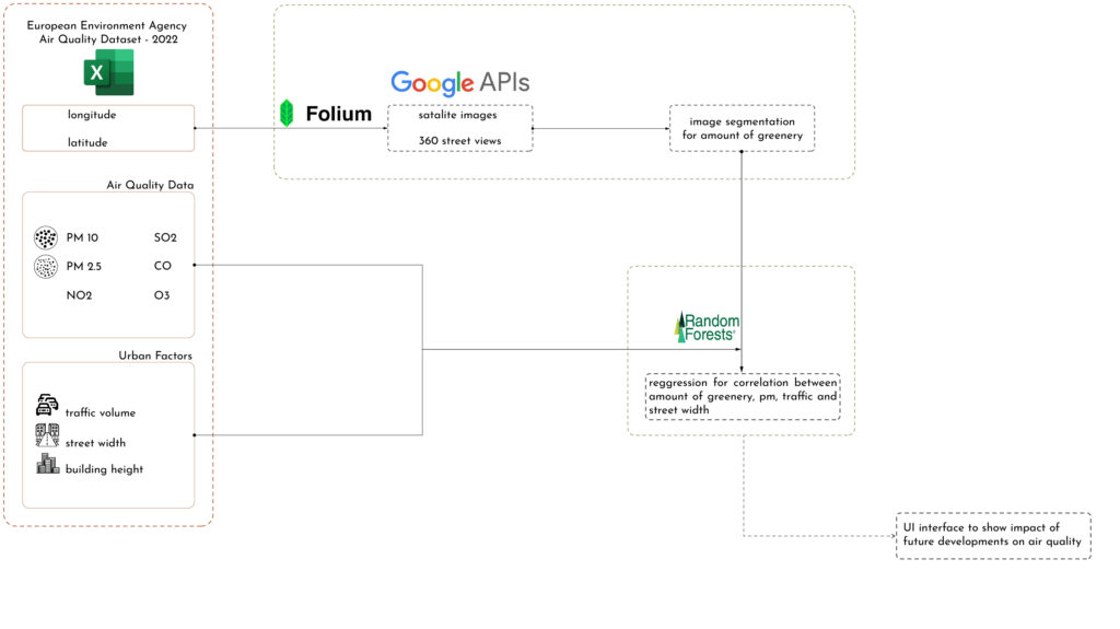
The result will be an environmental impact assessment tool for the municipalities and urban designers to analyse the impact of vegetation to be implemented, addition of new road networks and buildings on the air comfort of the development zone.
Methodology Diagram
Use-Cases
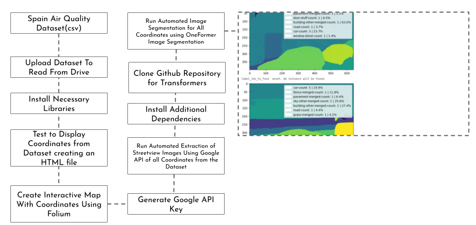
AI Workflow
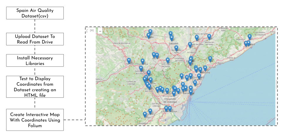
I – Linking Geo-locations from Dataset to Google Earth
I – Interactive Google Map of Geo-locations derived from the Dataset using a Google API Key

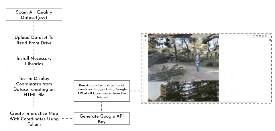
II – Automated Extraction of Google Streetview Images from Geo-locations derived from the Dataset
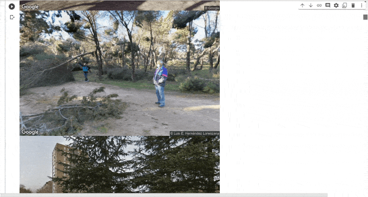
III – Automated Image Segmentation Experimentation from Geo-Locations based on Dataset
III (a) – Experiments with Automated B&W Line Drawing Image Segmentation of Google Streetview Images from Geo-locations derived from the Dataset using Canny

III (b) – Experiments with Automated Colored Image Segmentation of Google Streetview Images from Geo-locations derived from the Dataset using Canny
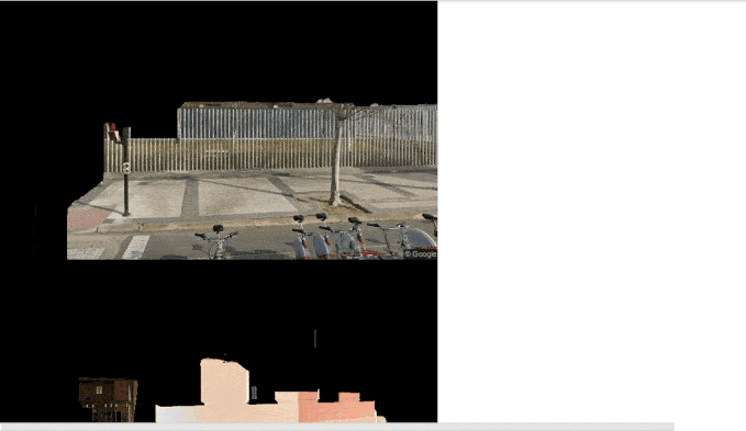
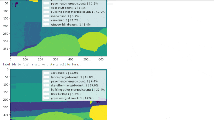
Final Image Segmentation | OneFormer
III (c) – Automated OneFormer Image Segmentation of Google Streetview Images from Geo-locations based on Dataset
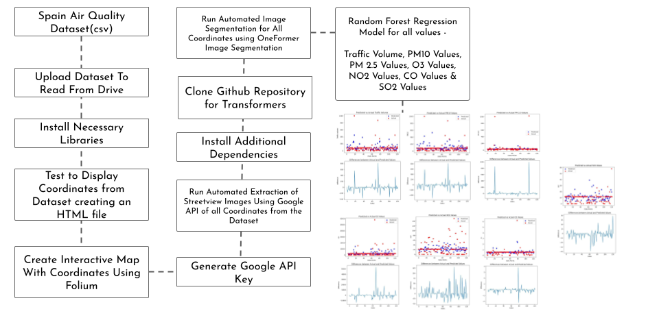
IV – Regression Model | Random Forest
IV – Developing a Prediction based
Random Forest Regression Model on each value from the Dataset

AI Workflow – Breakdown
AI Workflow – Step I

AI Workflow – Step II
AI Workflow – Step III
AI Workflow – Step IV
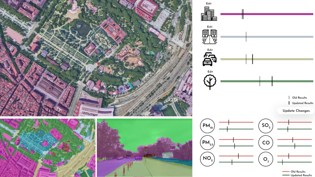
Use-cases | Platform – First Mock-up
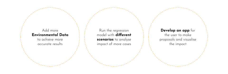
Roadmap | Next Steps
Link to Github :
