Go Passive
A web application that analyses an IFC building model and recommends passive cooling strategies for Mediterranean climates. Upload a building, place it on the map, set its orientation, and get a ranked set of design interventions backed by a knowledge graph and Claude AI. The tool helps architects explore the passive strategies of their building … Read more
inHabit – Rethinking Residential Layout Search with Spatial Intelligence
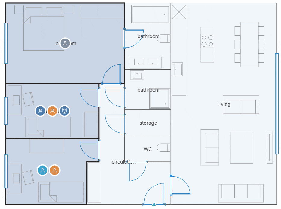
Introduction Finding the right home isn’t just about square meters or the number of bedrooms. A floor plan that works beautifully for one household can be completely unsuitable for another. Parents with young children, remote workers, retirees, or pet owners all experience the same space differently. Yet today’s search tools still rely on simple filters … Read more
Sensi: Making Comfort a Design Layer

Building Sensi, a sensory copilot for architectural floor plans. In architecture, we model everything. Structure, cost, energy, code compliance. Layer after layer of analysis that makes a building accountable before it’s built. But one thing was missing from the stack: how the space will actually feel. Not feel as in emotion. Feel as in the … Read more
PermanenceOS
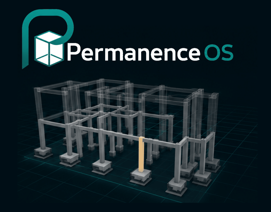
Every design decision has a structure. For the AI studio seminar, we built PermanenceOS , a structural intelligence platform that helps architects understand the consequences of early design decisions, before they get expensive to change. The Core Problem In early design, structural decisions get locked in fast and by the time the engineer is brought … Read more
A Systematic Review of Toronto Architectural Heritage Register
Applying CLIP vector embeddings to defensibly evaluate the architectural value of heritage-listed buildings Project Summary Project Presentation
PlanWise: Spatial Cost Copilot
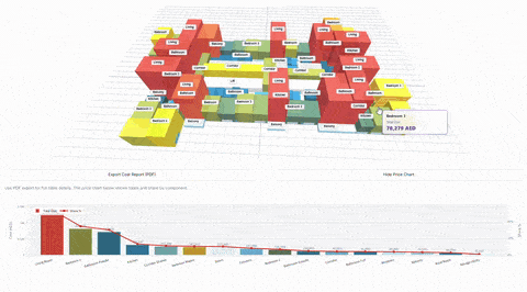
In the traditional Architecture, Engineering, and Construction (AEC) industry, there is a painful disconnect between the creation of geometry and the calculation of its cost. Architects design in spatial environments (CAD, BIM), while Quantity Surveyors and estimators work in abstract spreadsheets. The result? Budget overruns are usually discovered weeks after a design phase concludes, leading … Read more
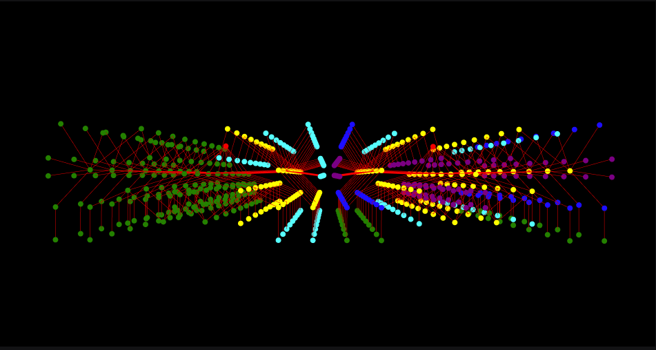
Designing for Encounter: How Spatial Analysis Reveals the Social Potential of Circulation Spaces
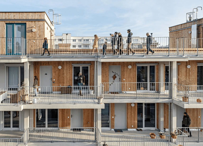
Introduction When we imagine a corridor in a typical apartment building, we picture a purely functional passageway — a space designed for movement, not for meeting. These circulation zones are often long, narrow, and socially inert. Yet they structure much of our daily experience of housing, shaping how residents encounter one another. Cohousing projects show … Read more
Brownstones

For the Graph Machine Learning (ML) seminar we took a classic New York brownstone and asked how graph ML can read the way a building is organized, and what happens when that organization changes. Objective: Our goal was to model an old and a new brownstone layout as spatial graphs in TopologicPy, compare how the … Read more
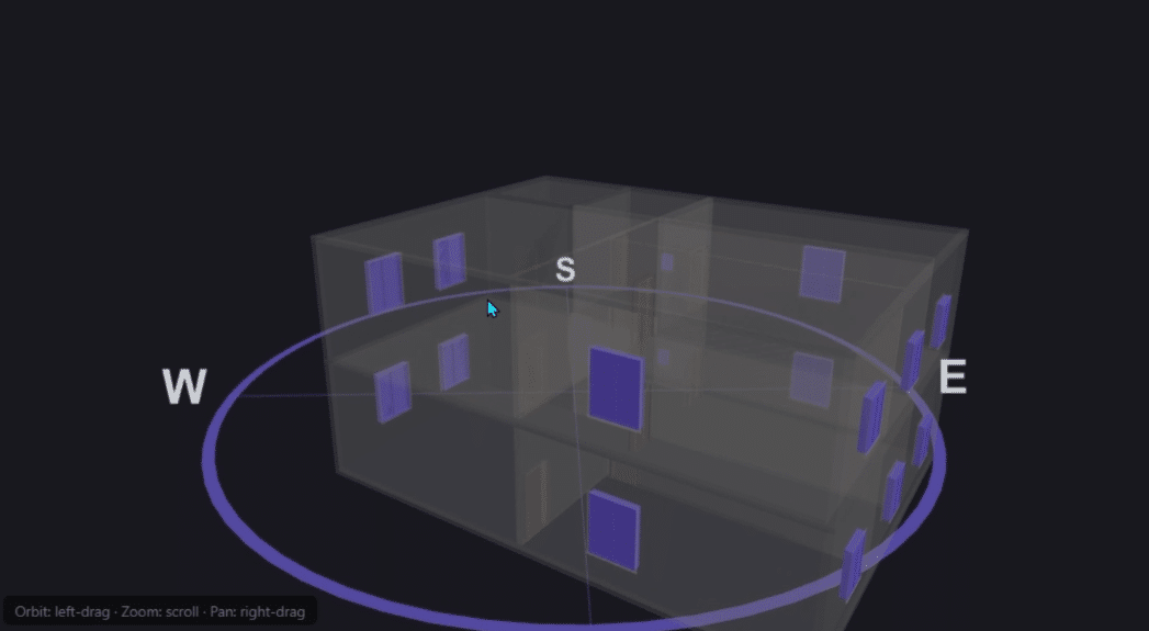
Analyzing Narkomfin Through Its Graph

The building The Narkomfin Building was completed in 1930 in Moscow, designed by Moisei Ginzburg and Ignaty Milinis. It is one of the most recognized examples of Soviet Constructivist housing — a dom-kommuna, or communal house. The design was deliberately unconventional: kitchens were minimal because residents were expected to eat in a shared canteen, and living … Read more
SURROUND

Turning pollution data into planning decisions. TEAM: Martina Simoni , Rim Choufani, Rashi Desadla, Bhavana Priya B INTRODUCTION Kraków’s air quality problem isn’t abstract. It’s measurable, and it’s bad. Over six sessions, our team (Rim, Martina, Rashi, and Bhavana) used the CRISP-DM framework to ask a focused question: can urban form (building density, road networks, … Read more
Crafty Studio
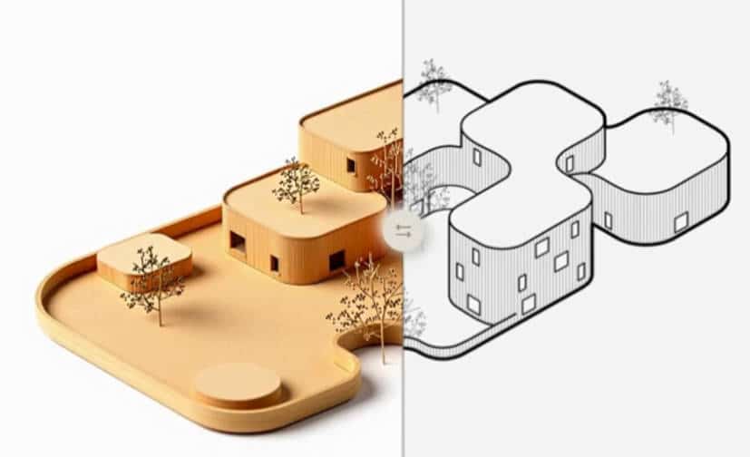
Every great building begins as a small model and a messy desk Abstract As architects we spend hours making physical study models, cutting foam, assembling balsa, running the 3D printer. These models are essential, but the process is slow. Crafty Studio asks a simple question: “What if you could see your design as a physical … Read more
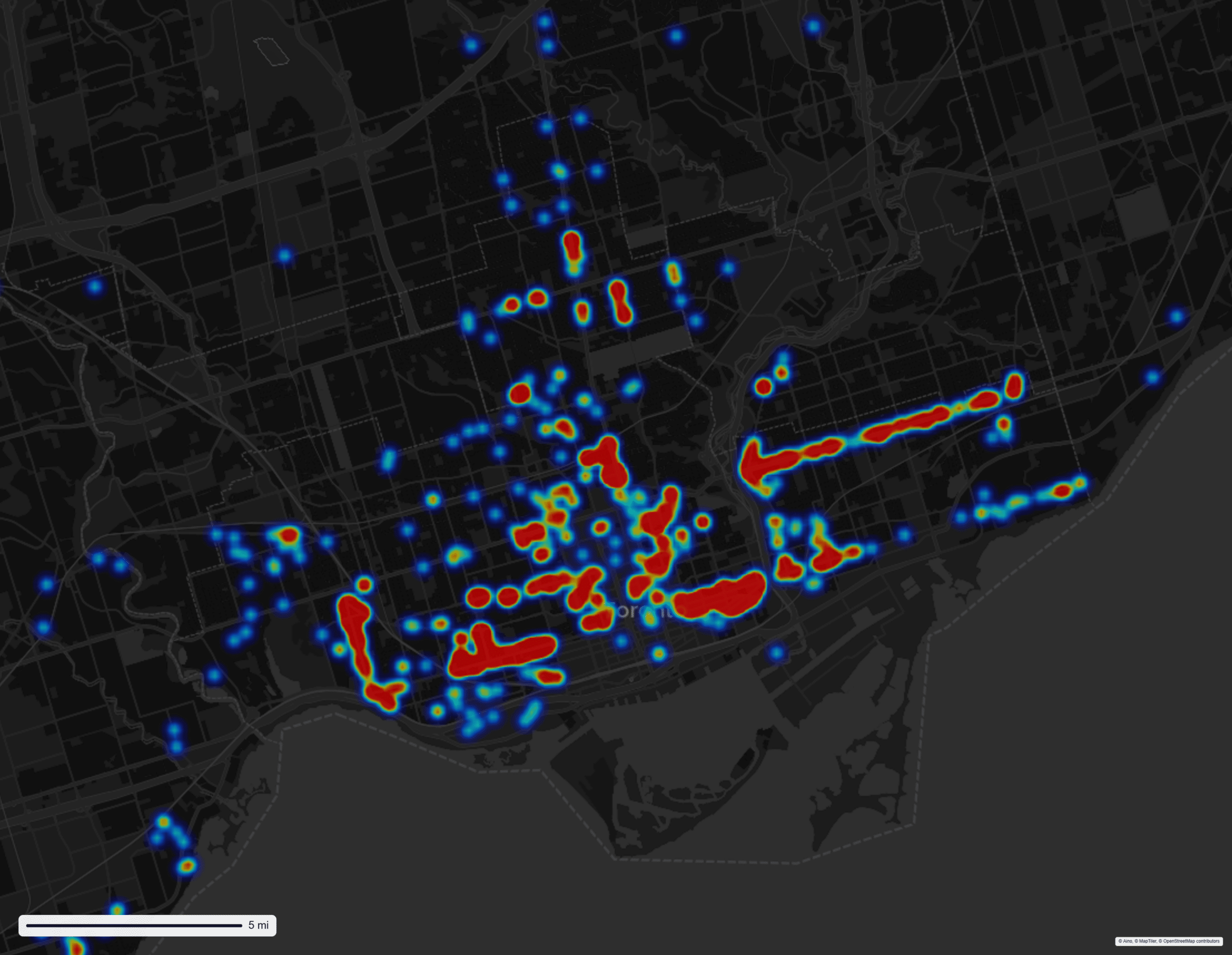
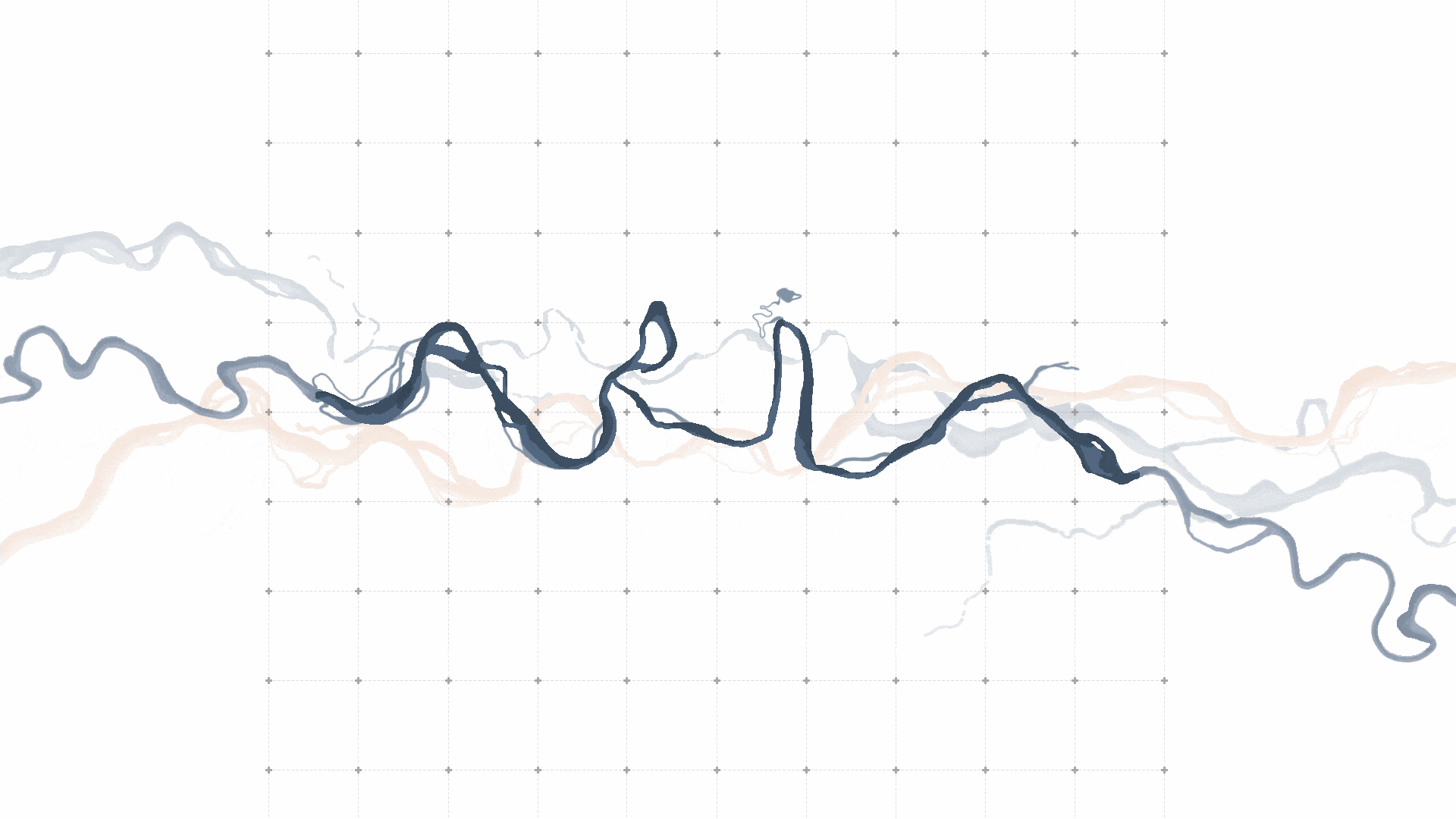
Beyond the Data Point: A Counter-Cartography of People on the Move through Mexico’s Vertical Border

“Power is not something you possess, it is something you exercise”– Michel Foucault With this phrase by Michel Foucault, I would like to invite you, reader, to adopt a lens focused on power relations as you move through this blog post. The first power dynamic I would like to highlight is the asymmetrical relationship between … Read more
Between Ritual and River
Ecological Renewal of Ghats Website Link: https://aria-final.vercel.app/ Statement “While industrial and sewage pollution receive significant attention in river conservation efforts. Ritual pollution stemming from religious and cultural practices remains largely unaddressed due to its sensitive nature. But it contributes substantially to river degradation and requires culturally respectful solutions.” Sacred Sites Across every continent and culture, rivers … Read more