
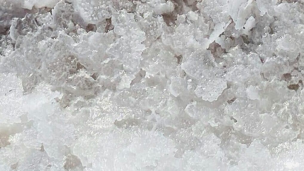
Salt is an essential mineral for humans and animals alike. When consumed, it breaks down into sodium and chloride – elements vital to muscle and nerve function, fluid balance, and the regulation of blood pressure and pH levels. Because sodium is lost through sweat, both humans and animals must replenish it to maintain physiological stability; in the wild, many animals obtain salt by licking natural mineral deposits. For centuries, humans have developed increasingly efficient methods to extract salt in large quantities, rendering the process both industrialized and largely invisible despite its necessity. Depending on geography, salt can be mined from underground rock deposits or extracted from brine through solution mining – techniques often used for chemical and industrial production. The salt most commonly found on dining tables, however, is produced through solar evaporation, a centuries-old method in which seawater is channeled into shallow ponds and left to dry under the sun.
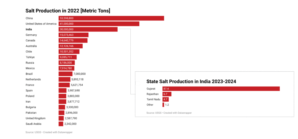
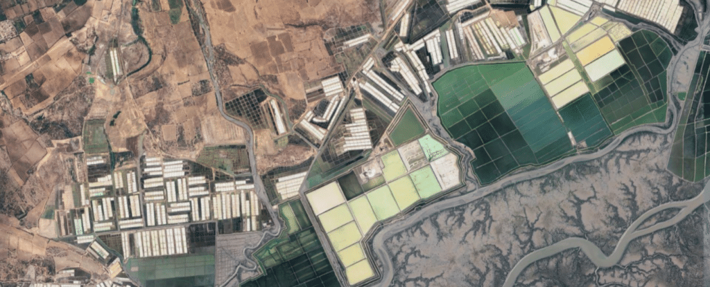
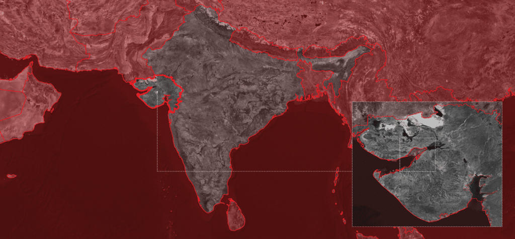
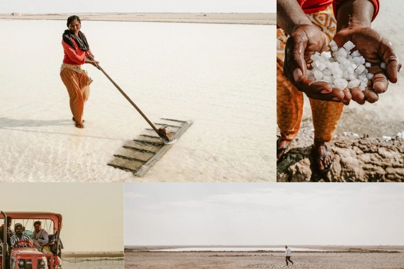
Today, India is one of the world’s largest producers of salt, and the state of Gujarat alone accounts for over 80% of the country’s production. Much of this salt is harvested through solar evaporation in the Little Rann of Kutch, where the Indian Wild Ass Sanctuary overlaps with traditional salt-producing lands. The workers here, known as Agariya, produce a significant share of India’s salt under extreme climatic conditions. Despite their economic contribution, they operate in legally precarious circumstances: after the sanctuary’s declaration in 1978, many lost formal land rights and today work in a space defined by informality, environmental regulation, and limited social protection.
Stories of the difficult conditions the Agariyas face have been well documented. From our preliminary research, however, it is more challenging to understand the spatial patterns of expansion or contraction within this labor-intensive and poorly compensated informal industry. Reports on the Agariyas’ transition from diesel-fuel–assisted operations to renewable energy sources have emerged between 2023 and 2025, suggesting that informal salt farming practices are continuing and potentially expanding — placing more Agariyas’ personal well-being at risk.
Through remote sensing methods can we see if there has been a significant expansion of informal solar salt farms and their accompanying settlements in the Gujarat region?
This project investigates how land ownership, conservation policy, and informal labor intersect in Gujarat’s salt-producing landscape. We are particularly interested in whether salt pan expansion over time reflects changing access to land within or near the sanctuary boundary, and whether nearby informal settlements have expanded alongside production.
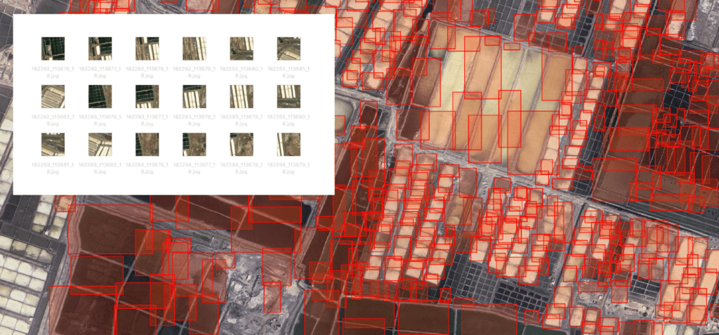
To examine this spatially, we trained an AI object detection model using Roboflow to identify salt pans in satellite imagery. The trained model was exported and integrated into QGIS via the Deepness plugin, allowing us to detect salt pan footprints across multiple time periods. By combining these detections with historical satellite imagery, water occurrence datasets, and sanctuary boundary data, we can analyze spatial change: expansion or contraction of salt pans and growth of adjacent settlements. This workflow enables us to quantify how environmental governance and informal labor practices reshape the landscape over time.
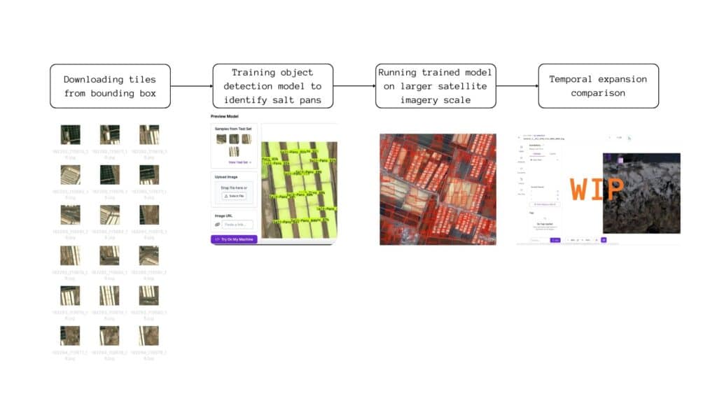
We are currently retraining our Roboflow object detection model to better recognize salt pans in older satellite imagery — a challenge given the lower resolution and spectral differences of historical data. Once the model reaches sufficient accuracy, we will use it to systematically identify and verify areas of salt-farming expansion over time. After mapping where expansion has been most significant, we will investigate additional environmental and socio-spatial factors to better understand the less visible dimension of our research: the quality of life of the Agariya farmers. By integrating ecological datasets and human-centered layers, such as land-use maps and settlement data, we aim to build a more comprehensive understanding of how landscape transformation intersects with lived realities.
