
-Problem statement-
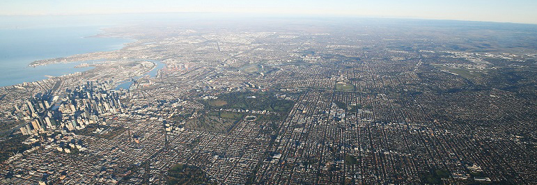
The extensive sprawl of Melbourne and the affordability challenges have led to a situation where purchasing a home in the central area is increasingly difficult. This situation urges residents to seek housing options in the outskirts, as a result consequently contributing to the city’s expanding boundaries.
-Aim of the project-
In the city of Melbourne, analyze the location of 20 minute neighborhoods and evaluate their socio-economical status.
Identify the extent of the city that satisfies the requirements of 20 min neighborhood and define their spatial distribution. The project raises hypothesis- the further is the 20 min neighborhood from the city center, the lower the family weekly income.
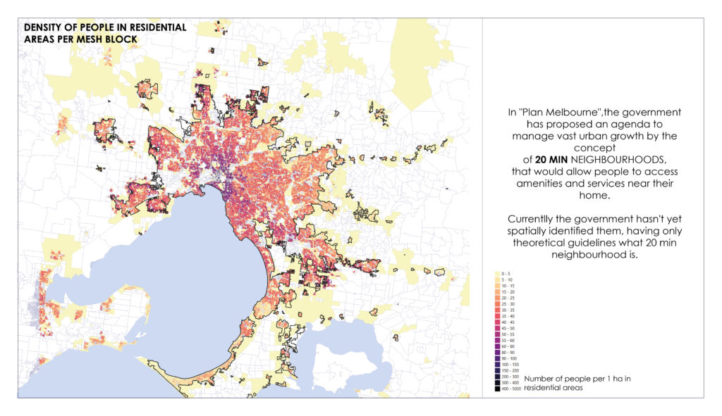
–01 Accessibility analysis-
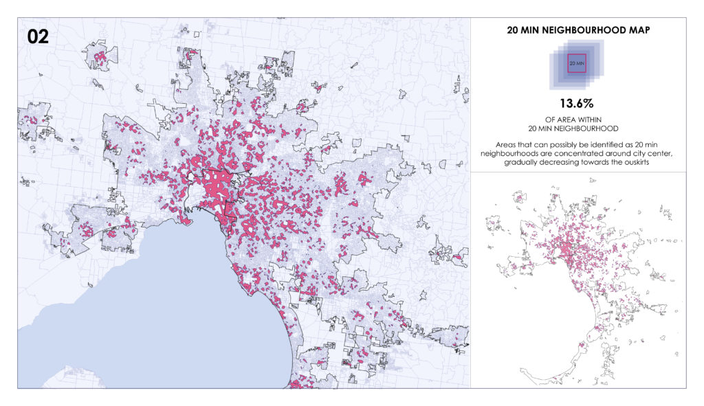
–02 Spatial identification of 20 min neighborhoods-
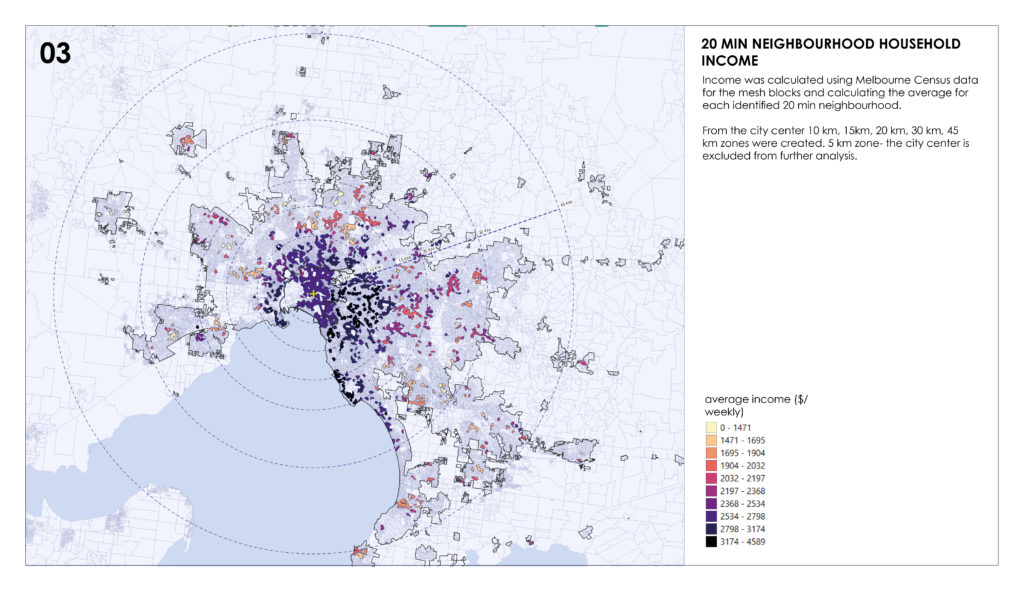
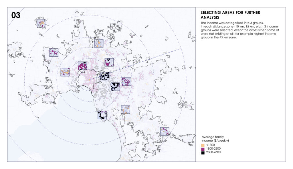
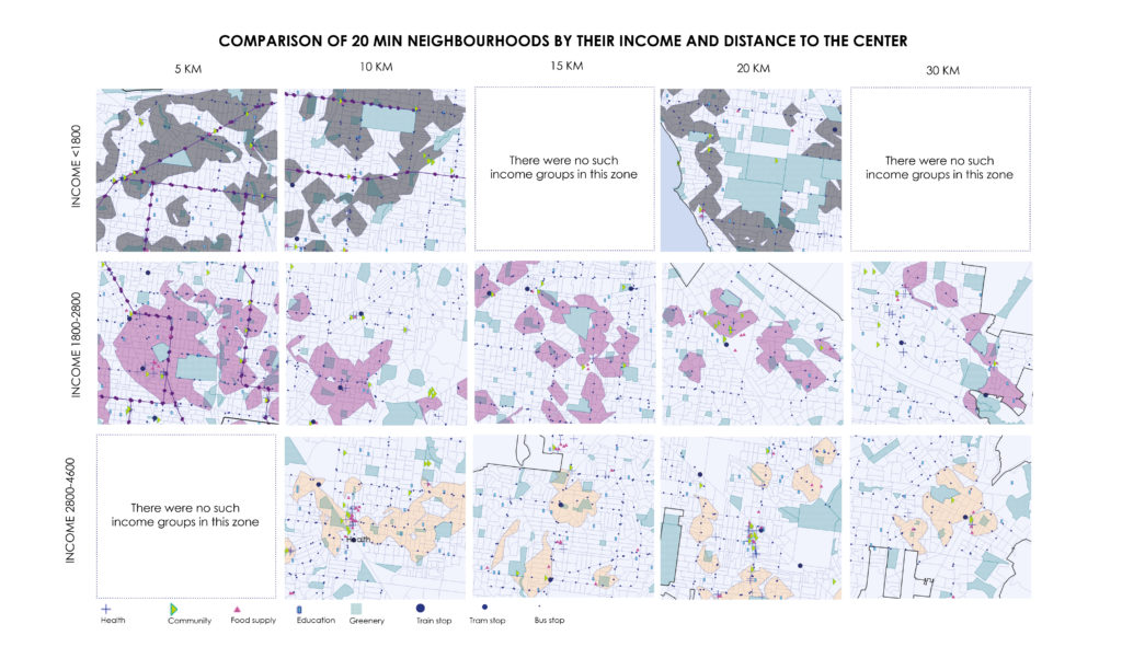
–03 Analysis of 20 min neighborhoods-
–Conclusion–
13.6% of the are of Melbourne has the features of 20 min neighborhood. The sparse distribution of identified 20 min neighborhoods indicates that Melbourne is being affected by urban sprawl, in some places reaching 45 km distance from the city center. The concentration of 20 min neighborhoods is the highest within 10 km radius from city center, having the highest income per household as well. The income difference towards the outskirts of the city has a tendency to decrease. In order satisfy the 20 minute city objectives of the Melbourne Plan, the government can use this analysis and identify the areas that need the most interventions and what kind of domains are lacking there.
