
Syllabus
Perceiving Urban Environments Through Data
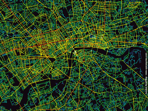
Credits: Space Syntax
According to the World Economic Forum, with our current rate, we generate 2.5 trillion gigabytes of data every day. A smart city of about 1 million people is estimated to generate 200 million gigabytes per day. 50% of this data comes from IoT devices while more than 10% comes from social media. However, only 1% of this data is usable. Data has the potential to and will completely and radically change our perception of the urban environment. In the Urban Sensing seminar, we aim to combine different sources of data, live as well as static, with spatial analyses to try to understand the complex relationships between urban form, human behaviour and features of the public space.
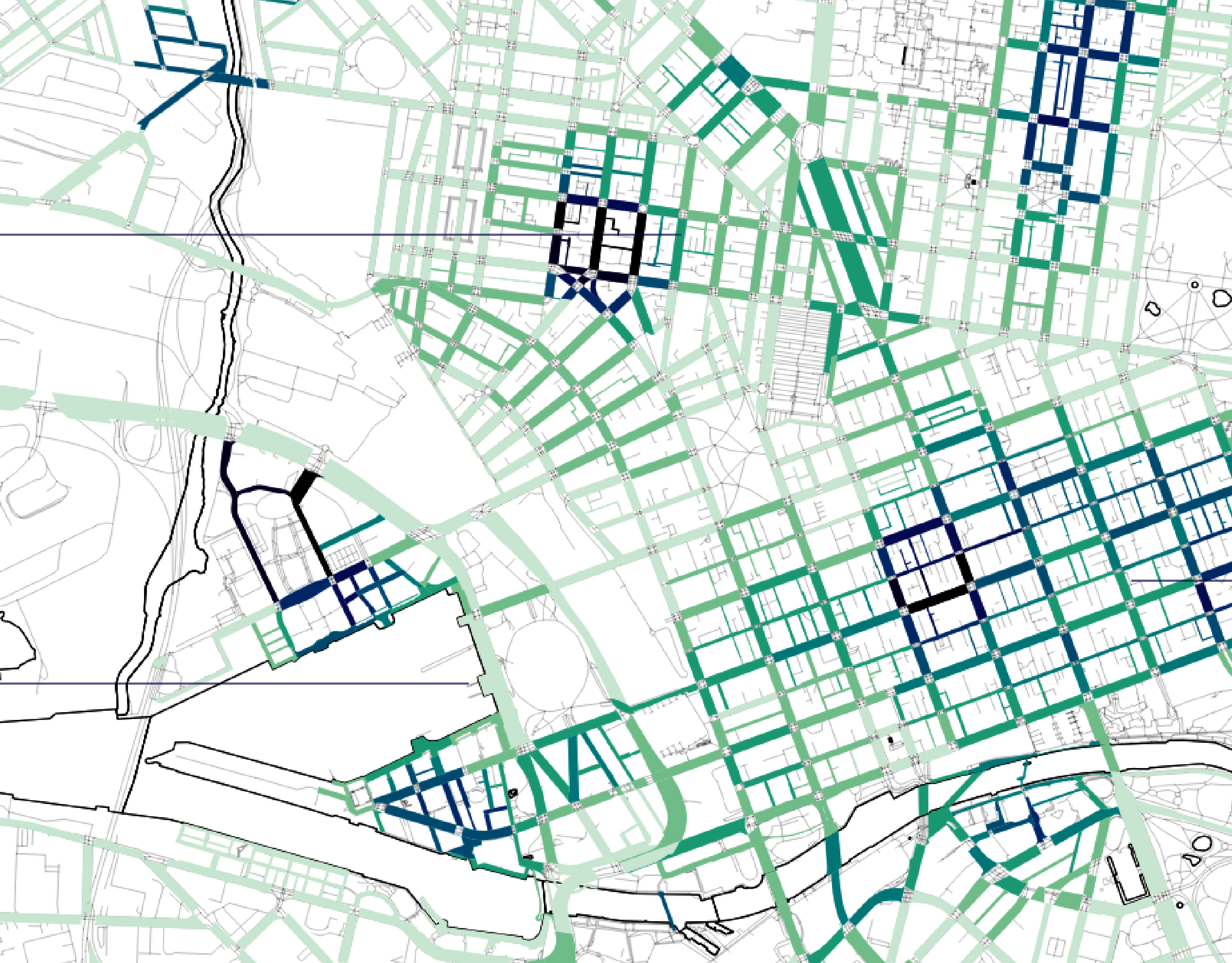
The seminar will focus on different methodologies and techniques around spatial analysis for urban design, through the integration and processing of different spatial open data sets that will ultimately inform specific questions and project proposals of data-driven analyses. Using the scripting language of R for ETL processes and its interoperability with Rhinoceros and Grasshopper as well as Python and social media APIs, we will explore different geocomputation techniques and methodologies to collect, analyse, and visualise urban data for the purposes of generating a parametric urban design model that assesses design options based on dedicated KPIs. We will dive into the Space Syntax theory and its metrics via the UNA Toolbox and we will combine movement analysis with social media and other data to enhance our understanding of urban settings. The objective is to explore and analyse urban environments through an integration of relevant workflows.
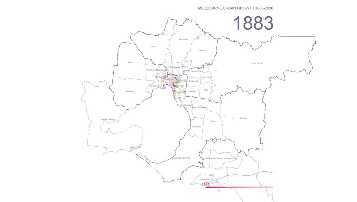
Focusing on two pilot cities, Melbourne and Amsterdam, the seminar aims to develop applicable data-driven project proposals which we aim to present to the pilot city’s municipalities.
Learning Objectives
The seminar aims more to equip the students with critical thinking and a methodological understanding of using data for urban analysis and design rather than teaching a specific software tool. The learning objectives of the seminar are
- Spatial data collection and preparation.
- Integration of spatial data with urban design methodologies.
- Use of data analytics on the urban scale.
- Formulation of applicable data-driven design methodologies.
Faculty


Projects from this course

GENDERED GEOGRAPHIES
Navigating Urban Realities through Women’s Perception of Safety Cities all over the world are being quantified and rated in terms of their livability and life quality for better understanding of citizen satisfaction. Safety, including both the tangible aspects and the subjective perception of safety, is a critical component in assessing urban life quality. According to … Read more
20 minute neighborhoods in Melbourne
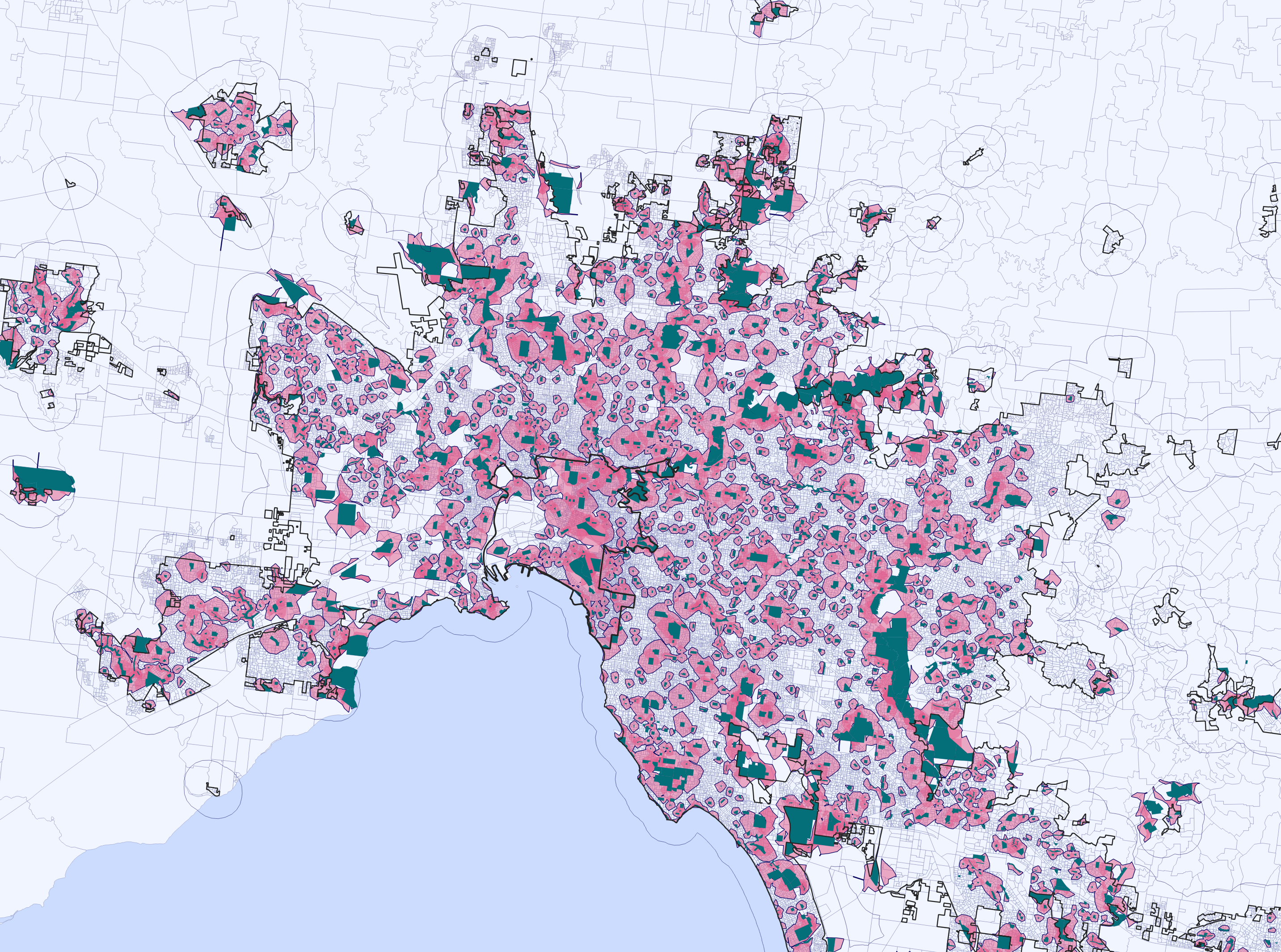
-Problem statement- The extensive sprawl of Melbourne and the affordability challenges have led to a situation where purchasing a home in the central area is increasingly difficult. This situation urges residents to seek housing options in the outskirts, as a result consequently contributing to the city’s expanding boundaries. -Aim of the project- In the city … Read more
Green Printing

Urban Green Spaces are critical urban infrastructure – equally important to how our city functions as transport networks, and particularly vital to the wellbeing of our community. Urban greening supports Melbourne’s economy, providing cooling and amenity which supports the pedestrian economy and reduces operating costs for local businesses. Melbourne is encouraging more innovative methods for … Read more
The Heat Gap

This project explores the relationship between urban heat and mental health in a city using clustering analysis. Four distinct clusters were identified, revealing patterns related to population percentages with mental health problems, urban heat levels, and proximity to industrial areas. Additionally, the study examines the association between urban heat, housing stress, and access to natural … Read more
Senseable Walks for Melbourne
OPTIMIZING THE EXISTING WALKABILITY INDEX Urban design plays a pivotal role in shaping the livability of a city, and walkability is a crucial aspect that directly impacts its residents’ quality of life. The City of Melbourne has developed a Walkability Index. This project aims at optimizing the existing framework by integrating key parameters related to … Read more
Remote sensing of the urban sprawl’s pace of Melbourne
Starting in 2015 urban development spread beyond the administratively defined Melbourne metropolitan area, into Greater Geelong and the Shire of Mitchell. The Melbourne Metropolitan Region or Greater Melbourne comprises 31 Local Authority Governments (LGA, municipalities and shires) aggregated in 6 metropolitan partnerships. Two of them, Inner and Inner South-East allocate the metropolitan core. This project … Read more
